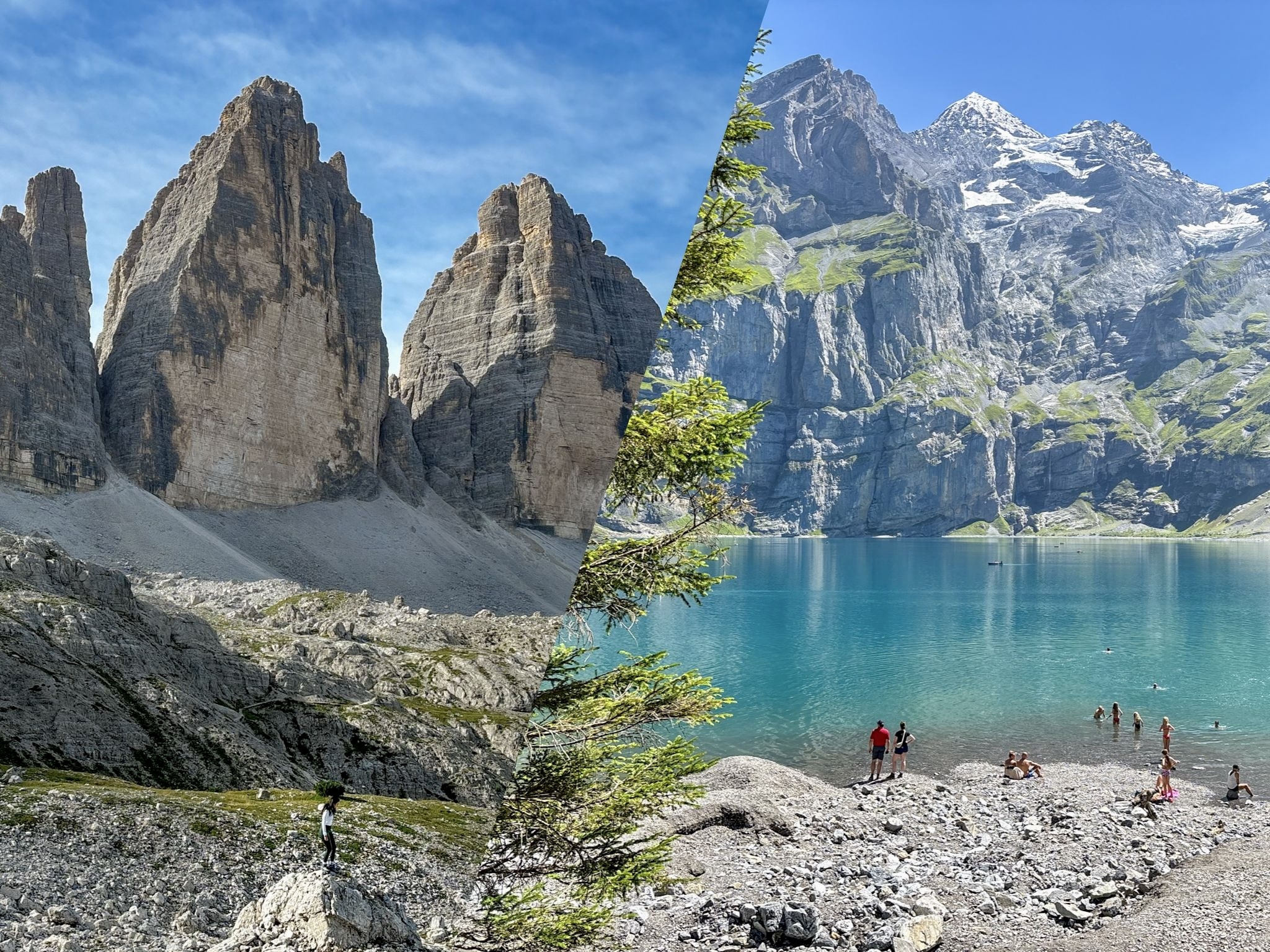
Looking for a hike that’ll take your breath away in more ways than one? The Cadini di Misurina hike leads you to a jaw-dropping viewpoint that’ll make you feel like you’ve stepped into a Dolomites postcard.

The Cadini di Misurina viewpoint has become one of the Dolomites’ most photographed spots, and after hiking it myself, I understand exactly why. The trail is short, exposed in places, and leads to a ridge that looks almost unreal when you finally step onto it.
What used to be a niche hike is now firmly on the map, and in 2026 the area is managed with stricter rules and new access limitations to protect the landscape from overtourism. This guide brings together everything you actually need to know before heading up: how the trail works, what to expect on the exposed sections, what’s changed this year, and how to plan your visit so you reach the viewpoint safely and without surprises.
-
- Read more: 10 Best Hikes in the Dolomites, Italy
Where is Cadini di Misurina Located?
The Cadini di Misurina is a mountain group situated in the Dolomites, in the northeastern region of South Tyrol, Italy. It is located adjacent to the renowned Tre Cime di Lavaredo hiking loop, with a famous viewpoint overlooking Lake Misurina. The nearest major towns are Cortina d'Ampezzo, which is 45 km away, and Bolzano, which is 120 km away.
How to Get to Cadini di Misurina
The hike begins at Rifugio Auronzo (Auronzo hut), the mountain hut that serves as the main trailhead also for the Tre Cime di Lavaredo loop.
There are several ways to reach Rifugio Auronzo, although as of 2026, new access restrictions and updated rules have been introduced to reduce overtourism in the area.
By Car
The easiest way to get to Rifugio Auronzo is by driving. This hut serves as a starting point and as the main parking area too. As of 2026, the toll road to Rifugio Auronzo costs €40 for cars, €26 for motorcycles, and €60 for camper vans, and requires a mandatory online reservation with a pre-selected entry time slot.
This pre‑booked parking permit is also valid for 12 hours from the selected entry time, so you need to plan accordingly.
By Public Transport
You can reach Rifugio Auronzo from some selected areas:
- From Dobbiaco (Toblach): The shuttle bus #444 runs directly from Dobbiaco to Rifugio Auronzo. The journey takes around 50 minutes and operates during the high season (mid-June to mid-October). Tickets must be booked ahead online on the official website, you just need to select your preferred stop in Dobbiaco and an available timeslot.
- From Lake Misurina: you can take the DolomitiBus shuttle bus #50, active daily from May 30th, 2026. The shuttle departs from Misurina Genzianella, with an intermediate stop at Lago d’Antorno, and arrives directly at Rifugio Auronzo. You can buy tickets directly on board using contactless payment (EMV Tap&Go), or via the DolomitiBus App, or at the automatic ticket machine located at the departure point in Misurina.
- From Cortina d'Ampezzo: there's no direct connection to Rifugio Auronzo for 2026, you have to take two steps. First, you reach Lake Misurina by using DolomitiBus bus #51. From there, you can reach Rifugio Auronzo via shuttle bus #50 as described in the previous step. Don't forget to visit the DolomitiBus App for the most up-to-date timetables.
By Foot
For the purists, you can hike up to Rifugio Auronzo from Lago d'Antorno. This trek is about 7 km and can take 2–3 hours, depending on your how fast you are. The reward is the gorgeous scenery along the road and the satisfaction of reaching the peaks on your own, whenever you want (and for free!).
Cadini di Misurina Hike Guide
Length, Elevation, Trail Difficulty, Useful Links
- Length: 6 km / 3.7 miles
- Difficulty: Easy to Moderate
- Elevation gain: 300 m / 987 feet
- AllTrails Link
This hike isn’t going to chew you up and spit you out, but it will demand a little effort. It’s rated as a moderate hike, but you won’t need to be scaling cliffs or mastering advanced survival skills. There are rocky paths, a few steep sections with the occasional exposed path, and tons of photo-worthy breaks along the way. This trail is perfect for intermediate hikers who want a rewarding climb without an all-day slog.
For a detailed map of the trail and real-time trail conditions, check out the Cadini di Misurina AllTrails.com page. The map will give you additional details and route variations to help you plan your hike.
Also, you can find the exact Google coordinates of the Cadini di Misurina viewpoint at this link.
Trail Step-by-Step Description
The Cadini di Misurina hike starts right from Rifugio Auronzo, and it follows Trail 117. This trail takes you away from the more crowded Tre Cime paths and immediately immerses you in a quieter, wilder landscape. You'll begin with a gentle ascent that quickly opens up to some fantastic views of the Dolomites.
I found the first part easy, with a well-marked gravel path that winds through the valley. After about 20 minutes, you'll notice the trail starting to incline more steeply. Don’t worry—it’s a gradual climb at first, and it gives you plenty of opportunities to stop and take in the scenery without burning out too soon.


As you approach the midpoint of the hike, the path becomes rockier and narrower. Here’s where the 300-meter (984-foot) elevation gain will make itself known, but the trail remains manageable. Take your time, watch your footing, and enjoy the increasingly spectacular scenery unfolding around you. Along the way, you’ll encounter various scenic viewpoints.
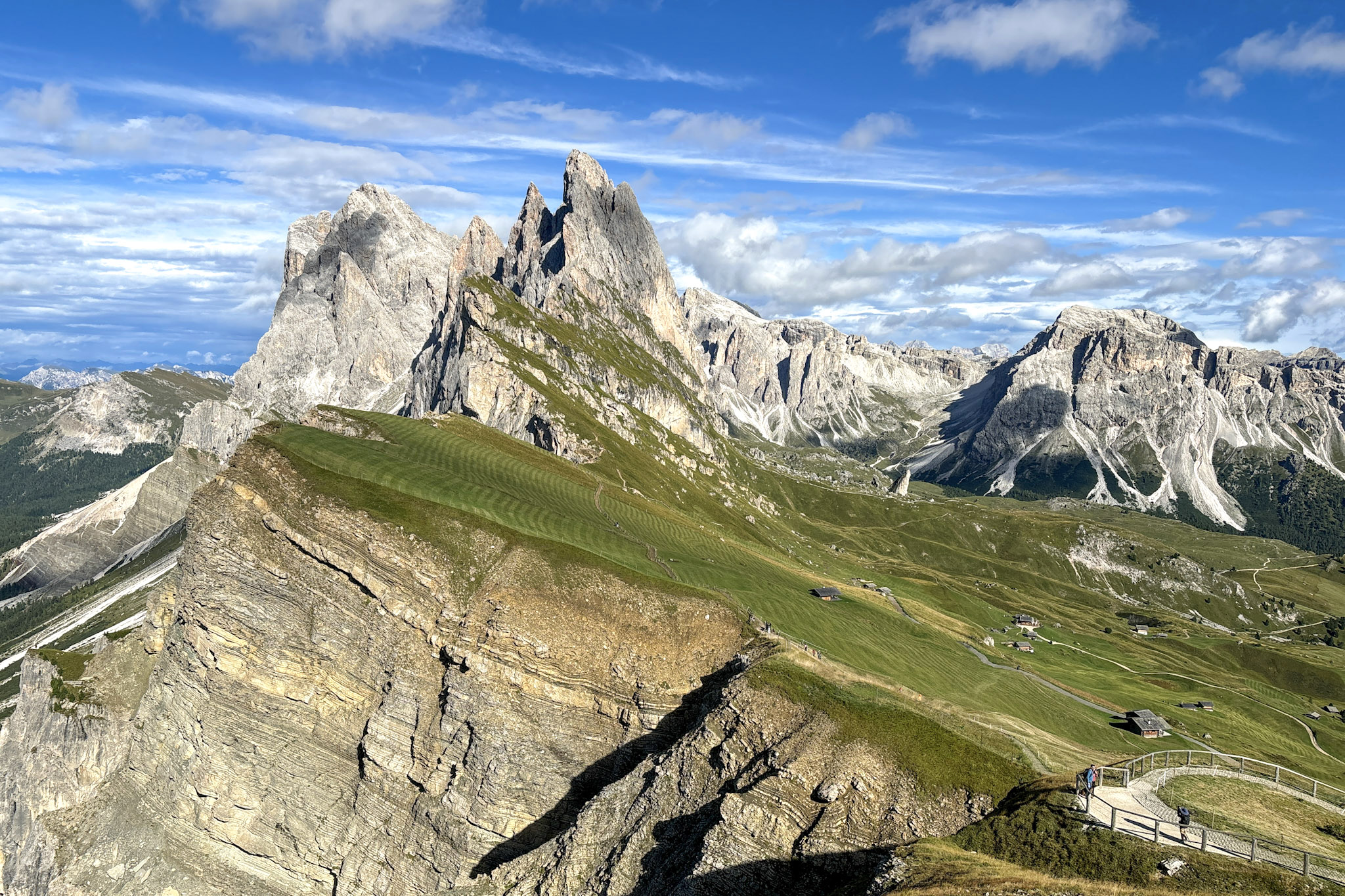
Finally, after about 1.5 hours of hiking, you’ll spot the Cadini di Misurina viewpoint. The jagged peaks pierce the sky, and the valley below stretches out endlessly. It’s the perfect spot to catch your breath, take in the views, and of course, snap the photo of a lifetime.
Since early 2026 this viewpoint has become quite popular, so sometimes you can actually find a queue to reach the top of the viewpoint.


Tips for Hiking Cadini di Misurina Like a Pro
- Arrive early or at sunset: You’ll want to get to Rifugio Auronzo early or after 3 p.m., especially during high season, to snag a parking spot and start the hike without feeling rushed. The earlier you go, the more likely you are to have the viewpoint almost to yourself.
- Bring plenty of water and snacks: Besides the one at the starting point in Rifugio Auronzo, there aren’t any other huts or water refill points on the hike, so carry at least a liter of water with you. Throw in some snacks for good measure—you’ll want something to munch on while you’re soaking in the views at the top.
- Wear hiking boots: The terrain is rocky, and you’ll feel much more comfortable in sturdy boots with good grip, especially on the steeper and more exposed sections of the trail.
- Keep an eye on the weather: The Dolomites are known for fast-changing weather, so bring a waterproof jacket even if the skies are clear when you set off. You don’t want to be caught in a mountain downpour.
- Check shuttle schedules: If you’re taking public transport, be sure to check the shuttle schedule ahead of time. Missing the last shuttle back down from Rifugio Auronzo is not the adventure you want.

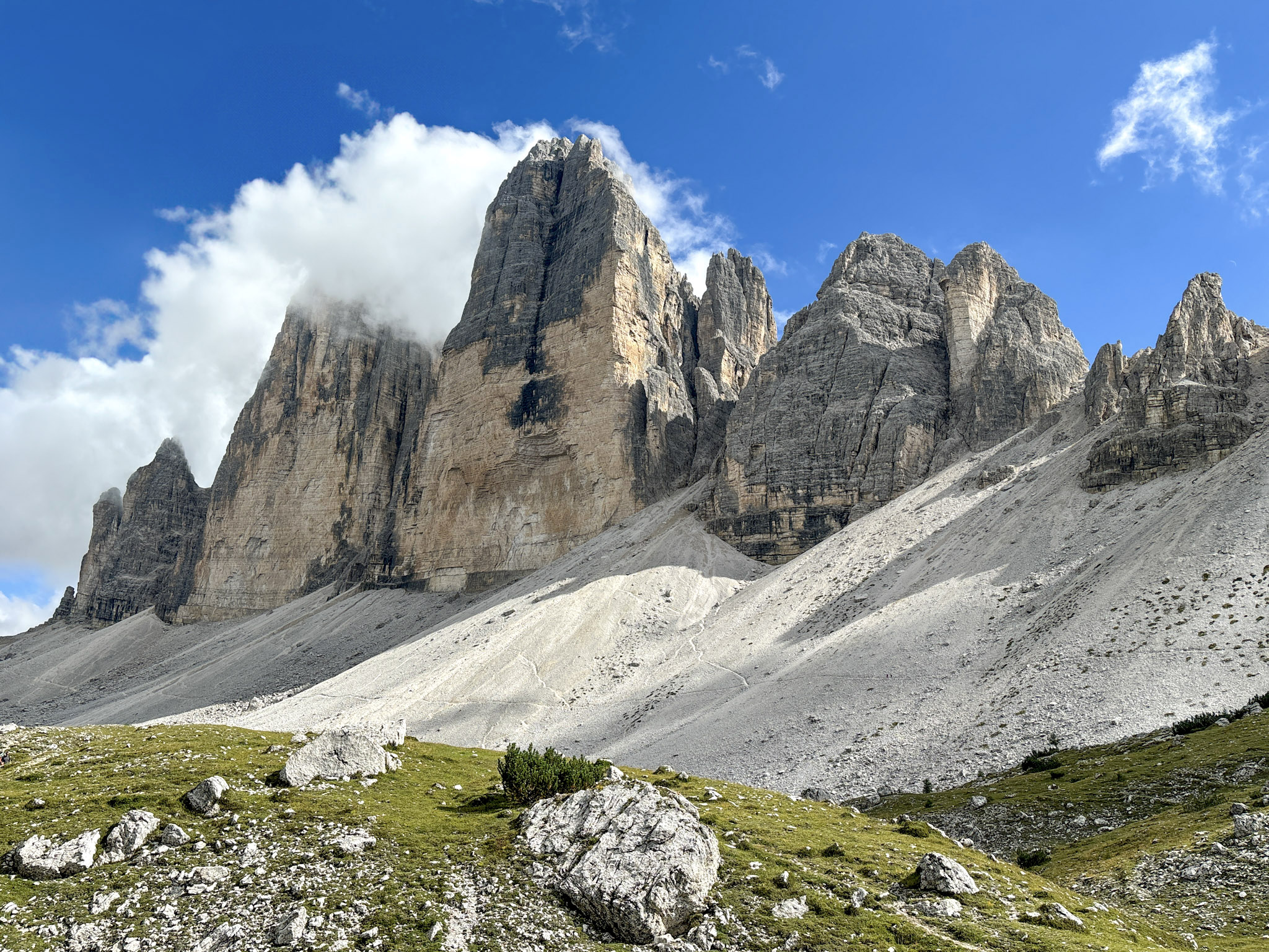
Nearby Hike: Tre Cime di Lavaredo
Just a stone's throw from Cadini di Misurina you'll fin Tre Cime di Lavaredo, the superstar of the area, offering jaw-dropping views that might have you double-checking if you're still on planet Earth. The towering peaks are nothing short of epic, and the trail itself is as iconic as it gets.
For more detailed info on this unforgettable hike, check out the Tre Cime di Lavaredo hiking guide here.

FAQs About the Cadini di Misurina, Dolomites
How long does it take to hike Cadini di Misurina?
The full hike to the Cadini di Misurina viewpoint and back takes about 2.5 to 3 hours, depending on how long you spend admiring the views (and let’s be honest, you’ll want to linger). It’s a short but rewarding hike, perfect for those with limited time who still want to experience some of the Dolomites' most stunning scenery.
Is the Cadini di Misurina Hike difficult?
The Cadini di Misurina hike is rated as moderate. The trail is well-marked and relatively short, with some steep sections and rocky terrain. It’s suitable for intermediate hikers, but beginners with a reasonable level of fitness should be able to handle it, especially if they take it slow.
How do I get to the Cadini di Misurina viewpoint?
The trailhead starts at Rifugio Auronzo, the same location as the Tre Cime di Lavaredo hike. From the rifugio, follow the signs toward Cadini di Misurina, where the trail veers off to the left. It’s about 6 km (3.7 miles) round-trip with an elevation gain of 300 meters (984 feet).
Can I hike Cadini di Misurina in winter?
Hiking in winter is possible, but it’s much more challenging. Snow and ice cover the trail from November to April, and the trail can be difficult to navigate without snowshoes or crampons. Winter hikes in the Dolomites are best suited for experienced hikers with the right gear.
What makes Cadini di Misurina special?
The Cadini di Misurina viewpoint offers some of the most spectacular views in the Dolomites, with jagged peaks, rugged valleys, and panoramic vistas stretching in every direction. It’s a quieter, less crowded hike than Tre Cime, making it perfect for those who want an off-the-beaten-path experience.
Can I Combine Cadini di Misurina and Tre Cime in One Day?
Yes, absolutely! In fact, many hikers choose to do both hikes in the same day, especially if they’re already at Rifugio Auronzo. Start your day early with the Tre Cime di Lavaredo loop, then tackle the Cadini di Misurina trail in the afternoon for a full day of epic Dolomites adventure.