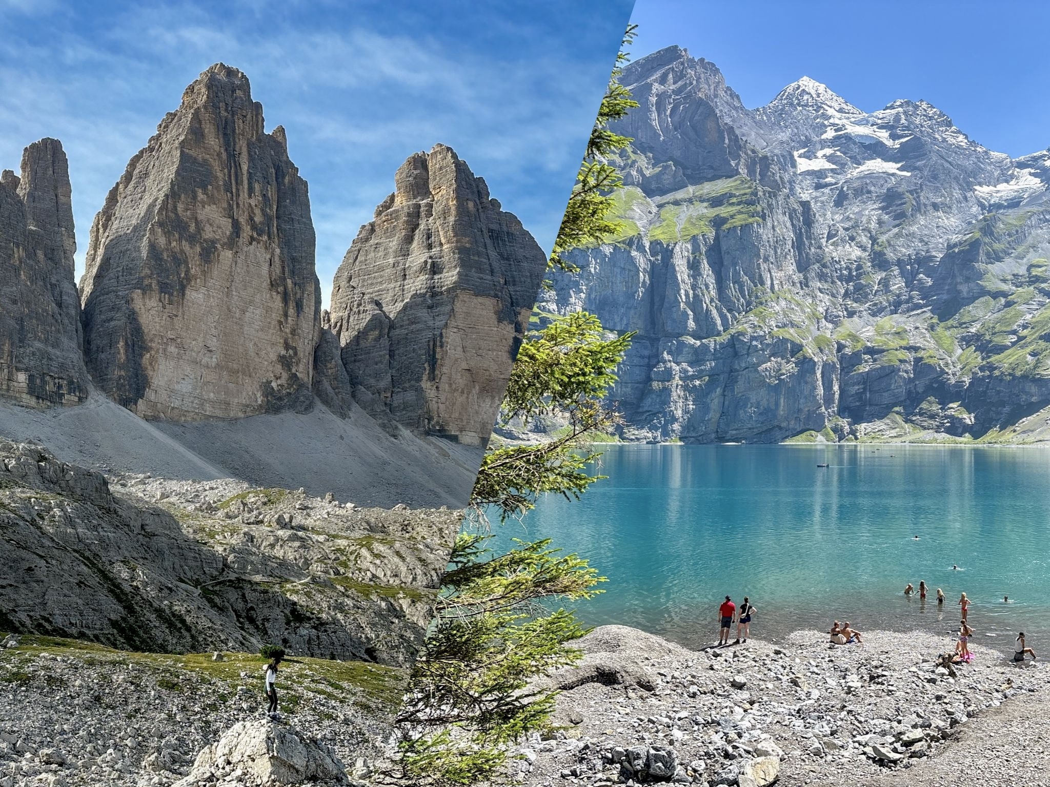
The 10 best hikes in the Dolomites, ranked from personal experience and updated for 2026. Trail notes, current parking and cable car prices, plus all the access rules you need to know.
Famous for their jagged peaks and turquoise lakes, the Dolomites have a way of making every other mountain range feel a bit ordinary. I've spent the last few seasons chasing trails across this UNESCO World Heritage range, and this guide brings together the ten day hikes I keep coming back to, or recommending to anyone who'll listen.
In this guide I'm drawing on my own recent experience plus a proper research pass, so every price, cable car rule, and parking regulation in this guide is accurate as of July 2026. This last part matters more than it used to, because the Dolomites have gotten noticeably stricter about access over the last couple of years.
Before I get into the individual hikes, though, it's worth stepping back for a second. The Dolomites aren't one compact area you can "do" from a single hotel, they're a sprawling range split across three provinces, and the trailheads in this guide are spread out.
So next, I'll walk through how to get into the region and how to think about splitting your trip across bases, before we get to the hikes themselves.
Getting to the Dolomites: Airports, Driving Times, and Getting Around
The three areas of the Dolomites, simplified
Forget trying to memorize the provinces, here's a summary of the Dolomites areas that matters for planning:
- West → anchor town: Ortisei. Covers Seceda, Alpe di Siusi, and Adolf Munkel.
- East → anchor town: Cortina d'Ampezzo. Covers Tre Cime, Cadini di Misurina, Sorapis, Cinque Torri, Croda da Lago, and Lake Braies.
- South → anchor town: Vigo di Fassa. Covers Vajolet Towers only. It's a bit out of the way from the other two, so treat it as an add-on rather than a base for everything.
Which airport to fly into
Realistically, you've got three good options:
- Venice Marco Polo. Best if you also want a couple of days in Venice before or after your trip. It’s close to the eastern side of the Dolomites (Cortina, Tre Cime, Sorapis, Braies).
- Bolzano. The closest airport overall, right in the middle of the Dolomites. Small, with limited flight routes, but unbeatable if the schedule works for you.
- Milan. Makes sense if you're combining the Dolomites with a broader Northern Italy trip. It's the furthest of the three, so budget more driving time.
Here's roughly what to expect getting from each one to the two main hiking areas covered in this guide:
| From | To the western Dolomites (Ortisei) | To the eastern Dolomites (Cortina) |
| Bolzano | ~45 min–1 hr (~40 km / 25 mi) | ~2–2.5 hrs (~165 km / 103 mi) |
| Venice | ~3–3.5 hrs (~250 km / 155 mi) | ~2–2.5 hrs (~165 km / 103 mi) |
| Milan | ~4–4.5 hrs (~380 km / 235 mi) | ~4.5–5.5 hrs (~410 km / 255 mi) |
These are dry-road, no-traffic estimates. Mountain roads are slow, and summer weekend traffic can add real time, so build in a buffer.
Should you rent a car?
If your target is to do multiple hikes across different areas of the Dolomites, yes, renting a car is the most practical option. A car gives you the flexibility to move between regions and reach the trailheads on your own schedule. Public transport in the Dolomites is built around getting locals between villages, not stringing together ten trailheads across three valleys for tourists.
A quick reality check on alternatives: Uber doesn’t exists here, you’ll find only Uber Black in a couple of bigger cities, and never in the mountains, and regular taxis are thin on the ground and expensive for anything beyond a short village hop. So "I'll just grab a cab" cannot be plan in the Dolomites the way it might be elsewhere.
Getting around without a car / Public transport
That said, if you're only doing a handful of hikes in one area rather than the whole list, public transport can work, and I'll flag the specific bus or train option for each hike below.
Here's a summary on how these hikes work with no car (more details will be given in each section):
- Tre Cime / Cadini di Misurina: take the train from Bolzano to Dobbiaco, then a direct shuttle bus from Dobbiaco straight to Rifugio Auronzo, the trailhead for both hikes. There are also alternative options, although longer, from Cortina d’Ampezzo.
- Lake Braies: also direct bus from Dobbiaco train station.
- Seceda / Alpe di Siusi: the first step is to reach Ortisei by a train + bus combo from Bolzano. Then both hikes are reachable directly by cable car from Ortisei.
- Cinque Torri from Passo Giau / Lake Sorapis: from Venice, take the Cortina Express 100 bus to get to Cortina d’Ampezzo. From there, you can find a seasonal Dolomiti Bus that will bring you to the trailheads, but schedules are limited.
- Croda da Lago / Adolf Munkel / Vajolet Towers: these are realistically doable only with a car. Bus options exist but involve more transfers and planning than they're worth for most people.
Map of the 10 Best Hikes in The Dolomites
You can see below a quick image on where the hikes mentioned in this list are located across the Dolomites:
1. Tre Cime di Lavaredo
Area: East | Best base: Dobbiaco, Misurina, Cortina d'Ampezzo | Crowd level: Very high

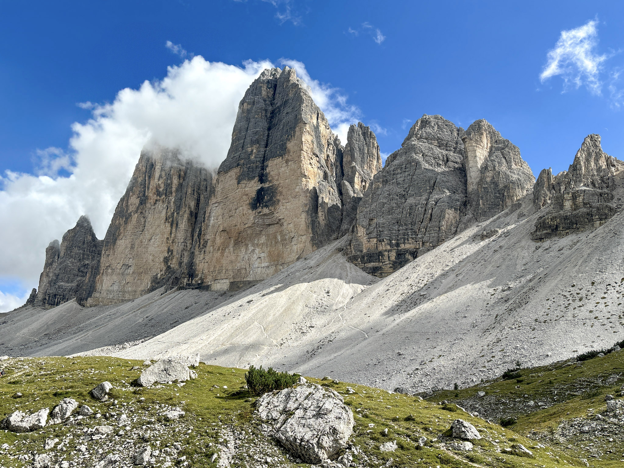
Tre Cime means "three peaks" and that's exactly what you're circling on this hike: three enormous, sheer limestone towers that rise straight out of the plateau like something out of a fantasy film. It's the single most photographed formation in the Dolomites.
The full loop passes several rifugios (mountain huts) and a set of preserved WWI fortifications, so you get history along with the scenery. This is also the busiest hike on this entire list, so go in with the right expectations: you will be sharing the trail with a lot of other people, especially in July and August.
Quick stats
- Starting point: Rifugio Auronzo Parking Area
- Length: 10.1 km / 6.2 miles, loop
- Elevation gain: 467 m / 1,531 ft
- Duration: 3 to 4 hours
- Difficulty: Easy to moderate. Wide, well-marked trail, no technical sections
Getting there in 2026
Access rules here have gotten stricter. If you're driving, you now need a mandatory online reservation for the toll road up to Rifugio Auronzo, with a fixed entry time slot (€40 for cars, €26 for motorcycles, €60 for camper vans), and your slot is valid for 12 hours from entry.
Without a car, shuttle bus #444 runs from Dobbiaco (about 50 minutes, book ahead online), or DolomitiBus #50 connects from Lake Misurina, with a stop at Lago d'Antorno along the way. Coming from Cortina, there's no direct bus in 2026. You'll connect via bus #51 to Misurina, then #50 up to Auronzo. If you'd rather skip wheels entirely, you can hike up from Lago d'Antorno in about 2 to 3 hours, for free.
My experience
I've hiked this loop more times than I can count at this point, and it still gets me every time. From Rifugio Auronzo, the trail (numbers 101 and then 105) is genuinely hard to get lost on: an easy first stretch to Rifugio Lavaredo, a short steeper climb up to Forcella Lavaredo where the three peaks properly reveal themselves, then on to Rifugio Locatelli for the classic northern view with the small Laghi dei Piani below it. The return leg down the back side to Malga Langalm and back to Auronzo is mostly easy. If you're short on time, there's also a shortcut version that skips the climb to Locatelli and cuts about 3 km off the loop.
2. Cadini di Misurina
Area: East | Best base: Dobbiaco, Misurina, Cortina (same trailhead as Tre Cime) | Crowd level: High

Cadini di Misurina is the hike I used to send people to when they want that jaw-dropping Dolomites ridgeline photo without fighting the Tre Cime crowds for it. Though I'll be honest, since early 2026 that's gotten harder to promise. It shares a trailhead with Tre Cime but splits off almost immediately onto a quieter, rockier path that leads to one of the most dramatic viewpoints in the entire range: a narrow ridge overlooking a fan of jagged spires that seem to cut straight into the sky. There are no huts on this trail and no lake, just pure rock drama. It's short, it's punchy, and it delivers one of the best payoffs-per-kilometer in the Dolomites.
Quick stats
- Starting point: Rifugio Auronzo (same trailhead as Tre Cime di Lavaredo)
- Length: 6 km / 3.7 miles, round trip
- Elevation gain: 300 m / 984 ft
- Duration: 2.5 to 3 hours
- Difficulty: Easy to Moderate, mostly due to some rocky, narrow and exposed sections near the viewpoint.
Getting There
Since this starts from the exact same trailhead as Tre Cime, the access rules are identical: the same mandatory online reservation for the toll road (€40 cars, €26 motorcycles, €60 campers, 12-hour validity), or the same bus combinations — #444 from Dobbiaco, #50 from Misurina, or #51 then #50 if you're coming from Cortina. Because you're at the same starting point, this is the easiest hike on the list to pair with another one: most people who drive up to Auronzo just do both hikes in the same day.
My experience
From Rifugio Auronzo, trail 117 splits off from the main Tre Cime crowd almost right away, and within a few minutes it already feels like a different hike. The first stretch is a gentle gravel climb through the valley; it gets rockier and narrower and more exposed as you approach the ridge, and after about 1.5 hours you're standing at the viewpoint, with jagged limestone spires on one side, a valley dropping away endlessly on the other. There are no rifugios anywhere on this trail. Since the trail blew up in 2026, I've hit an actual queue to get onto the viewpoint itself on a busy midday. My best tip is to go midweek and early, or wait until around 3 p.m. when the day-trip crowd starts thinning out.
3. Seceda Ridgeline
Area: West | Best base: Ortisei | Crowd level: Very high at the main viewpoint, quiet once you walk further out

Seceda is the hike behind that ridgeline photo you've probably seen a hundred times on Instagram, the one with green slopes falling away on one side and the jagged spires of the Odle/Geisler group rising on the other. It's one of the most accessible big-view hikes in the Dolomites, since a cable car does most of the elevation work for you. The catch is that everyone knows this, so the main platform right off the lift gets genuinely crowded. The upside: walk five or ten minutes past it, and the ridge opens into a much quieter network of trails that most day-trippers never bother with. No lake here, but several rifugios scattered across the plateau, and on a clear day you can see as far as Austria.
Quick stats
- Starting point: Seceda cable car station, Ortisei
- Length: 2.4 km round trip for the classic ridge walk (longer routes go much further)
- Elevation gain: 100 m / 328 ft for the short ridge walk
- Duration: 2 to 3 hours for the classic route
- Difficulty: Very easy to moderate depending on the specific trail selected
Getting there
Ortisei is best reached by car, but there's a train+bus combo option from Bolzano if you don't want to drive. The cable car up from Ortisei runs in two segments (Ortisei → Furnes → Seceda), about 15 minutes total. A 2026 return ticket costs €74 for adults, €49 one-way, with discounted junior tickets and free entry for kids 7 and under. Booking online ahead gets you a small discount and lets you skip the ticket line, which is worth doing in peak season. If you'd rather reach the viewpoint and trailhead on foot, the Sentiero degli Scoiattoli (Squirrel Trail) climbs up from Cristauta Parking via trails 6A, 1, and 2 (a solid 3 to 4 hour, 1,200 m climb).
My experience
The area is exactly what you'd expect from one of the Dolomites' busiest viewpoints: organized, efficient, and packed with people right at the top of the lift. But that atmosphere changes fast once you step away from the main platform. The ridge opens into a wide network of trails, and you can move between short, easy walks and longer routes toward Pieralongia or the Puez area without ever feeling rushed. The classic ridge walk to Forcella Pana is the easy, go-to option most people do. If you want more, the Val Gardena Complete Loop (9 km, 5 to 6 hours) drops you into the Puez-Odle plateau, and the route toward Pieralongia gets properly technical for experienced hikers only. I always stop at Rifugio Firenze or Troier Hütte for South Tyrolean dumplings and a coffee with a view.
4. Alpe di Siusi Meadows Walk
Area: West | Best base: Ortisei | Crowd level: Moderate

Alpe di Siusi is Europe's largest high-alpine meadow, and it's the easiest way to get a huge, open Dolomites view without a demanding climb. This isn't a peak-bagging hike or a lake walk, it's a wide, rolling green plateau with the Sciliar and Sassolungo peaks standing guard on either side, criss-crossed by gentle, well-marked trails and dotted with rifugios serving proper South Tyrolean food. It's the best pick on this list if you're traveling with family, recovering from a harder hike the day before, or just want a slower, more relaxed day in the mountains.
Quick stats
- Starting point: Mont Sëuc mountain station (if arriving from Ortisei by cable car) or Compatsch if you want to get there by driving
- Length: 10 to 12 km / 6 to 7.5 miles, round trip (varies by route chosen)
- Elevation gain: ~300 m / 984 ft
- Duration: 3 to 4 hours
- Difficulty: Easy, accessible to most fitness levels and families
Getting there in 2026
This is one hike where it genuinely matters which way you arrive, because the cable car from Ortisei and driving up don't put you in the same place.
If you're staying in Ortisei as recommended, take the Mont Sëuc cable car right from the town center, a 2-minute walk from most hotels. It lands you directly at the Mont Sëuc mountain station on the eastern side of the plateau, and the trail starts the moment you step off. A round-trip ticket runs around €39 for adults.
If you drive instead, you'll end up at Compatsch, a different hub on the western side of the plateau, not at Mont Sëuc. The two areas connect via longer trails if you want to walk between them, but they're not the same starting point. Access here via car has gotten stricter in 2026: the road to Compatsch is closed to private traffic from 9 a.m. to 5 p.m., and parking lots (P1 Spitzbühl and P2 Compatsch) require an online reservation made up to six days in advance. Outside those hours, you can drive up freely if you arrive before 9 a.m. There's also a separate cable car up to Compatsch from the village of Siusi.
My experience
Stepping out of the Mont Sëuc station is a genuine "wow" moment. You see that wide, rolling plateau opening up in every direction, cows grazing in the distance, the Sciliar looking so overly dramatic against all that green. The trail from the station is easy to follow and well signed, and I stopped at Schgaguler Schwaige for a break with local food and a view that made it hard to get moving again. It's a genuinely relaxed day out compared to most of the other hikes on this list.
5. Cinque Torri Loop from Passo Giau
Area: East | Best base: Cortina d'Ampezzo (or Passo Giau area) | Crowd level: Moderate
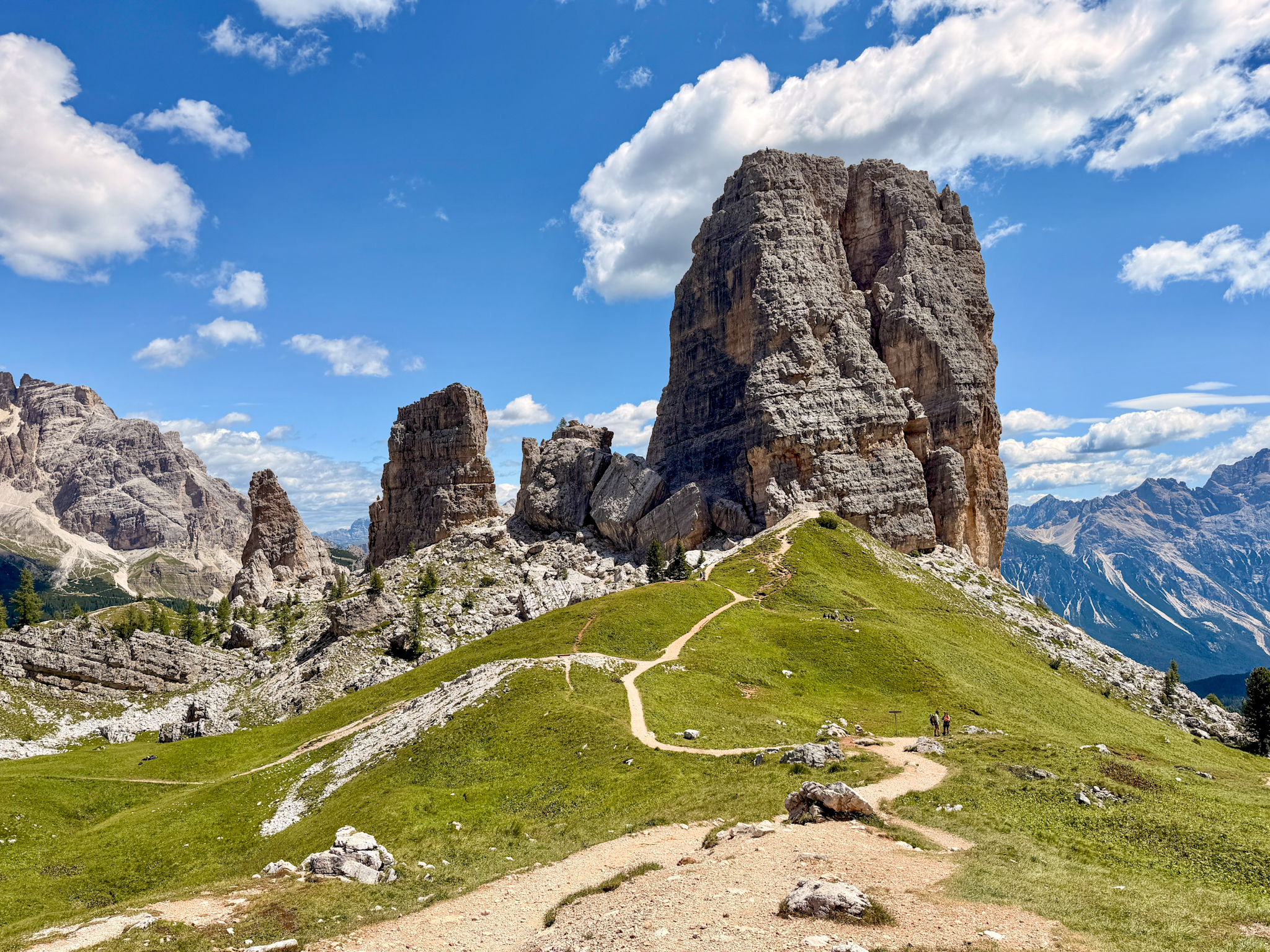
Cinque Torri means "five towers" and this loop takes you right up to and around those distinctive rock formations while also climbing to one of the best panoramic viewpoints in the eastern Dolomites. What sets it apart from the other big-view hikes on this list is the history: the area was a real WWI front line, and the trail passes through a free open-air museum of restored trenches and military positions built directly into the rock. It's also one of the few hikes on this list that needs zero cable car or no parking planning or fees. You get to a free parking area and start walking directly from there. No lake, but several huts, one genuine high-altitude viewpoint at Rifugio Nuvolau, and a second half of the loop that's noticeably quieter and rougher than the first.
Quick stats
- Starting point: Passo Giau
- Length: 10.3 km / 6.4 miles, loop, clockwise
- Elevation gain: ~592 m / 1,942 ft
- Duration: ~5 hours
- Difficulty: Moderate, as the return leg after Rifugio Cinque Torri is rougher and rockier than the first half
Getting there in 2026
Bus line 53 runs from Cortina to Passo Giau in about an hour if you'd rather not drive, though departures are limited. No cable car needed, you start hiking directly from the parking area at Passo Giau. There's a small dedicated lot (around 30 spaces) plus plenty of roadside parking, and it was more manageable than I expected even arriving around 9:15 on a summer Sunday.
My experience
This is now one of my favorite hikes in the Dolomites. From Passo Giau, which is already a spectacle itself, I climbed to Rifugio Averau, then up to Rifugio Nuvolau (2,575 m, one of the oldest mountain huts in the Dolomites, dating back to 1883) for the best panoramic view of the whole day (Tofane, Pelmo, Civetta, and the Marmolada glacier on a clear day). From there I dropped down toward Rifugio Scoiattoli, through the Cinque Torri area and its WWI open-air museum, and stopped for canederli and goulash at Rifugio Cinque Torri. The return leg back to Passo Giau is quieter, rockier, with a few short exposed sections.
6. Croda da Lago and Lake Federa Trail
Area: East | Best base: Cortina d'Ampezzo (or Passo Giau area) | Crowd level: Moderate

I did this one just a few weeks ago, and it might be the most underrated hike on this entire list. Croda da Lago centers on Lago Federa, a lake that's genuinely different from the milky glacial lakes you see elsewhere in the Dolomites: you can actually watch vegetation and fish moving around in it. There's a rifugio right on the shore, and depending on how much time and energy you have, you can either walk out to the lake and back, or continue on a full loop that climbs over two mountain passes and around the jagged Croda da Lago ridge. No cable car anywhere on this one, it's on foot from the road the entire way. It also sits close enough to Passo Giau that it pairs naturally with the Cinque Torri hike above if you're short on days.
Quick stats
- Starting point: Ponte di Rocurto (also spelled Ponte de Ru Curto), on road SP638 between Cortina and Passo Giau
- Length (out and back to the lake): ~8.4 km / 5.2 miles
- Length (full circuit around Croda da Lago): ~12.6 to 13.5 km / 7.8 to 8.4 miles
- Elevation gain (full circuit): ~900 m / 2,950 ft
- Duration: ~2.5 to 3 hours for the lake out-and-back; 5 to 7 hours for the full circuit
- Difficulty: Easy for to moderate depending on which route you select
Getting there
By car, Ponte di Rocurto is about a 15 to 20 minute drive from Cortina along the road toward Passo Giau. There's a small gravel parking area right at the trailhead, and it's free — but it's limited and does fill up, so I'd aim to arrive by 8 or 9 a.m. in peak season. Without a car, Dolomiti Bus line 30/4 (Cortina d'Ampezzo → Passo Giau → Selva di Cadore → Pescul) stops right at the trailhead, at a stop called Pian del Pantan, running from mid/late June to mid/late September — though service is infrequent, so I'd check the schedule carefully before relying on it.
My experience
I took the shorter out-and-back version up to the lake shore and the rifugio rather than the full loop, and it was genuinely one of the most pleasant, low-stress hikes I've done in the Dolomites. The trail winds gently through forest the whole way up, easy to follow throughout, and I had almost no one else on the path. Rifugio Croda da Lago sits right on the water and served proper traditional alpine food when I stopped in. I didn't take on the harder full loop this time (the version that climbs up over Forcella Ambrizzola and Forcella di Formin for a panoramic ridge walk) but it's on my list for next time.
7. Sorapis Lake Trail
Area: East | Best base: Cortina d'Ampezzo or Misurina | Crowd level: Very high

Sorapis is all about the water: an impossibly bright, milky turquoise lake tucked into a cirque below Punta Sorapis, colored by suspended glacial sediment in a way that genuinely looks edited. Unlike some of the other big-name hikes on this list, there's no cable car shortcut here, you earn this one entirely on foot, including a stretch of exposed, cable-aided ledge walking that makes it feel more serious than the distance suggests. One small hut sits just above the lake.
Quick stats
- Starting point: Passo Tre Croci
- Length: ~12.6 km / 7.8 miles, round trip
- Elevation gain: ~630 m / 2,067 ft
- Duration: 4 to 5 hours round trip
- Difficulty: Moderate, with exposed cable-aided sections. Not for anyone uneasy on narrow ledges
Getting there
Parking at Passo Tre Croci is free but famously tight, arrive before 7 or 8 a.m. in summer or you'll be walking up from an overflow lot further down the road. DolomitiBus routes connecting Cortina and Misurina also stop at the pass if you'd rather not drive. There's no reservation system here as of 2026, unlike Tre Cime or Alpe di Siusi, but the parking squeeze does the same job of forcing an early start.
My experience
I hiked out to Sorapis myself a few years back, and the color of that lake really is as unreal in person as it looks online. This is trail 215, and it's one I'd take seriously rather than treat as a casual stroll: the first 45 minutes to an hour through forest are easy and almost deceptively gentle, and then the trail narrows into a ledge traverse with fixed steel cables bolted into the rock. It isn't technical climbing, but it does demand steady footing and zero fear of exposure, and in peak season you can expect a short queue at the narrowest point. Rifugio Vandelli sits just above the lake and serves hot Alpine meals, and it's also possible to stay overnight there if you want the lake to yourself at sunrise. Two things worth knowing before you go: swimming is banned to protect the glacial ecosystem, and the trail loses cell signal in several stretches, so it's worth telling someone your plan before setting off, especially if you're hiking solo.
8. Adolf Munkel Trail
Area: West | Best base: Ortisei or Santa Maddalena | Crowd level: Moderate

This is the trail I'd send anyone who wants Seceda-level views of the Odle/Geisler peaks without the cable car crowds. Instead of climbing up to the peaks, Adolf Munkel takes you along their base with a mostly flat, forested path that runs directly beneath those jagged spires the entire way. There's no lake and no cable car here, but there are three different rifugios along the route, all serving proper South Tyrolean food with the Odle peaks as a backdrop, and the valley itself (Val di Funes) is noticeably quieter than the big hubs like Ortisei or Cortina.
Quick stats
- Starting point: Zans / Zanser Alm parking lot, at the end of the Val di Funes valley road
- Length: ~9 km / 5.6 miles, loop (a longer variant to Rifugio Broglesalm and down to Ranui runs about 13 km / 8 miles, 4.5 hours)
- Elevation gain: ~400 m / 1,310 ft
- Duration: 3 hours for the standard loop
- Difficulty: Easy
Getting there
By car, follow the valley road through Val di Funes all the way to its end at the Zans parking area. Parking is paid (around €10/car) and genuinely fills up fast: arriving after 9:30 or 10 a.m. in peak season means you may be waiting for a spot, so I'd get there earlier than that.
My experience
I did this one in 2025, and what's stuck with me since is how different it feels from Seceda despite the similar payoff. Instead of a crowded viewing platform, you're walking through forest and open meadow with the Odle peaks looming directly above you almost the entire time. The trail is well marked and easy to follow, running past three huts along the way (Rifugio delle Odle, Malga Casnago, and Malga Dusler), all worth a stop for something to eat. It's an easy, relaxed day that doesn't ask much of you physically but still delivers real Dolomites scenery.
9. Vajolet Towers & Santner Pass Hut
Area: South | Best base: Vigo di Fassa | Crowd level: Moderate on the lower trail, quiet and exclusive once you're past Rifugio Vajolet
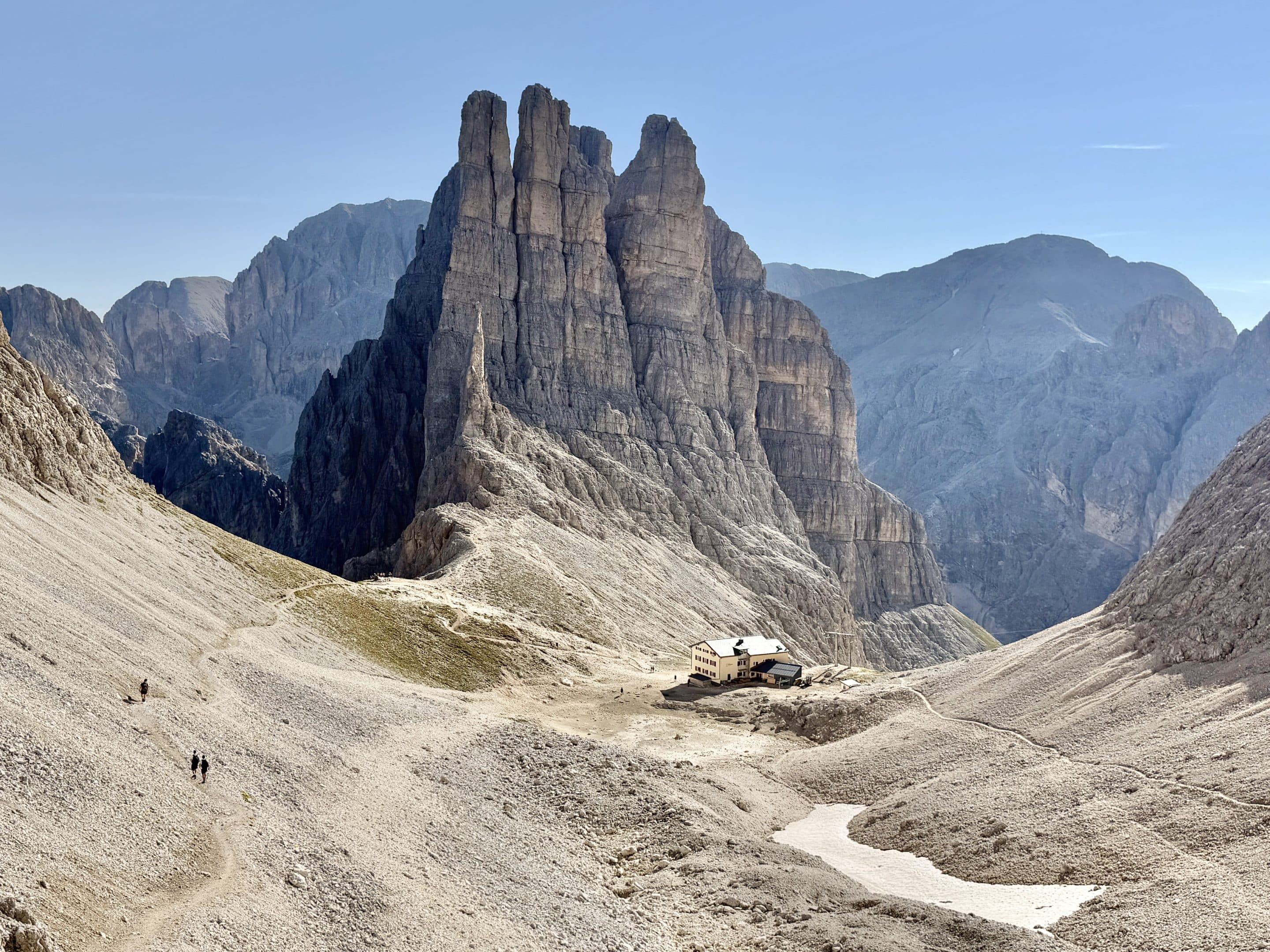
This is the hardest hike on the list, and the only one where I'd genuinely recommend building your trip around a overnight hut stay rather than a day trip, although a day trip is completely feasible. The Vajolet Towers are a cluster of pale, sheer rock spires in the Catinaccio group that look almost artificial until you're standing directly beneath them. The hike up is beautiful but demanding, with one properly exposed, cable-assisted section that separates this from every other trail on this list. The real reason to do it, though, is what happens after the day-trippers leave: sleeping at Santnerpass Hut, right above the towers, for a sunset and sunrise that most visitors never see.
Quick stats
- Starting point: Vigo di Fassa cable car to Ciampedie
- Length: 13.6 km / 8.5 miles, out and back
- Elevation gain: 868 m / 2,848 ft
- Highest point: Santnerpass Hut, ~2,726 m / 8,942 ft
- Duration: ~6 hours to the hut from Ciampedie roundtrip
- Difficulty: Difficult with steep, exposed, fixed-rope sections; not for anyone uneasy with loose rock or heights
Getting there
Vigo di Fassa is the town you're aiming for. From Vigo di Fassa, the hike itself starts with the Ciampedie cable car, with a return ticket around €28 for adults. There's free parking right above the cable car station, but note the fine print: if you're staying overnight at Santnerpass Hut, overnight parking requires separate authorization.
My experience
I reached the Vajolet towers viewpoint and Santnerpass Hut about three hours after taking the cable car up: first trail 540 to Rifugio Gardeccia (easy forest path), then trail 546 to Rifugio Vajolet and Rifugio Paul Preuss (steeper, still manageable), then trail 542 up to Rifugio Re Alberto. This final section was by far the toughest thing I did on any of these ten hikes: steep rock and gravel, real exposure, hands-on-the-rock the whole way. But staying at Santnerpass Hut turned the whole trip into something else entirely. The pale spires catch the evening light right outside the door, there's an orange cat that unofficially runs the place, and sunrise over the towers the next morning was the best part of the entire trip, full stop.
10. Lake Braies Circuit
Area: East | Best base: Dobbiaco (Toblach), or Cortina d'Ampezzo | Crowd level: Very high

Lake Braies, also known as Pragser Wildsee, is probably the most photographed lake in the Dolomites, due to that impossibly clear turquoise water, the small wooden boathouse, and the sheer wall of Croda del Becco rising directly behind it. It's also historically significant for hikers: this is the official northern starting point of the Alta Via 1, the most famous long-distance trek in the range. Unlike everything else on this list, there's no real elevation gain here, the trail is a flat, easy loop that circles the entire lake, which makes it the most accessible entry on this whole guide. No huts along the loop itself, but a restaurant and hotel sit right at the lake edge, and you can rent a small rowboat if you want to get out on the water.
Quick stats
- Starting point: Parking area or bus stop at the lake (Hotel Pragser Wildsee)
- Length: ~3.5 km / 2.2 miles, full loop around the lake
- Elevation gain: Minimal — around 50 m / 165 ft
- Duration: 1 to 1.5 hours for the loop alone
- Difficulty: Easy, suitable for almost anyone
- Best season: Year-round, though the lake freezes over completely in winter
Getting there
Access here is more tightly managed than anywhere else on this list, so it's worth reading carefully. From 1 July to 15 September 2026, the road into the Braies Valley is open to private traffic between 9 a.m. and 4 p.m. only with a pre-booked reservation, and you'll be turned away at the checkpoint without it. Outside those hours, or outside that date range entirely, you can drive in and pay on site as normal.
You need can book your access and parking spot in advance at prags.bz. Prices range from around €7 to €8 for the basic P2 lot (about 800 m from the lake) up to a €40 to €44 combined ticket for P4, right at the lakeshore, which includes a food voucher.
Without a car, bus line 442 runs from Dobbiaco (Toblach) or Villabassa (about 30 minutes). During the same July 1 to September 15 peak window, bus tickets must also be booked and paid for online in advance. If you're coming from Cortina, take bus 445 to Dobbiaco first (about 40 to 50 minutes), then transfer to bus 442.
My experience
The lake itself really does live up to the photos: that clear, still water with the mountain wall reflected in it is genuinely striking in person. The loop trail is flat and simple to follow the whole way around, which makes it an easy add-on to a day built around Tre Cime or Cadini di Misurina, since they're all reasonably close together in the same corner of the Dolomites. One thing worth knowing: swimming isn't allowed, since the lake sits inside a protected nature park.