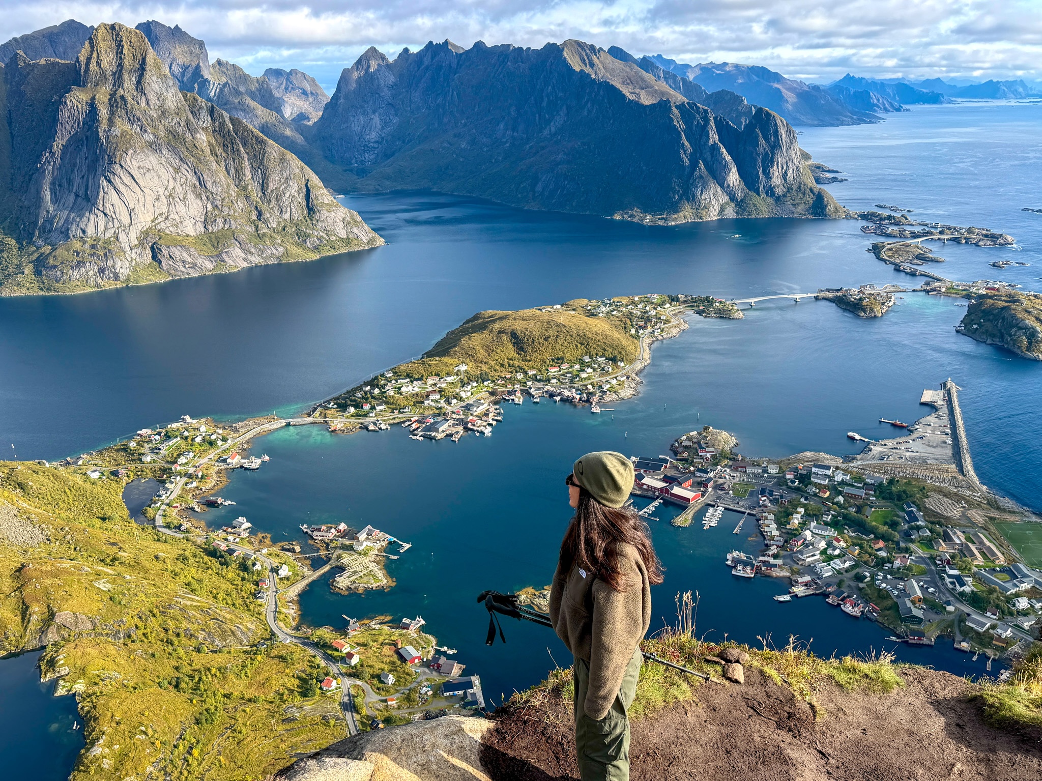
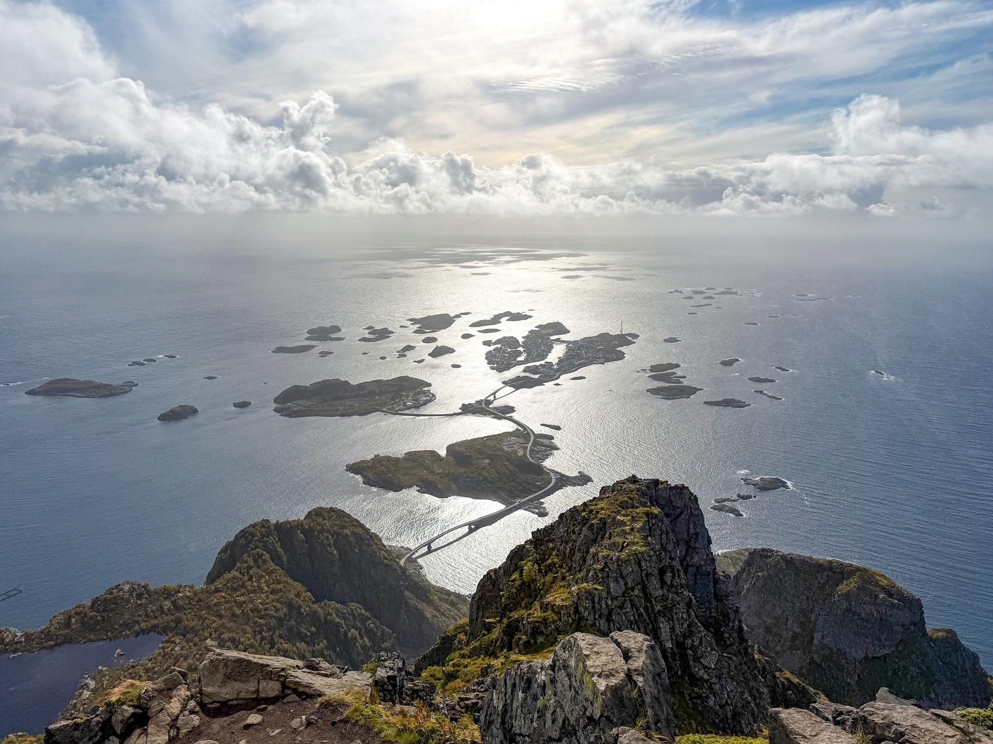
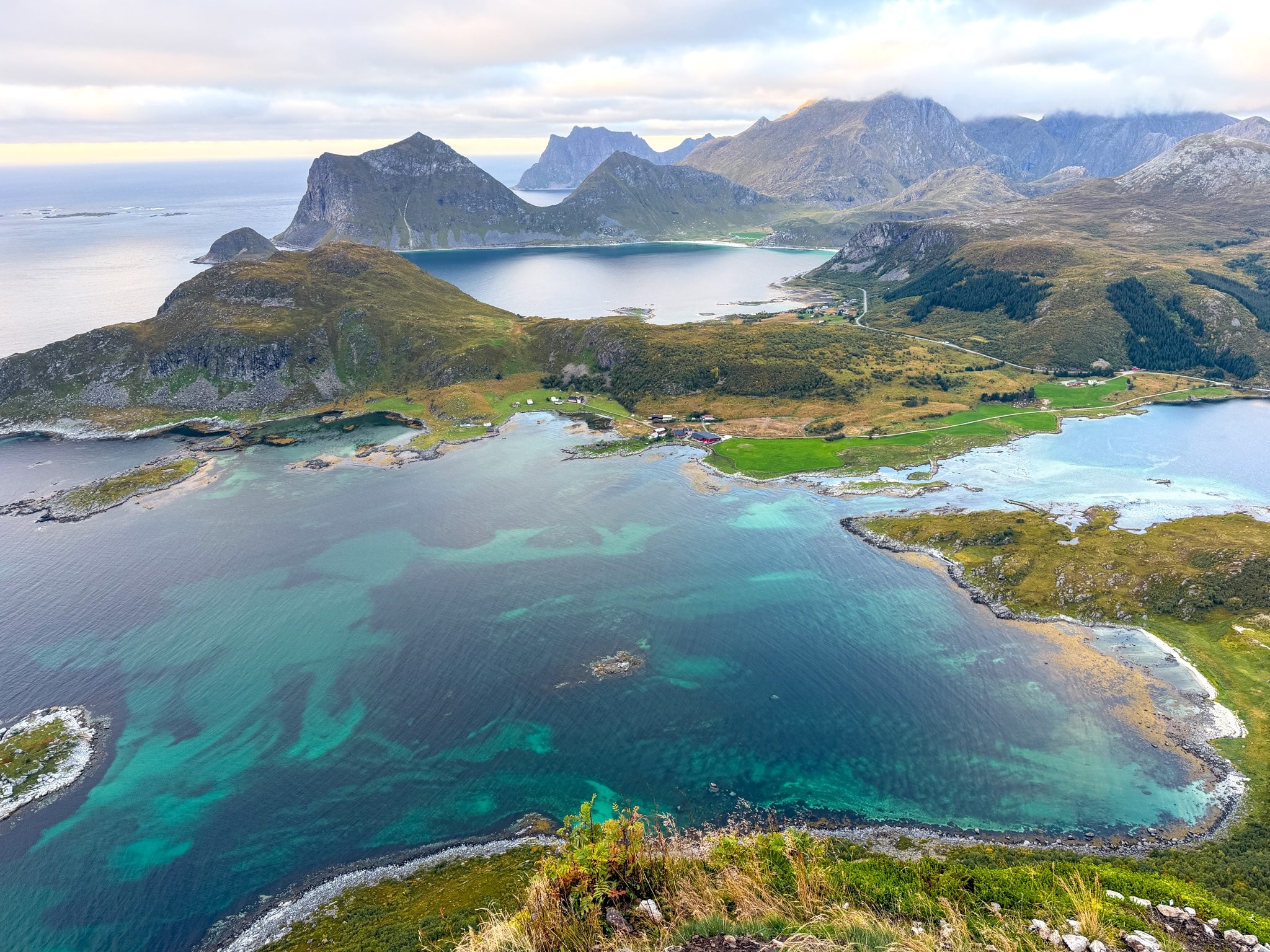
The Mannen hike climbs 400 meters above Haukland Beach in Lofoten. See how the out-and-back compares with the loop via Uttakleiv, where to park, and the trail stats from my recent hiking experience.
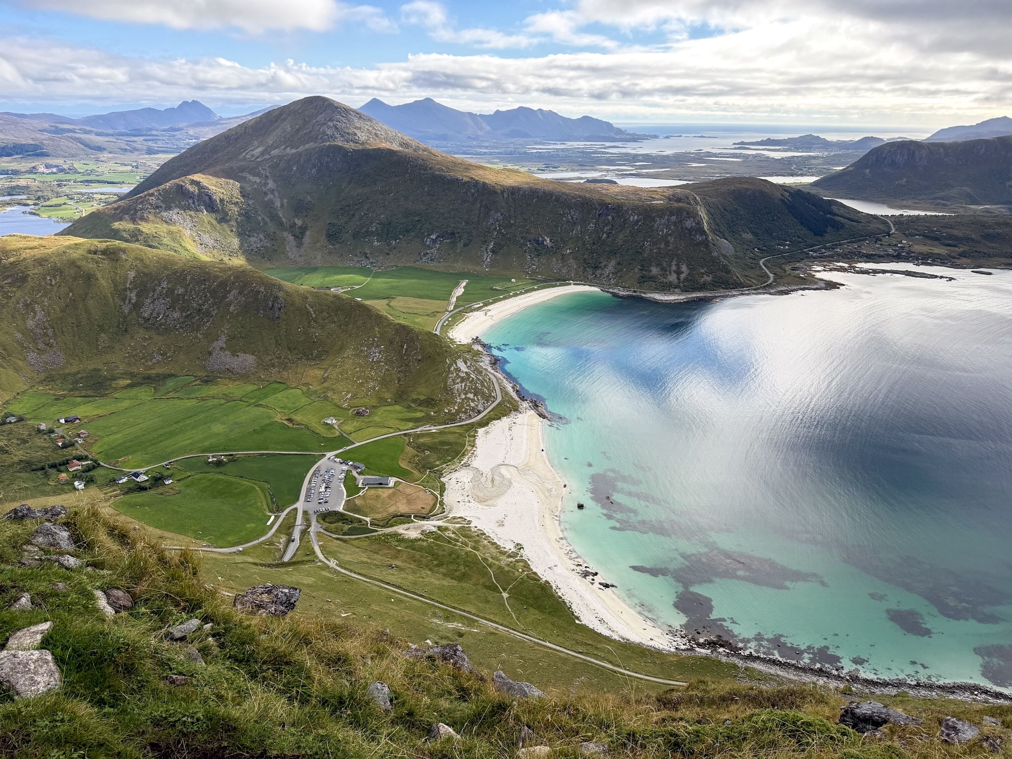
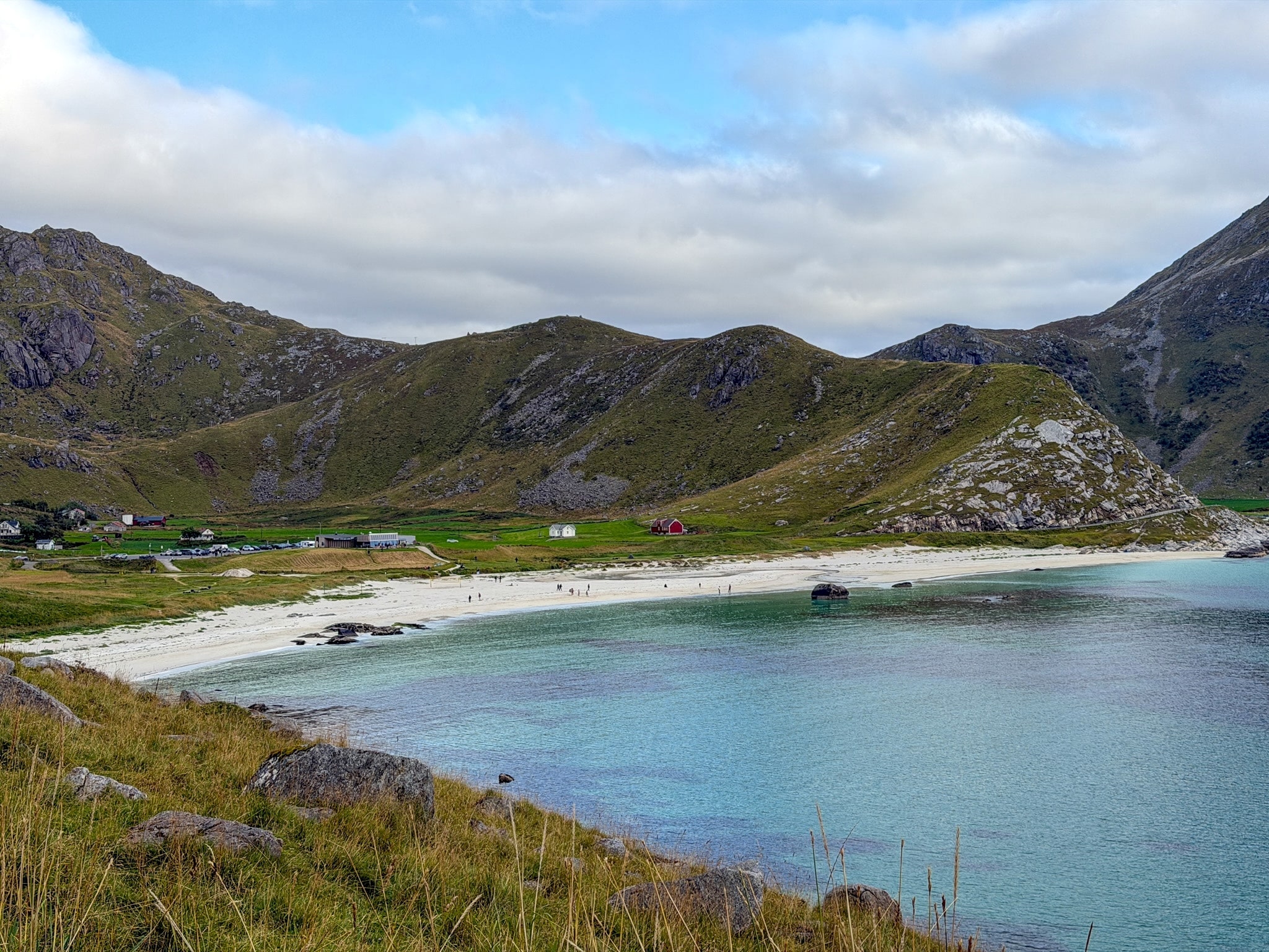
The Mannen hike was the first thing I did in Lofoten, about an hour after picking up my rental car at Leknes airport. It’s a short and fairly steep climb to a 400-meter (1,312 ft) ridge above Haukland Beach, a long curve of white sand and very clear water on the island of Vestvågøy. From the top you look down on three beaches at once.
You can hike Mannen as a quick out-and-back from the Haukland beach parking lot, or keep going down to Uttakleiv, the next beach along, and walk back on a quiet road by the sea. I did the loop, and I’d do it again.
Below I compare both routes with the distances and times from my GPS track, explain how parking at Haukland Beach works, from the pay machines to the Haukland café right by the lot, and walk through each part of the trail so you know where it gets rocky and a bit exposed.
Where to Base Yourself in Lofoten for the Mannen Hike
Lofoten has two main areas to stay: the west, around Reine, and the east, around Svolvær. Haukland Beach is right between them, about 15 minutes from Leknes, so you can do Mannen from either base. If you’d rather sleep close to the trail, there are also a few cabins nearby.
- Lofoten Basecamp: red cabins near Offersøy, the closest of these three options to Haukland, just about 10 minutes by car.
- Lofoten Apartments: my base in the east, near Kabelvåg, with sea views and private parking. About 1 hour 10 minutes from Haukland.
- Anitas Waterfront Cabins: my base in the west, located between Hamnøy and Reine. About 1 hour from Haukland, plus the wait at the Nappstraumen tunnel, which only lets cars through in escorted convoys until the end of 2027.
I compared ten cabins and hotels in both areas in my Lofoten where-to-stay guide, and if you’re still planning flights, here’s the easiest way to get to the Lofoten Islands and Leknes.
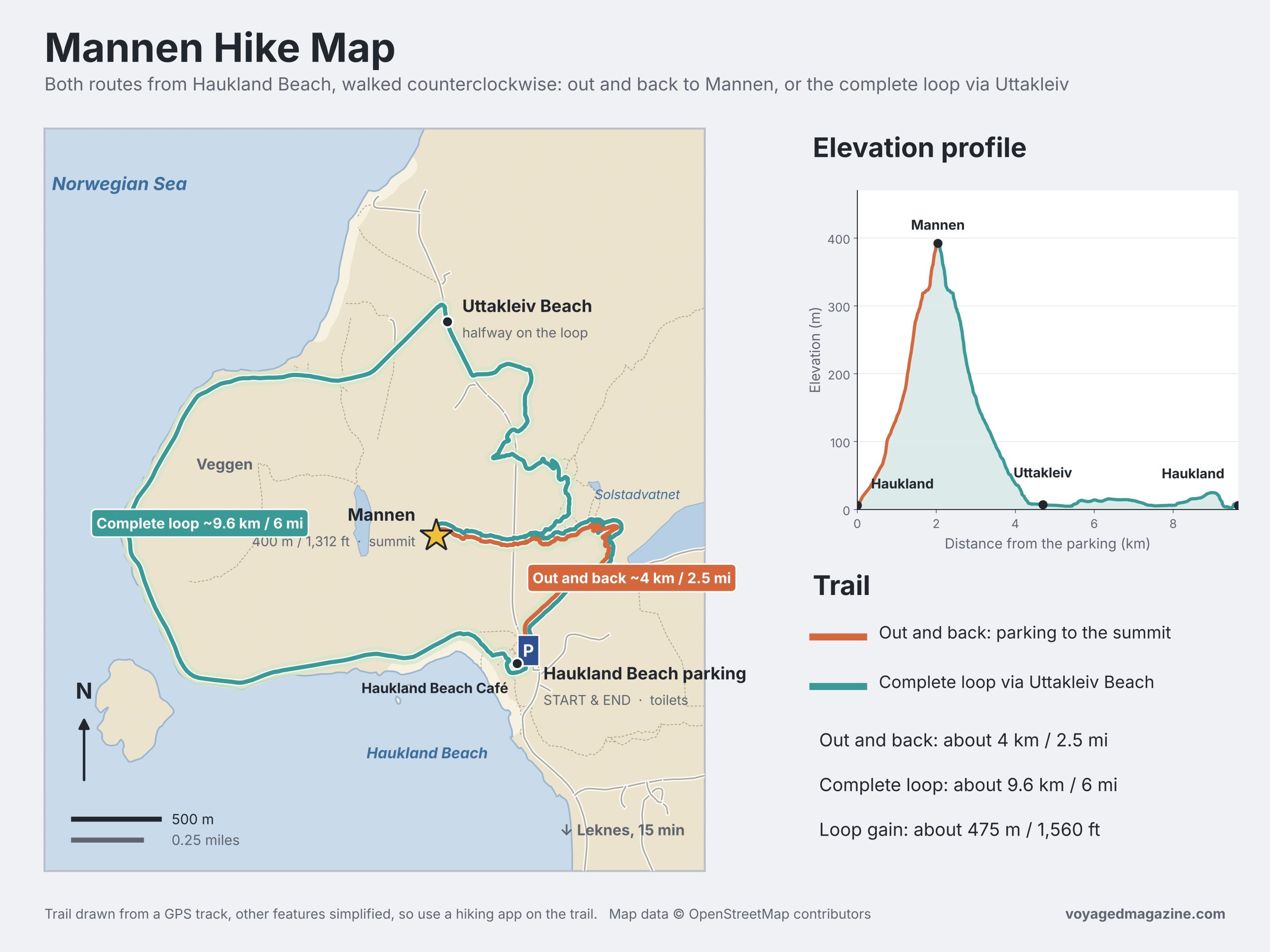
Mannen Hike From Haukland: Quick Info + Trail Map
Mannen is a 400-meter (1,312 ft) mountain on Vestvågøy, one of the central islands of Lofoten. It rises straight above Haukland Beach, and every route up starts from the beach parking lot.
- Start: Haukland Beach parking, about 15 minutes by car from Leknes
- Distance and Elevation:
- Haukland Beach to Mannen (out and back): about 4 km (2.5 mi), 400 m (1,310 ft) of elevation gain, 2 to 3 hours
- Haukland Beach to Mannen & Uttakleiv Beach (full loop): about 9.6 km (6 mi), 475 m (1,560 ft) of elevation gain, 3 hours 45 minutes of walking for me
- Difficulty: moderate on the climb to Mannen, with rocky and slightly exposed sections; easy on the rest of the loop
- Trail markings: no signs at the start, but the path is clear and easy to follow
- Best season: May to September, when the trail is free of snow
- Rules to keep in mind: dogs allowed only on a leash, required from April 1 to October 15 because of grazing sheep
- Parking: paid, with all the details in the parking section below
- Facilities: Haukland Beach Café and toilets right by the parking lot, nothing along the trail
- Alltrails GPX track for this hike here
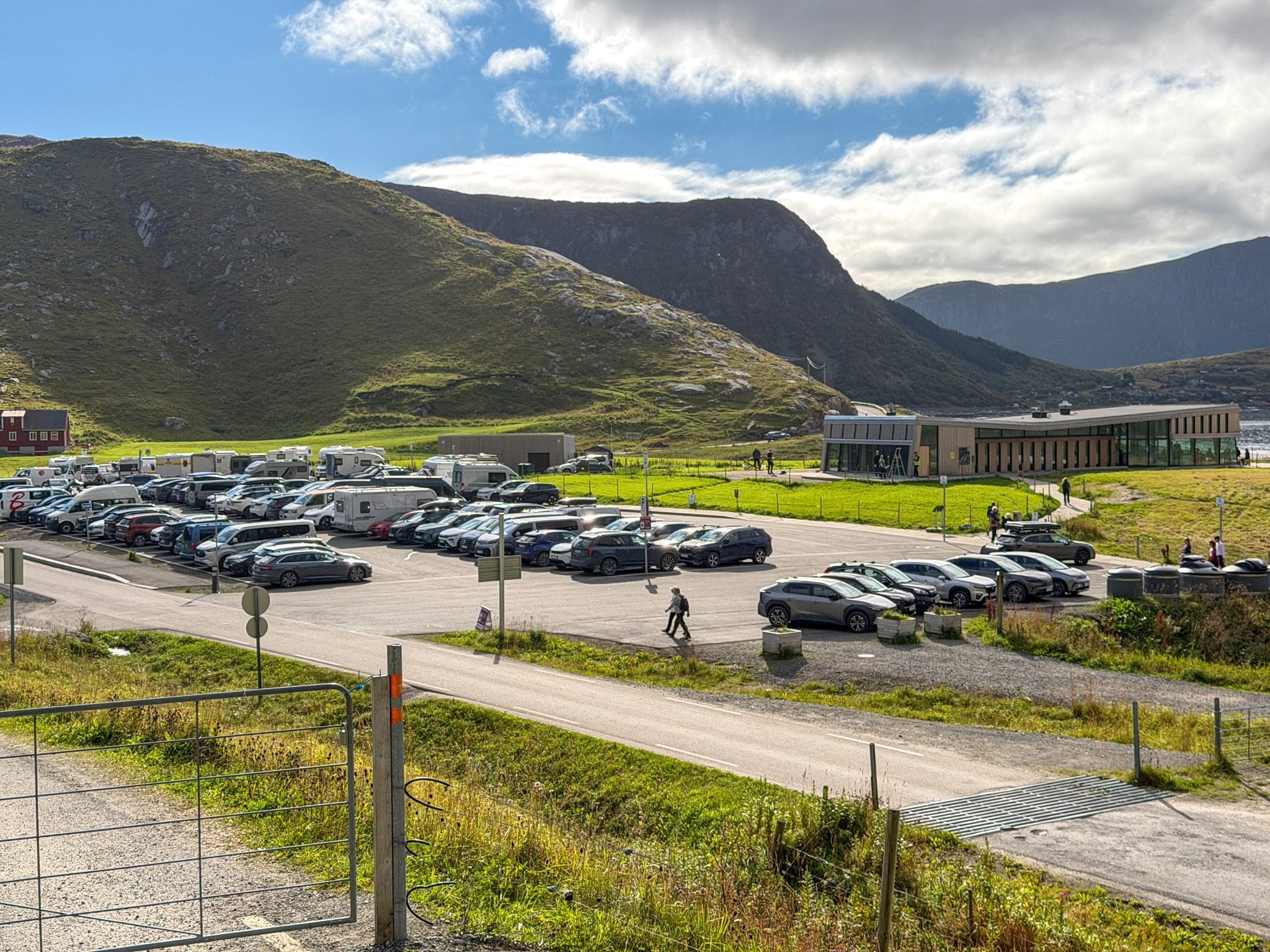
Haukland Beach Parking and the Mannen Trailhead
Parking at Haukland Beach
All hiking routes start from the main lot at Haukland Beach, so this is where you’ll leave the car.
- Size and facilities: a large lot (100 slots for cars and then some more for campervans), with the Haukland Beach Café and toilets at one end
- Price: as of 2026, it's NOK 26 per hour, with the first 20 minutes free. In practice that comes to about NOK 65 for the out-and-back hike (2.5 hours) and about NOK 95 for the complete loop (3.5 hours), EasyPark fee included.
- How to pay: you can use the EasyPark app or the parking lot machine (no paper ticket is issued, it's by license plate).
- When it fills up: it was pretty full when I arrived around 12:30, so in summer I’d come in the morning
- If it’s full: the small parking area at Vik Beach is about a 20-minute walk away
- Fines: keep all four wheels inside the white lines. I explain how parking and fines work in my guide to renting a car and parking in Lofoten.
Without a car
There’s a bus, but it’s seasonal and infrequent, so it only works if you plan around it.
- Bus 765: from Leknes to Haukland and Uttakleiv, only in summer, two departures a day
- Timetable: check it in the Reis app before you go
Where the Mannen trail starts
The trail begins right behind the lot. Go through the metal gate at the edge of the parking lot onto a gravel road, and follow it with Mannen on your left. After a while, a dirt path branches off to the left and heads up the mountain. That’s your trail.
My Mannen Hike from Haukland Beach (+Uttakleiv, Full Loop)
I started at 12:30, a little over an hour after landing in Leknes, and went counterclockwise around the loop. If you’re doing the out-and-back, the first three parts below are your whole hike.
From Haukland Beach to the Pass
The first stretch is easy. A paved bit turns into a gravel road that climbs gently away from the beach, and it gets steeper the higher it goes. There were sheep everywhere, wandering across the road and ignoring me completely.
At some point a dirt path leaves the gravel road and heads up the slope. From here the trail zigzags uphill, with a low stone wall along one side, and every turn gives you a slightly higher view of Haukland Beach and the parking lot shrinking below.
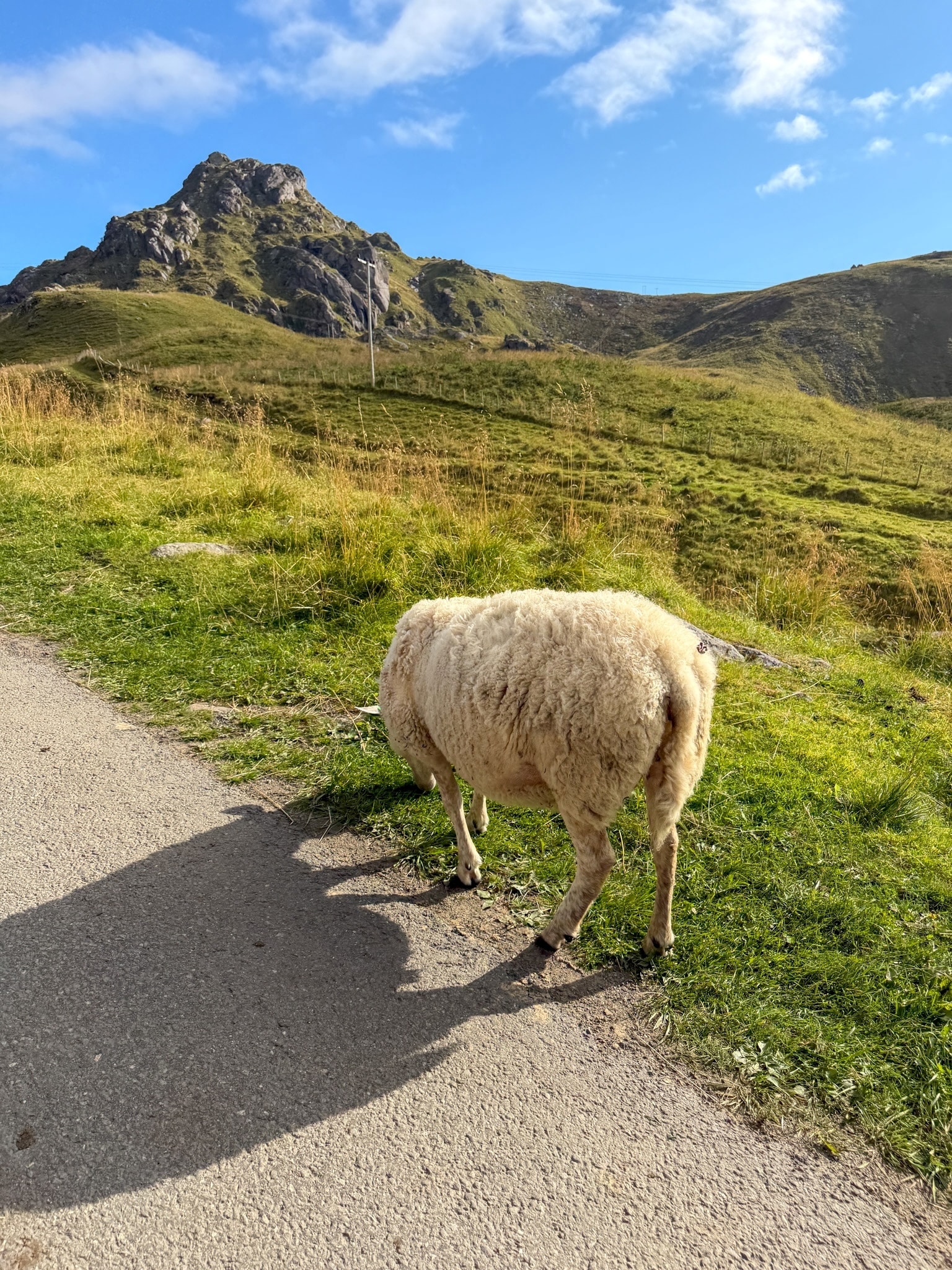
Sheep on the Mannen trail
The welcome committee on the gravel road above Haukland
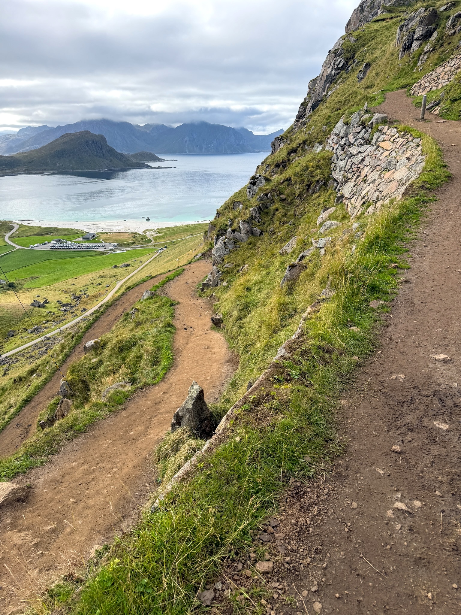
Switchbacks above Haukland Beach
The zigzag section, with Haukland Beach already well below
Up the Ridge to the Summit
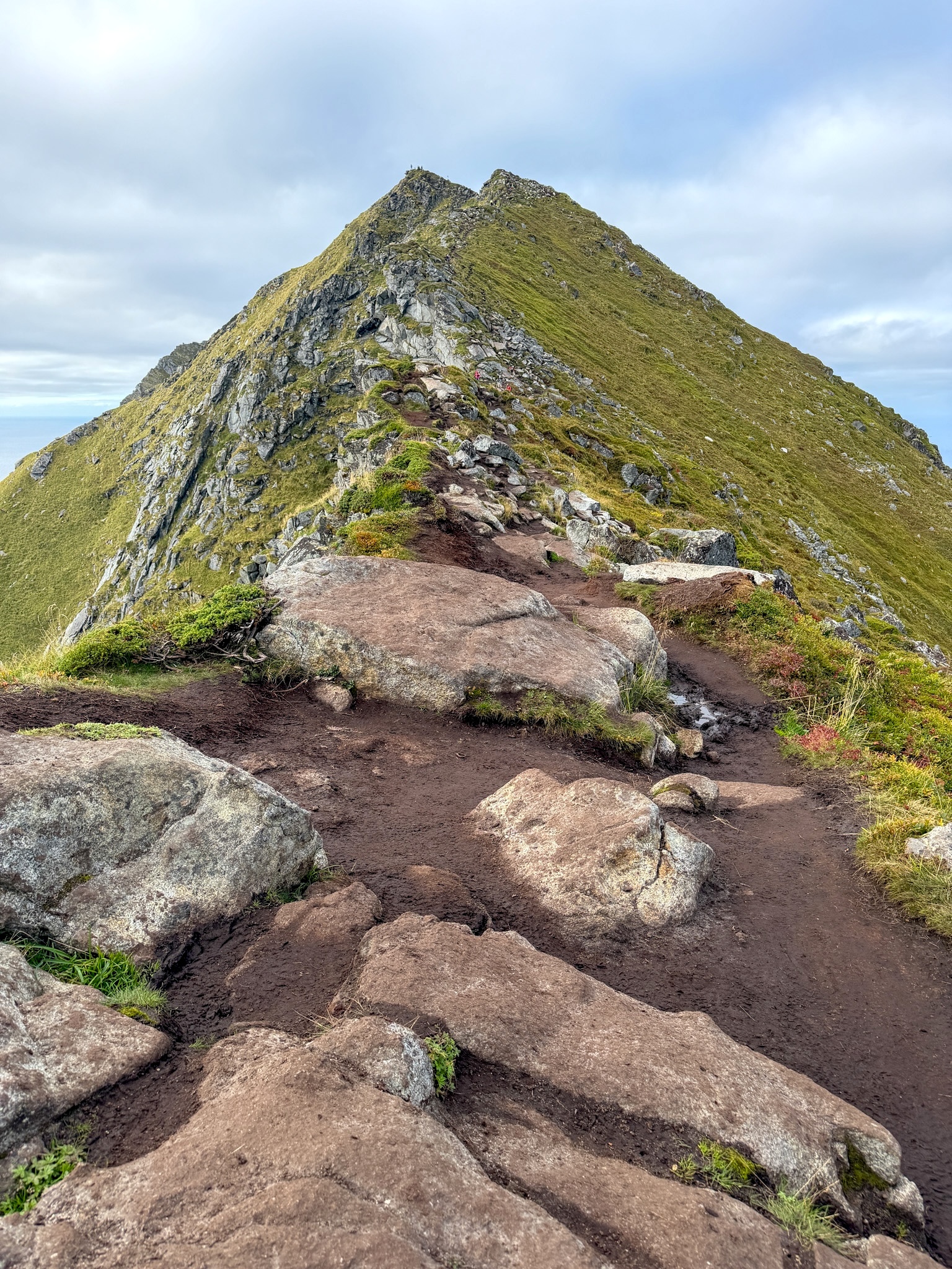
This is where the hike gets real. The path turns into a mix of dirt, mud and rock, worn into deep grooves in places, and you’re walking uphill most of the time. There’s a wooden marker post along the way, and not much else in terms of signs.
On the inland side, the lake Solstadvatnet comes into view and keeps getting bigger as you climb. I stopped more than once just to look at it.
Near the top there are a few spots with big boulders where I used my hands, and a couple of places where the slope drops off close to the path. None of it was hard, but I slowed down and paid attention. The last part follows a narrow ridge of rock and earth straight to the summit.
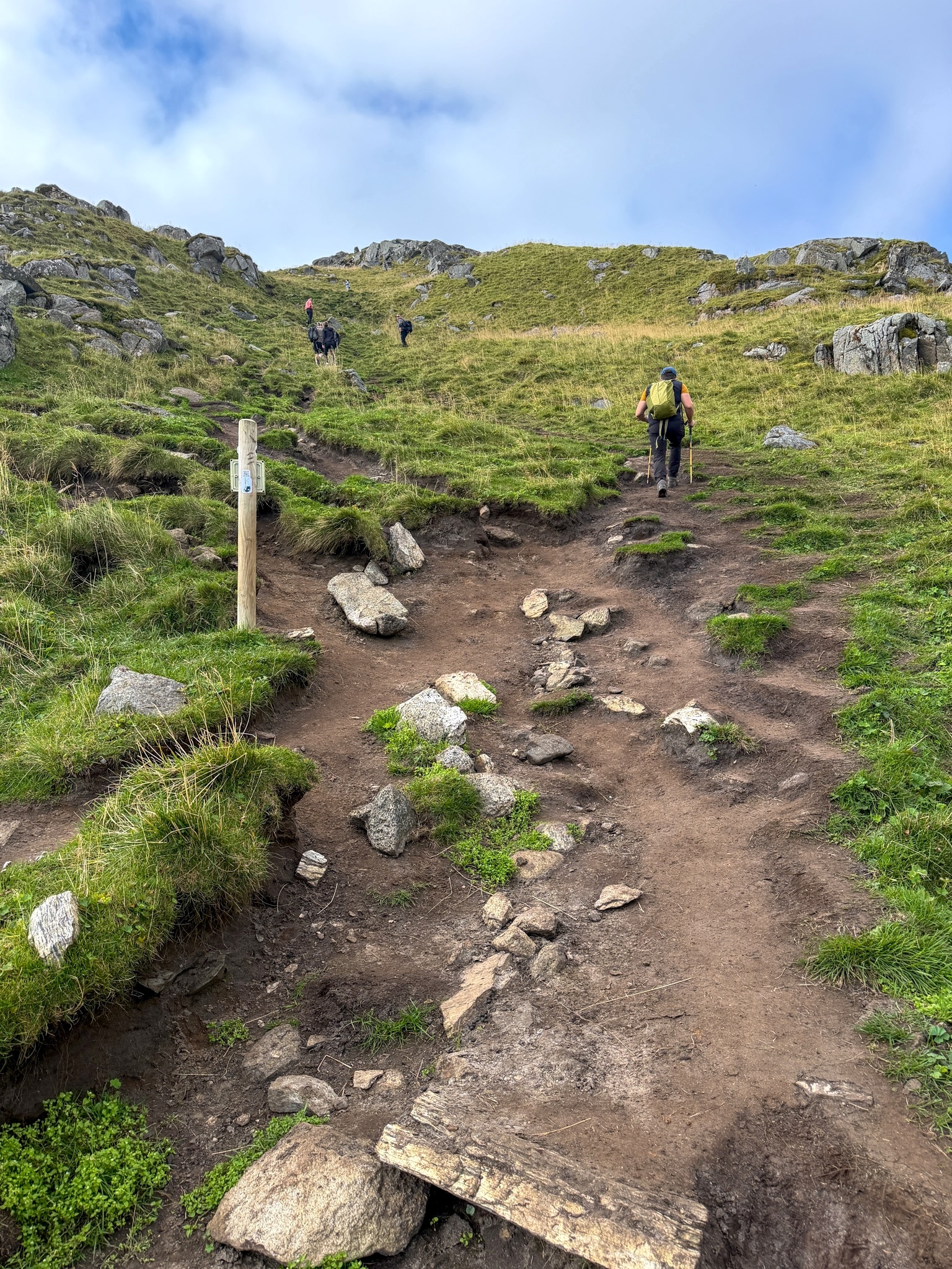
Rocky section of the Mannen trail
Mud and loose rocks on the way up, with a wooden post marking the path
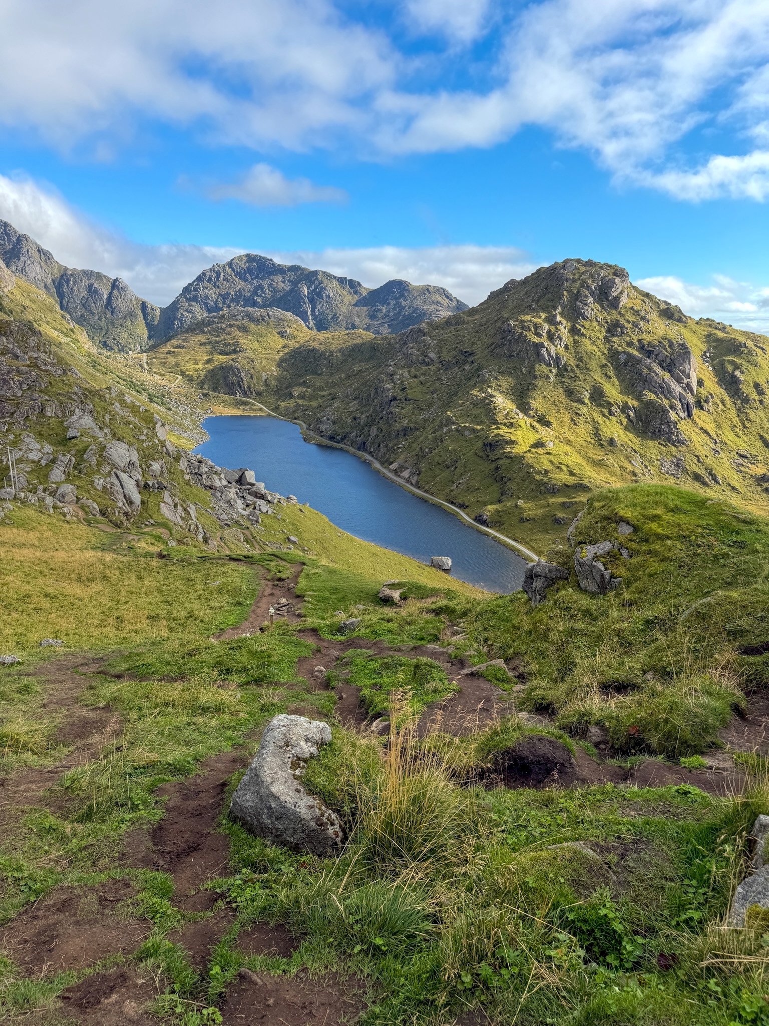
Solstadvatnet from the Mannen trail
Solstadvatnet, on the inland side of the ridge
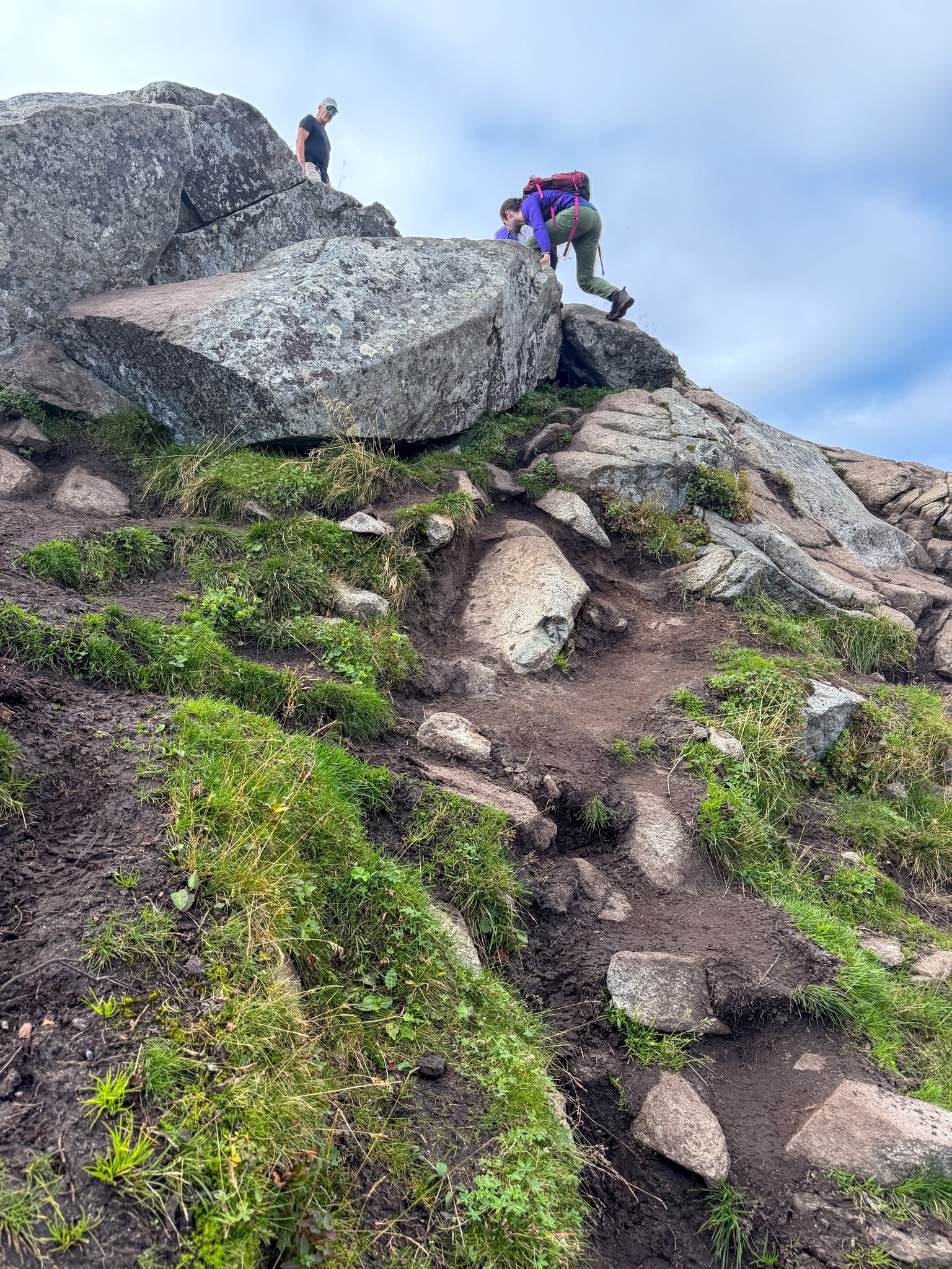
Boulders near the top of Mannen
One of the spots near the top where you need your hands
The View From the Top of Mannen
I reached the summit at 13:42, so about an hour and ten minutes from the car. On one side you look straight down on Haukland Beach, on the other on Vik and Uttakleiv, all white sand and that very clear turquoise water. It was a mix of sun and clouds, and the clouds were reflecting on the sea, which looked great in photos.
There were a few other people at the top, but plenty of space. I stayed about 15 minutes, mostly taking photos, including the classic one sitting on the rock that sticks out over Haukland.
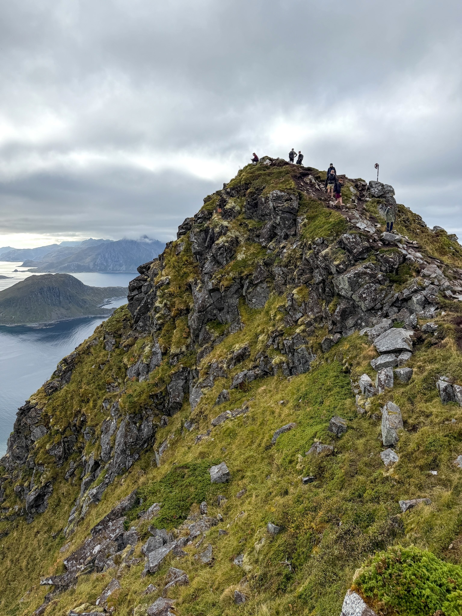
Mannen summit point
Approaching the Mannen Hike Summit
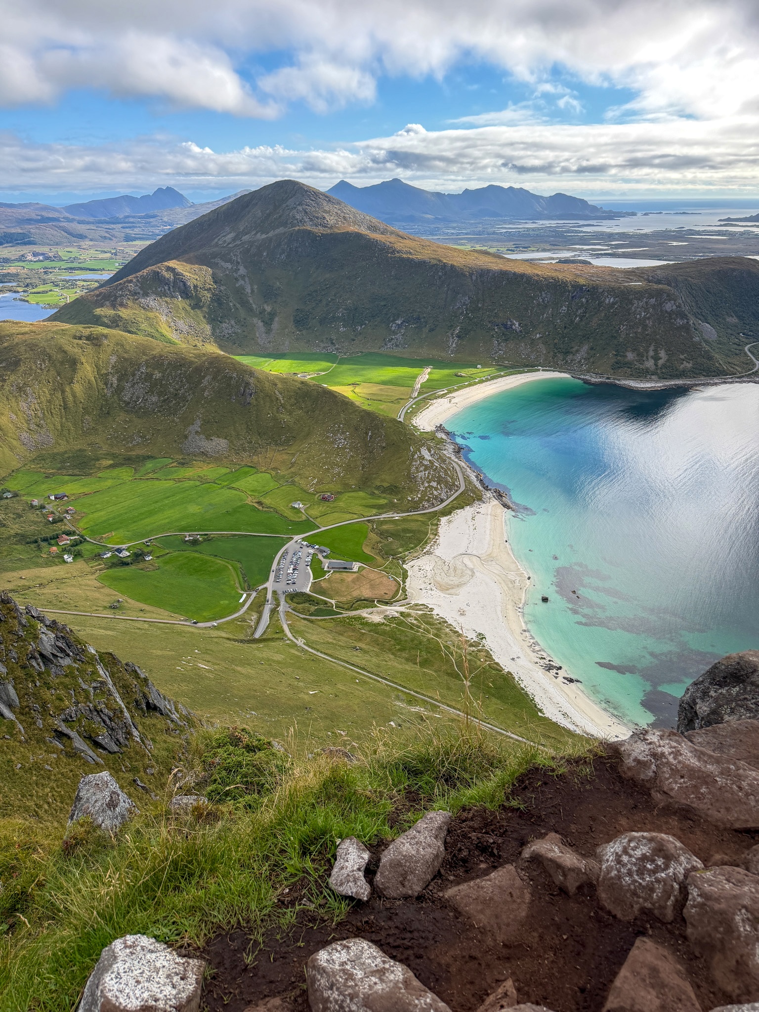
View from the summit of Mannen
Haukland Beach from the summit of Mannen
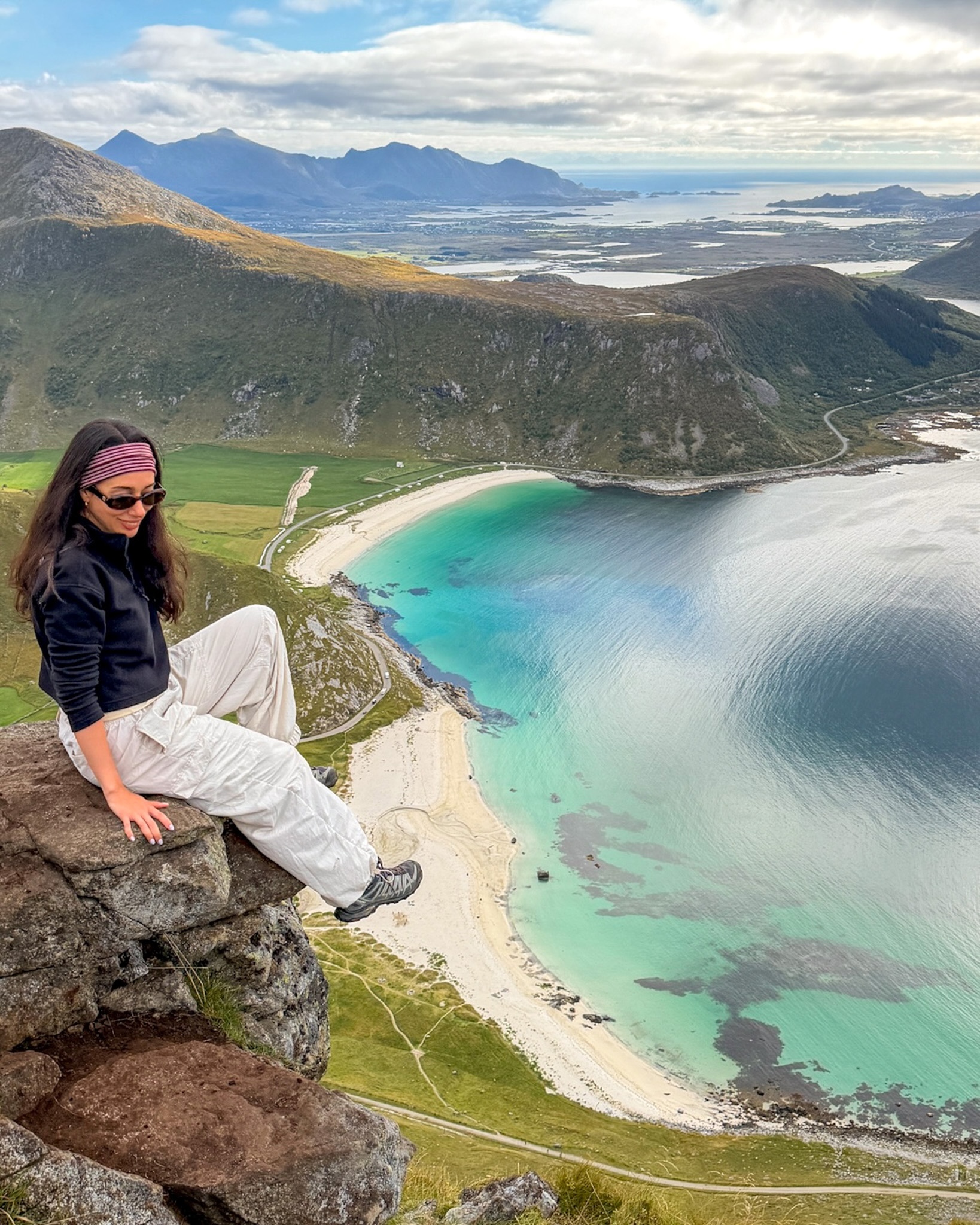
Photo spot on Mannen
Me on the rock above Haukland Beach, the most popular photo spot on the Mannen hike
Down to Uttakleiv and Back Along the Coast
To continue the loop, I went back down from the summit and kept left toward Uttakleiv. From here on it’s all downhill or flat, first on a path of compact gravel and then on roads, some paved and some not. After the climb it was a nice change to walk without looking at my feet.
The path passes a small stream and then a farm before reaching Uttakleiv Beach, which has white sand, big boulders scattered across the grass and a beach volleyball net. From there the road follows the coast back to Haukland, under the steep cliffs of the Veggen mountain.
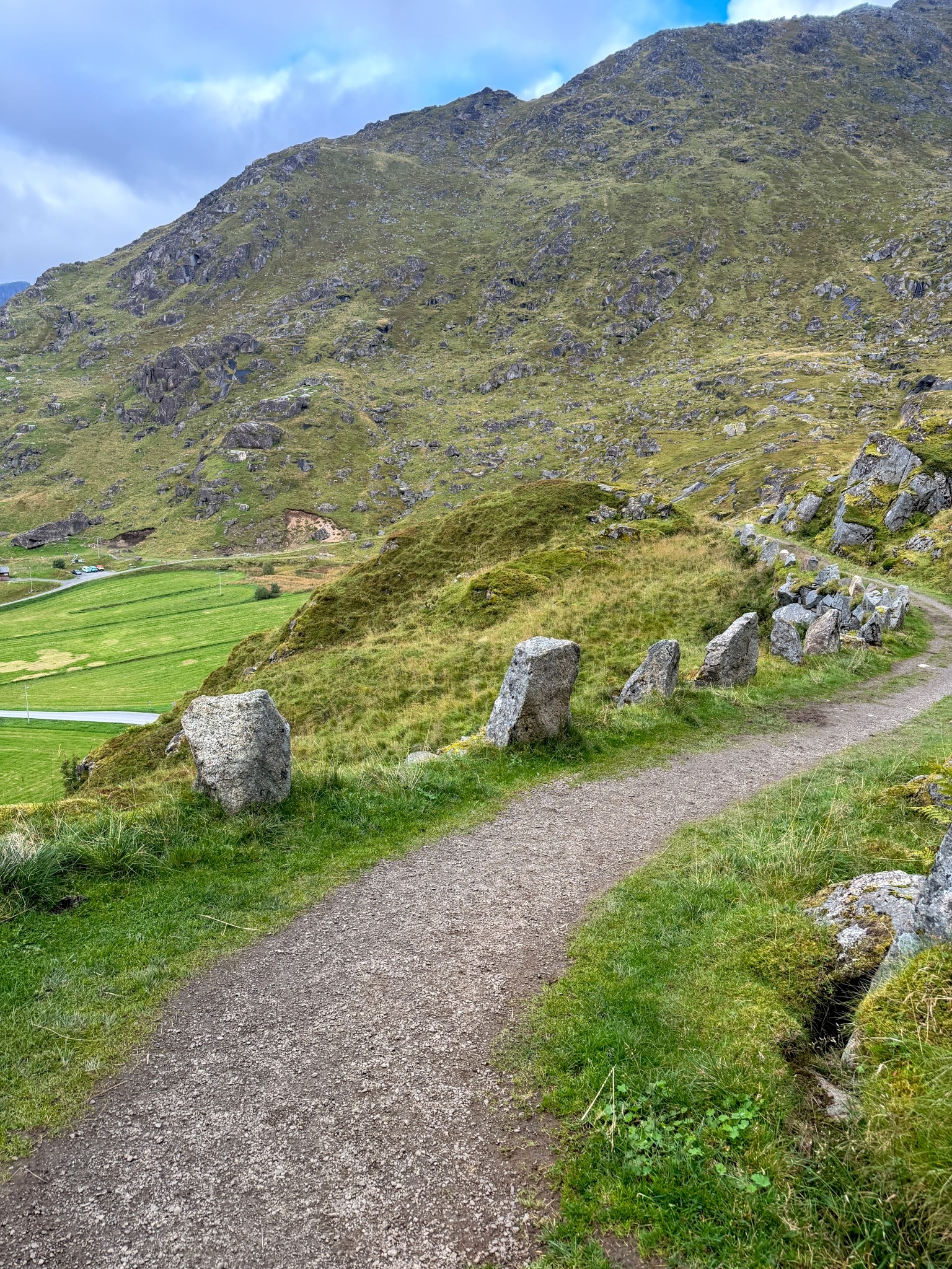
Path down to Uttakleiv
The easy gravel path down toward Uttakleiv
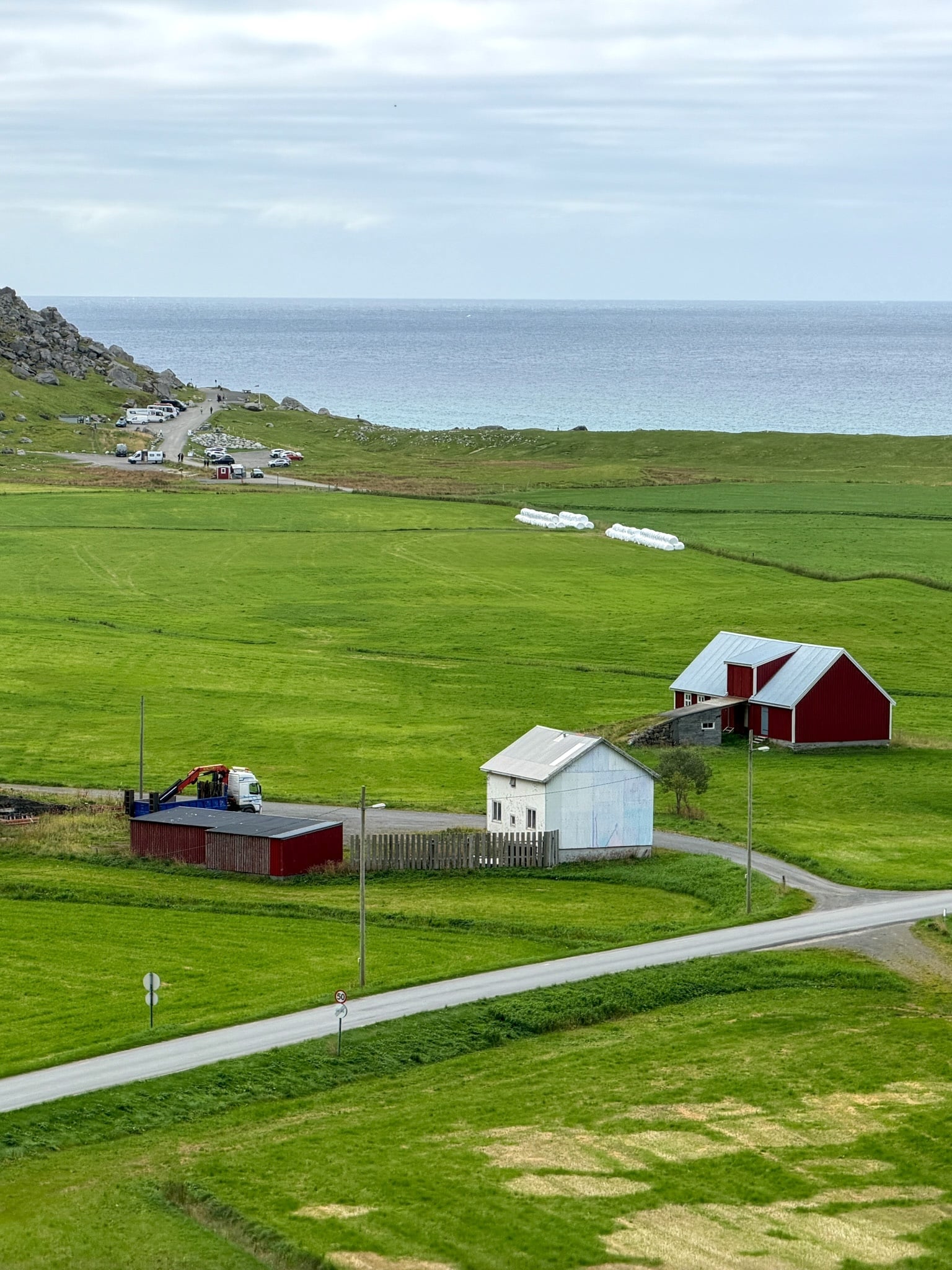
Farm at Uttakleiv
Farms and fields just before Uttakleiv Beach
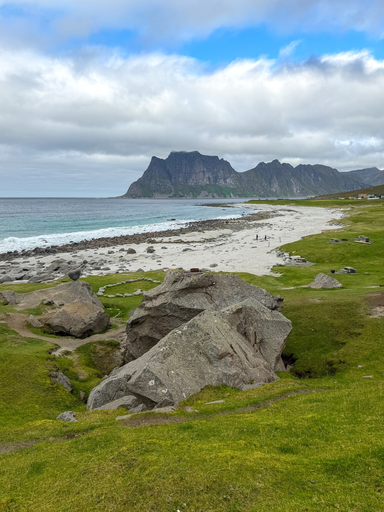
Uttakleiv Beach from Mannen Hike Lofoten
Uttakleiv Beach
Is the Mannen Hike Hard?
I’d call the Mannen hike moderate. The climb from Haukland Beach to the summit takes some effort and a bit of attention, while the rest of the loop is easy. It’s more exposed than the Offersøykammen hike a few minutes down the road, but much shorter and less tiring than the Kvalvika Beach and Ryten loop near Reine.
What makes it harder
All of these are on the climb, mostly in the last part before the summit.
- Exposure: a few short spots where the slope drops off right next to the path
- Boulders: a couple of places where I used my hands
- Mud: slippery sections even on a dry day, worse after rain
- Wind and weather: the ridge is open, so rain or strong wind make the top much less pleasant
Who it suits
Anyone who hikes now and then should be fine, with a couple of exceptions:
- Fear of heights: the exposed bits are short, but they come right before the summit
- Kids: I don't think it's safe for kids younger than 13. With younger kids I’d do the coastal walk below.
For Families: The Coastal Walk From Haukland to Uttakleiv
If you don’t want the climb, you can still walk from Haukland Beach to Uttakleiv Beach on the flat route along the sea. It’s the same stretch I used to get back at the end of my loop, just without Mannen.
- Distance: about 4.5 km (2.8 mi) each way, according to the Vestvågøy municipality
- Surface: a road along the coast, partly paved and partly gravel, under the cliffs of Veggen
- Who it suits: families with kids, anyone who doesn’t enjoy steep climbs, and even strollers, wheelchairs and bikes
- Getting back: walk the same way, or check if the summer bus 765 fits your timing
I’d recommend it to anyone with small kids. You get two of the best beaches on this part of Lofoten, and Uttakleiv, with its boulders on the grass and the volleyball net, is a good place to stop before walking back.
Coffee at Haukland Beach After the Hike
The loop ends right back at the Haukland Beach Café, in the glass-fronted building next to the parking lot. There are wooden tables outside facing the beach, and that’s where I sat.
I had a cappuccino and a slice of nut cake, plus a brownie on the table to share. They also had cinnamon buns. After almost four hours of walking it all disappeared fast.
Before leaving I walked down to the water and put my feet in. The water is so clear you can see every stone on the bottom. It was also freezing, at least by my standards, so the feet lasted about a minute.
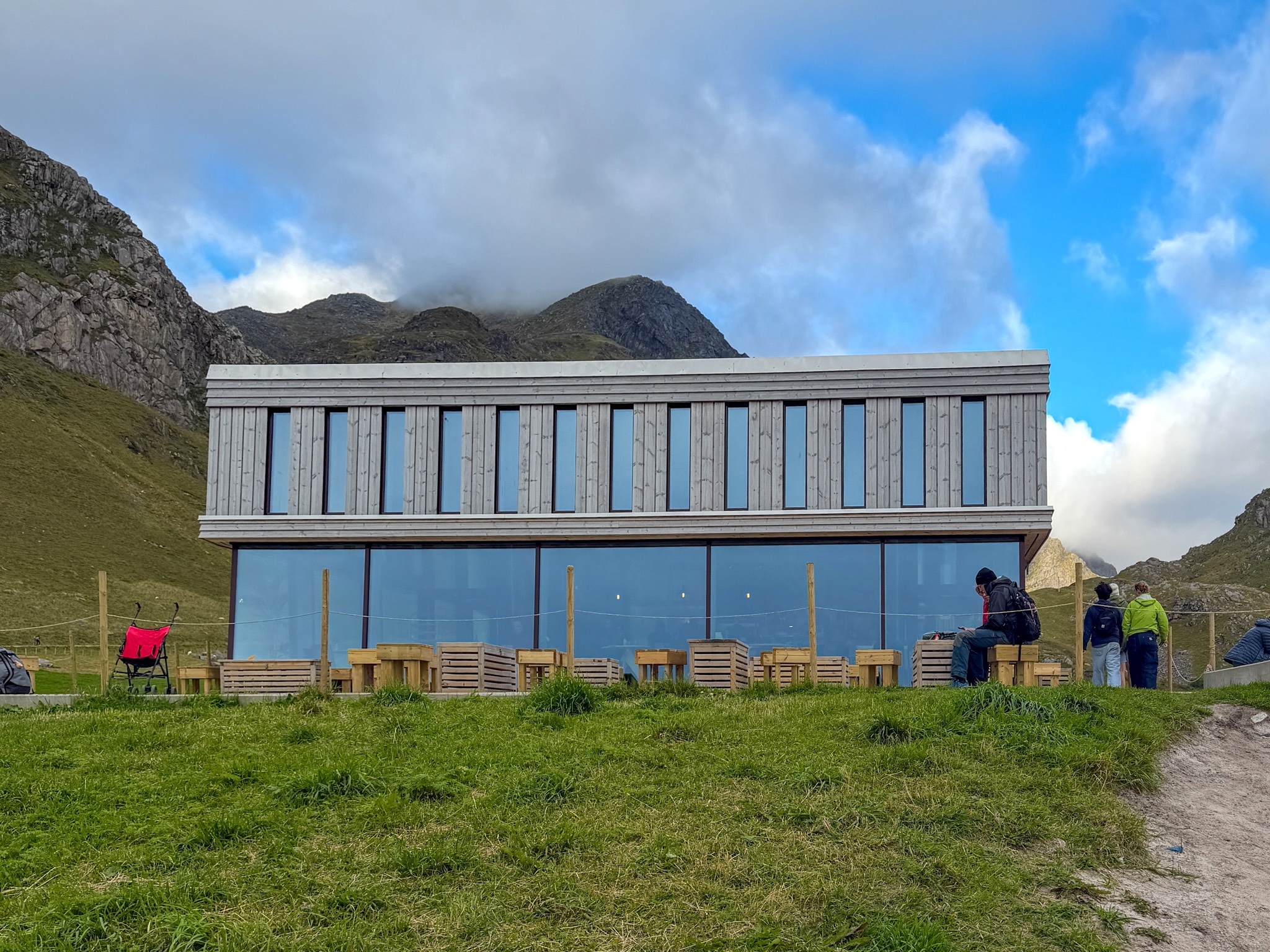
Haukland Beach Café
The Haukland Beach Café, right next to the parking lot

Coffee and cake at Haukland Beach Café
My post-hike coffee and cake
Mannen Hike FAQ
Can you start the Mannen Lofoten hike from Uttakleiv?
Yes. The loop works in both directions, so you can park at Uttakleiv Beach, walk the coastal road to Haukland first and climb Mannen at the end, or climb from the Uttakleiv side. I started from Haukland because I wanted the steep part first.
Can you do the Mannen hike in Norway’s winter?
Not as a normal hike. From late autumn to spring the trail is usually covered in snow and ice, and the exposed spots near the summit become a real risk. I’d only go then with winter hiking experience and the right gear, or with a local guide.
What time of day is best for Mannen?
Any time with clear weather. I went at midday and had good light on the beaches. In summer, mornings are easier for parking, and from late May to mid-July the midnight sun means you can hike late in the evening too.
Can you hike Mannen and Offersøykammen on the same day?
Yes, that’s what I did. I finished the Mannen loop around 16:30, drove to the Skreda parking for Offersøykammen, started at 18:00 and was back at the car by 20:00. Here’s how the Offersøykammen hike went for me.
Can you see the northern lights at Haukland Beach?
Haukland faces north and has very little light around it, so it’s a good spot if the forecast is right. I didn’t see the aurora here myself, but I saw it near Reine and shared the forecast apps and spots I used to see the northern lights in Lofoten.
Check Out My Other Lofoten Guides
- Where to Stay in Lofoten: Best Areas, Hotels & My Experience
- How to Get to the Lofoten Islands: 4 Easy Routes + My Pick
- Renting a Car in Lofoten: Agencies, Parking & My Driving Tips
- Lofoten Northern Lights: Best Time, Places & Forecasts I Used
- Kvalvika Beach & Ryten Hike: Routes, Parking, Map & My Tips
- Offersøykammen Hike, Lofoten: Parking, Trail Map & My Stats
- Festvågtind Hike, Henningsvær: Difficulty, Map & My Photos
- Reinebringen Hike: Trailhead, Parking Lots, Steps & Closures
Keep reading: