How to hike to Kvalvika Beach and Ryten in Lofoten, from where to park and which route to pick to how the trail looks after the 2026 works, based on my experience with the loop that ended on the famous rock.
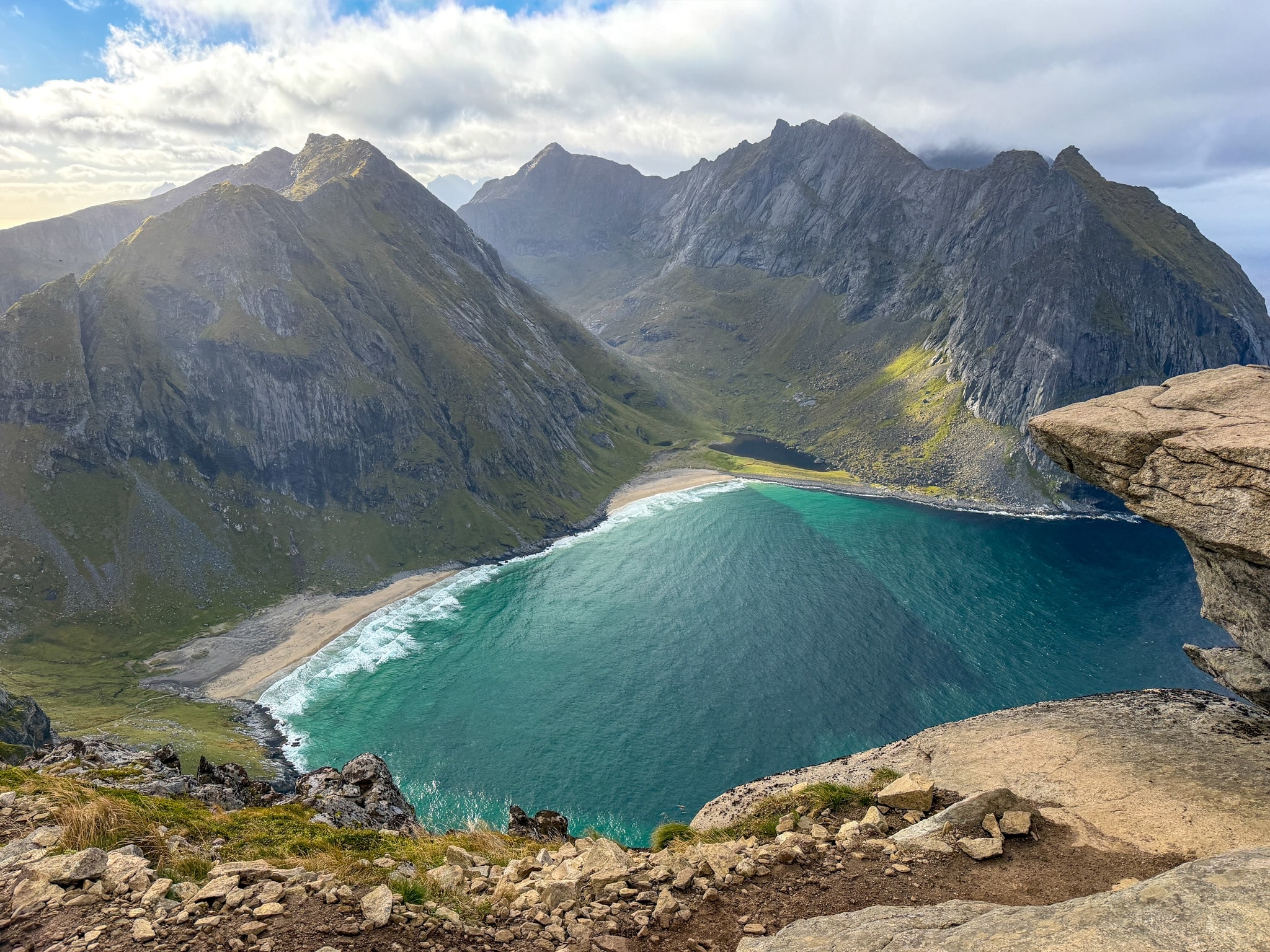
Kvalvika Beach is a sandy bay on the north side of Moskenesøy, one of the western Lofoten islands, and no road reaches it. You can only walk in. Ryten is the 543 m (1,781 ft) mountain right next to it, and from the top you look straight down on the whole beach.
I hiked both in September 2026 as one loop, starting early in the morning, going down to the beach first and keeping Ryten for the end (you can also do it the other way). It was probably my favorite hike of the whole trip, a nice trek with a bit of everything and very little that’s technical.
This guide covers where to park (you have two options), the different routes you can take, the trail step by step with my photos, and how Kvalvika Beach and Ryten trail looked with the 2026 trail works still going on.
As you'll see scrolling down, I had a rare encounter with Nepalese Sherpas at work.
Where I’d Stay Near Kvalvika Beach
- Anitas Waterfront Cabins: where I slept. It’s a modern cabin between Hamnøy and Reine, with a kitchen and private parking, and about 30 minutes by car from the trailhead.
- Sakrisøy Rorbuer: the yellow fishermen’s cabins on Sakrisøy, next to Reine and about 35 minutes from the trailhead.
- The Tide Hotel: a smaller hotel with breakfast included, farther south and about 40 minutes from the trailhead.
More options in each area are in my guide to where to stay in Lofoten.
Kvalvika Beach & Ryten Hike at a Glance, and Map
You can do this hike in three ways. I did the full loop, which links the beach and Ryten. The two shorter versions are out-and-back hikes, where you walk in and come back the same way, each from a different parking lot.
- Distance and elevation:
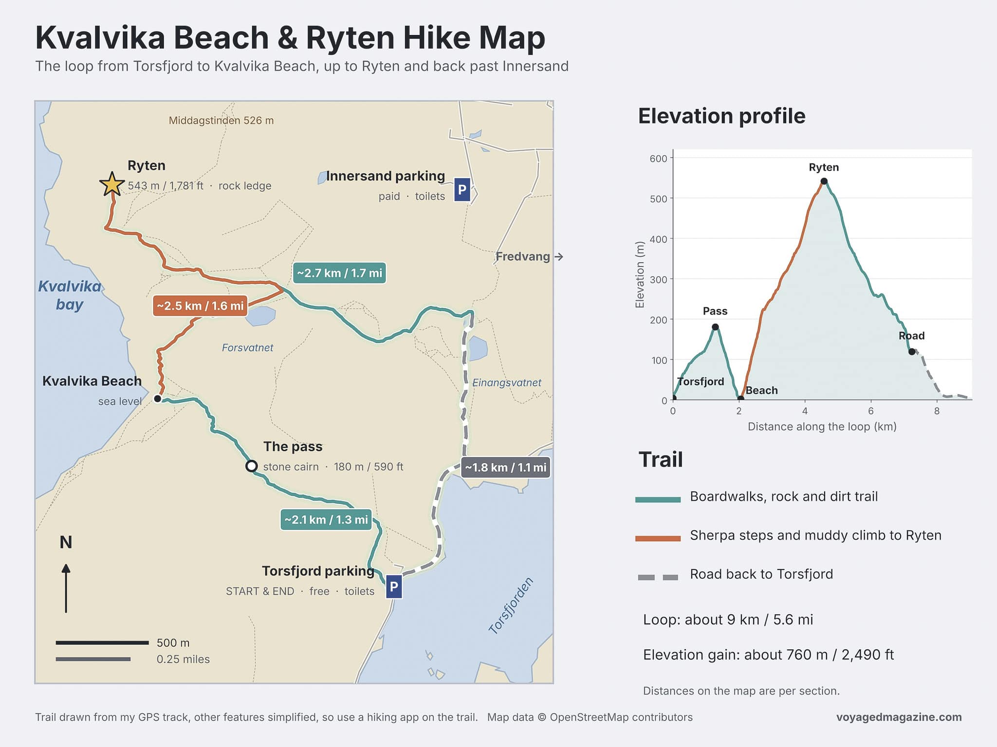
- Full loop: about 9 km (5.6 mi) round trip with 760 m (2,490 ft) of elevation gain.
- Beach only, from Torsfjord: about 4 km (2.5 mi) round trip with 330 m (1,080 ft) of elevation gain
- Ryten only, from Innersand: about 7 km (4.3 mi) round trip with 520 m (1,710 ft) of elevation gain
- Highest point:
- Full loop and Ryten only: Ryten, 543 m (1,781 ft)
- Beach only: the pass above the beach, about 180 m (590 ft)
- Time:
- Full loop: a little over 4 hours, which is what it took me with photo stops
- Beach only: about 2 hours
- Ryten only: about 3 hours
- Difficulty:
- Full loop: moderate. Nothing technical, but the climb from the beach to Ryten is long and steep, and some stretches are muddy.
- Beach only: easy to moderate, with a steep and rocky descent from the pass to the sand
- Ryten only: moderate, with the steepest part right after the parking lot
- Start (Trailhead and Parking):
- Full loop: Torsfjord or Innersand parking
- Beach only: Torsfjord parking
- Ryten only: Innersand parking
- Facilities: toilets at both parking lots, nothing on the trail
- Cost: the trail is free; you only pay for parking at Innersand or Fredvang School
The Kvalvika Beach & Ryten trail map below shows the loop with both parking lots, the beach, Ryten and the elevation profile-
How to Get to Kvalvika Beach & Ryten: Parking and Bus
There are two places to park for the Kvalvika Beach and Ryten hike, both near the village of Fredvang and both about 30 to 35 minutes by car from Reine. Both parking areas are in front of the trailheads.
Torsfjord Parking (Free, Closest to the Beach)
- Price: free
- Space: small, with room for about 16 cars
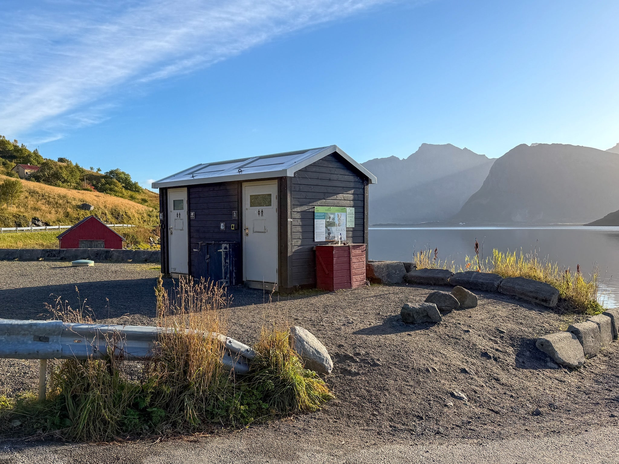
- Facilities: public toilets right by the water
- Walk to the trail: none, the trailhead is across the road
- Best for: the beach-only hike, or the full loop if you arrive early
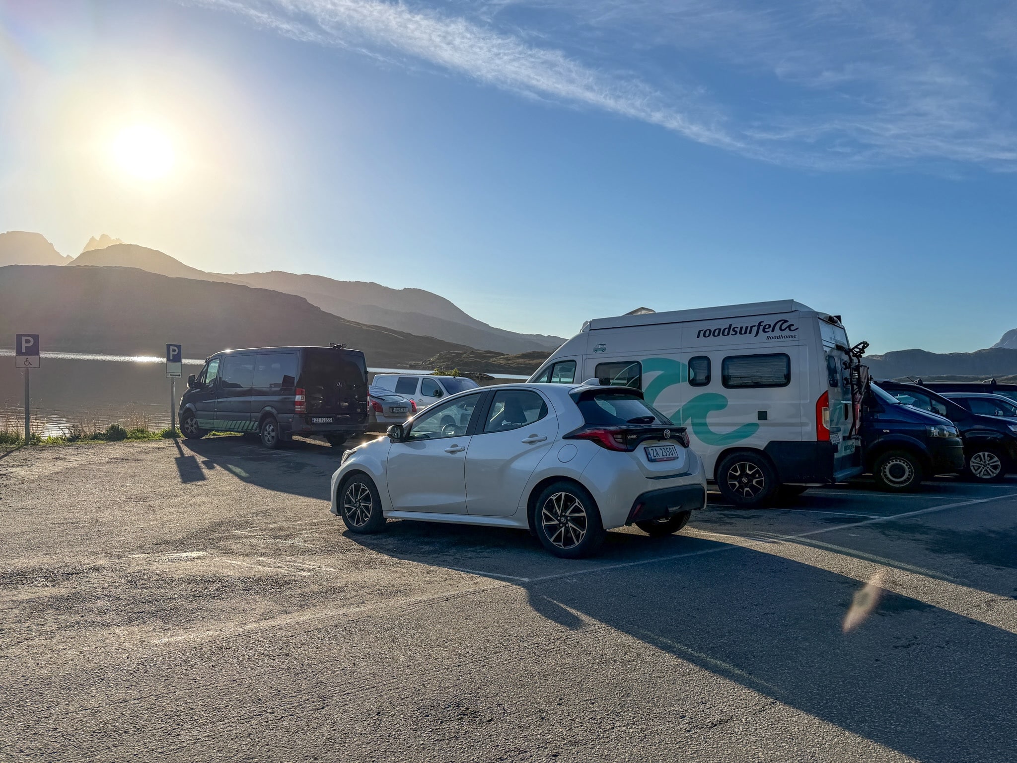
This is where I parked. I pulled in at 8:40 a.m. in September and there were two spaces left. In summer it’s usually full by around 9 a.m., so get there early or plan on Innersand. Also, please park with all four wheels inside the white lines. When I got back after the hike, an attendant was fining a car that had one wheel over the line. I explain the parking rules and fines in Lofoten in more detail in my guide to renting a car in Lofoten.
Torsfjord parking for Kvalvika Beach
The Torsfjord parking lot at 8:40 a.m. in September, with two spaces left.
Toilets at Torsfjord parking
The toilets at Torsfjord, the last ones before the beach.
Innersand Parking (Paid, Closest to Ryten)
- Price: 100 NOK (about $10) per day, by cash, card or Vipps (a Norwegian payment app)
- Space: large, with room for over 80 cars
- Facilities: toilets, drinking water and trash bins
- Walk to the trail: a short path of about 350 m (0.2 mi) to the main trail
- Best for: the Ryten-only hike, or the full loop in the other direction
It’s a private lot on a local farm, signposted as “Parking for Kvalvika og Ryten” after you cross the Fredvang bridges. I didn’t park here, but the loop passes close to it on the way down from Ryten.
There's a third parking lot sometimes mentioned in guides: the Fredvang School Parking. The local tourist office recommends it in high season because the two trailhead lots fill up, but the walk adds about an hour to your day. It's about 3 km (1.9 mi) along the road to the trailheads, and it costs 250 NOK (about $24) per day, paid with the EasyPark app. No facilities are listed on site
Can You Get to Kvalvika Beach by Bus?
Yes, but it takes planning. No regular bus goes into Fredvang itself, so the trailheads aren’t served directly.
- Bus to take: line 300, the main bus that crosses Lofoten along the E10. Get off at the Fredvang kryss stop, where the road to Fredvang leaves the E10.
- Walk from the bus stop: about 4 km (2.5 mi) to the Innersand parking, around an hour, and about 5.5 km (3.4 mi) to Torsfjord.
- Frequency: only a few buses a day, even in summer. Check the times in the Reis app.
With the walk from the road in both directions, the full loop turns into a very long day. Without a car, I’d do Ryten only from Innersand, since it’s the closer of the two trailheads.
Which Route Should You Take? Beach, Summit or Complete Loop
All three versions use the same Kvalvika trail network, so the choice comes down to time, legs and what you want to see. The beach and the view from Ryten are two very different halves of this hike.
a) Torsfjord Parking to Kvalvika Beach Trail Only
- Quick stats: about 4 km (2.5 mi) round trip, 330 m (1,080 ft) of elevation gain, easy to moderate
- Best for: a shorter morning, families, or anyone camping on the beach
- What you see: boardwalks across a bog, a pass marked by a big stone cairn and then the bay opening up below you
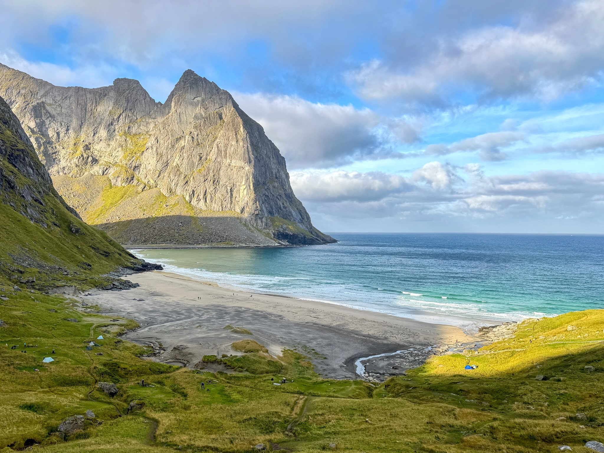
- Best photo spot: the first part of the descent from the pass, where the whole beach and the mountain wall behind it appear at once
- What you miss: the view of the whole beach from above
- My take: this is the first part of the loop I did. From the car to the sand took me about 50 minutes. The descent from the pass is steep and rocky, and a bit slippery when it’s wet.
b) Innersand Parking to Ryten Trail Only
- Quick stats: about 7 km (4.3 mi) round trip, 520 m (1,710 ft) of elevation gain, moderate
- Best for: the view, photos, anyone who likes a steep climb
- What you see: the beach from 543 m (1,781 ft) up and the famous rock ledge just below the summit
- Best photo spot: the rock ledge a few minutes below the summit, the one in every Lofoten photo.
- What you miss: walking on the beach itself
- My take: I reached Ryten from the beach side, so I haven’t done this out-and-back. On my way down I walked the upper part of this trail, and it’s the busier of the two.
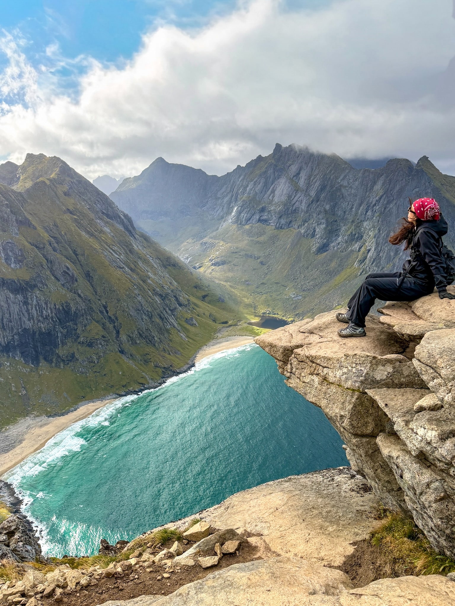
The rock ledge on Ryten
Me on the Ryten ledge. It was windy enough that I stayed seated.
Kvalvika Beach Ryten Hike
View of Kvalvika Beach from Ryten
c) The Full Loop
- Quick stats: about 9 km (5.6 mi), 760 m (2,490 ft) of elevation gain, moderate
- Best for: anyone with half a day and decent fitness
- What you see: everything above, in one go
- Best photo spot: the ones mentioned for the trails above, plus the new stone steps between the beach and Ryten. Turn around halfway up and the whole bay is behind you.
- What you miss: nothing, apart from a short stretch on the road at the end
- My take: I did the full loop; going to the beach first meant reaching it while it was still quiet and keeping the best view for the end. The loop also works the other way, starting with Ryten and descending to the beach, if you’d rather do the steep climb fresh.
If you have the time, do the full loop. Pick Ryten only if your legs or your schedule can’t handle more, and keep the beach-only hike for a slow morning or a night of camping.
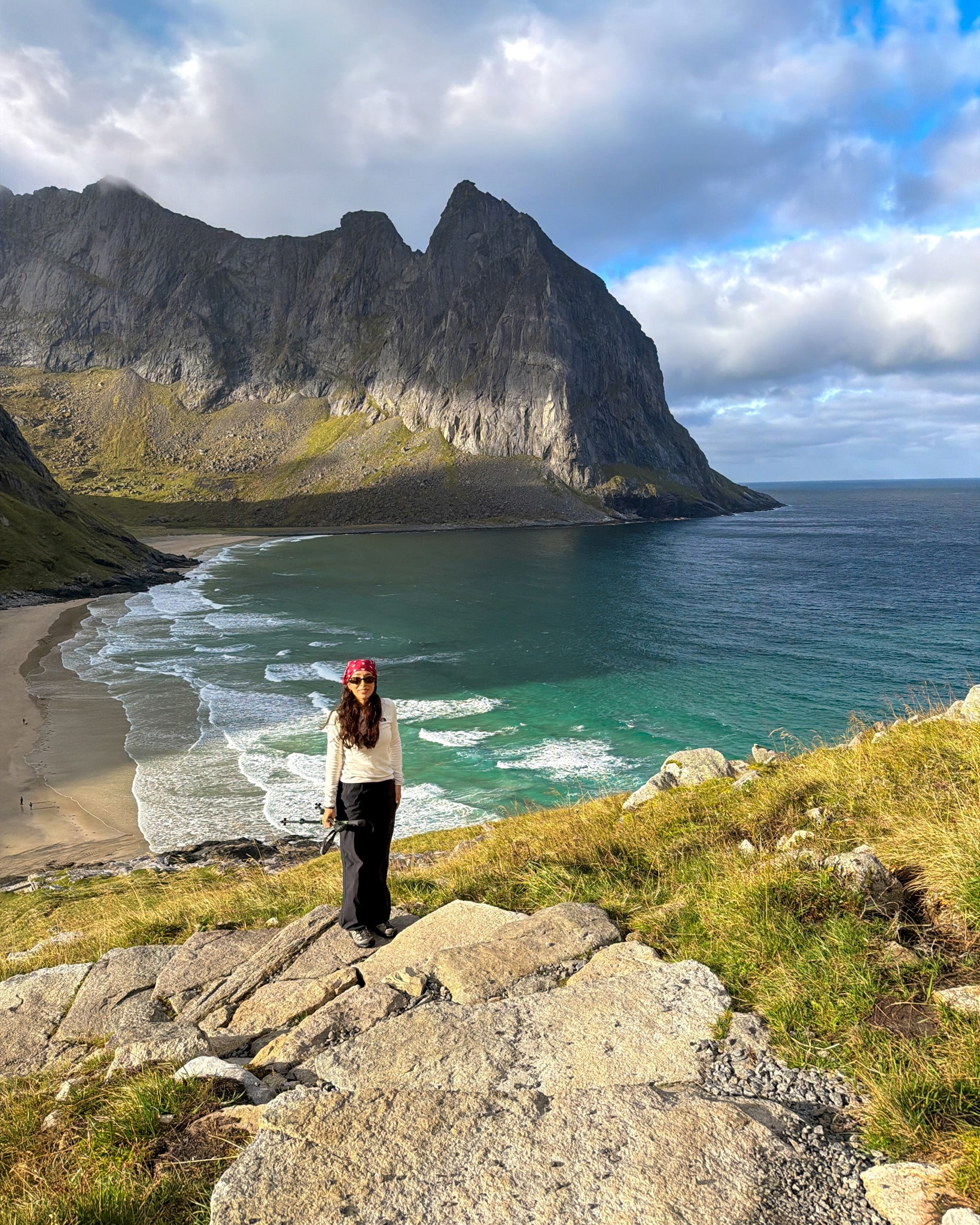
Stone steps between Kvalvika Beach and Ryten 2
Me starting up the stone step trail from the beach to Ryten.
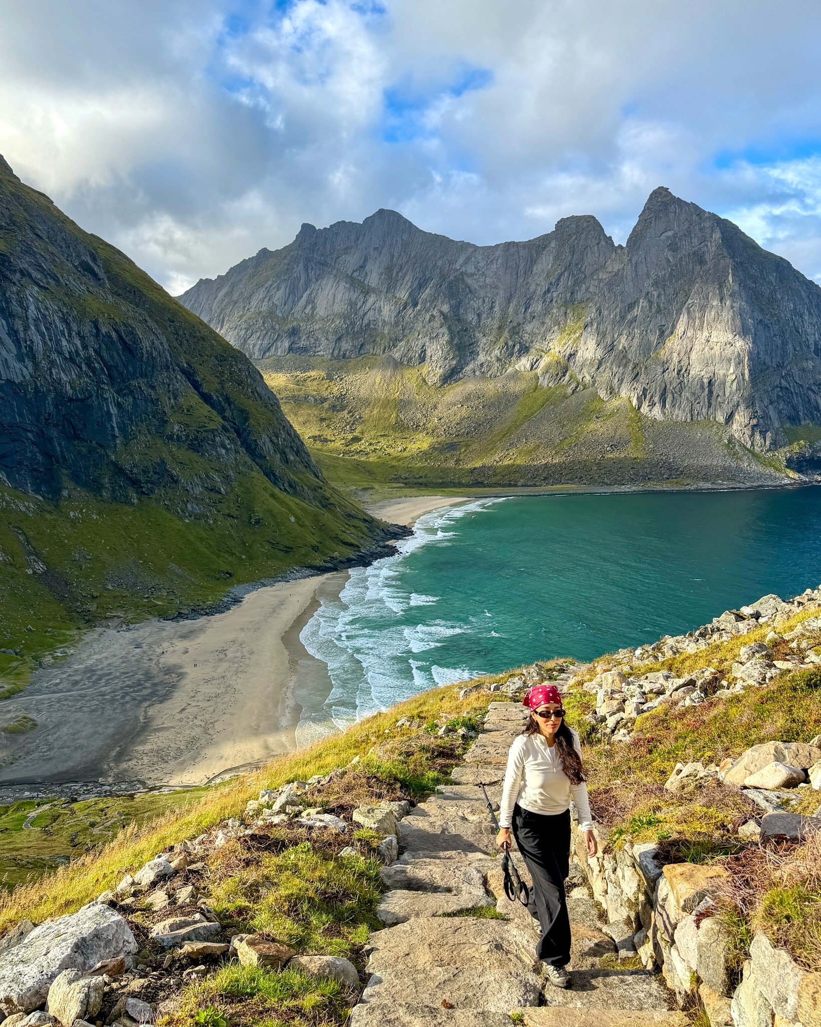
Stone steps between Kvalvika Beach and Ryten
Halfway up the stone steps from the beach to Ryten.
My Kvalvika Beach & Ryten Hike, Step by Step (Full Loop)
From the Torsfjord Trailhead to the Pass
The trail starts right across the road from the Torsfjord parking lot, with a few flat stones and a signpost. After a short rocky climb, it flattens out into a wet valley. Most of it is covered by wooden boardwalks, laid over the bog to protect the plants.
In early September the grass in the bog had already turned orange and the birches were getting their first yellow leaves. The climb is gentle, and at the top there’s a big stone cairn and your first glimpse of the sea between the rocks, which means the beach is right below.
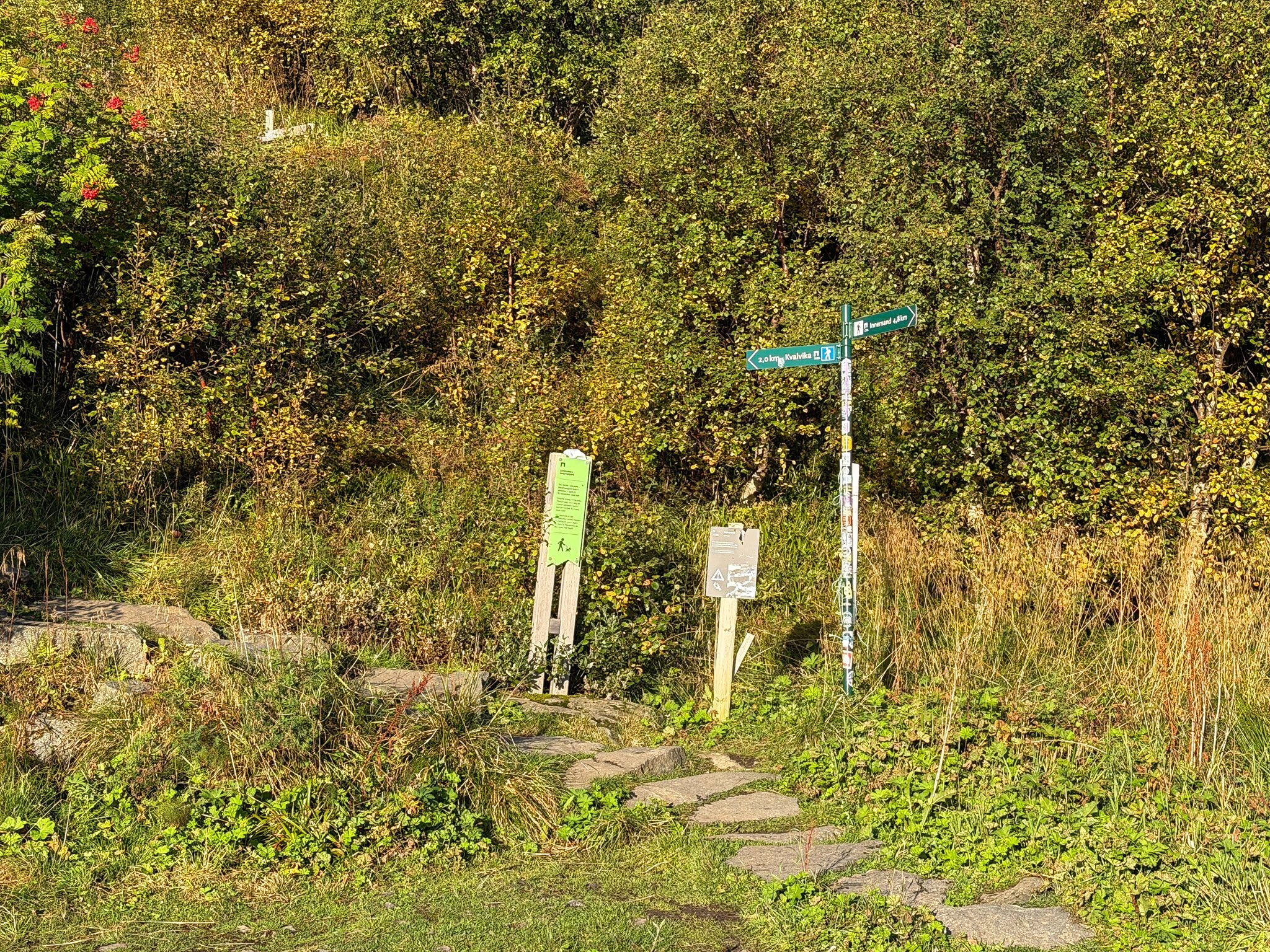
Kvalvika Beach trailhead at Torsfjord
The trailhead across from the Torsfjord parking lot. Kvalvika is 2 km away, Innersand 4.8 km.
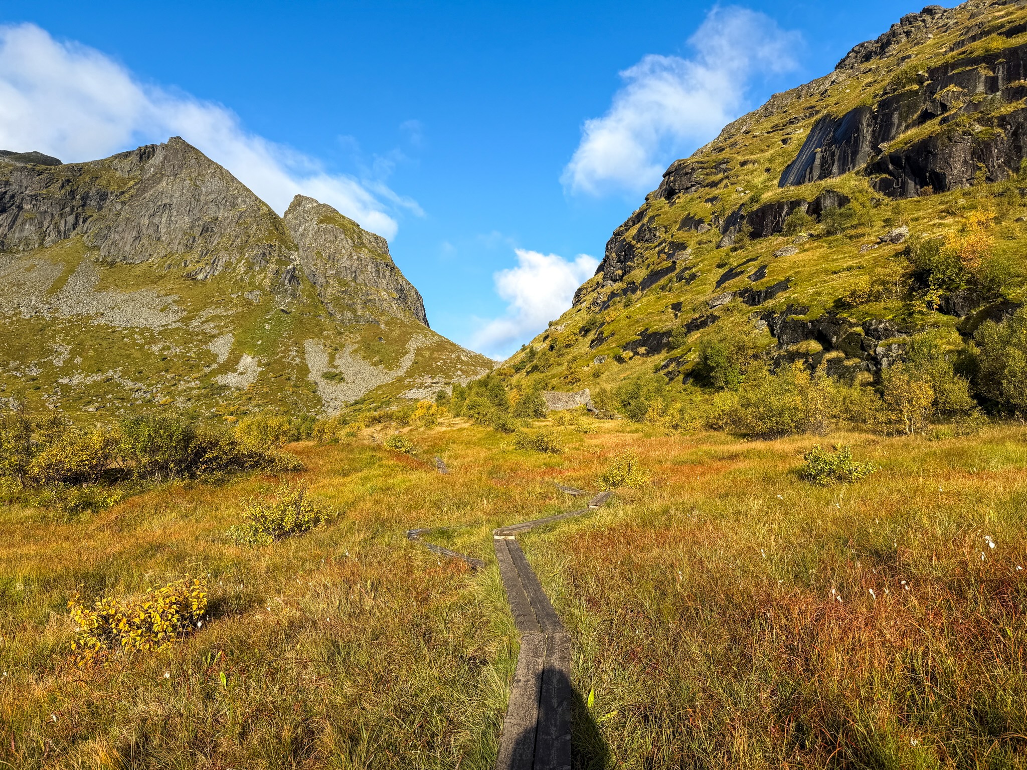
Bog boardwalks on the way to Kvalvika
The boardwalks across the bog, orange already in early September.
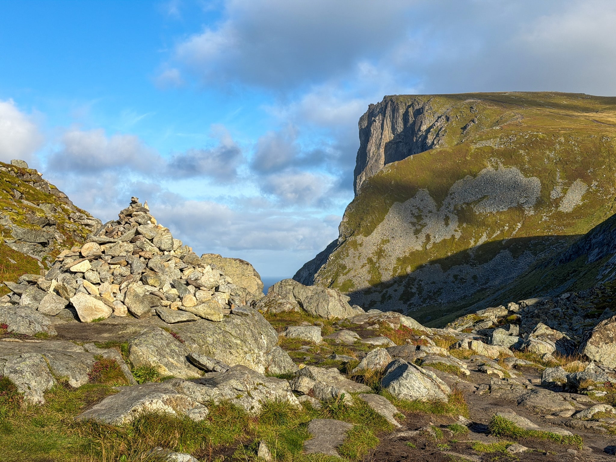
The cairn at the pass above Kvalvika
The cairn at the pass. Ryten is the cliff on the right.
Down to Kvalvika Beach
From the pass the trail drops down to the beach, steep and rocky in places. I reached the sand at 9:30, about 50 minutes after leaving the car.
There were already quite a few tents on the grass behind the beach, and a couple of surfers in the water. I only walked on the beach for about ten minutes.
The climb to Ryten starts at the edge of the beach. First you cross a small stream on the rocks, then a long stone staircase begins.
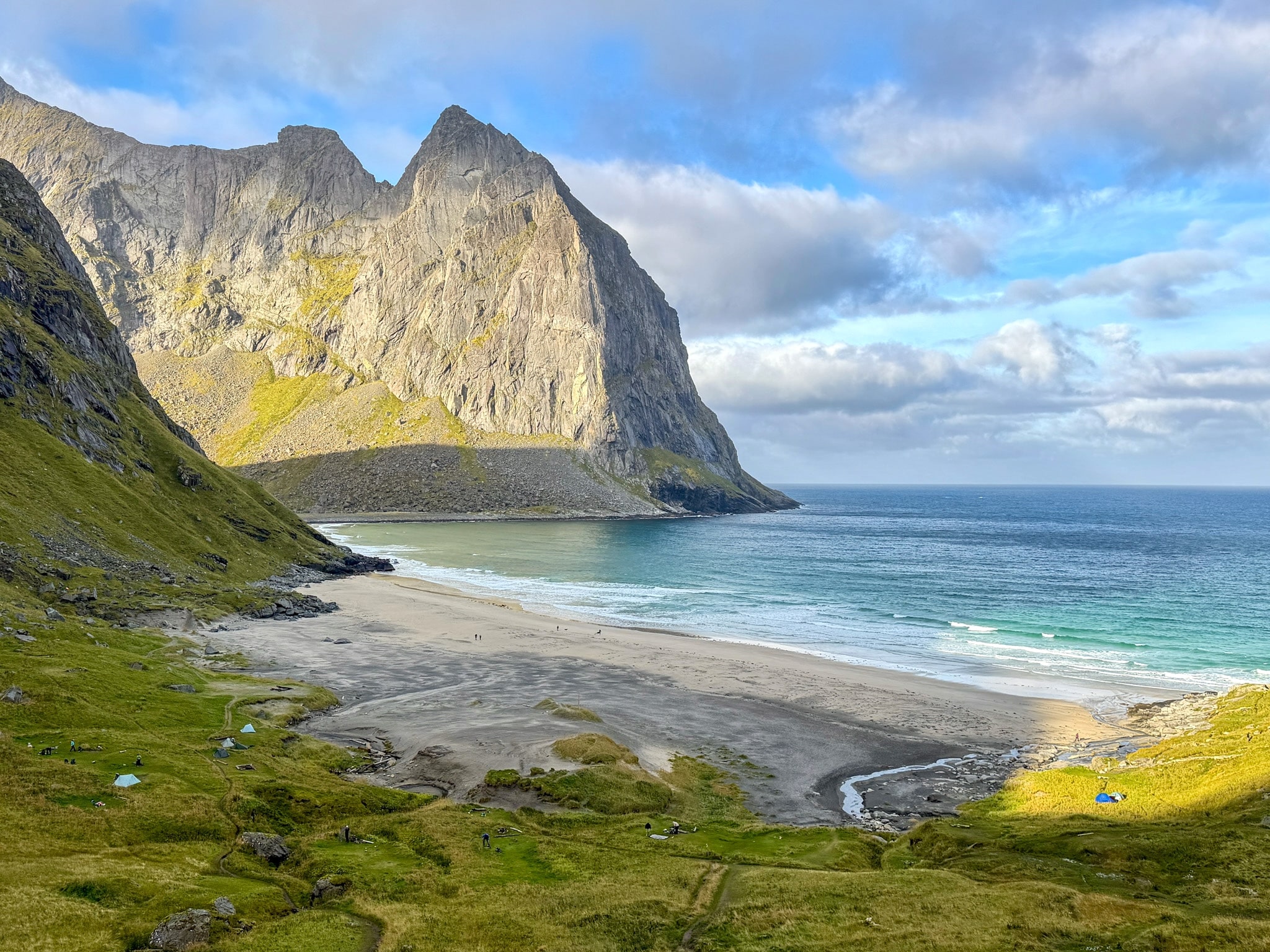
Kvalvika Beach from the trail
Kvalvika Beach as seen from the way down
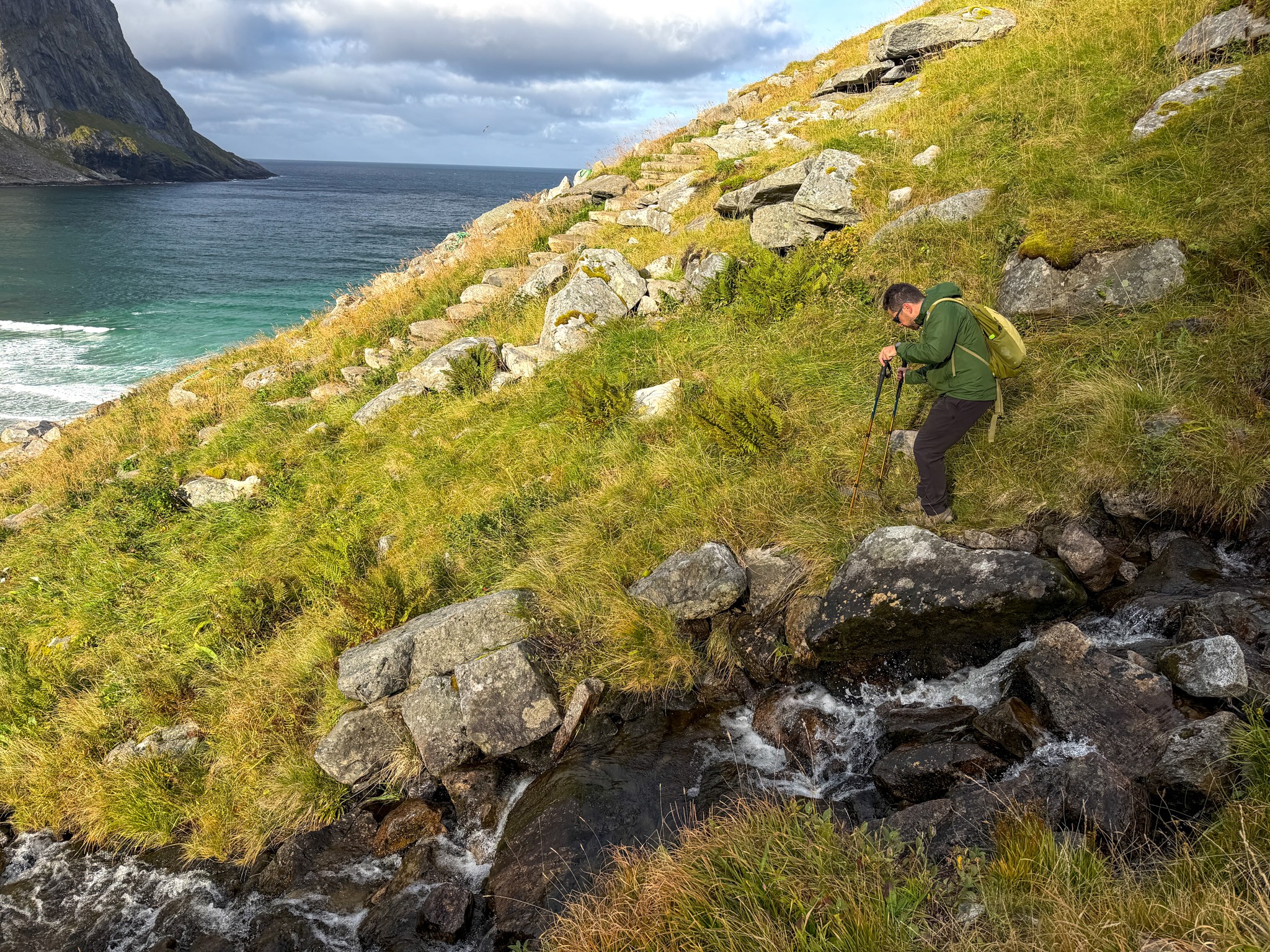
Stream crossing above Klavika and below the Ryten steps
Crossing the stream at the bottom of the climb.
The Sherpa Steps Up to Ryten
The stone staircase you see from this point was built by Nepalese Sherpas, and I’d put it among the most photogenic parts of the whole hike. Every time you turn around, the bay looks better.
At 10:45, close to the top, I passed a group of Sherpas who were still laying the last steps. The staircase stops a little before Ryten. From there it’s a dirt path, and it was muddy on the morning I went.
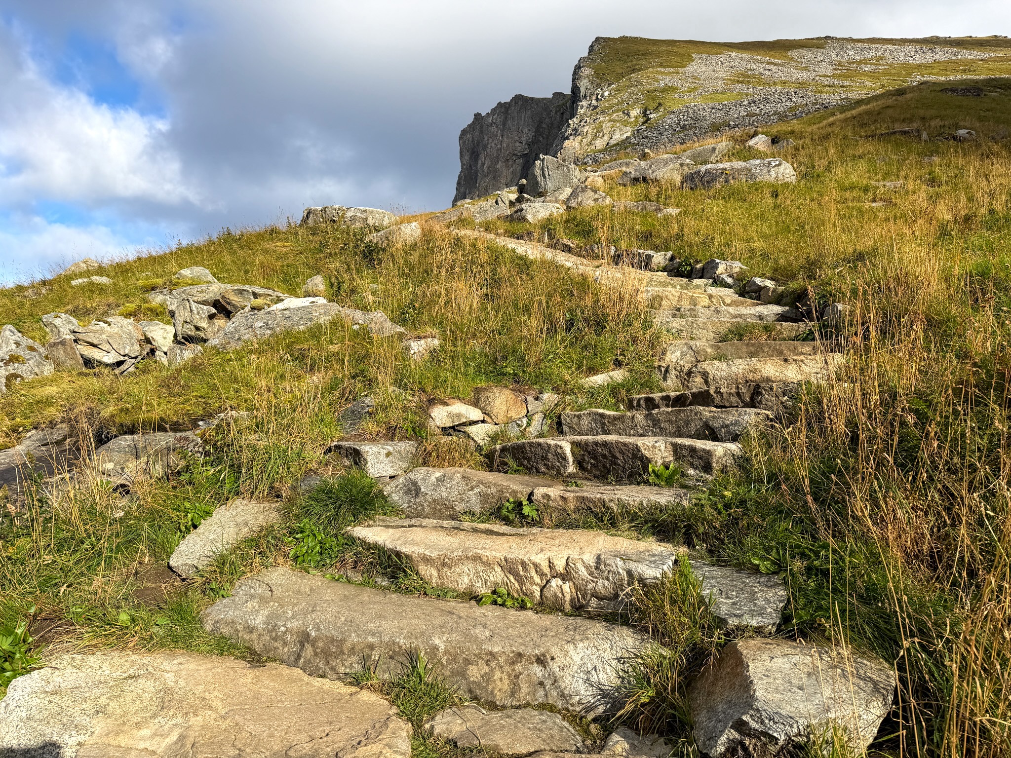
Sherpa steps from Kvalvika Beach to Ryten
The new Sherpa steps, heading up toward Ryten.
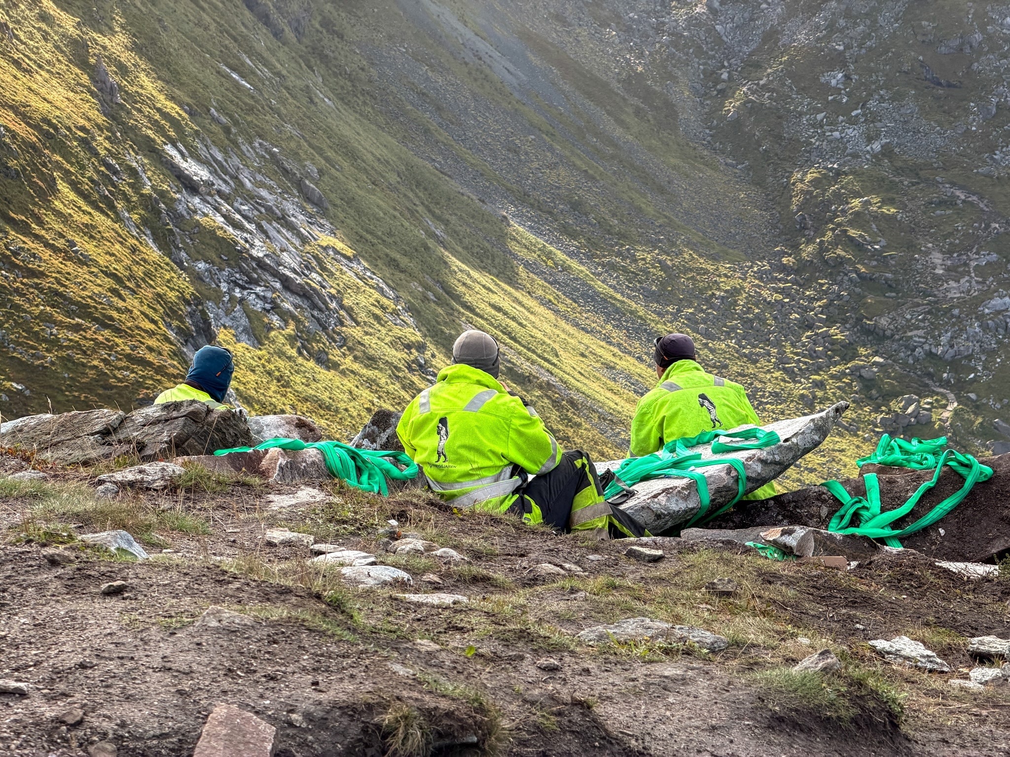
Sherpas building the Ryten steps
Some of the Sherpas finishing the steps in September 2026.
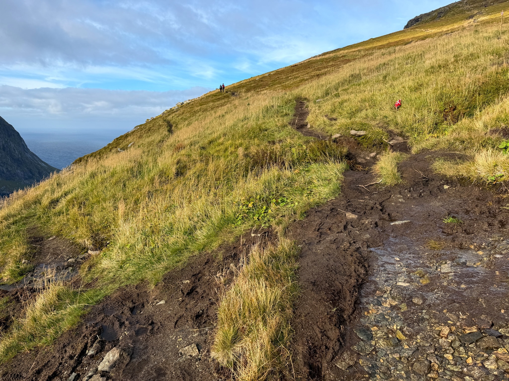
Muddy trail below Ryten
Where the steps end, the mud begins.
The Famous Rock on Ryten
I got to Ryten at 11:00. The rock ledge everyone photographs sticks out over the drop, with the whole beach straight below. The wind was so strong that I sat down on it and stayed seated.
The top is exposed on all sides, so be careful near the edges. Don’t climb onto the ledge in rain or strong gusts.
Back Down via Innersand
From Ryten I headed down toward Innersand to close the loop. The descent is gentle, with boardwalks over the wettest spots and a mix of rock and dirt. Nothing technical. The views on this side face the other way, toward the fjord and the Fredvang bridges.
One short passage squeezes between two boulders, with a chain to hold onto and mud underfoot. Around 12:15 I passed close to the Innersand parking lot. The last part back to Torsfjord mixes a short stretch of road with a little-used path through tall, wet grass, since most people start from Innersand. I was back at the car at 12:50.
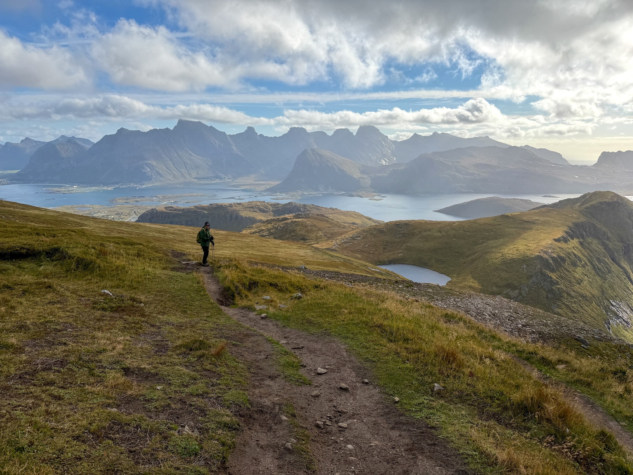
Descending from Ryten toward Innersand
On the way down, the view turns to the fjord and the Fredvang bridges.
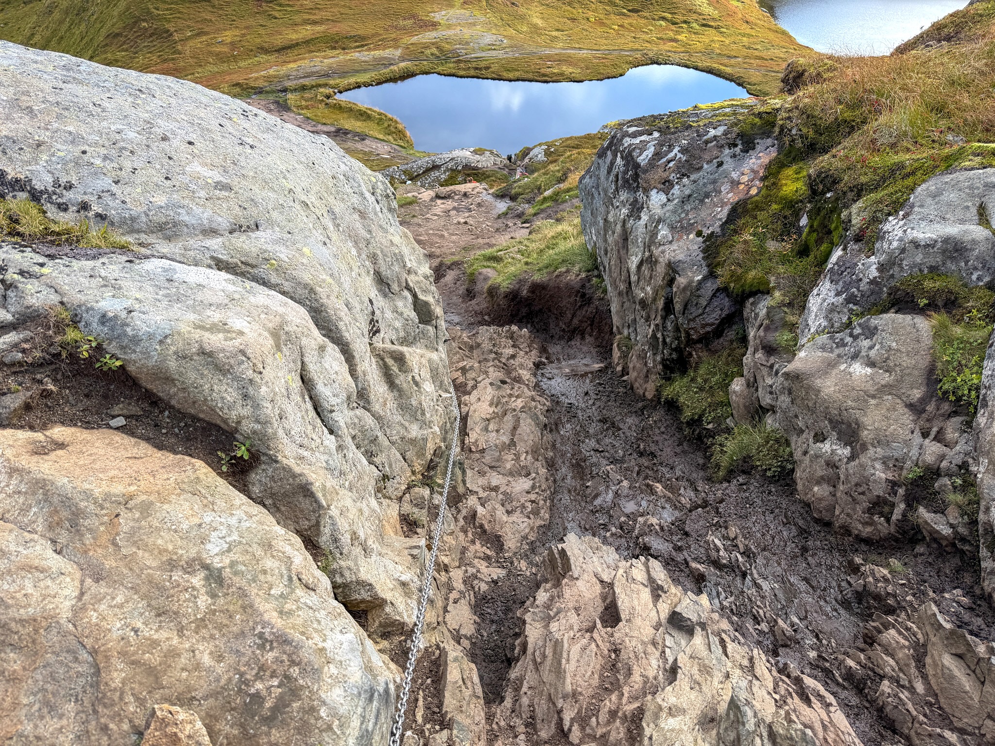
Chain section on the Ryten trail
The short chain section on the way down to Innersand.
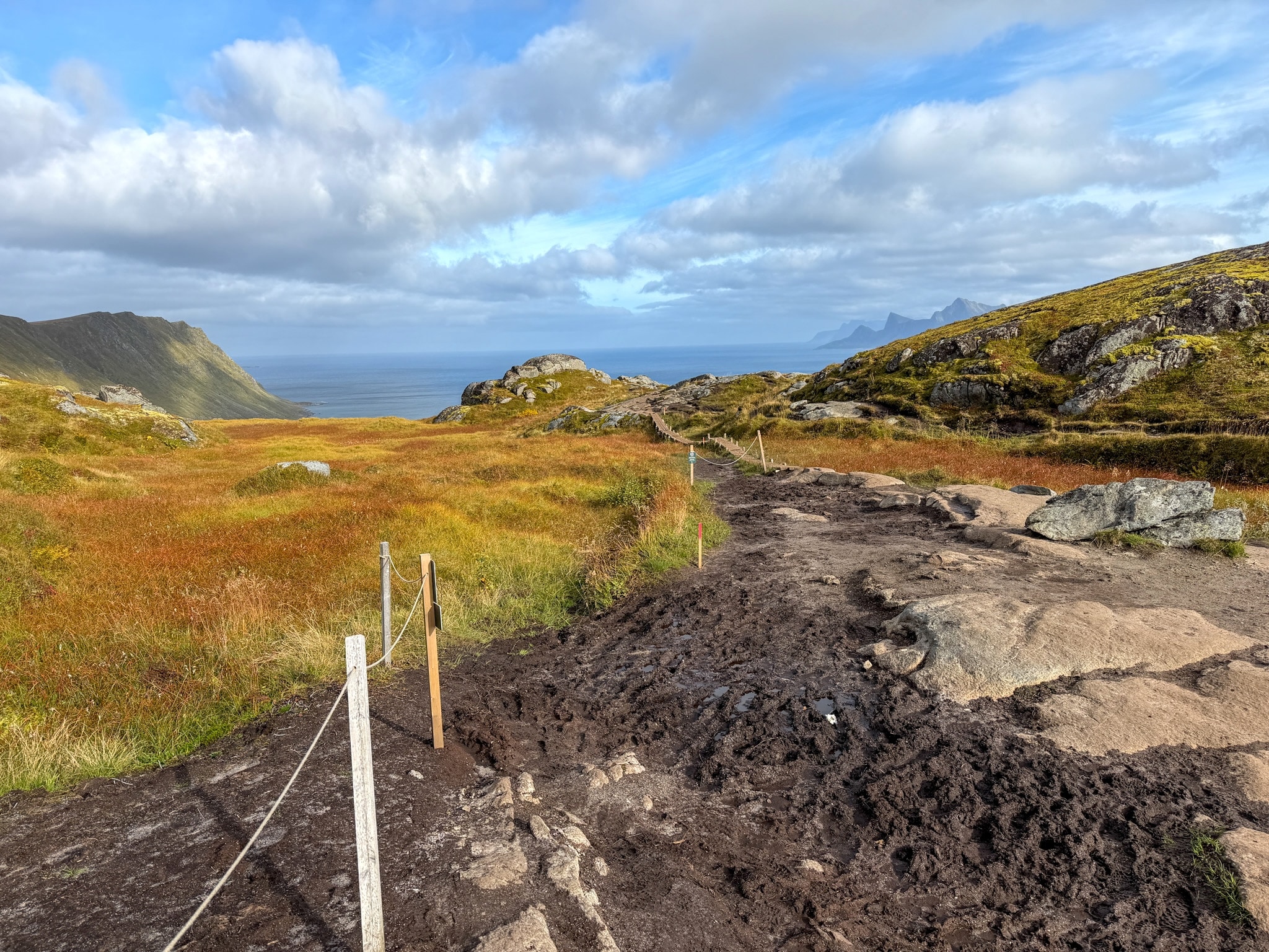
Muddy trail on the Innersand side
Ropes now mark the trail to keep hikers off the vegetation.
Kvalvika Trail Conditions
The Kvalvika trail has been changing a lot. According to Visit Lofoten, close to 90,000 people hike to Kvalvika and Ryten every year, and the ground couldn’t take it anymore. Lofotodden National Park, which covers the whole area, has been rebuilding the trail to keep hikers on one path and protect the vegetation and the nesting birds.
- The 2026 works: in 2026, trail builders worked on the paths to the beach and up to Ryten. Detours were marked, and staff were on site. I couldn't find any reference to a 2027 schedule yet.
- Full closures: on days when helicopters flew in materials, both the trail up to Ryten and the trail down to Kvalvika were closed completely. The park announced those days a few days ahead on their Facebook page and in the local paper.
- Always open: the trail from Torsfjord to the beach stayed open as usual.
- What I found there: everything was open, with no detours on my loop. The Sherpas were laying the last steps below Ryten, and new ropes and posts marked the path on the Innersand side.
- Stay on the marked trail: green park signs ask you to keep off the vegetation, even where the path is muddy. Walking around the mud on the grass is exactly what created the damage in the first place.
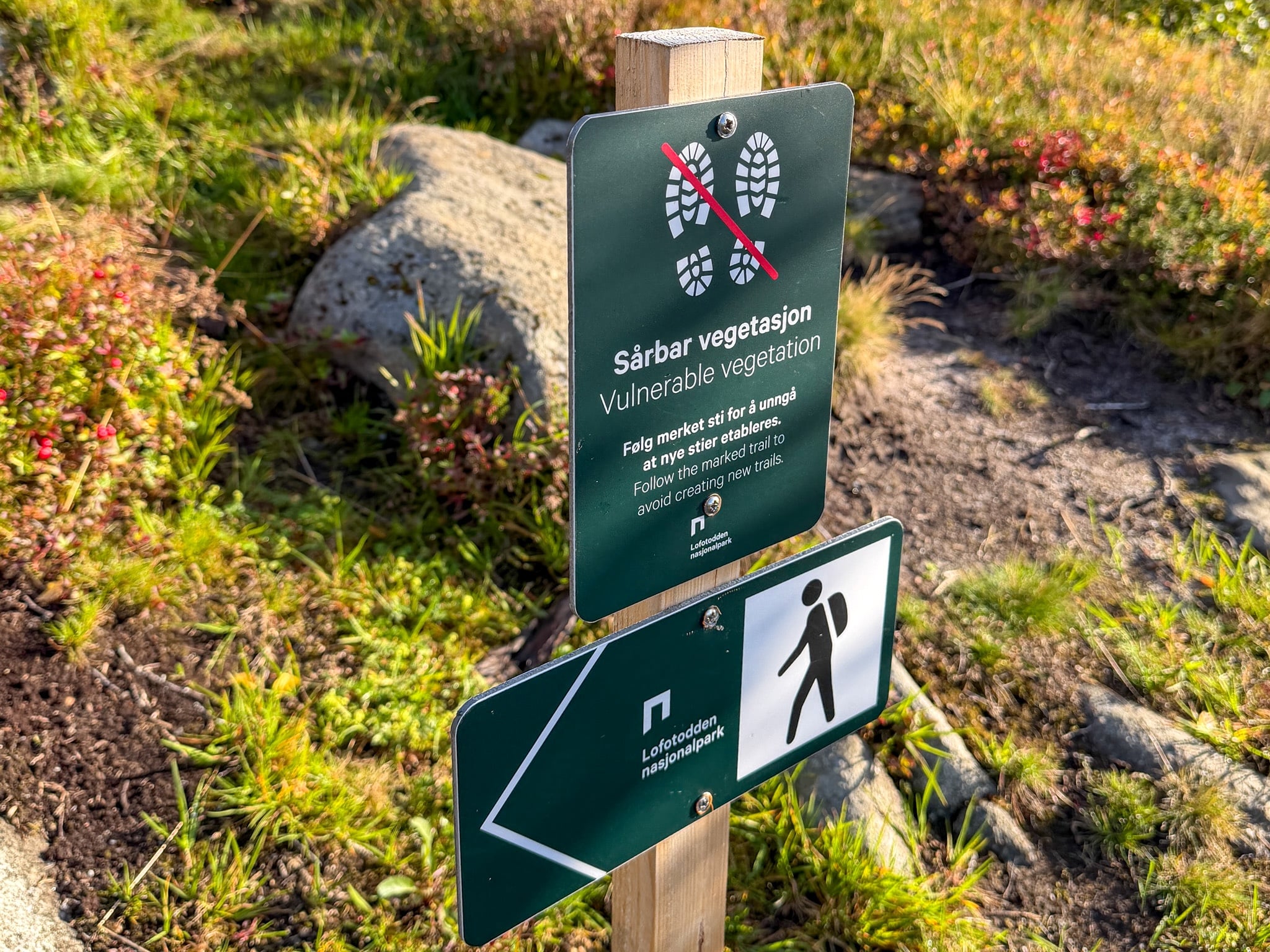
Know Before You Go
A few things I’d tell a friend before they head out to Kvalvika Beach and Ryten:
- Bring all your water. The streams at the beach look clean, but tests have found E. coli in them, mostly because so many people camp there. I carried water and food for the whole loop.
- Waterproof hiking boots are enough. My Salomon mid-cut boots handled the mud and the wet grass fine. Trail runners would get soaked on the muddy stretches.
- Pack a windproof jacket for the top. Even on a sunny morning, Ryten was the windiest spot of my whole trip.
- Start early. By around 10 a.m. the trail was getting busy in September. In July and August, an early start is also the only way to get a parking spot.
- Check the weather in the Yr app. It was the most accurate of the apps I used in Lofoten. Even so, the weather can turn within an hour, so keep the hike flexible across a couple of days if you can.
- Leave the drone at home. Drones are banned in Lofotodden National Park, and that includes the whole Kvalvika area. You can check this drone usage guideline for Lofoten for additional details.
- Camping on the beach is allowed. The flat grass behind the sand is the spot, and Norway’s right to roam lets you stay up to two nights in the same place. There are no toilets or bins, so you carry out everything you bring.
- Download the route offline. The trail is well marked, but an offline map helps at the junctions where you choose between the beach, Ryten and Innersand.
FAQ
When is the best time to hike Kvalvika Beach and Ryten?
June to September, when the trail is free of snow and the days are long. I went on September 10 and liked the timing. There were fewer people than in summer, the bog was turning orange, and the nights were already dark enough for the aurora. All of that is in my guide to the Lofoten northern lights.
Can you hike to Kvalvika Beach and Ryten in winter?
Ryten, yes, but only with snowshoes or microspikes and in calm weather, because the first climb from the parking lot freezes over. If you’ve never hiked in Arctic snow, this guided winter snowshoe hike to Ryten from Reine takes care of the gear and the route. I haven’t done it myself since I didn't need to, but the reviews are great.
Is the Kvalvika Beach hike good for kids?
The beach-only route works for kids who are used to walking on inclines, as long as you help them on the steep, rocky descent from the pass. The local tourist office suggests Ryten from about age 10, because the full climb is long and often muddy.
Can you swim at Kvalvika Beach?
You can, if you can handle very cold water. The bay is open to the ocean, and on the morning I was there it was surfers, more than swimmers, who were in the water. I stayed on the sand.
Is there a hut at Kvalvika Beach?
Yes. A small cabin made of driftwood stands under the rocks at one end of the beach. Two Norwegian surfers built it while spending a winter there, a story told in the 2012 documentary North of the Sun. It’s unofficial and has no facilities, and I didn’t walk over to see it. It's very small and well hidden so you'll need some time to find it.
Check Out My Other Lofoten Guides
- Where to Stay in Lofoten: Best Areas, Hotels & My Experience
- How to Get to the Lofoten Islands: 4 Easy Routes + My Pick
- Renting a Car in Lofoten: Agencies, Parking & My Driving Tips
- Lofoten Northern Lights: Best Time, Places & Forecasts I Used
- Mannen Hike From Haukland: Out-and-Back or Loop, Map & Parking
- Reinebringen Hike: Trailhead, Parking Lots, Steps & Closures
Keep reading: