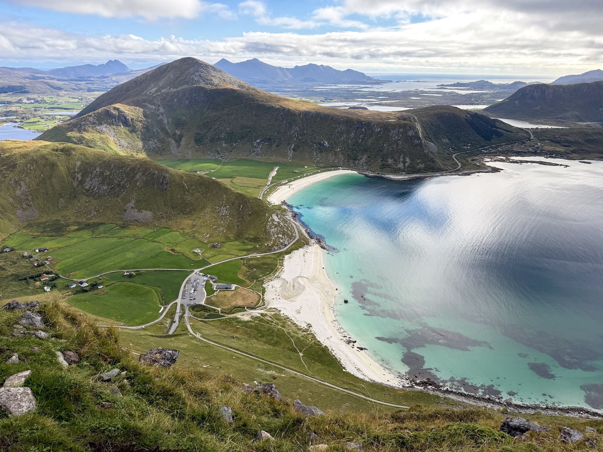
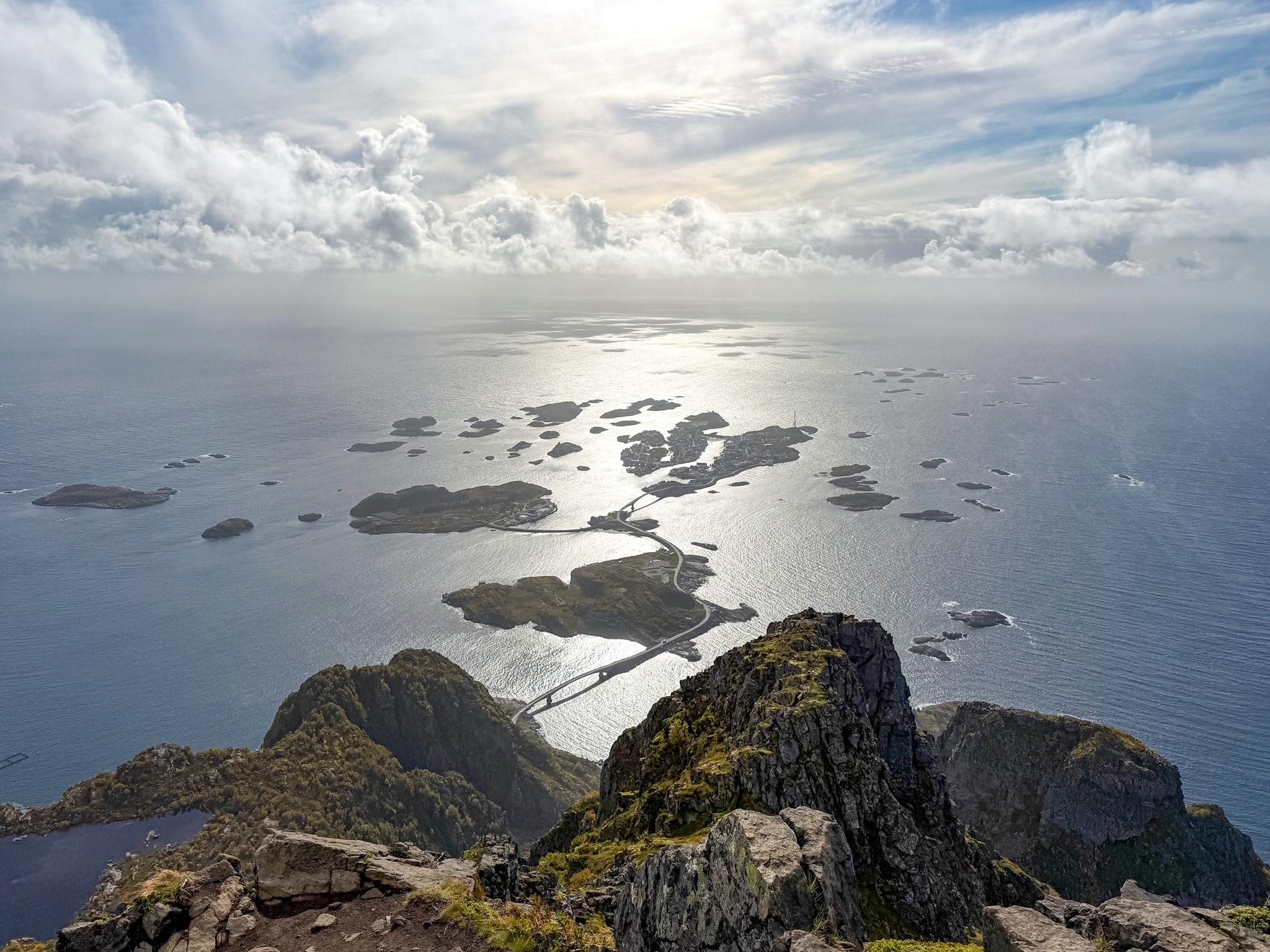
A practical guide to the Offersøykammen hike in Lofoten, covering where to park at Skreda, how to find the unmarked trailhead and how steep the climb gets, with my GPS stats and photos.
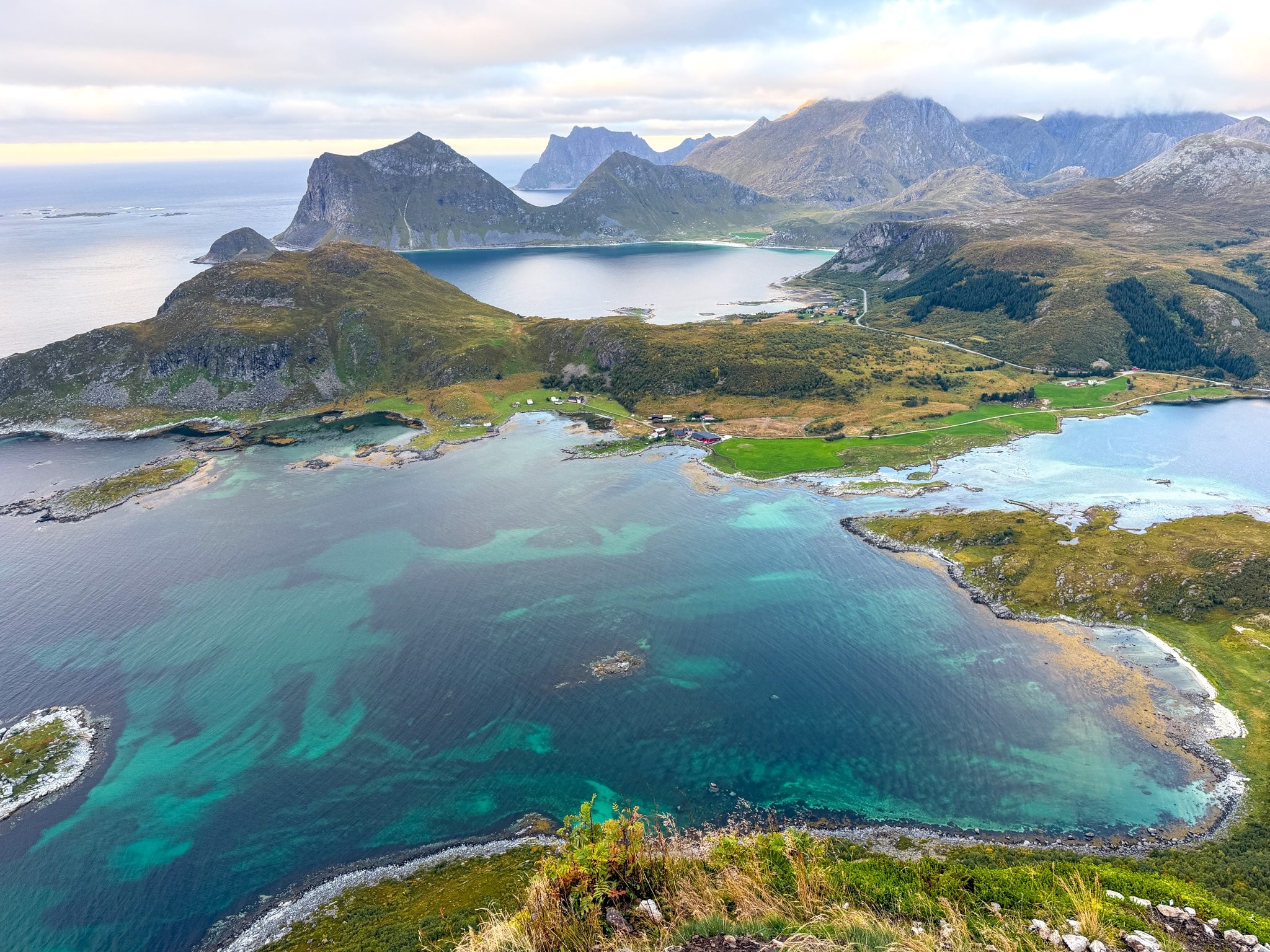
Offersøykammen was my second hike of the day. I had just finished the Mannen loop above Haukland Beach, drove a few minutes along the E10 and started walking from the parking area at 6 p.m., on September 5. My legs had opinions about this plan.
The Offersøykammen mountain is a small, isolated peak of 436 m (1,430 ft) on Vestvågøya, the island in the middle of Lofoten where Leknes and Haukland Beach are. The climb is short and steep, and I reached the top a little after seven, with the sun getting low over the sea and only a couple of other hikers around.
Before going, most of my doubts were about the start. The parking has a time limit, you walk along the road for a bit, and the trail begins in the grass with no sign at all. This Offersøykammen hike guide covers all of that, with the numbers from my own GPS track.
Where I’d Stay Near the Offersøykammen Trailhead
Most people split Lofoten into two bases, one in the west near Reine and one in the east near Svolvær, and plan the hikes from there. That’s what I did too. Offersøykammen sits roughly in the middle, so here are my two bases plus the closest option to the trail.
- Anitas Waterfront Cabins: my red cabin between Hamnøy and Reine for the last three nights, about 50 minutes from the trailhead (possible extra waiting time at the Nappstraumen tunnel).
- Lofoten Apartments: my first base, in Hopen near Kabelvåg, with a barrel sauna on the water, about 1 hour 15 minutes away.
- Lofoten Basecamp: the closest you can sleep to this hike, a short walk from the trailhead. The cabins are renovated rorbuer, and some have big views over the water.
I compared my two bases and eight other places, area by area, in my full breakdown of where to stay in Lofoten.
Offersøykammen Hike Stats From My GPS Track
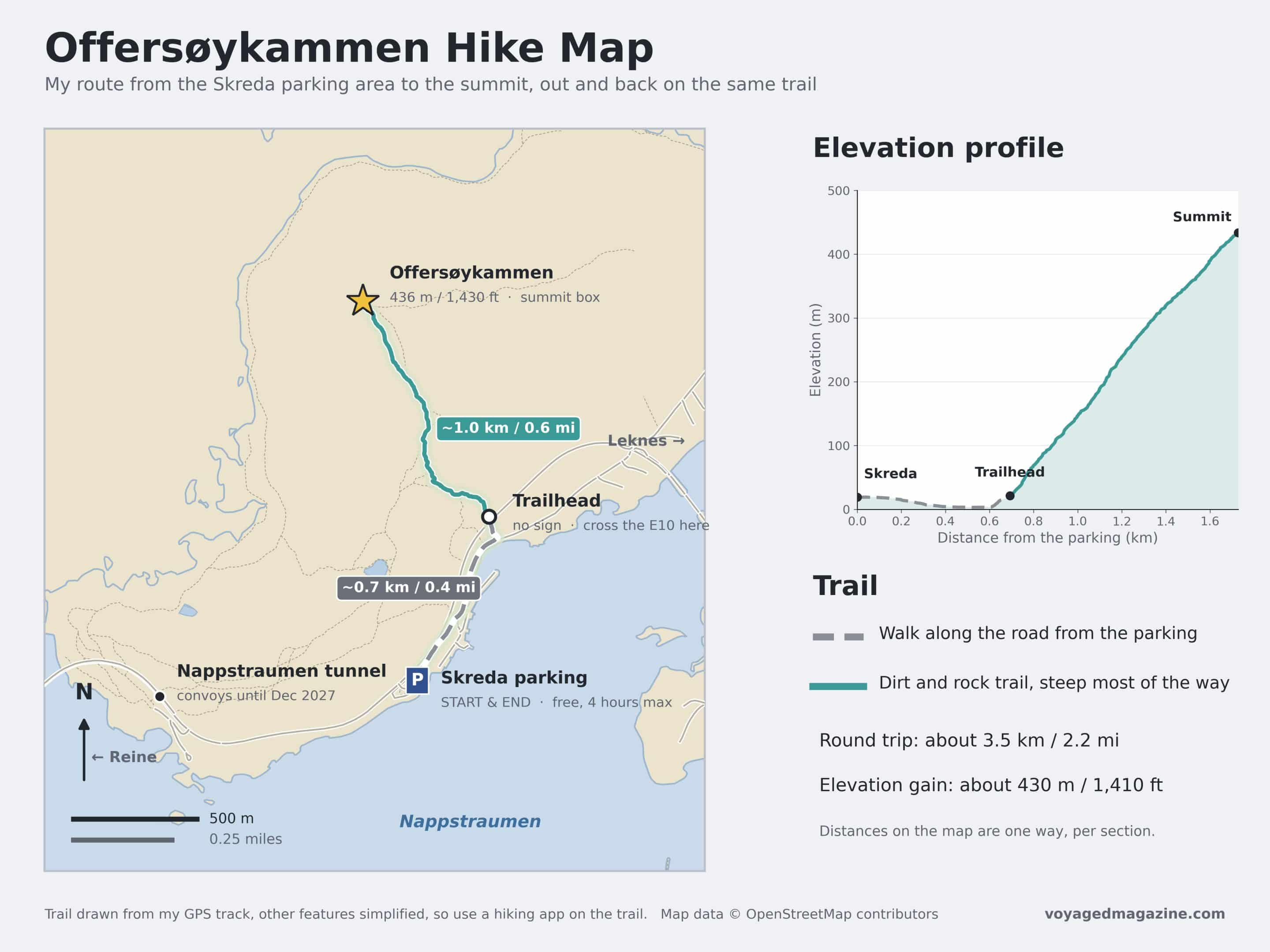
- Distance: about 3.5 km (2.2 mi) round trip from the Skreda parking area
- Elevation gain: about 430 m (1,410 ft)
- Summit: 436 m (1,430 ft)
- My time: 2 hours car to car, with about 50 minutes from the trailhead to the top and a short photo stop
- Difficulty: easy on the technical side, steep almost all the way up, no exposed sections
- Route type: out and back on the same trail
- Parking: Skreda rest area on the E10, free, 4 hours max with a parking disc, public toilets available. Scroll to the next chapter for the exact location on Google Maps.
- Trailhead: about 650 m (0.4 mi) east of the parking along the E10, with no sign. Scroll to the next chapter for the exact coordinates.
- Best season: late spring to early fall without snow; I went on September 5
Where to Park for the Offersøykammen Hike
There are two places people park for this hike. Right now, only one of them works.
1. Skreda Rest Area and Parking
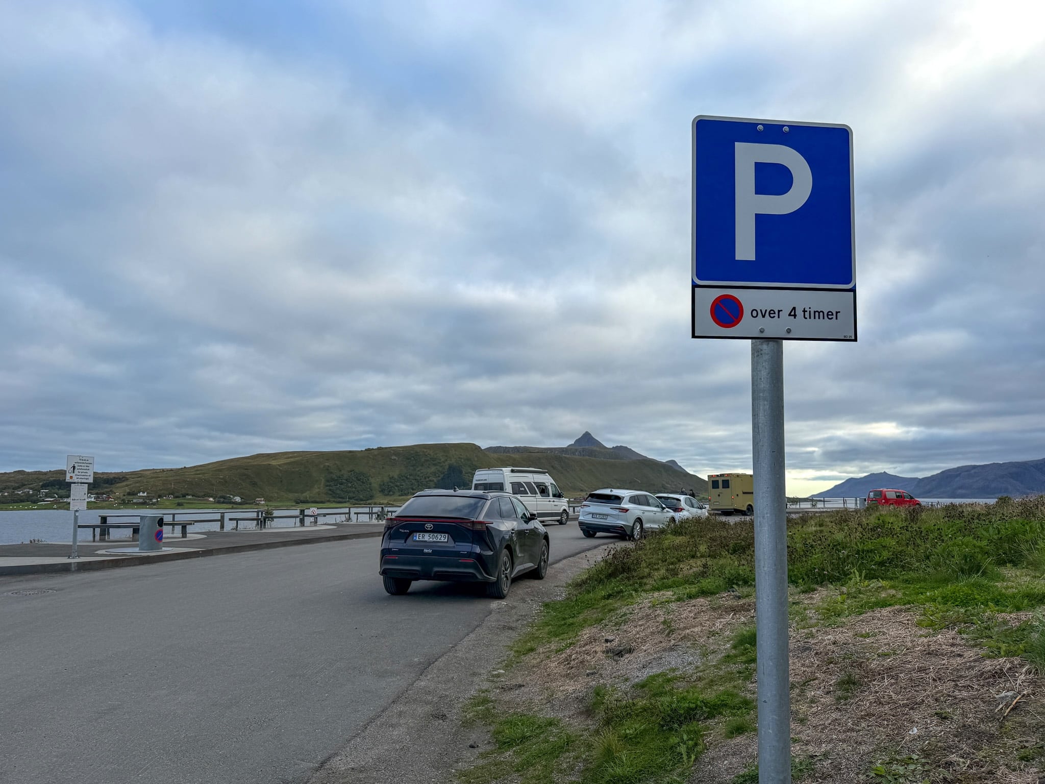
Skreda is a small rest area right on the E10, on the sea side of the road, about 6.5 km (4 mi) west of Leknes. It’s free, there are public toilets, and a few picnic tables face the water.
The catch is the sign at the entrance: parking is limited to 4 hours, and you need a parking disc on the dashboard to show when you arrived. Four hours is plenty for this hike. I had my own disc from home, but if you don’t, they’re sold in some souvenir shops around Lofoten.
When I pulled in at 6 p.m., the lot was half empty. It’s small though, around 20 spaces, so in summer I’d expect it to fill up by mid-morning. The 4-hour rule probably helps, because cars keep leaving.
2. The Nappstraumen Tunnel Lot (Vestvågøy Restplads, CLOSED until 2027!)
The second theoretical option is a bigger gravel lot just before the eastern entrance of the Nappstraumen tunnel. From there, a longer trail climbs over the tunnel and joins the main path halfway up, so you don’t have to cross the E10. It’s about 6 km (3.7 mi) round trip and takes longer.
However, as of 2026, this area is closed to the public until the tunnel upgrade ends in December 2027. I am only mentioning this just in case you see this parking area mentioned in older blogs.
From Reine, Expect a Wait at the Nappstraumen Tunnel
The Offersøykammen trailhead and the Skreda parking area are both only a few minutes from the Nappstraumen tunnel, mentioned in the previous chapter. This is a road tunnel that runs under the sea and connects two of the Lofoten islands: the one to the east with Leknes and Offersøykammen and the one to the west. If you’re coming from Reine or Hamnøy, you’ll drive through it to get to this hike, because it’s the only road. At the moment, the Nappstraumen tunnel is under renovation.
Cars can go through, but only in convoys behind a pilot car, once or twice an hour, depending on the time of day, and at night it’s closed except for one passage. So if you’re coming from Reine or Hamnøy, plan some extra time, because you might reach the entrance just after a convoy left. You can check updates on the Nappstraumen tunnel convoy schedule and the night closures at this link.
Finding the Offersøykammen Trailhead
From Skreda Parking Area you walk east along the E10, in the direction of Leknes, for about 650 m (0.4 mi). There’s no sidewalk, so I stayed close to the guardrail and walked in single file. It takes about 10 to 15 minutes.
The trail starts on the mountain side of the road, so you’ll need to cross the E10. There’s no sign, no arrow, nothing painted on a rock. Watch for a double wooden power pole on the slope above the road, then two tall fir trees right by the shoulder. The path is the narrow dirt line climbing into the grass next to them.
To be safe, put these coordinates into Google Maps before you leave the car: 68.1545 N, 13.5138 E. I’d really use them, because a bit before and a bit after the real start there are other paths that look like trailheads. They either take a longer way around or get steeper and messier.
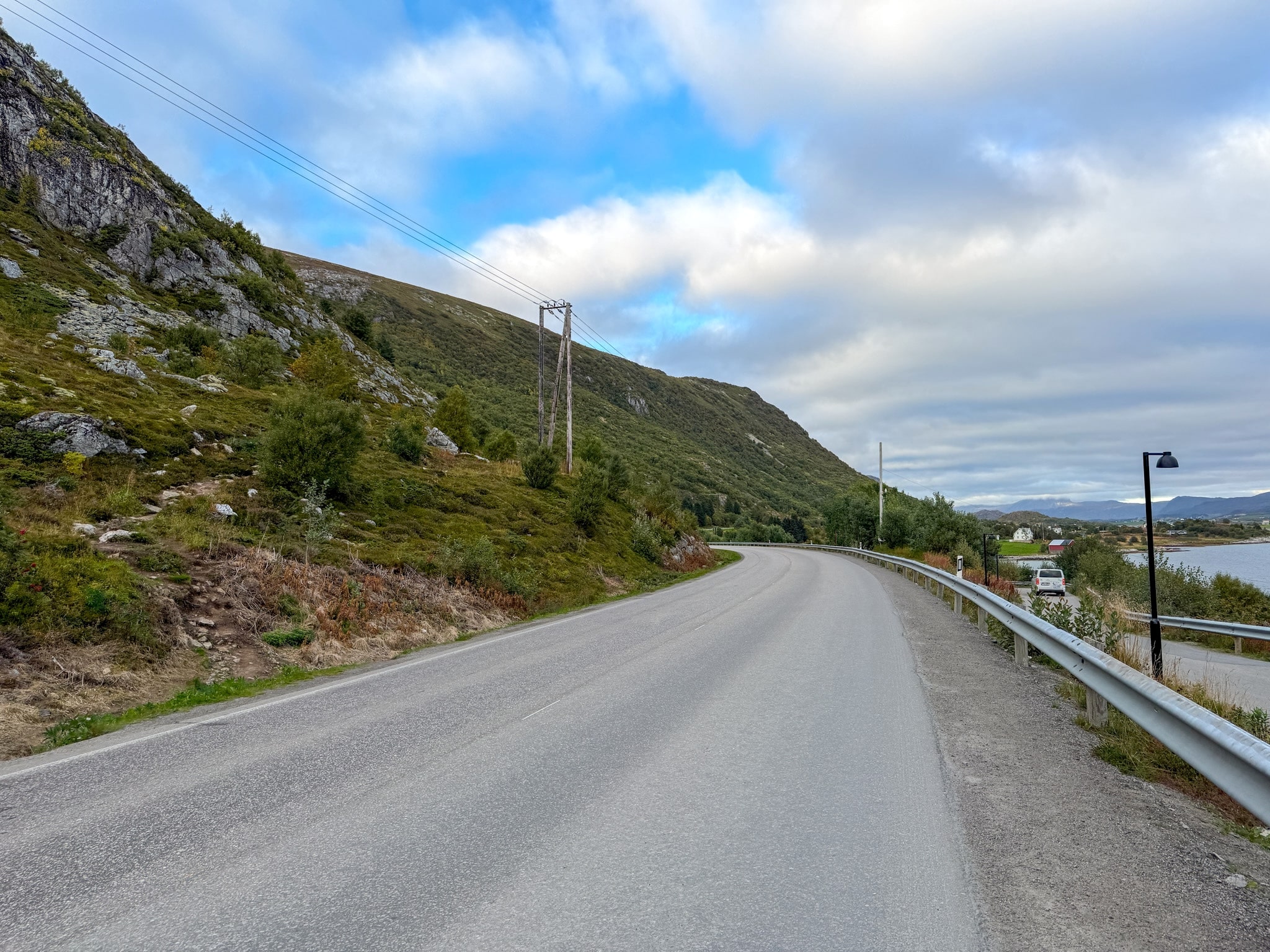
Walking Along the E10 to the Offersøykammen Trailhead
The walk along the E10 from Skreda Parking Area
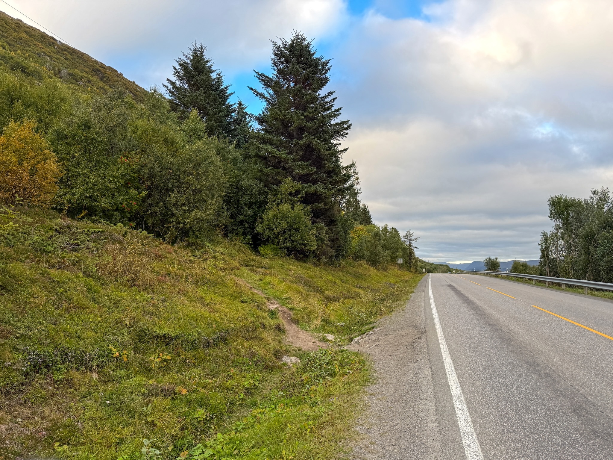
Offersøykammen Trailhead Next to the E10, Lofoten
The unsigned Offersøykammen trailhead, right by the two fir trees
My Offersøykammen Hike, Step by Step
Through the Birch Woods
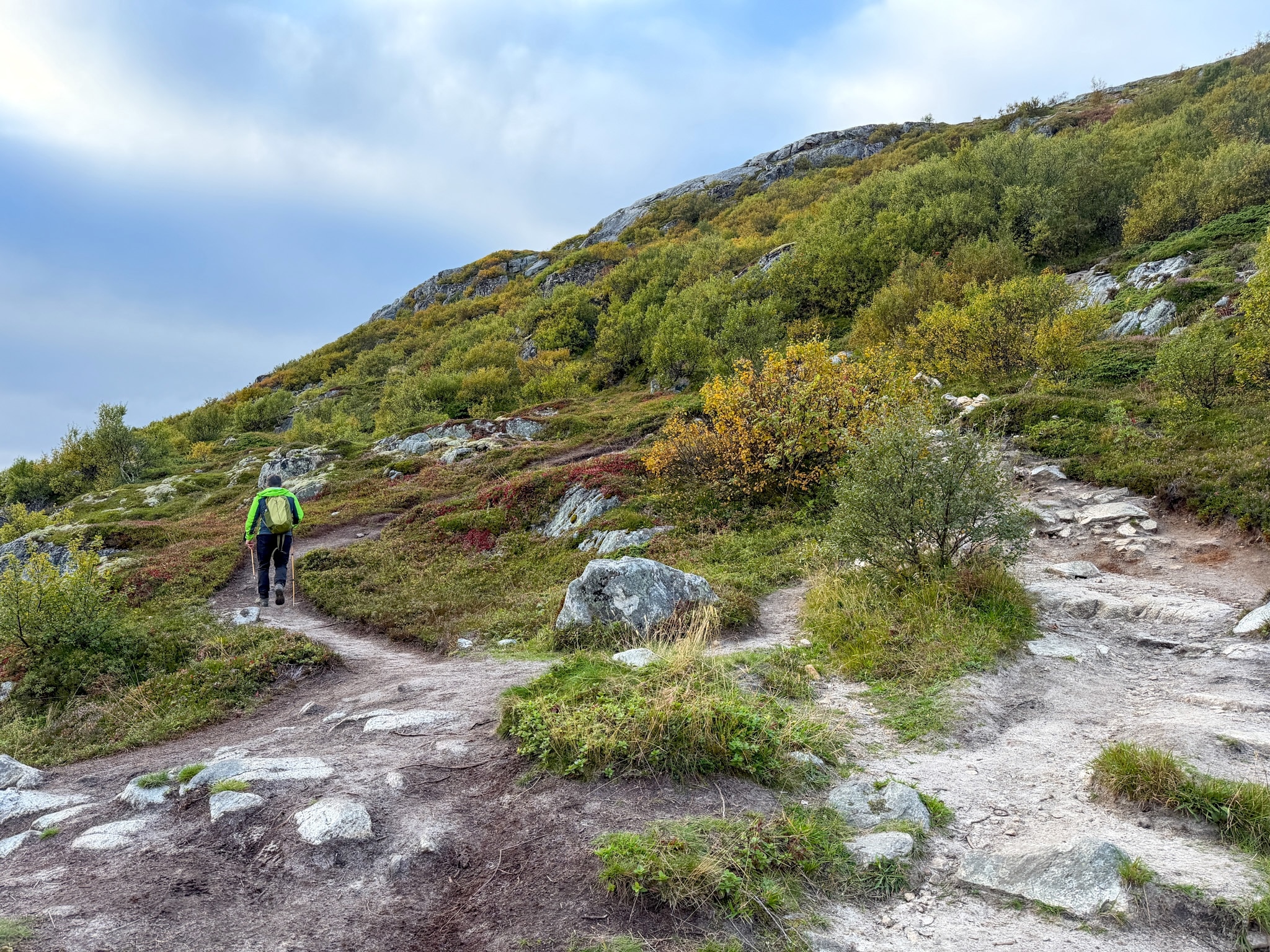
The first part climbs through low birch trees, with blueberry bushes and heather turning red along the path. The ground is mostly rock and packed dirt, with roots here and there. It was dry when I went, with very little mud, which I hadn’t expected after reading other reviews.
This is where I saw a stoat crossing the path, already in its white winter coat, and a little later a hare. They were both gone before I could get my phone out. It was the only hike in Lofoten where I saw any wildlife at all.
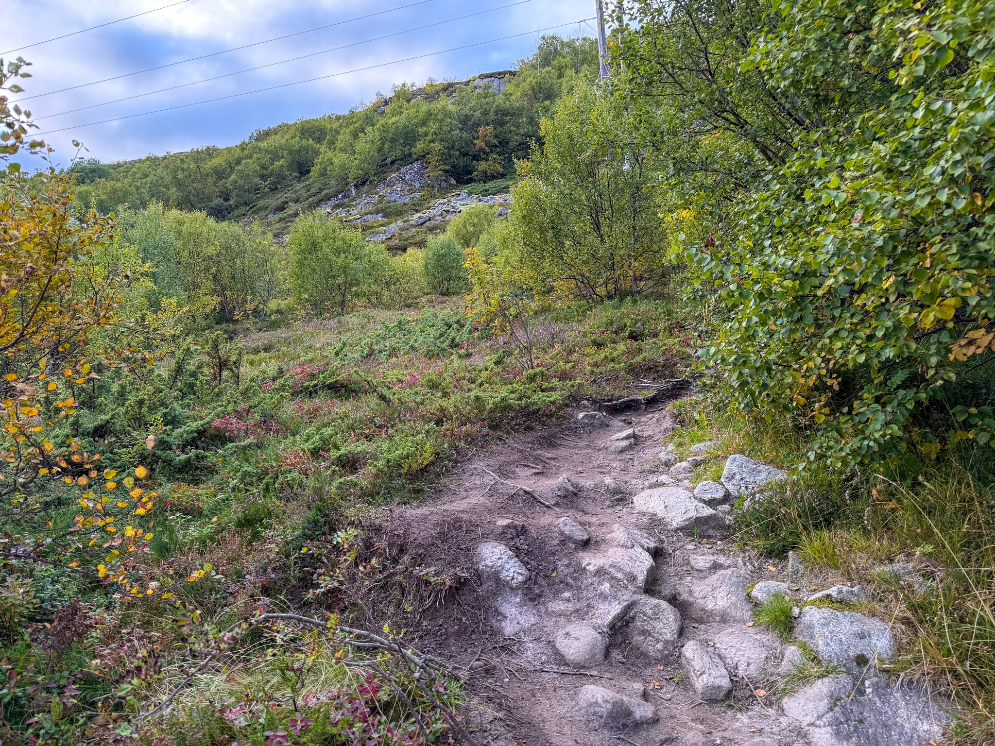
The Steep Middle Section
After the trees the slope opens up and gets steeper, and from here on it barely stops climbing. A few times the path splits into two parallel tracks. They meet again higher up, so I just picked the one that looked more worn.
There’s no scrambling and nothing exposed, just a steady uphill that asks for some stamina. I stopped a couple of times to look back at the views opening up over the water.
The Summit at Sunset
The top is wide and almost flat, and you’ll know you’re there when you see a wooden box on legs covered in stickers. Inside there’s a notebook for hikers to sign. I opened it and had a look, then left the writing to others.
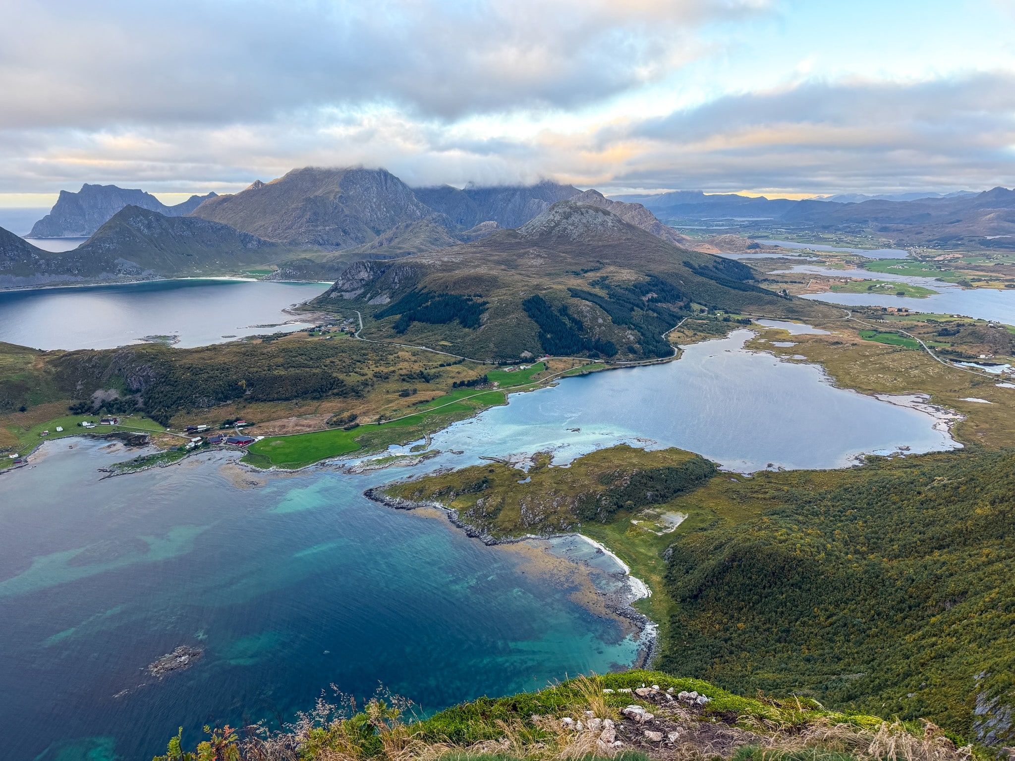
The view goes all the way around. To the north and west there’s a turquoise bay right below, a few red farmhouses and green fields, then Haukland and Vik beaches with the mountains of the next island lined up behind them. To the east you look over the Nappstraumen strait and the flat land around Leknes. The sun was already low over the sea, and only a couple of other people were up there with me.
Be careful on the north side of the summit, where the edge drops off as a cliff.
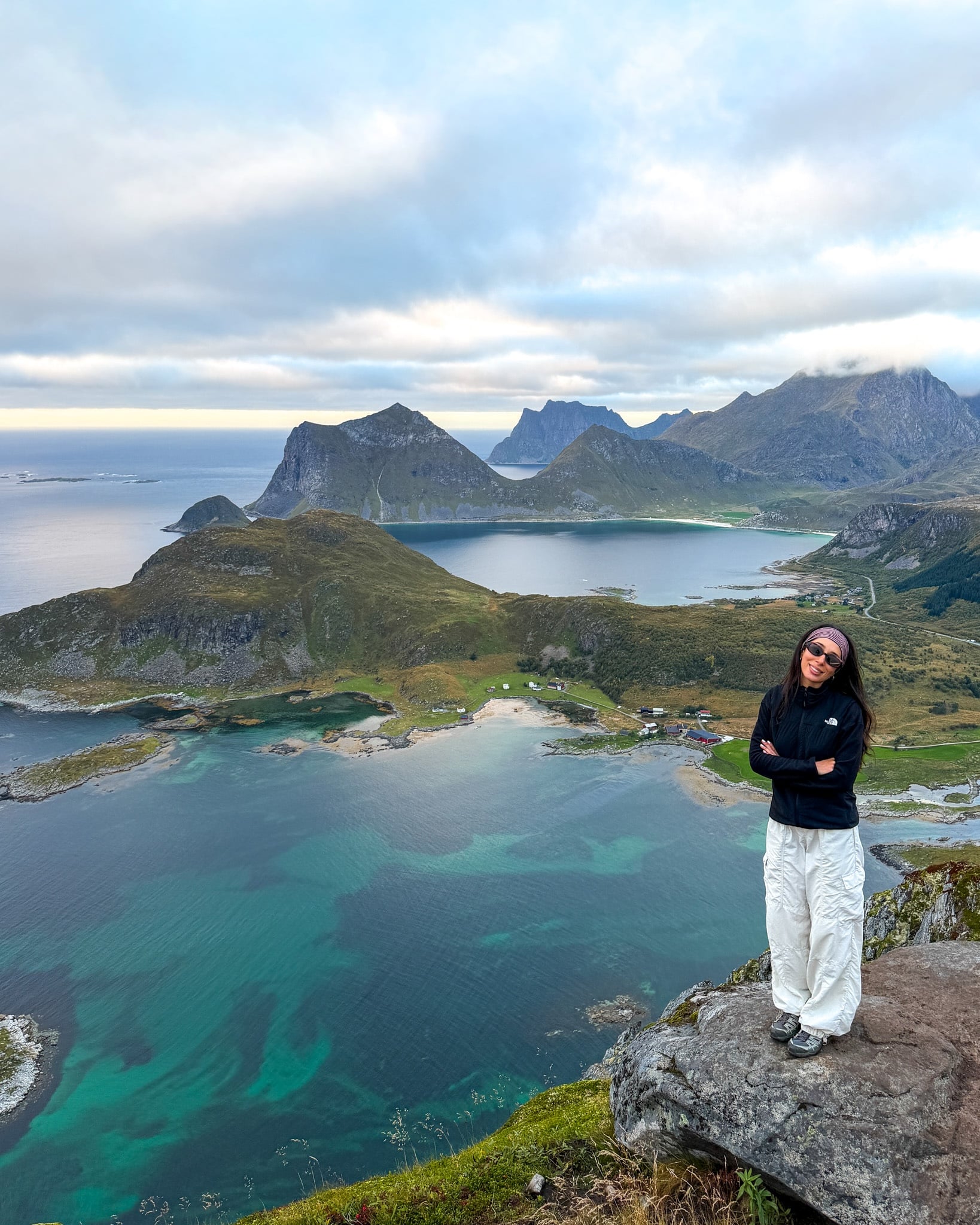
Me on the Summit of Offersøykammen, Lofoten
Me at the top of Offersøykammen, a little after 7 p.m.
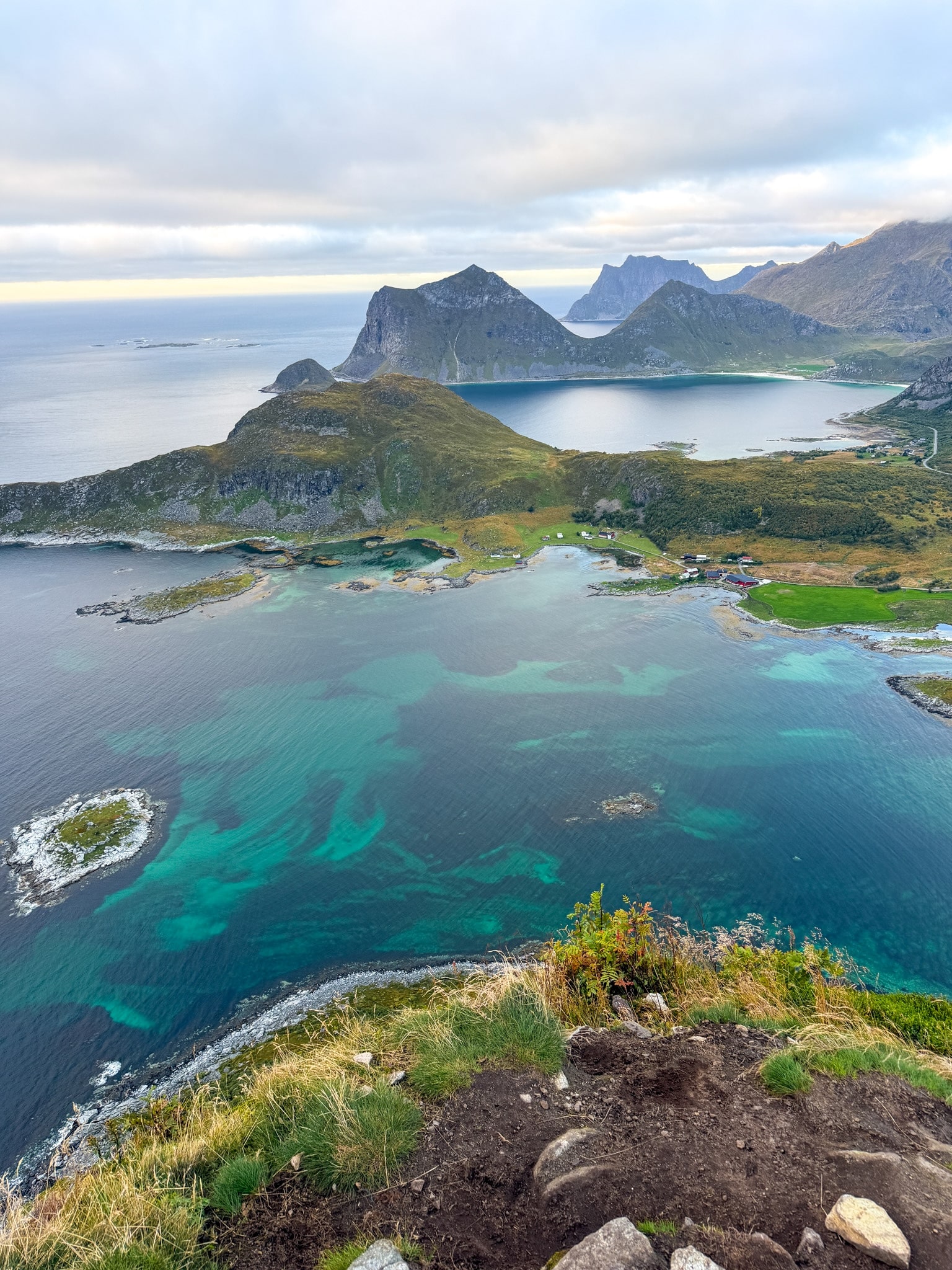
Turquoise Water Below Offersøykammen, Lofoten
The water right below the summit, with Haukland and Vik beaches in the distance
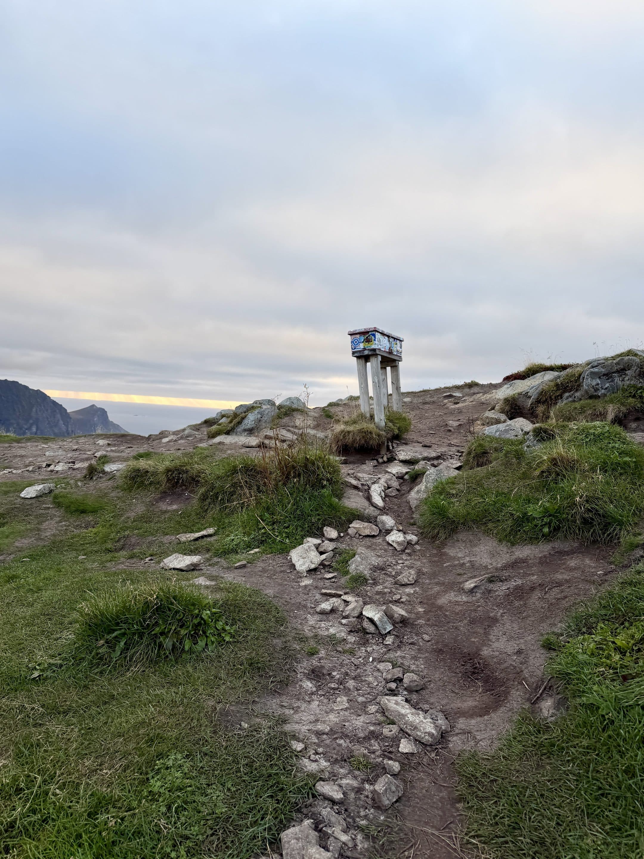
Wooden Summit Box on Top of Offersøykammen, Lofoten
The summit box, the easiest way to know you’ve reached the top
How Hard Is the Offersøykammen Hike and How Long It Takes
Technically, Offersøykammen was one of the easiest hikes I did in Lofoten. No exposed bits, no scrambling, no chains, and only a few spots where I had to watch my feet. It goes up steadily from the road to the summit, so you need some stamina, but it’s short enough that most people with average fitness will be fine. Overall, I would classify this hike as easy, for the Norwegian standard.
For timing, I needed about 50 minutes from the trailhead to the top and 2 hours car to car, with a photo stop. If you like to go slowly or stay longer at the top, I’d plan 2.5 hours.
Compared with the other hikes I did on this trip:
- Mannen above Haukland Beach is the closest match, a bit more exposed and with a longer loop if you add the beaches. It's located nearby, so you can do the Mannen full loop in the morning and Offersøykammen in the afternoon like I did. I wrote up the full route in my guide to the Mannen hike from Haukland.
- Festvågtind near Henningsvær was much harder, with big boulders at the start and narrow, exposed sections near the ridge, as you can see in my guide to the Festvågtind hike.
- Reinebringen above Reine is about as easy technically, since it’s almost all stone steps, but it felt a slightly harder push on the legs. I covered parking and prices in my guide to the Reinebringen hike.
- The Kvalvika Beach and Ryten loop is more than twice the distance and close to twice the climbing, so slightly harder. I shared the route and parking in my guide to the Kvalvika Beach and Ryten hike.
As always in Lofoten, after rain the path gets muddy and the rocks turn slippery, especially on the way down, so shoes with good grip make a real difference. I didn’t have that problem on a dry September evening.
Offersøykammen Hike FAQ
When is the best time of year to hike Offersøykammen?
From late spring to early fall, when the trail is free of snow. Between late May and July, you get the midnight sun in Lofoten, and Offersøykammen is a popular spot to watch it. I went in early September and loved the sunset light. In winter the trail is covered in snow, so only go with proper gear and experience.
What should I bring?
A windproof jacket, because the top is open on all sides and gets windy even on calm days. Bring water too, since there’s nowhere to refill on the trail, and shoes with good grip for the way down. Don’t forget a parking disc for Skreda, and a headlamp if you’re going up late in the season.
Is the Offersøykammen hike good for kids and dogs?
It’s short and has no exposed parts, so older kids who are used to walking uphill should manage, with an eye on them near the cliffs on the north side of the summit. Dogs are allowed, but in Norway they have to be on a leash from April 1 to August 20.
Can you combine Offersøykammen with another hike on the same day?
Yes, and I did. I hiked the Mannen loop above Haukland Beach around midday and started up Offersøykammen at 6 p.m., a short drive away. Together they’re more than 850 m (2,790 ft) of climbing, so the second one was slower, but very doable. I’ll cover the full loop in a separate guide soon.
Can you see the northern lights from Offersøykammen?
In theory yes, from late August to mid-April, and the summit has a clear view in every direction. In practice, hiking down a steep trail in the dark isn’t something I’d do, and the aurora is just as visible from the shore. I explained the apps and the spots I used in the guide where I tracked the northern lights in Lofoten.
Check Out My Other Lofoten Guides
- Where to Stay in Lofoten: Best Areas, Hotels & My Experience
- How to Get to the Lofoten Islands: 4 Easy Routes + My Pick
- Renting a Car in Lofoten: Agencies, Parking & My Driving Tips
- Lofoten Northern Lights: Best Time, Places & Forecasts I Used
- Kvalvika Beach & Ryten Hike: Routes, Parking, Map & My Tips
- Festvågtind Hike, Henningsvær: Difficulty, Map & My Photos
- Mannen Hike From Haukland: Out-and-Back or Loop, Map & Parking
- Reinebringen Hike: Trailhead, Parking Lots, Steps & Closures
Keep reading: