A detailed guide on how to hike the Truso Valley from Kazbegi, based on my recent experience: how to get to the trailhead, how’s the road past the main parking lot, shuttle options, plus all the best things to see including mineral springs, Ketrisi's ruins, Abano Lake & Village, and finally the Zakagori Fortress.
Truso Valley sits just off the Georgian Military Highway, close enough to Kazbegi that most guides call it one of the easier hikes nearby.
Once you're on foot, I agree that's fair. It's flat almost the whole way, past mineral springs that stain the ground orange, semi abandoned villages, a monastery run by monks and another by nuns, and a ruined fortress at the end, a few hundred meters from the border with South Ossetia.
However, getting to that starting point is the tricky part I found out most guides gloss over. How far you can drive depends on your car, your driver, and how much risk you're willing to take on, and it changes the shape of the whole hiking day.
So now that I’ve been there myself, I can guide you through all of it: the drive in and where it turns genuinely hazardous, the cafés you'll pass along the way, what the ground underfoot is actually like, what's worth packing for this hike specifically, and every stop in order, from the first travertines to the Zakagori fortress itself.
-
- Truso Valley is not the only incredible trail around Kazbegi, there's much more! For the full ranking, see my guide to the 5 best hikes in Kazbegi
Quick Numbers & Info On The Truso Valley Hike
-
- Starting point: the free parking area marked here on Google Maps "Truso Valley Start Point". You’ll recognize it by the blue-railed bridge. Tourists with a 4x4 and excellent driving skills can reasonably drive up to this point (there's a way to go further with a local driver, covered in the next chapter)
- Distance: from the above-mentioned starting point (blue-bridge), it’s about:
- 10 km (6.2 miles) round trip to Cafè Truso & Abano Mineral Lake, or
- 18 km (11.1 miles) round trip to Abano Village, or
- 22 km (13.7 miles) round trip to Zakagori Fortress
(there's a way to make them shorter, covered in the next chapter) - Elevation gain: around 450 m (1,475 ft) regardless where you stop of after Cafè Truso, since the elevation is concentrated at the beginning and afterwards it’s mostly flat
- Highest point: about 2,250 m (7,380 ft) at Zakagori Fortress
- Time required: 4 to 8 hours round trip on foot from the parking area, depending on staring point, pace and stops. We had a driver take us further in, so we covered the stretch from Truso Camping-Cafe to the fortress and back on foot in about 4 hours, including stops at Abano Lake, Ketrisi, and the fortress itself
- Difficulty: Easy underfoot, flat to gently rolling with one short climb near the start, but muddy in a lot of places. The road in is the harder part, not the walk
- Best season: June to September
- Alltrails GPS Trail Track
-
- Where to Stay: you can stay in Stepantsminda, a short drive away. Here are my favourite hotels in the area:
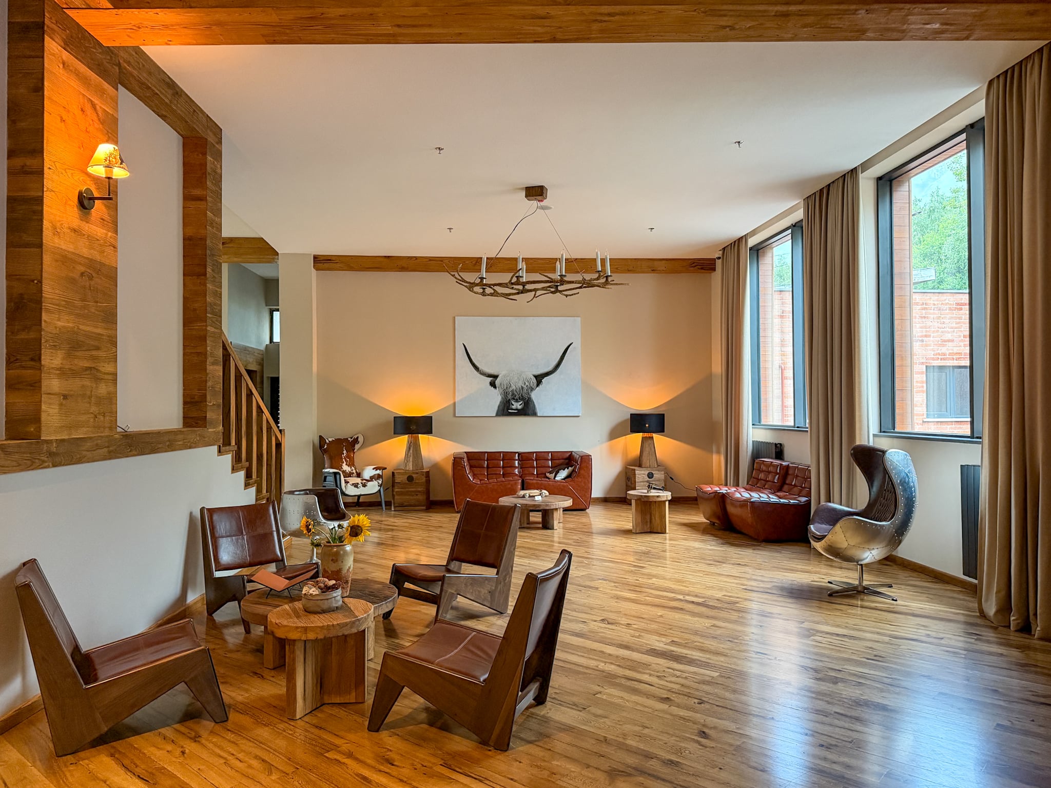
- Lens Design Hotel, a sleek modern stay where I spent the night before the hike
- Rooms Hotel Kazbegi, if you want something even more on the luxury side.
- Where to Stay: you can stay in Stepantsminda, a short drive away. Here are my favourite hotels in the area:
More options of places to stay in for this specific hike further down.
How to Get to the Truso Valley Trailhead
Option 1: Driving Yourself
From Stepantsminda, which is most people’s base, you head south on the Georgian Military Highway for about 17 kilometers. The dirt road stays decent for a while, then it doesn't. A long stretch is full of potholes, some deep enough that you can't see the bottom from the driver's seat. You need a car with real clearance here, obviously a 4x4.
Then the road starts runs alongside the Terek River through a narrow gorge, rock walls on both sides, streaked with waterfalls after rain. You need a driver comfortable with driving on narrow bumpy roads with very direct exposure to cliffs.
The parking area most self-drivers end up using sits by a small bridge with blue railings, it’s located here (Google Maps pin). It's free, with room for several cars.
Past this point, the track narrows and gets genuinely sketchy: sections that have partly slid down the hillside, bridges with no guardrails, a few spots where you drive straight through a deep stream. Don't try continuing on your own.
Option 2: Take a Shared Transfer
For people that don’t feel taking the risk of driving themselves here, there are several options. One is to book a shared transfer.
- Mountain Travel Agency (MTA) located in Stepantsminda runs a shuttle, but only once enough people have signed up in person, so it's not something you can count on at a fixed time or book online. Either way, these transfers get you to the same parking area you'd reach driving yourself, nothing further.
- Mountain Freaks used to run two daily shuttles from their office in Stepantsminda out to this parking area, and most guides online still list them as the easiest way in if you don't have a car. As of 2026, that daily service is suspended, with no sign yet it's coming back for 2027. Worth a call before you go in case that's changed, but don't plan your day around it.
Option 3: Hiring a Private Local Driver
This is the option I chose. If you want to get further into the valley than the parking area, this is really the only way to do it. You can find a driver specialized in this route once you're in Kazbegi, ideally through your guesthouse or hotel. Price scales with distance, and so does how much of the walk gets cut:
- around 200 GEL round trip only gets you to the same parking area as driving yourself, no shortcut there.
- about 250 GEL gets you to the travertine formations and Truso Camping-Cafe, a 20 minute walk from Abano Lake, which trims a good chunk of the flat opening stretch. This is what I picked.
- around 300 GEL gets you dropped near Abano village, close to the final push to the fortress. So basically there’s no more hiking involved.
Option 4: Book a Guided Tour
There's also the option of a full guided tour from Kazbegi, where instead of just arranging transport, someone hikes the valley with you. It's a nice way to go if you want things explained as you walk, or if hiking alone in a remote valley or around the shepherd dogs makes you uneasy. A quick search on Google or Instagram/Facebook Groups turns up several local guides offering it. If you need a suggestion, I’ve heard good things for the one offered by The Alpine Project and by Mountain Freaks.
Some tours depart from Tbilisi rather than Kazbegi. I personally don’t love that option: the drive from Tbilisi alone eats up a big part of the day, before you've even reached the valley, and staying in Kazbegi is truly part of the experience in this region.
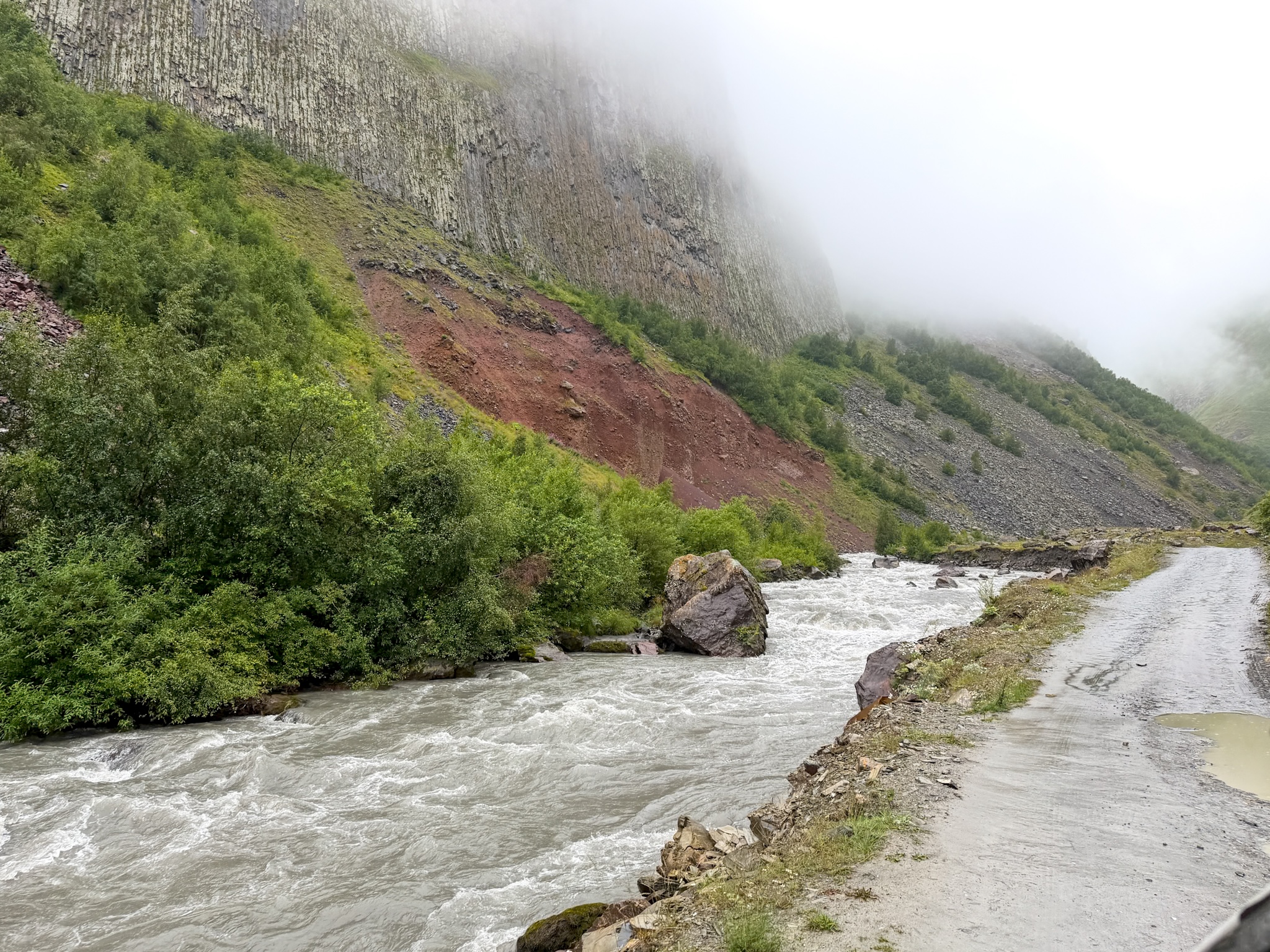
Truso Valley River
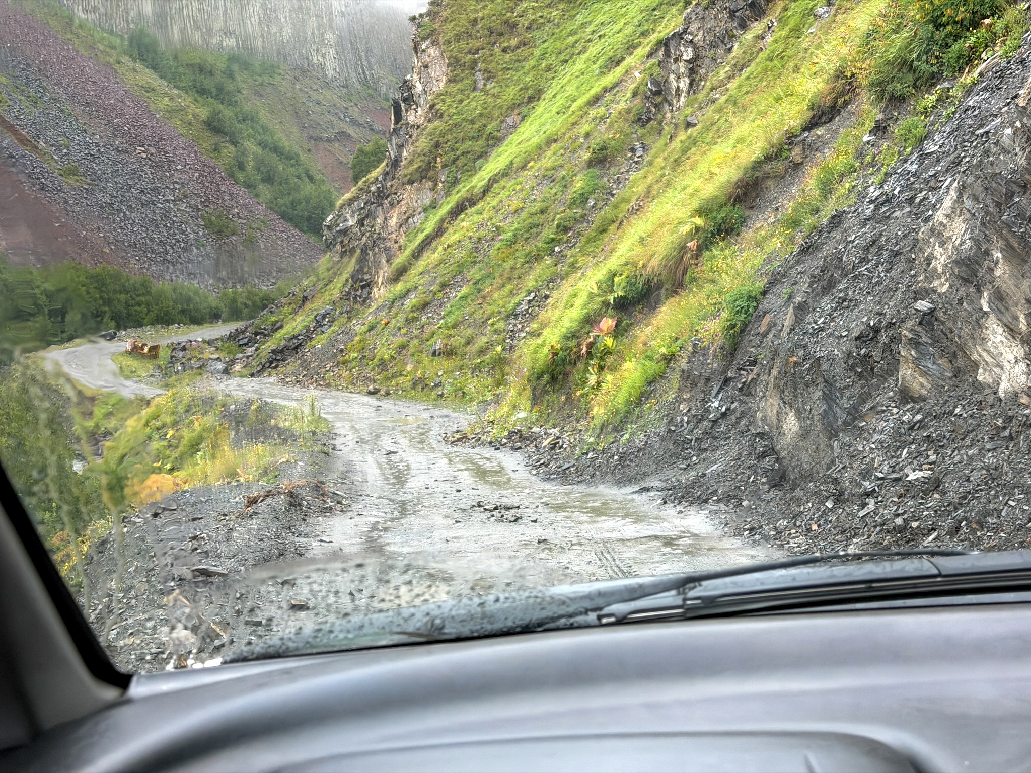
Truso Valley Road
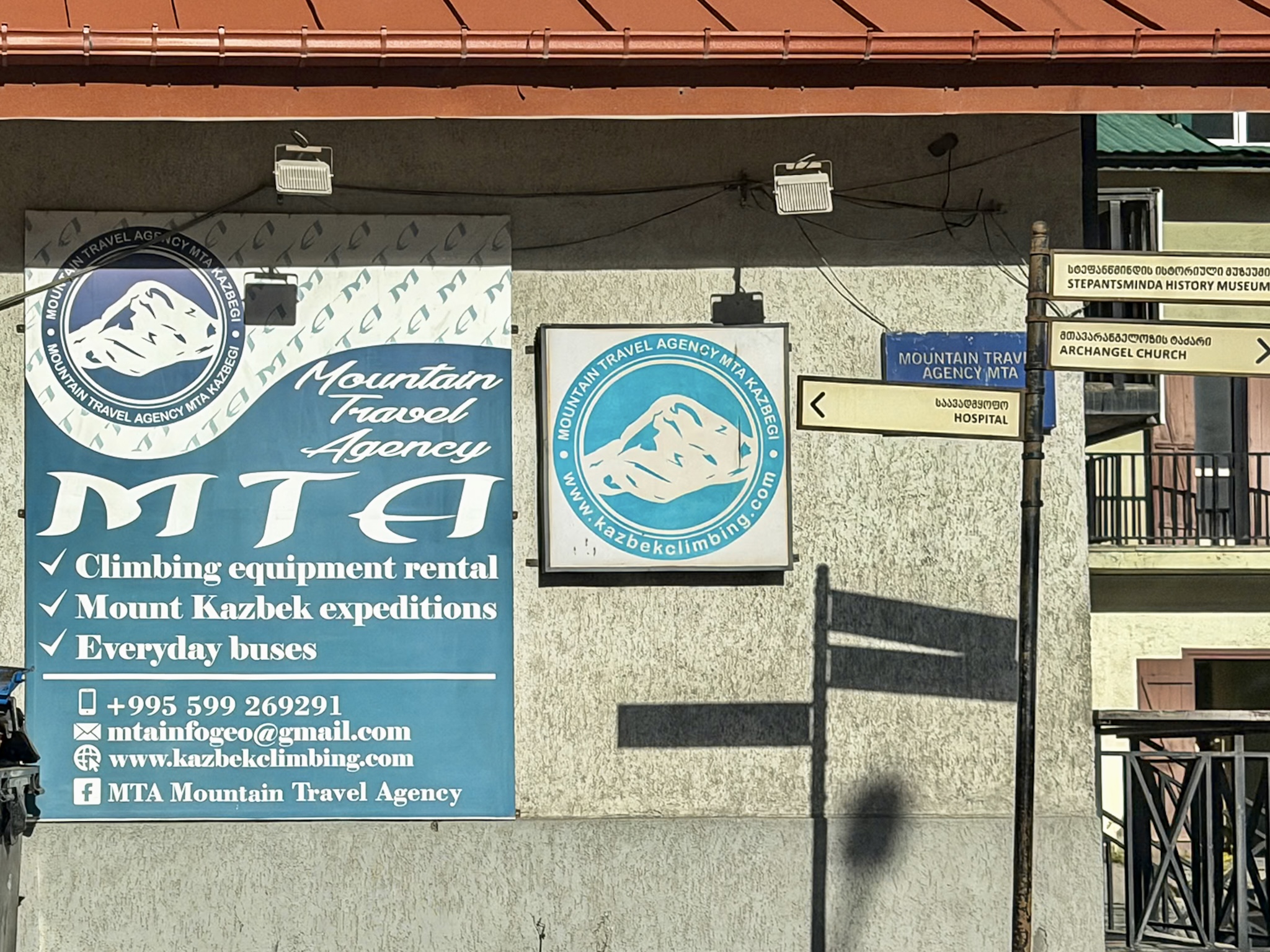
Mountain Travel Agency
The Truso Valley Hike, Step by Step
From the Parking Lot to Truso Camping-Café
I saw this section from the car. As mentioned above, I hired a local driver who drove up to the vicinity of Truso Camping-Cafè, so I started hiking only from that point. This specific section after the blue bridge parking lot is not necessarily the most scenic part of the trail, but we did stop twice to look at some small waterfalls and the first travertine formations. This is also where most of the elevation is concentrated, around 400m.
Since hiring a drive is a popular option, you will share the trail with cars, too.
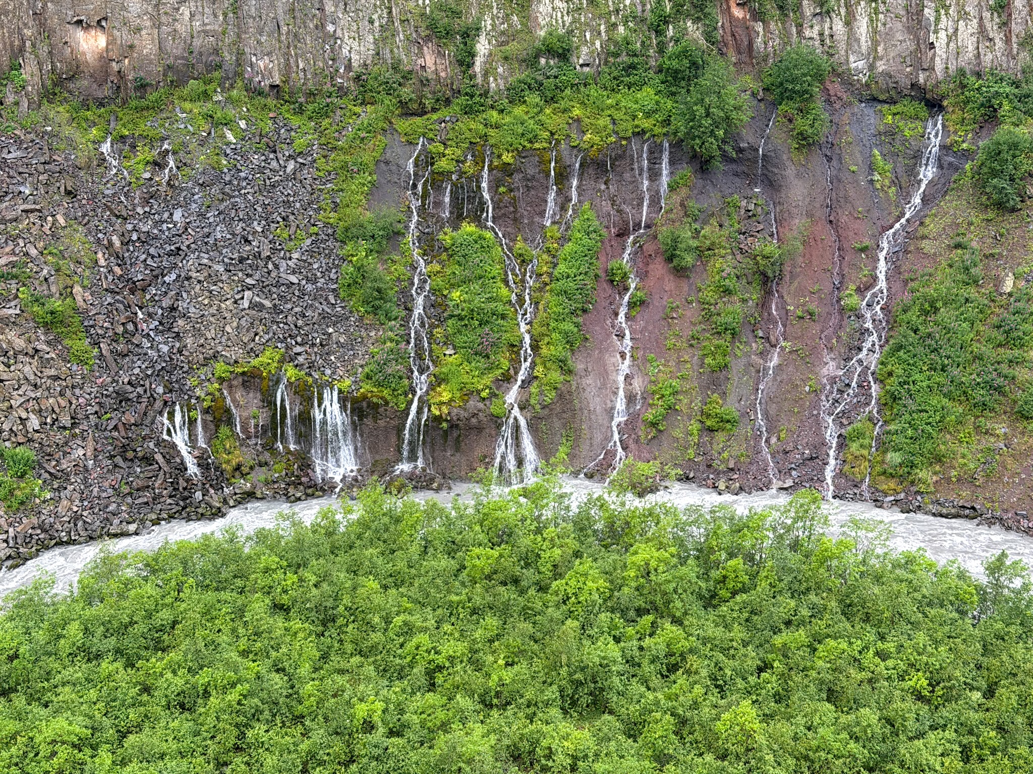
Truso Valley Waterfalls
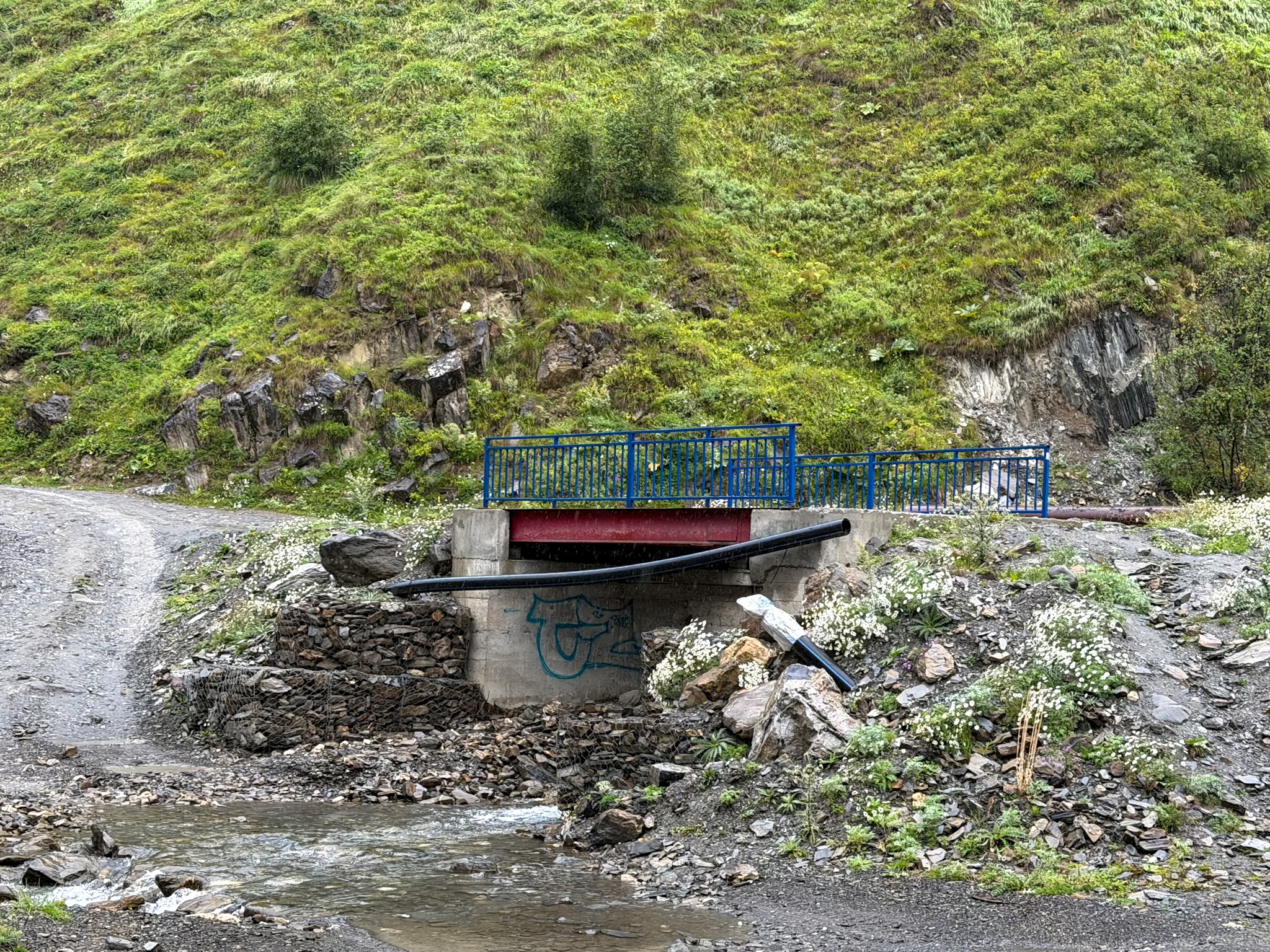
Truso Valley Blu Bridge
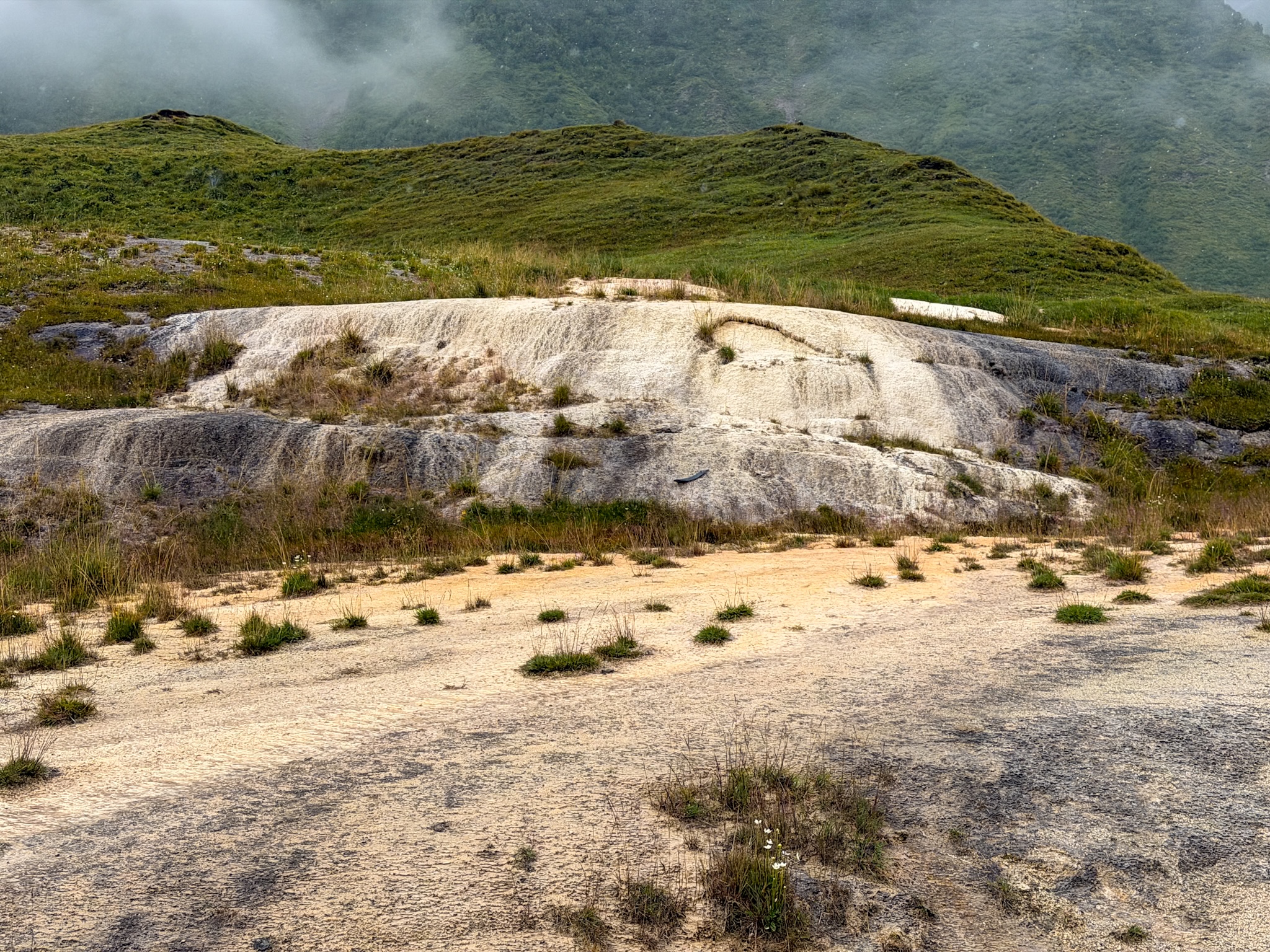
Truso Travertines Monuments
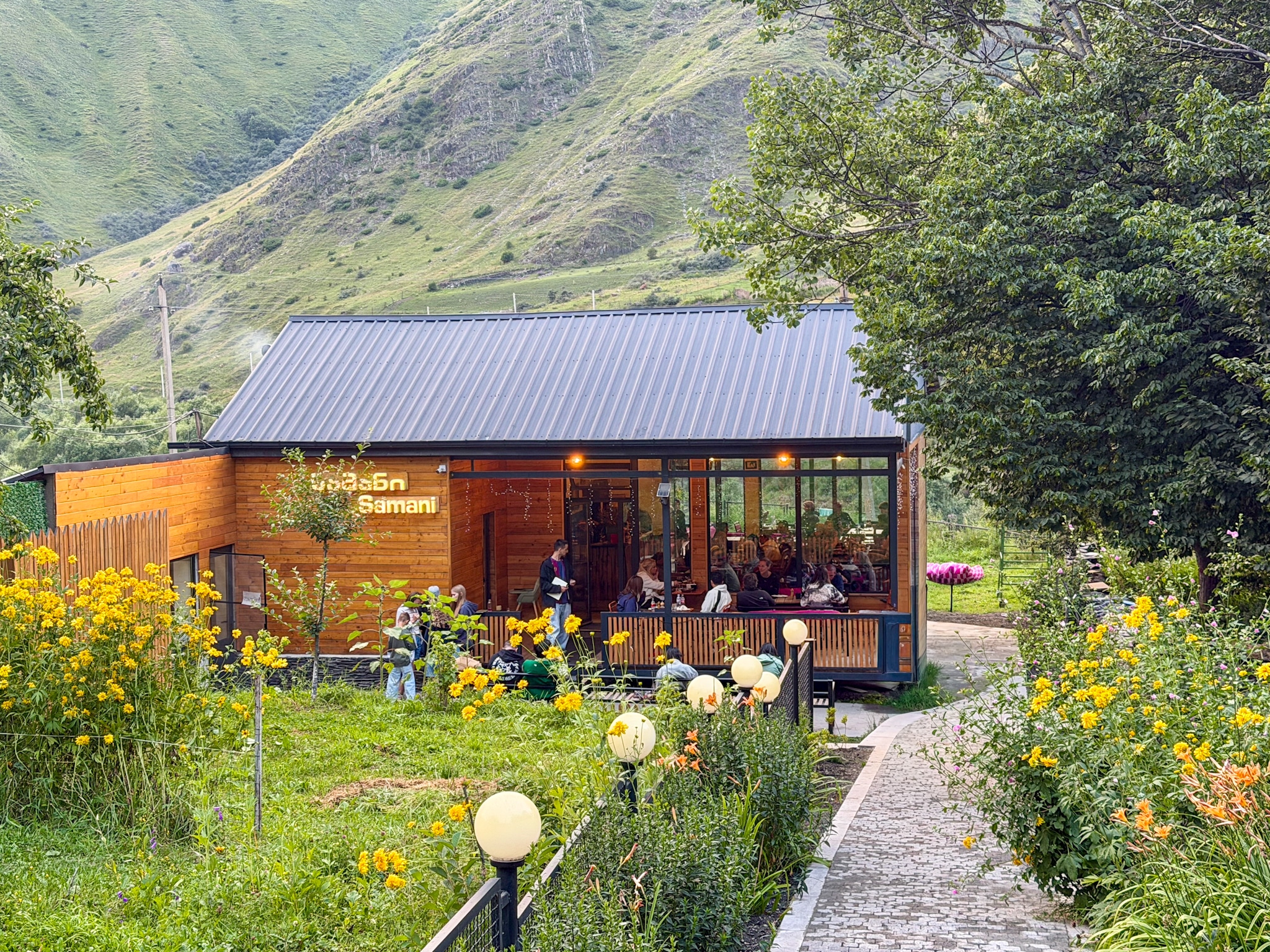
Truso Camping-Cafe
Whether you arrive here with a car or on foot, about 100 meters after the first travertine natural monuments, you’ll see a pedestrian bridge that crosses the river, with signposts pointing toward Abano Lake and Ketrisi. Cross it, and Truso Camping-Cafe sits right there on the other side, with a chalkboard sign out front advertising drinks and snacks, tables and cottages for rent. This is maybe the last real sign of civilization before the rest of the hike.
If you walk beyond the Cafè, you’ll see steps built out of old tires that climb the grassy slope. Take that route to get panoramic views over the next stop, which is the Abano Mineral Lake.
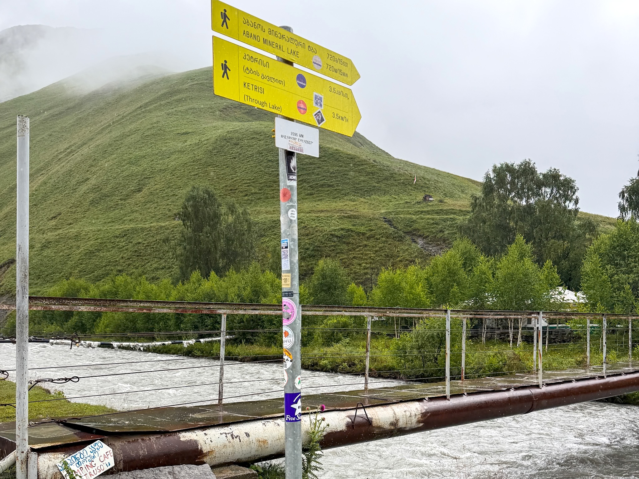
Pedestrian Bridge to Cafè Truso
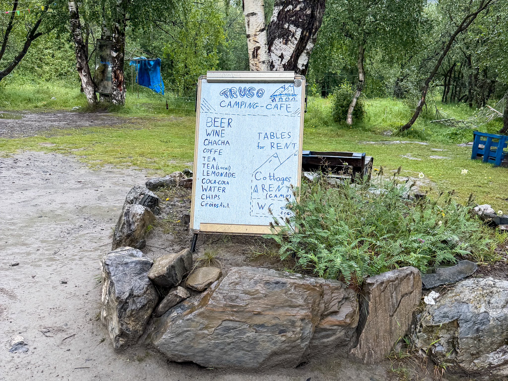
Truso Cafè Menu
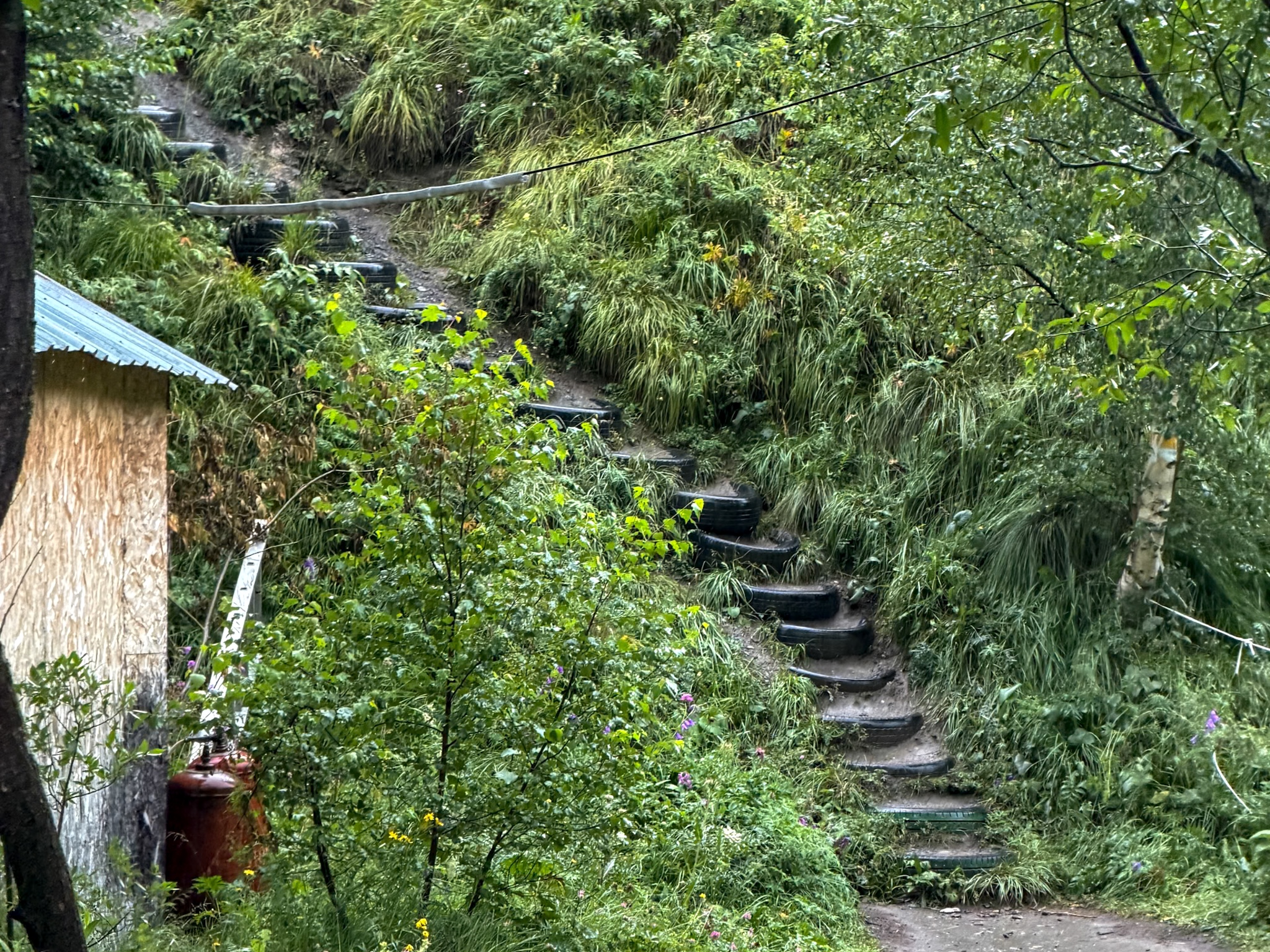
Truso Cafè Tire Slope
Abano Lake and Its Mineral Springs
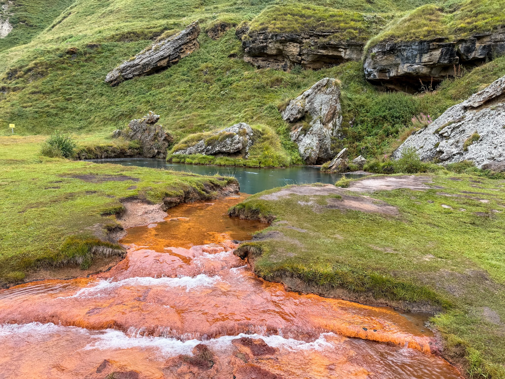
After 10 minutes of walking, the trail opens onto Abano Lake, a tiny deep blue-green pond that feeds a stream stained bright orange with iron. The water is cold, bubbly in some areas, and there's a smell of sulfur in the air around it. It's a protected natural monument, so no swimming, camping, fires, or driving here.
A signpost at the lake gives the numbers straight: 2,129 meters elevation here, and distances on to the travertines, Ketrisi, and Zakagori Fortress. From here the trail climbs a little further along open ground before dropping back down toward the valley floor, with wide views back over the river and the mountains closing in on both sides.
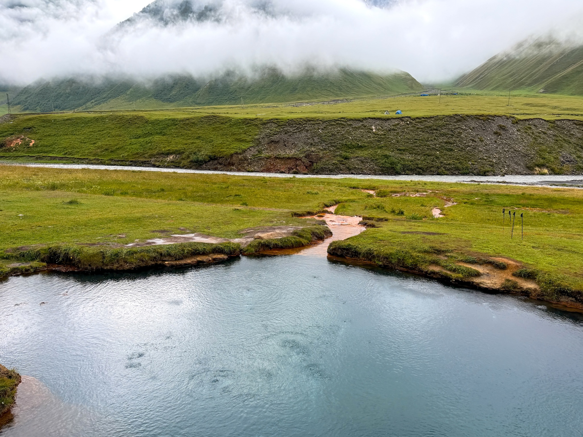
View over Abano Mineral Lake
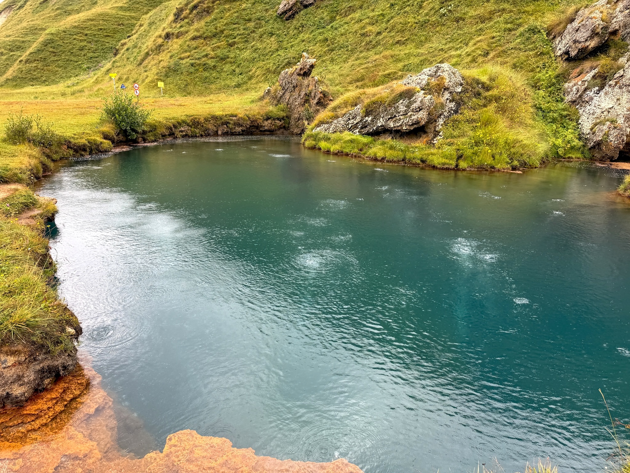
Bubbles Surfacing at Abano Mineral Lake
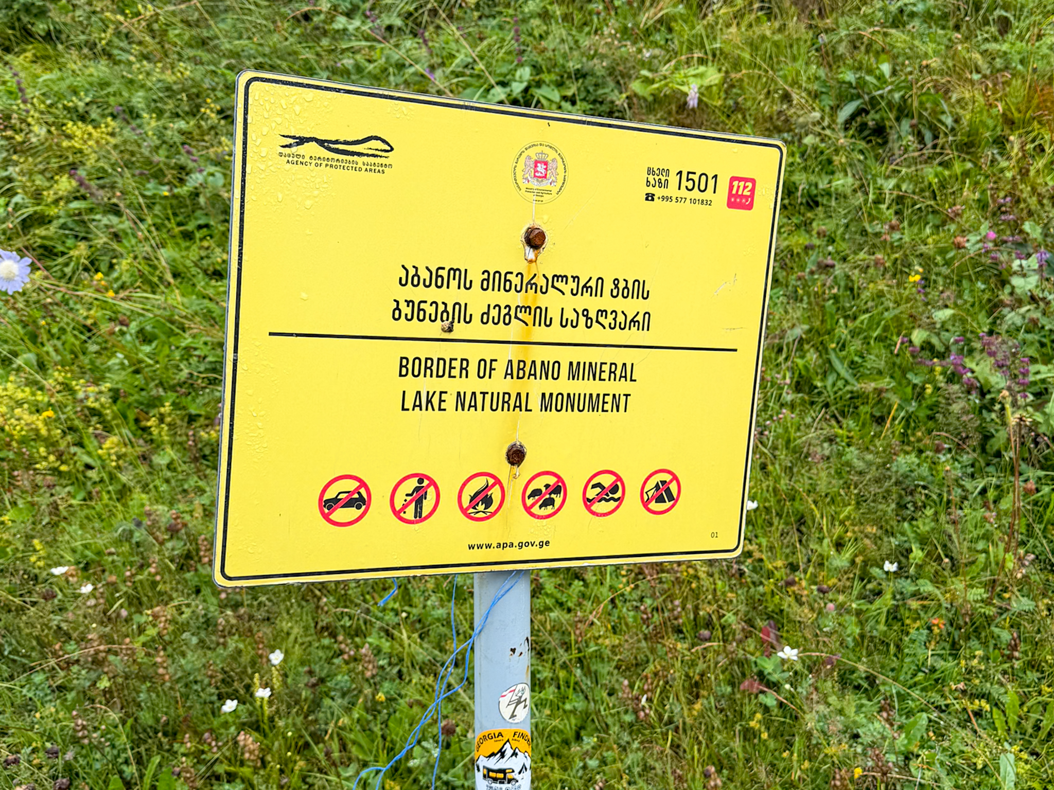
Warnings at Abano Lake
Ketrisi: Ruins and More Mineral Springs
Heading back down and then straight ahead toward the valley floor, the trail passes another mineral spring, water surfacing out of the rock and staining the ground around it a deep orange. Then it's a wide, grassy walk through the valley itself before Ketrisi comes into view.
Ketrisi is officially empty, one of the villages abandoned during the conflicts with South Ossetia, marked on maps as a "nasoplari". What's left is a scatter of collapsed stone houses and one tall defensive tower still standing. I didn’t find it entirely deserted, though. Further back from the ruins, we could make out tents and tarps that looked like an informal camp, and even a small café, though we didn't go over to check.
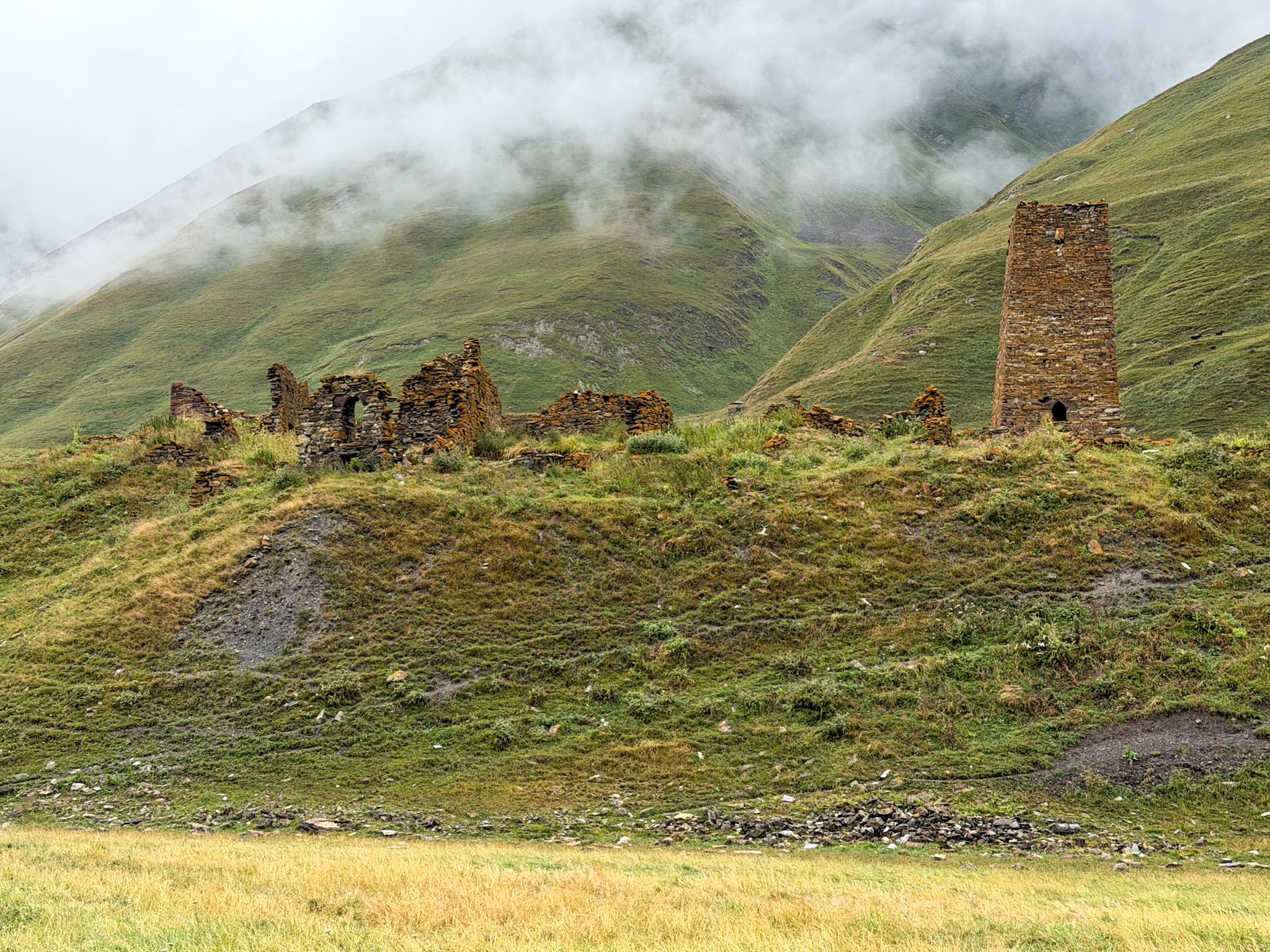
Ketrisi Ruins & Tower
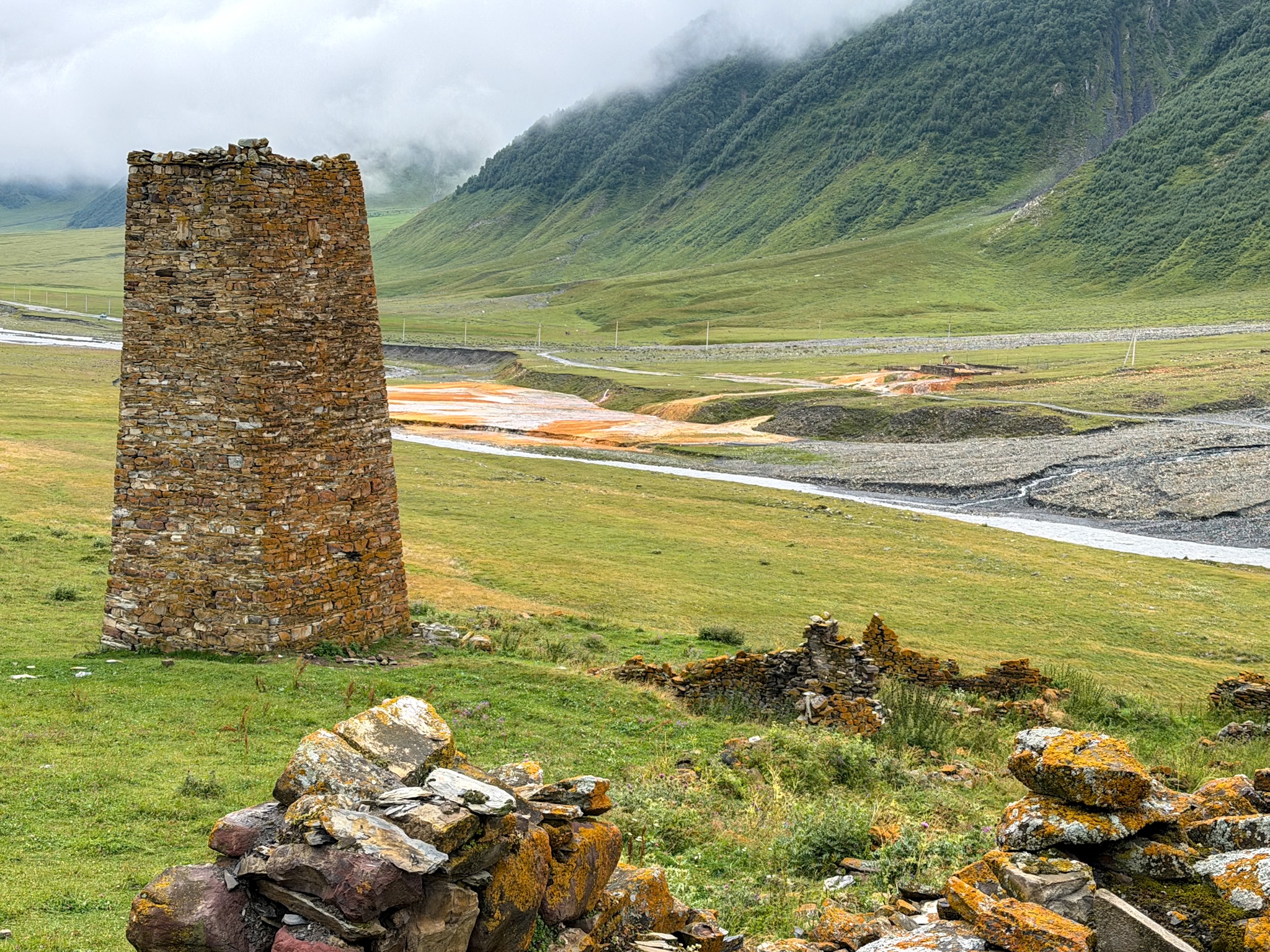
Ketrisi Tower & Sulphur Streams
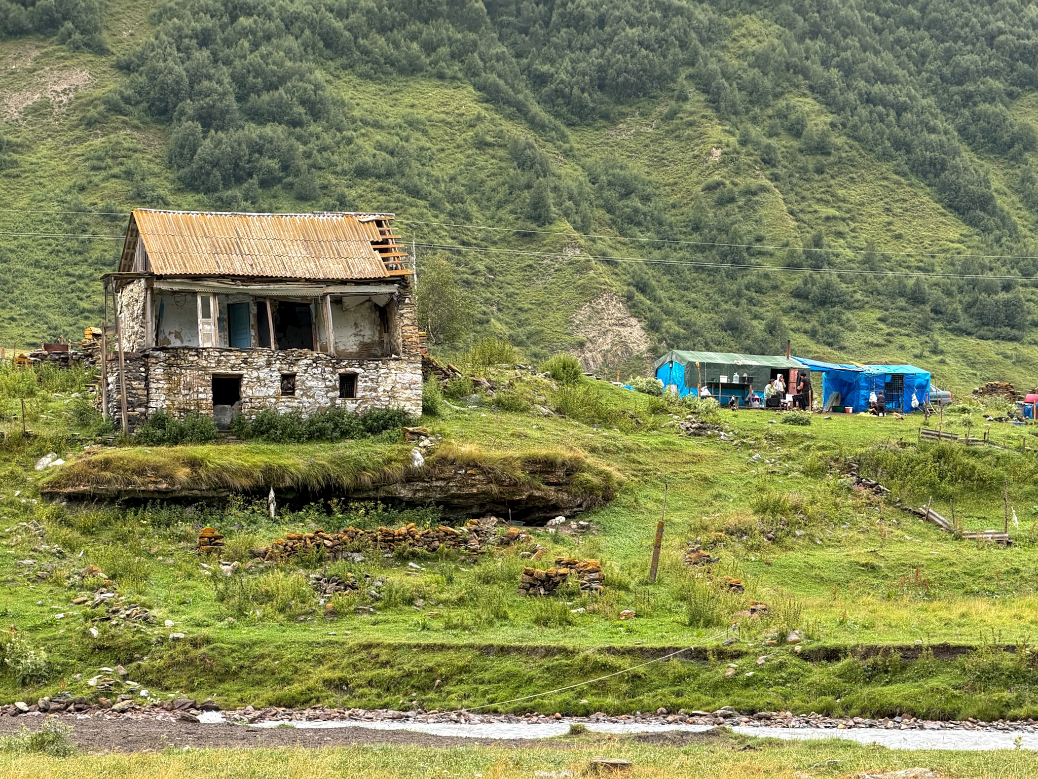
Ketrisi Village
St. 12 Apostles Fathers Monastery
A little while past Ketrisi, a hand-painted sign points toward St. 12 Apostles Fathers Monastery, its stone church painted pink on the sign, tucked into the hillside with a second, smaller building above it.
It's a working men's monastery, and from the trail you only see it from a distance, set back against the slope.
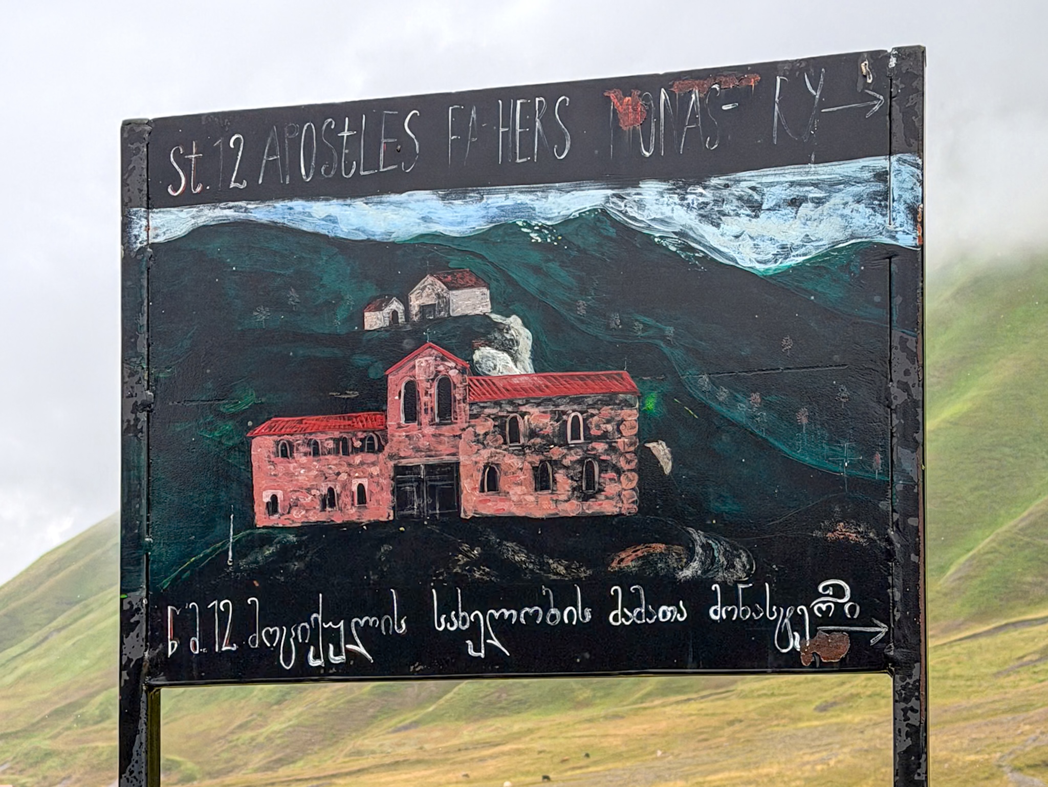
St 12 Apostles Monastery Sign
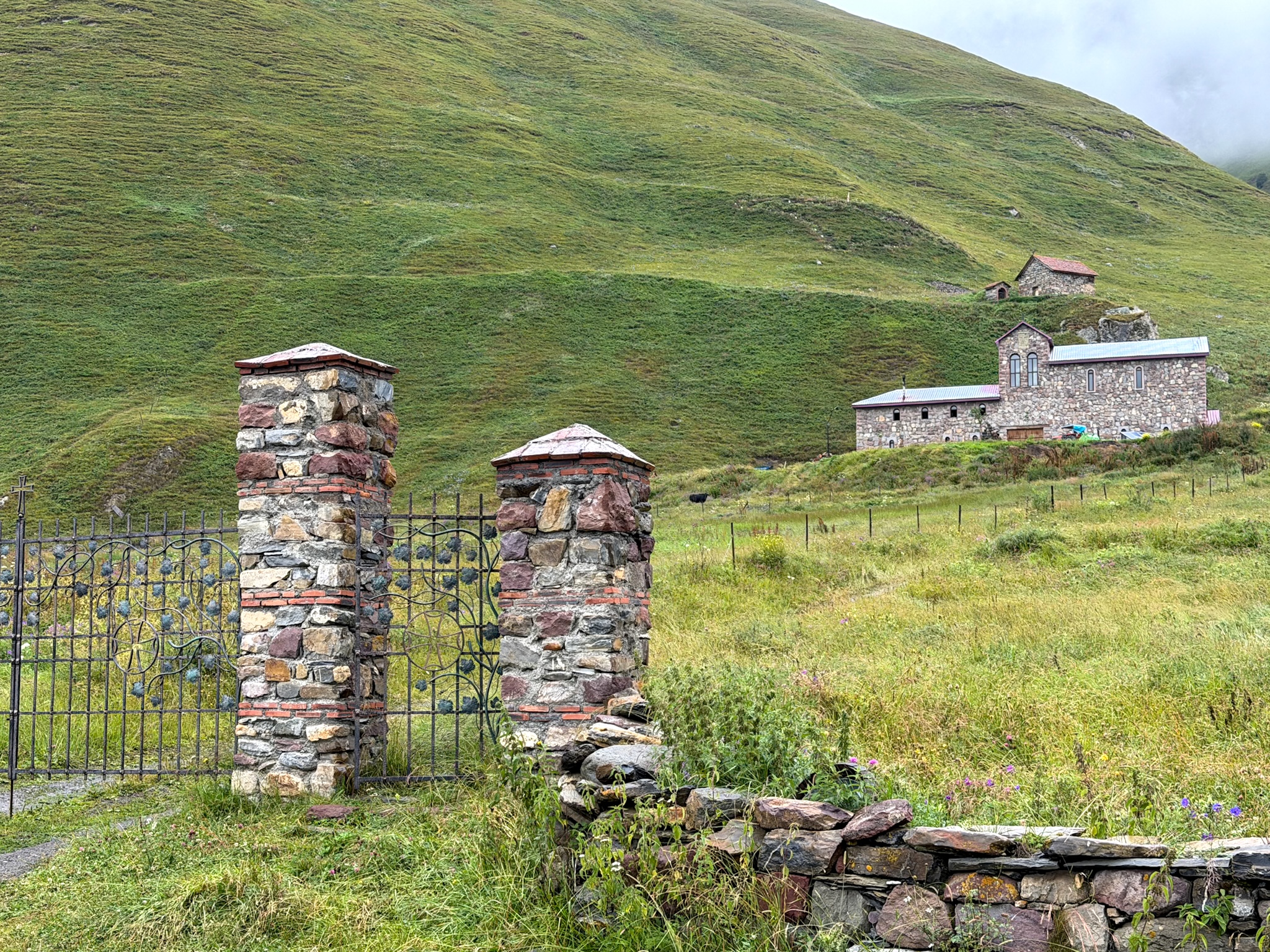
St 12 Apostles Monastery Gates
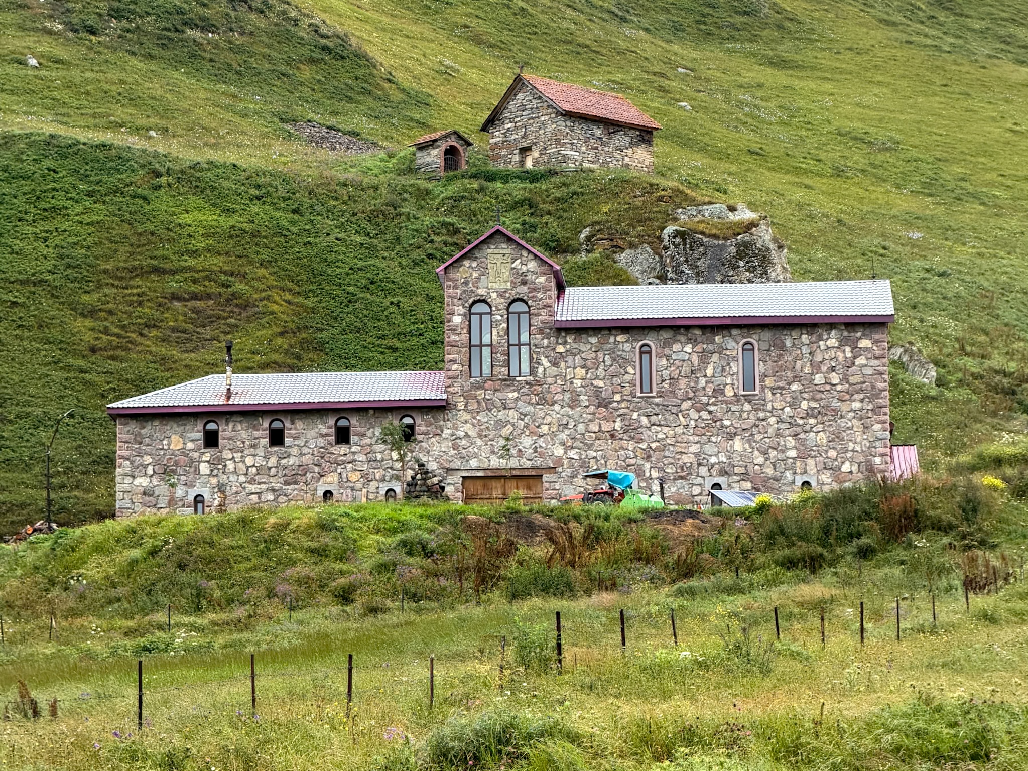
St 12 Apostles Fathers Monastery
The Convent and the Village of Abano
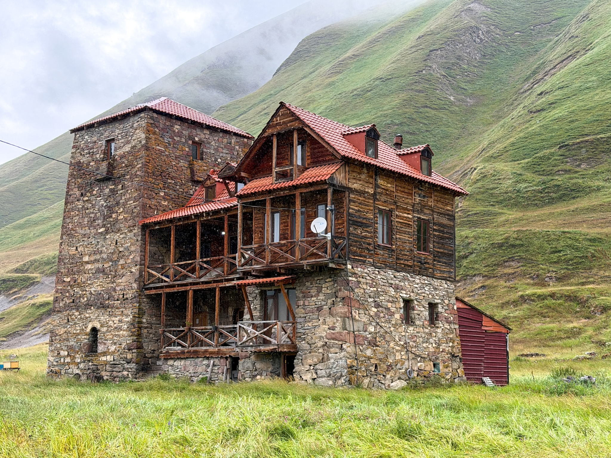
A little further on, another sign, carved into wood and hung from two posts, marks the village of Abano. It's less a village at this point than a small cluster of buildings: a stone tower, a tiny chapel with a red roof and a cross on top, and larger lodges built from stone and timber.
Here you’ll find the Convent of the Blessed Virgin Mary, and the nuns run a café right across from it called Truso Satrapezo, genuinely good food, payment by donation. A yellow sign by the entrance lists parking, camping, and guesthouse rooms too, also available on request and paid by donation (search for the lodging separately online as Truso Guesthouse). No electricity, very basic, but a quiet bed if you need one.
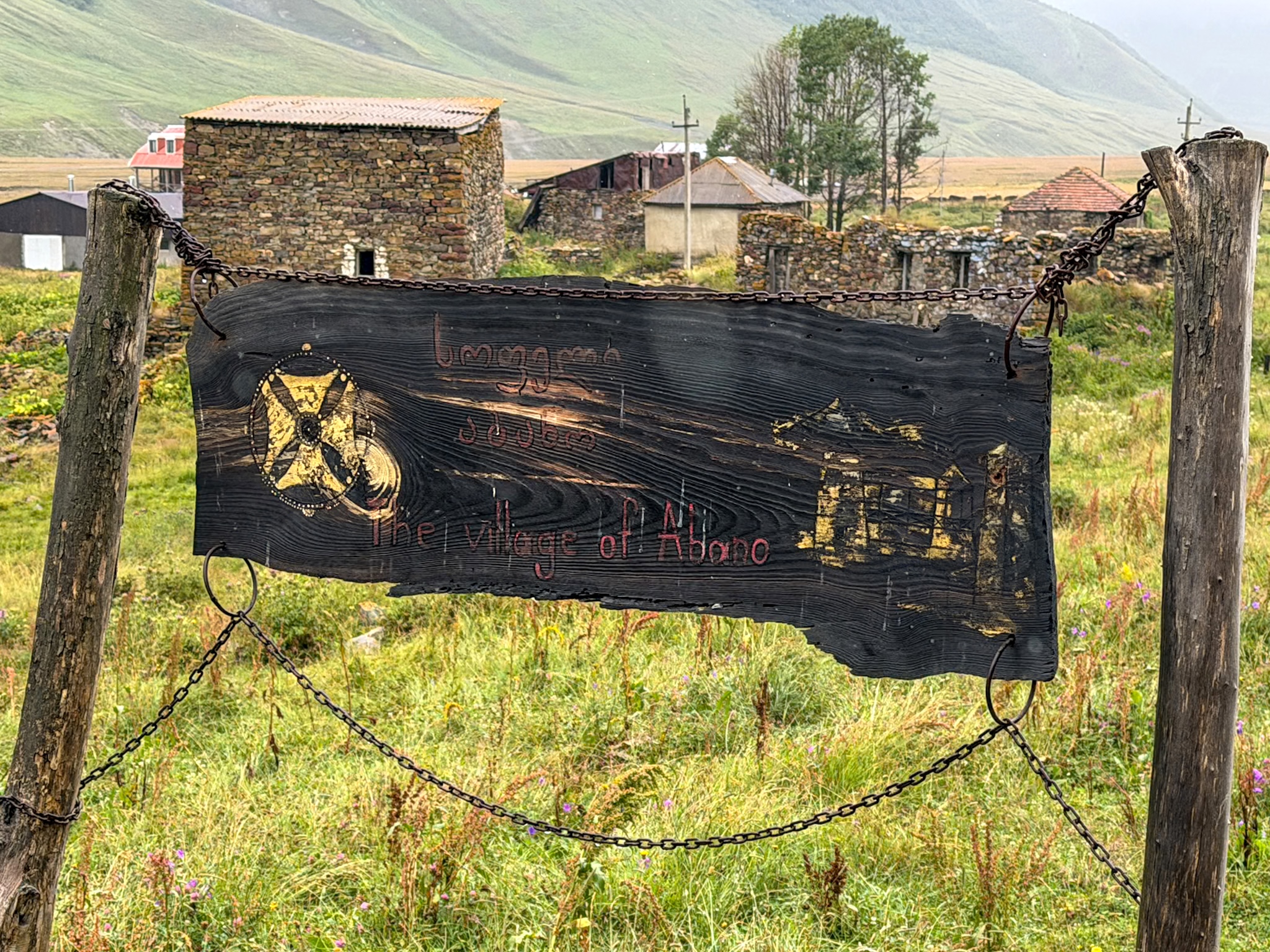
Abano Village Sign
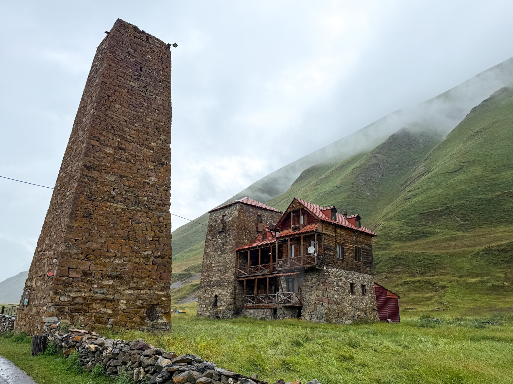
Abano Village
Abano Nunnery
Zakagori Fortress
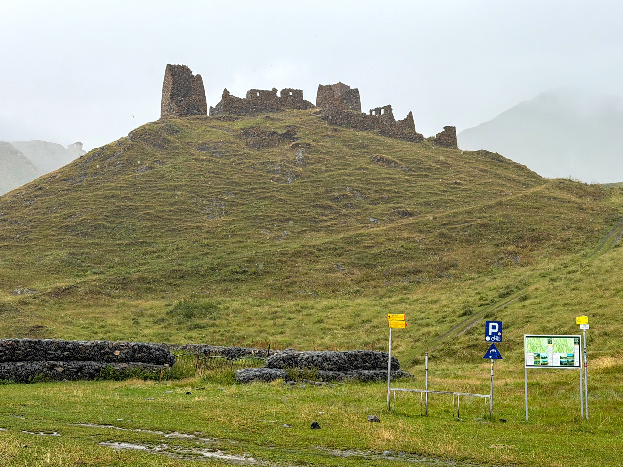
From Abano, Zakagori Fortress comes into view on its own hilltop a short walk ahead, a jumble of crumbling stone towers and walls against the sky. Some sources date it to the 17th or 18th century, others put it centuries earlier. Either way, this is the end of the road: past the fortress lies South Ossetia, and going further needs a border permit.
Getting to the fortress and climbing up into the ruins doesn't. I was told that sometimes friendly border guards are stationed at the base, but we didn't see them up there when we visited in August 2026.
Practical Tips
What to Pack, Weather and Trail Conditions
It is very rare to find a fully sunny forecast in this region, even during the summer months. Some clouds here and there are to be expected, and even sudden rain.
For this reason, I highly suggest bringing with you:
- Waterproof hiking shoes. The valley sits in a spot that pulls in rain often, and the ground underfoot is muddy in long stretches even when it hasn't rained that day.
- Waterproof clothing with an extra emergency outer layer like a poncho is highly recommended too, and a waterproof cover for your backpack. You don’t want to find yourself unprepared for sudden rain at the fortress, when there are still 10+km to get back with the parking area.
- Sunscreen. If you're lucky and get a sunny day, sunscreen is crucial as there's basically zero shade along the path.
- Trekking poles aren't really needed, the terrain is mostly this flat.
Stray and Shepherd Dogs
Of every hike we did around Kazbegi, this was the one with the highest ratio of dogs to people, by a wide margin. Most are shepherd dogs guarding sheep somewhere nearby, not strays looking for trouble, but the sheer number of them can catch people off guard if nobody's warned you in advance.
A few things worth knowing before you go: keep your distance unless a dog is unmistakably friendly and coming toward you relaxed, tail loose. Never walk toward a flock of sheep if you spot one in the distance, the dogs guarding it will read that as a threat. And if a dog ever does seem aggressive, back off slowly, facing it, and reroute.
Where to Stay for the Truso Valley Hike
There are several options:
- Stepantsminda is an excellent base town for the Truso Valley hike, it’s close enough and it keeps you close also to the other hikes in the area if this isn't your only stop. If you aren’t driving yourself, Stepantsminda is also the place where all organized tours will start from. If you need a few hotels suggestions:
-
- I stayed at Lens Design Hotel, and it was honestly one of the nicer places I stayed in Georgia. Modern rooms, good views, well run.
- If budget is unlimited and you only want the best, Rooms Hotel Kazbegi is the well known upscale option, the place people book specifically for the hotel itself.
- For a four-star option that's well equipped without going fully luxury, Alpine Lounge Boutique Hotel is great. I tried their restaurant and it was amazing.
- And if you want the best possible value for money, Capra Hotel is the best pick I found in the more budget-friendly range, still a solid hotel choice.
-
- If Truso is the one hike you're doing, Gudauri works fine as a base too, and sits closer to Tbilisi.
- Staying inside the Truso Valley trail is possible, but it's really only for people who don't mind roughing it. I saw two options:
-
- Truso Camping-Cafe, near the Abano Mineral Lake, rents out a handful of simple huts, several mattresses to a room, no electricity, no shower, just drop toilets.
- Further in, the Convent of the Blessed Virgin Mary in Abano village also takes guests on request, search for it online as Truso Guesthouse. Same story there, don’t expect modern facilities, just a quiet bed. Rooms are priced by donation here, so be fair about what you leave, and it's worth calling ahead either way just to make sure they’re not out of beds.
-
FAQ
Is Truso Valley safe to hike, given how close it is to the South Ossetia border?
We hiked it in August 2026 without a single issue, and didn't see a border guard anywhere along the way, not even at the fortress. That said, Zakagori Fortress genuinely sits right on the line with South Ossetia.
The hike itself is popular by Georgian standard, and well known. Just don't push past the fortress ruins onto the hillside beyond them, guard or no guard, that's not Georgia anymore. If you want to do this hike but still don’t feel totally comfortable on your own, you can always book a guided hiking tour.
Do you need a border permit?
As for 2026, not for anything covered in this guide. You can walk, drive, or ride all the way to Zakagori Fortress and climb into the ruins without one. A permit only matters if you want to continue past the fortress toward Kelitsadi Lake or deeper into the border zone, a completely different, much longer undertaking. Same rule applies: the fortress is the hard line, treat it that way regardless of who's watching.
How far can you actually drive in Truso Valley?
Theoretically, you can drive all the way. The professional drivers who specialize in this valley, with the right custom vehicles, will take you literally to the fortress if that's what you're after, so in that sense nothing here is truly off-limits to a car.
For a regular tourist, the honest answer is the blue-bridge parking area covered earlier, and only if you're a confident driver in a proper 4x4. Even that "easy" stretch felt sketchy to us: narrow, a drop straight down on one side, and genuinely unpleasant when another car needs to pass and you're the one sitting on the cliff side. We were glad we weren't the ones driving it.
Do you need a guide?
Not for the hiking itself, the trail is a wide dirt road practically the whole way, impossible to lose. Worth hiring one if you're nervous about the shepherd dogs, want company for a long day in a genuinely remote valley, or just aren't used to walking this far in an area with so few other people around. I didn’t have a guide, just a driver.
Are there dangerous animals besides the dogs?
We didn't run into anything beyond the dogs and sheep covered above. Bears come up occasionally in things written about this general area, but we found absolutely no evidence of them actually being a concern on this specific trail, no local mentioned them, and neither saw nor heard anything ourselves. Again, you just need to be careful about the dogs.
Can you combine it with Gergeti Trinity Church the same day?
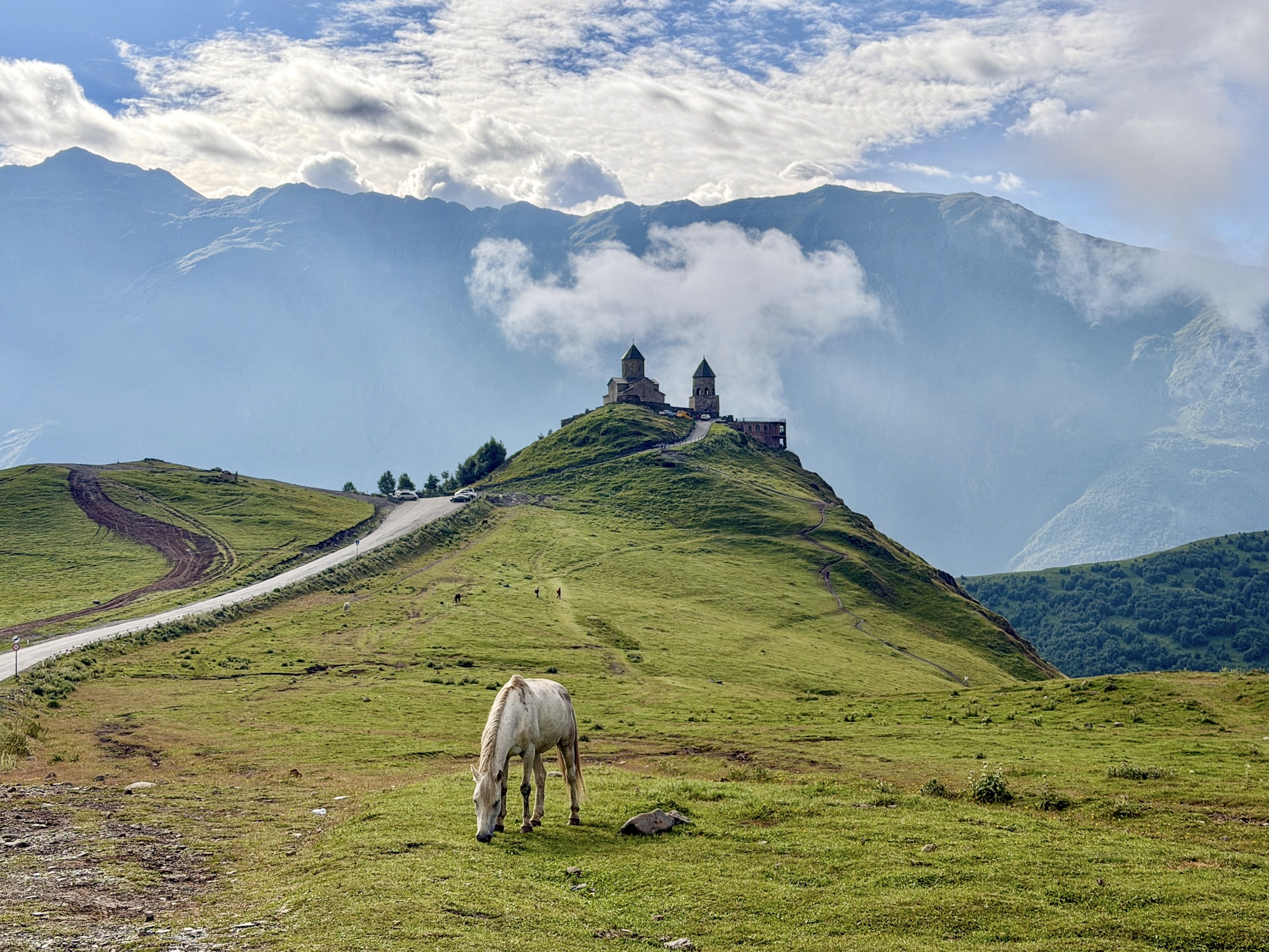
Truso plus a visit to Gergeti Trinity Church itself, yes, that's a realistic day and one we'd actually recommend.
Truso plus the full hike up to Gergeti Glacier, no. The glacier route is steep, exposed, and tiring enough on its own, stacking it onto a full day at Truso is a bad idea. If you want a taste of that trail without committing to the whole thing, walking up to its first viewpoint of the Gergeti Trinity Church from above and turning back pairs fine with Truso instead.
-
- If you're still planning the rest of your trip, from the drive up from Tbilisi to what to see beyond the trails, my complete guide to the Caucasus mountains in Kazbegi covers all of it
Keep reading: