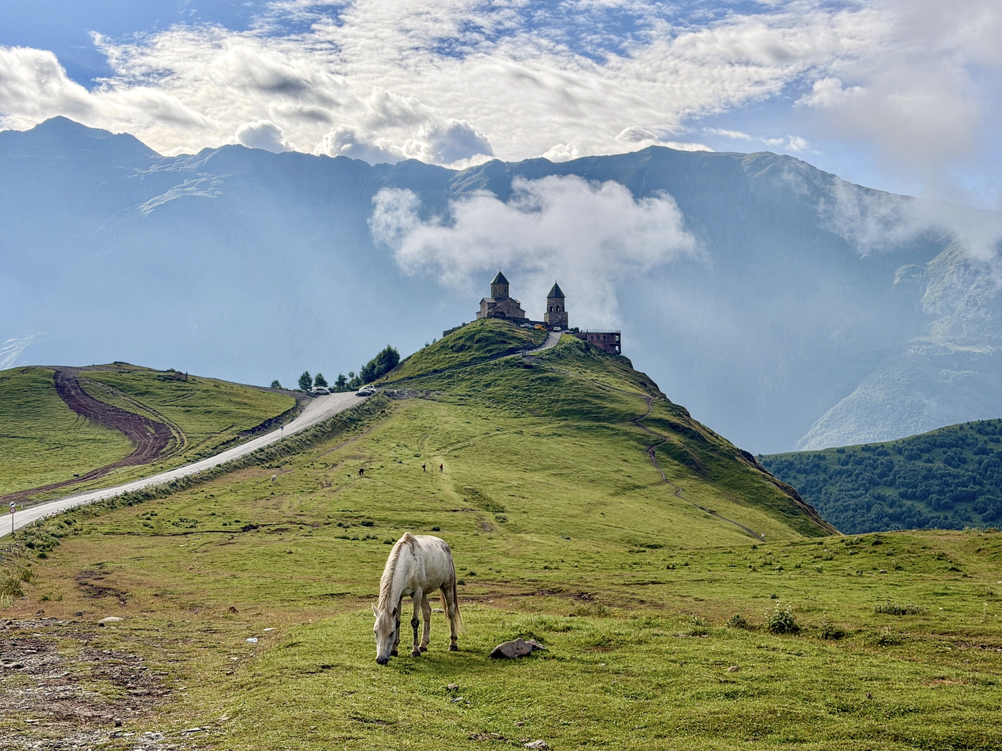
The 5 best hikes in Kazbegi I completed from Stepantsminda, from a full Gergeti church & glacier day hike to easy waterfall walks, with accurate distances, elevation gain and trail notes.
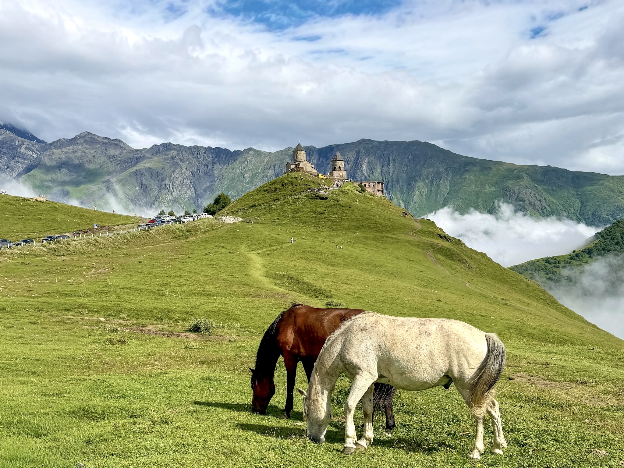
Kazbegi, or more precisely Stepantsminda, the town where almost everyone actually stays, sits at the base of some of the best hiking trails in Georgia. Mount Kazbek looms over the whole valley, and depending on how far you want to walk, you can reach a glacier, alpine lakes, waterfalls, and old fortresses all within a day trip from town.
I hiked five different trails out of Stepantsminda this past August, and so below is my honest ranking of the best hikes in Kazbegi, with GPS trail maps, accurate distances, elevation gain and trail conditions I found on each one.
I'll start with a quick comparison table, if you just want the numbers before deciding.
Quick Comparison: All 5 Kazbegi Hikes at a Glance
Gergeti Glacier Hike from Trinity Church
- Distance: 14 km (8.7 miles) round trip; Elevation gain: around 1,200 m (3,940 ft)
- Time: 6 to 7 hours; Difficulty: moderate/hard
- Starting point: the free parking lot at the trailhead, below Gergeti Trinity Church
- Getting there: paved road the whole way, you can drive or taxi up, no 4x4 needed
Truso Valley Hike
- Distance: 10 to 22 km (6.2 to 13.7 miles) round trip, depending on where you stop; Elevation gain: about 450 m (1,475 ft)
- Time: 4 to 8 hours; Difficulty: easy
- Starting point: the free Truso Valley parking area at the blue-railed bridge ("Truso Valley Start Point" on Google Maps)
- Getting there: dirt road with potholes, 4x4 needed to drive yourself, or hire a local driver/guided tour
Chaukhi Lake Hike from Juta Village
- Distance: 8 km (5 miles) ound trip, can be longer up to Chaukhi Pass; Elevation gain: about 450 m (1,475 ft)
- Time: 4 to 6 hours; Difficulty: easy to moderate
- Starting point: Juta Village center
- Getting there: Drive with a 4x4 up to a small lot 3km away from the village, then walk or taxi into Juta Village center
Gveleti Waterfalls
- Distance: about 6 km (3.7 miles) round trip; Elevation gain: about 350 m (1.140 ft);
- Time: 1 to 2 hours; Difficulty: easy
- Starting point: a paid parking area off the Georgian Military Highway
- Getting there: short drive or taxi off the highway, no 4x4 needed
Arsha Waterfall (via Pansheti)
- Distance: about 17 km (10 miles) round trip; Elevation gain: about 280 m (930 ft);
- Time: 5 to 7 hours; Difficulty: moderate
- Starting point: Stepantsminda town center, following the river road toward Pansheti
- Getting there: walkable directly from Stepantsminda, or you can drive partway to shorten it
-
- If you're still planning the rest of your trip, from the drive up from Tbilisi to what to see beyond the trails, my complete guide to the Caucasus mountains in Kazbegi covers all of it
Best Hikes in Kazbegi
1. Gergeti Glacier Hike from Trinity Church
Distance: 14 km (8.7 miles) round trip. Elevation gain: about 1,200 m (3,940 ft). Time: 6 to 7 hours. Alltrails GPS track here.
This is the hardest hike on the list, and the one I'd pick first if you only have one day in Kazbegi. The trail runs from the church all the way up to the edge of Gergeti Glacier, with Mount Kazbek in view for nearly the entire climb.
Getting to the Trailhead
There are two parking areas near Gergeti Trinity Church. The one you want is the larger free lot right at the trailhead itself, not the smaller one up by the church, which is only for people visiting the church. The road up from Stepantsminda is fully paved now, so a normal rental car handles it without any trouble. Without a car, a taxi or shared Delica SUV runs about 15 to 20 GEL per person, or 60 to 80 GEL for the whole vehicle.
The Route, From the Church to the Glacier
The trail climbs steeply almost from the first step, through open pasture with no shade for the first hour. About an hour in, it splits with no sign marking either direction. The right fork climbs onto an exposed ridge, the left drops into a valley, and both routes meet back up before Cafe 360, a small glass and timber hut with solar panels on the roof.
From Cafe 360 it's a short stretch to Altihut, a newer building with hot food, snacks, and free water refills. Past Altihut, the trail keeps climbing until you're standing right at the edge of Gergeti Glacier.
How Hard Is This Hike?
Nothing on this route is technical, there's no scrambling and no exposed ledges. What makes it hard is the elevation gain, steep and sustained for almost the whole way. If you hike regularly and the weather is nice, you'll manage the full distance with no particular issues, though it's still a long, tiring day.
If you're generally active but don't hike much, stopping at Cafe 360 or Altihut and turning back there is still a good day out on its own. Also: this isn't a hike for kids. Past the trailhead the climb doesn't let up, it's a long day even for a fit adult, and there's no easier shortcut once you're beyond the huts.
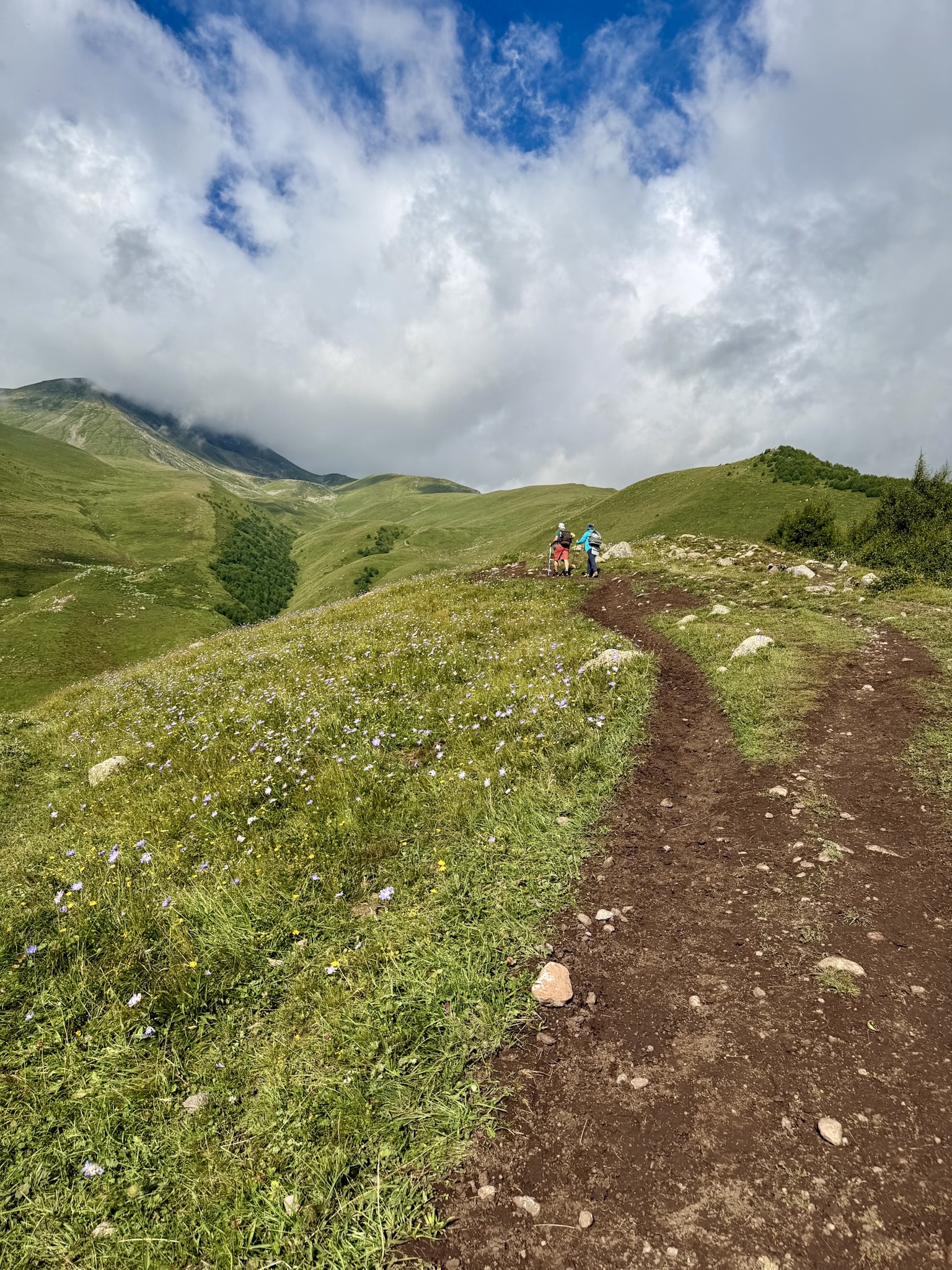
Gergeti Glacier Trail
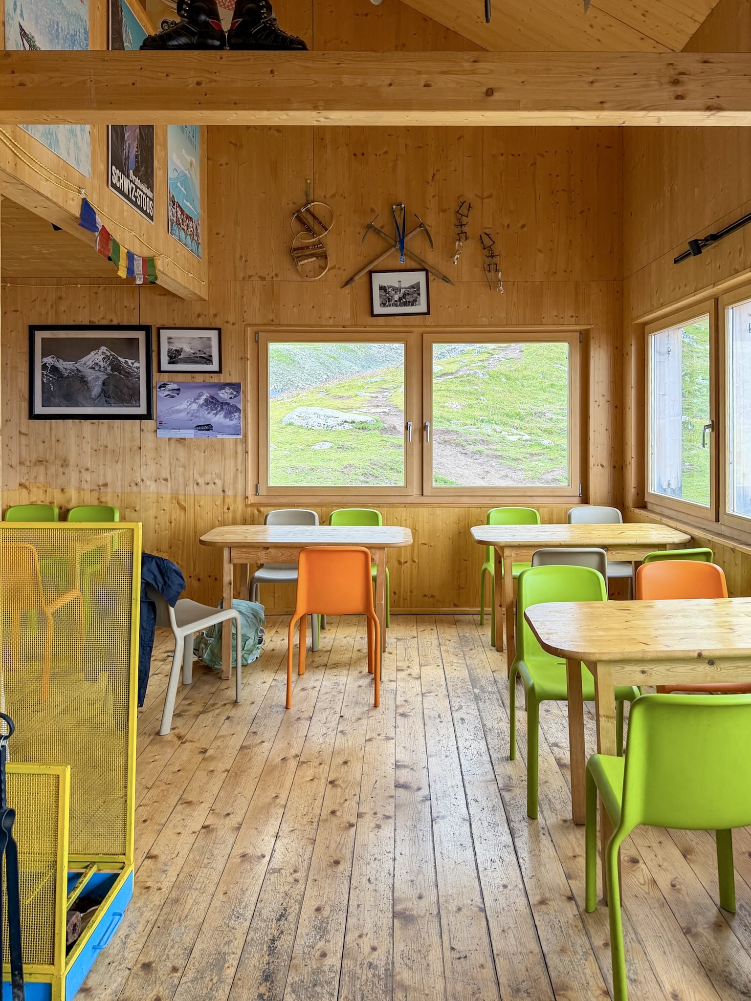
Altihut at Gergeti
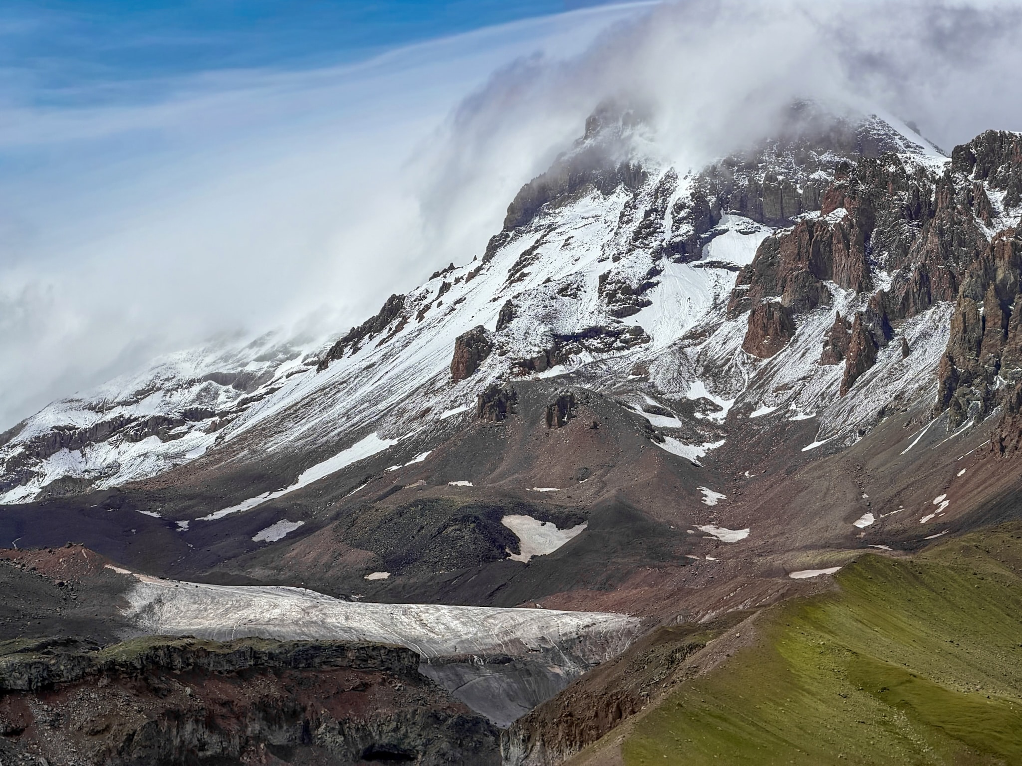
Gergeti Glacier & Mount Kazbek
-
- For the full stage-by-stage breakdown with exact timing, what to pack, and where to stay, my complete guide to the Gergeti Glacier Hike from Trinity Church has all of it
2. Truso Valley Hike
Distance: 10 to 22 km (6.2 to 13.7 miles) round trip, depending on where you stop. Elevation gain: about 450 m (1,475 ft). Time: 4 to 8 hours. Difficulty: easy underfoot. Alltrails GPS track here.
Once you're actually walking, Truso is the easiest hike on this list, flat almost the entire way past mineral springs, an abandoned village, two working monasteries, and a ruined fortress a few hundred meters from the South Ossetia border. The catch is getting there.
Getting to the Trailhead
From Stepantsminda, you need to drive for about 17 km south on the Georgian Military Highway, on a road that starts great and then finishes up with huge potholes and exposed sections. You need a 4x4, and be comfortable with driving in these difficult conditions.
People driving themselves should stop at a free parking area by a small blue-railed bridge.
Hiring a private local driver is also a good alternative that also lets you shorten the walk. For prices, 200 GEL usually just gets you from Kazbegi center to the first free parking area, but 250 GEL gets you as far as Truso Camping-Cafe near Abano Lake, and 300 GEL gets you dropped close to Abano village, near the final push to the fortress. Guided tours from Kazbegi are also available if you'd rather have someone hike it with you.
The Route: Springs, Ruins, and a Fortress
From the parking area, the trail passes small waterfalls and the first mineral deposits before reaching Truso Camping-Cafe, the last real sign of civilization before the valley opens up. Past it, Abano Lake appears after about ten minutes, a small blue-green pond feeding a stream stained bright orange by iron, sulfur in the air, swimming not allowed since it's a protected site. From there the trail drops back to the valley floor and passes Ketrisi, an abandoned village with one still-standing defensive tower, before reaching a monks' monastery visible from a distance and then Abano village, home to a convent run by nuns and a small donation-based café. The trail ends at Zakagori Fortress, a cluster of crumbling stone towers on a hilltop right at the edge of the border (no permit needed to reach it as of 2026, but this is as far as you can go).
How Hard Is This Hike?
The walking itself is genuinely easy, basically flat, with almost all of the elevation gain concentrated in the first stretch after the parking area. It's muddy in a lot of places even without recent rain, so proper waterproof shoes are a must. This makes it a reasonable option for families, especially if you hire a driver to cut down the walking distance. One thing worth knowing beforehand: this valley has more shepherd dogs than any other hike around Kazbegi. They're guarding sheep, not looking for trouble, but keep your distance and never walk toward a flock you spot in the distance.
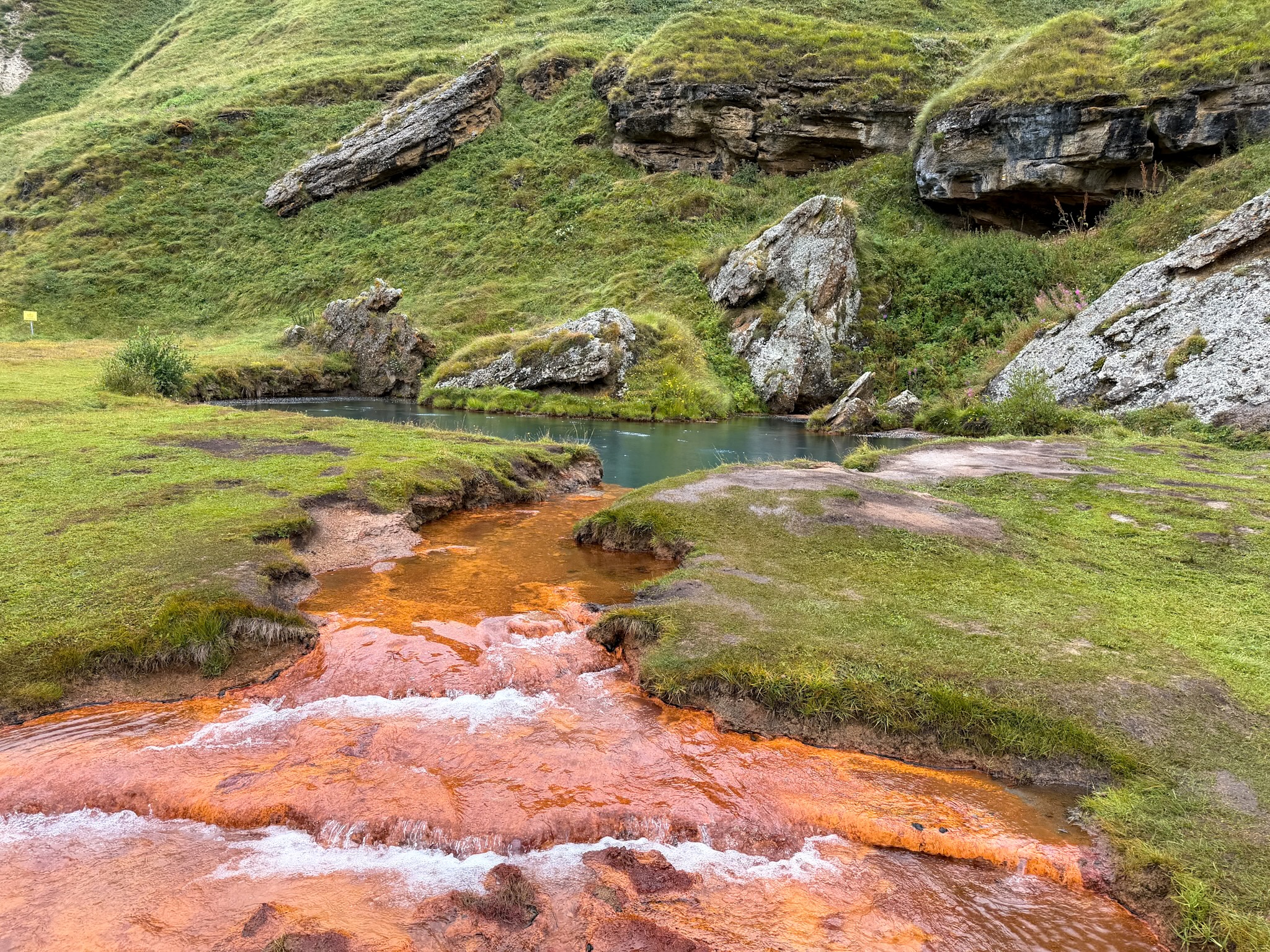
Abano Mineral Lake at Truso Valley
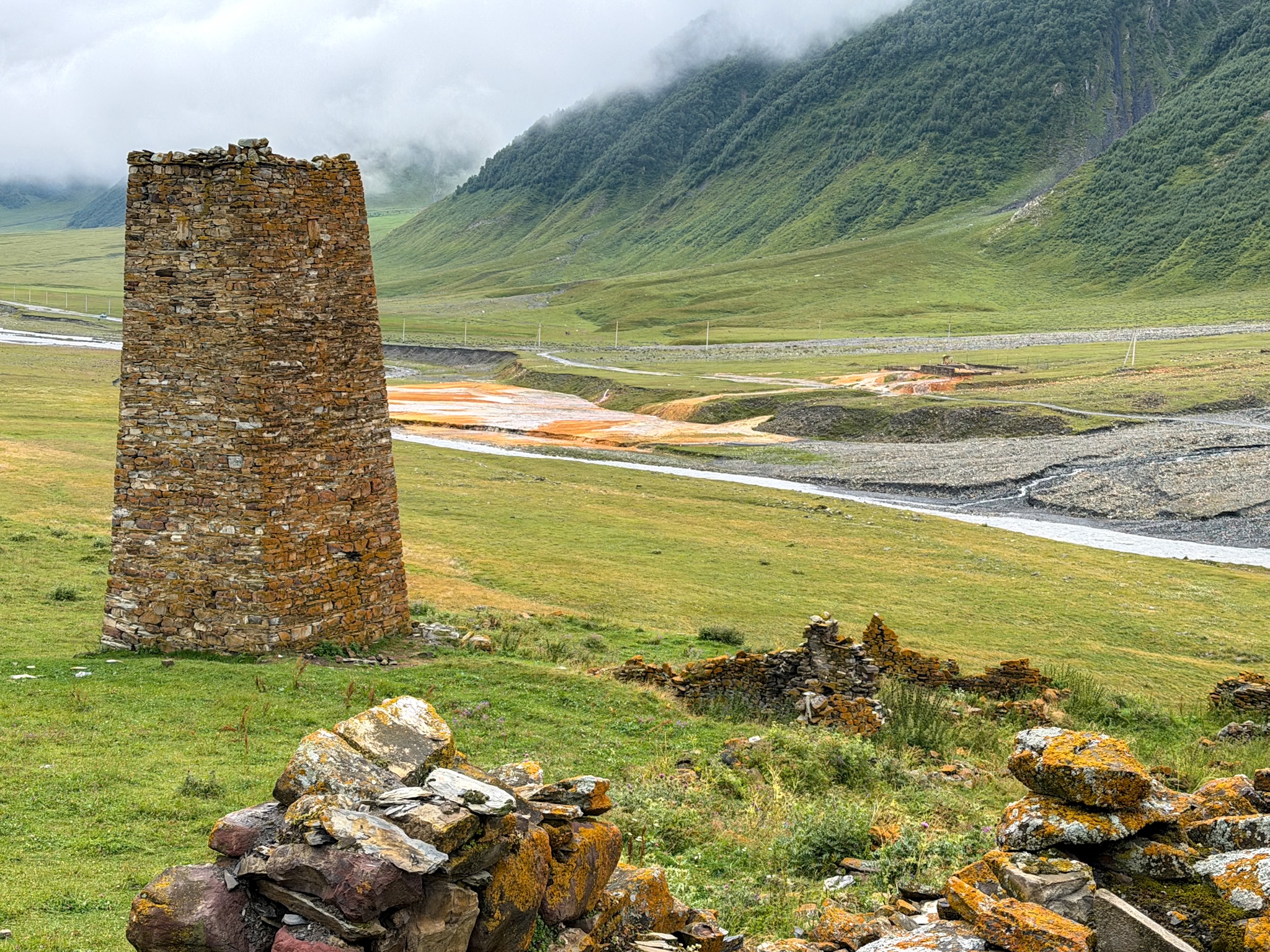
Ketrisi Tower & Sulphur Streams
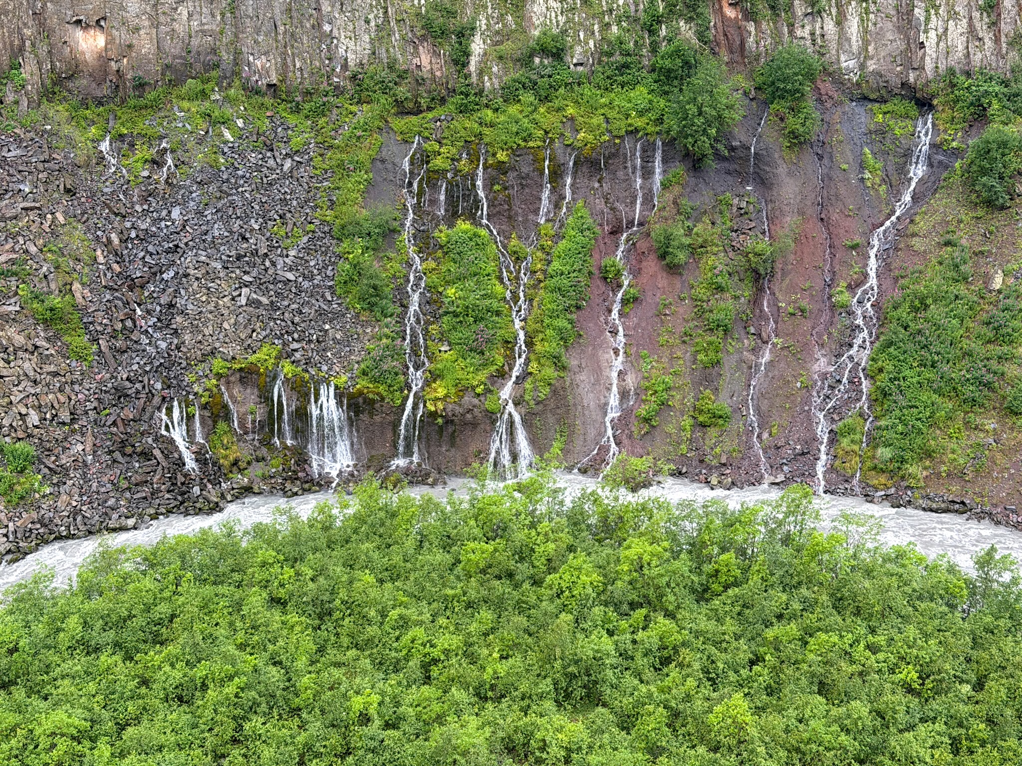
Truso Valley Waterfalls
-
- If you want to read the full stop-by-stop breakdown, driver pricing, and tips on where to stay, check out my complete guide to the Truso Valley.
3. Chaukhi Lake Hike
Distance: 8 km / 5 miles round trip. Elevation gain: about 450 m / 1,475ft. Time: 4 to 6 hours. Difficulty: easy to moderate. Alltrails GPS track here.
Chaukhi Lake sits below the jagged spires of Chaukhi Mountain, and the walk to reach it from Juta Village is short and genuinely easy. What complicates things is getting to Juta in the first place: part of the access road is closed by a landslide, and that one detail shapes how you need to plan the whole day.
Getting to the Trailhead
The trailhead is the center of the Juta Village. The drive up there from Stepantsminda is smooth as far as Sno village. Past it, the road turns rough fast, deep potholes and a narrow, steep stretch running close to a drop, so you need a 4x4 and a driver comfortable on mountain roads. About 3 km before Juta, the road hits a landslide closure: a local man runs a small parking area right before it, 10 GEL for the day or 20 GEL if you're staying overnight in Juta. From there, it's either a 45 minute walk past the damaged stretch or a taxi waiting just beyond it, about 40 GEL one way.
The Trail, From Juta to the Lake
The steepest part of the whole hike comes right out of the village, muddy and rocky underfoot as the trail climbs through open pasture. About forty minutes in, it flattens out near Fifth Season, a wooden guesthouse with a restaurant and a grassy outdoor area looking straight down the valley toward Chaukhi. Past it, the climb eases into a gentle grade the rest of the way, crossing a partly collapsed footbridge that still holds but is worth crossing carefully, one person at a time. The lake itself is small, with a background often partly wrapped in cloud. From the lake, hikers with more time can continue to Chaukhi Pass, which brings the round trip to about 12 km and 660 m of elevation gain in total, roughly two more hours of climbing past the lake. Beyond the pass, for a full day out and genuinely clear weather, the trail keeps going toward the Abudelauri Lakes, three small lakes each colored differently by mineral runoff in the water.
How Hard Is This Hike?
Nothing about this trail is technical, and the short distance keeps it manageable for most people. What makes it a harder call for families is two specific spots: the partly collapsed footbridge past Fifth Season, and the riverbed crossing near the lake if you take the loop back, both genuinely slippery underfoot. Teenagers used to hiking who can place their feet carefully should be fine. I would not bring younger kids.
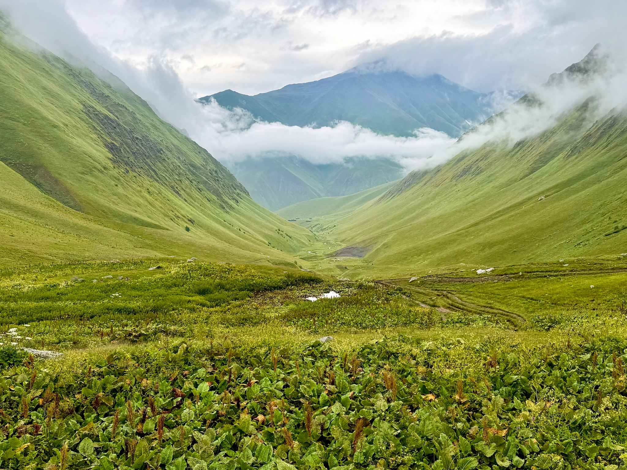
Chaukhi Pass Hike
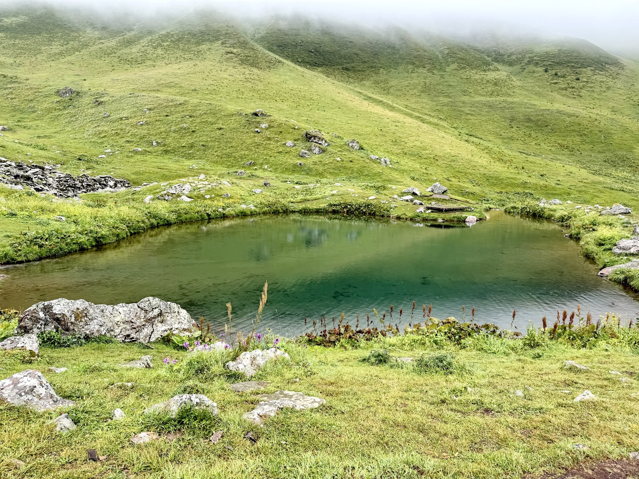
Chaukhi Lake Side View
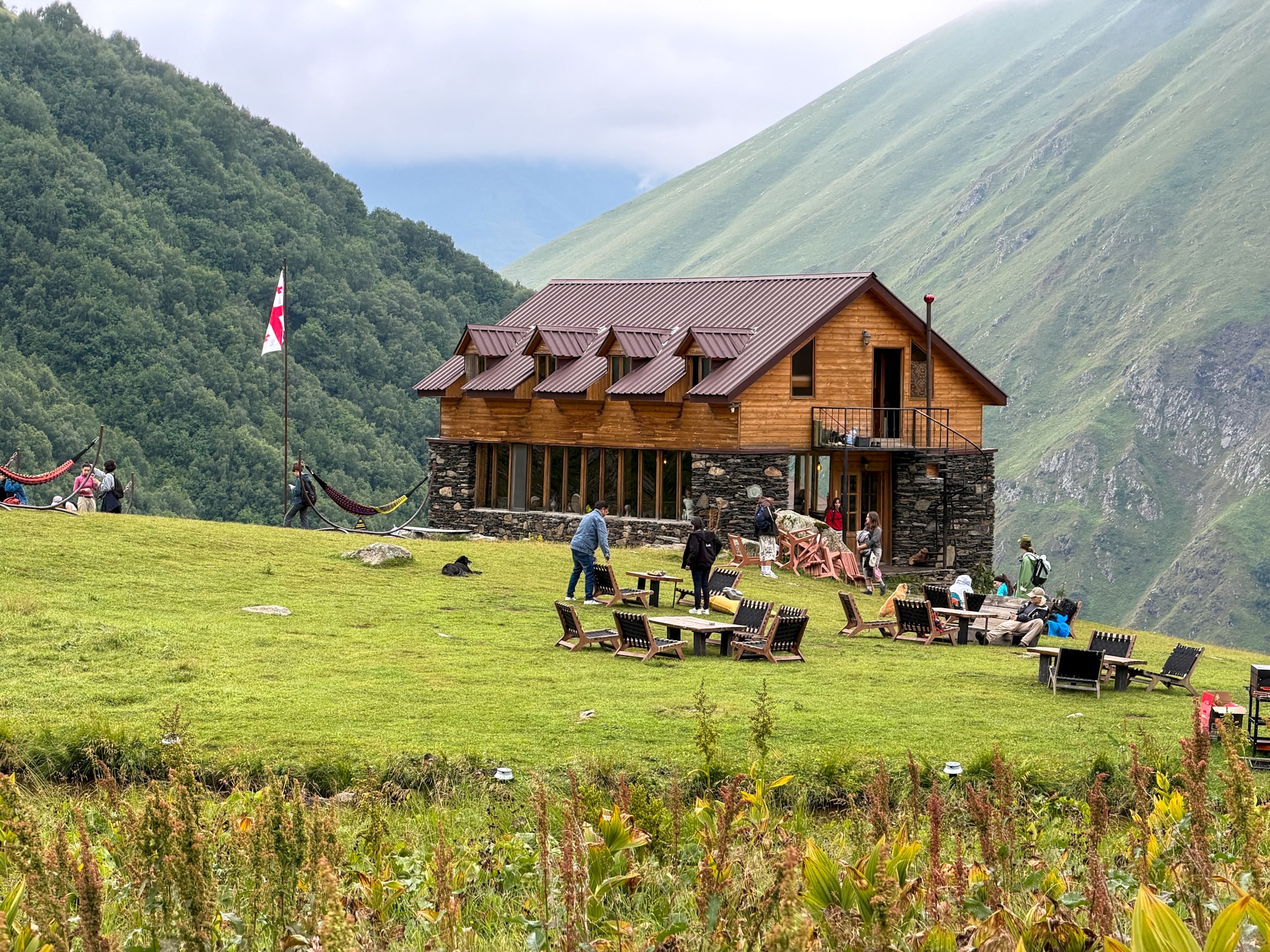
Fifth Season Hut
-
- For more details on the landslide situation, more trail pictures and other suggestions, you can find my detailed guide to the Chaukhi Lake Hike.
4. Gveleti Waterfalls
Distance: about 6 km / 3.7 miles round trip. Elevation gain: about 350 m / 1.140 ft. Time: 1 to 2 hours. Difficulty: easy. Wikiloc GPS track here.
Gveleti Waterfalls sit in the Dariali Gorge, the narrow valley the Georgian Military Highway follows north toward the Russian border. It's the shortest hike on this list, but not necessarily the easiest one, depending on which of the two waterfalls you're after.
Getting to the Trailhead
Despite the proximity, I discovered walking here from Stepantsminda isn't a great idea, as the only visible path is the highway that carries heavy truck traffic and has very little room on the shoulder. A short drive or taxi off the highway leads to a nearby parking area, 5 GEL for the day, with paid restrooms available for 1 GEL.
The Two Waterfalls
From the parking area, the trail splits toward two separate waterfalls. The path to the smaller one is flat and easy, barely counts as hiking. The path to the larger waterfall, the one most people come for, stays easy for most of the way before turning into a genuine scramble over rocks and boulders on the final stretch, steep and slippery when wet. The reward at the end is a waterfall dropping around 25 to 30 meters into a pool at the base.
How Hard Is This Hike?
The smaller waterfall is genuinely easy and works fine for most families. The bigger one is a different story: that last scramble over rock is real climbing with your hands in places, and it's not something I'd attempt with young children. Older kids who are steady on their feet and comfortable scrambling should be fine with supervision.
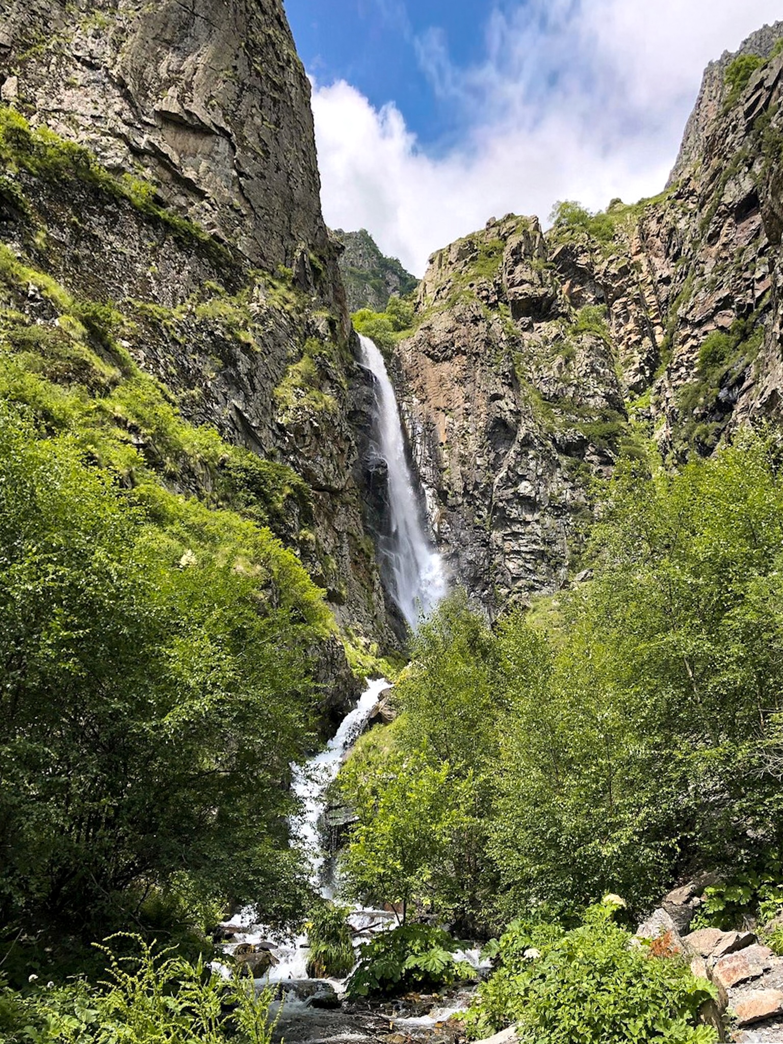
Gveleti Waterfall
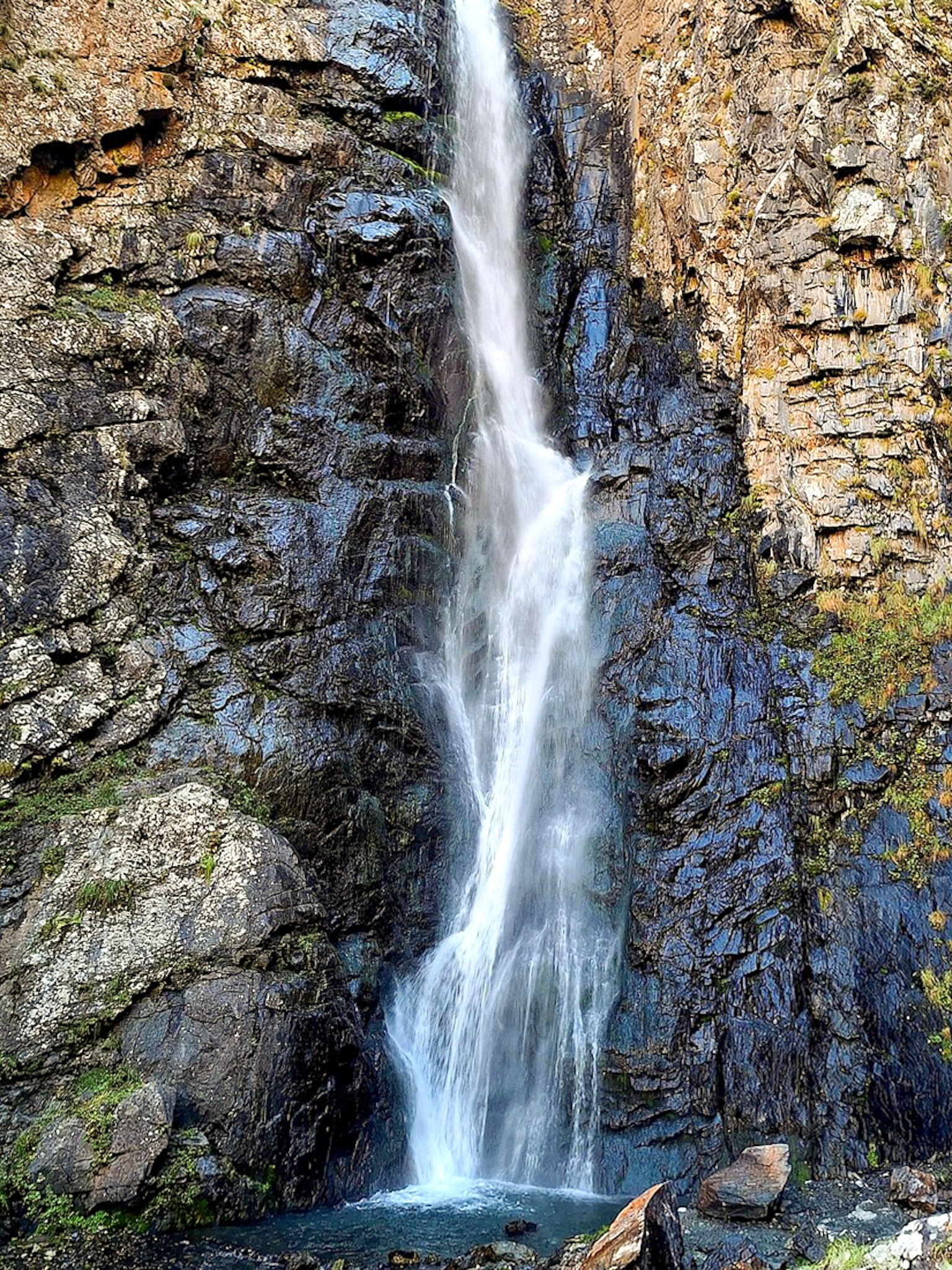
Gveleti Waterfall Close Up
-
- For more on this hike, this detailed writeup covers the trail conditions and exact coordinates in more depth.
5. Arsha Waterfall (via Pansheti)
Distance: about 17 km / 10 miles round trip. Elevation gain: about 280 m / 930 ft. Time: 5 to 7 hours. Difficulty: moderate. Wikiloc GPS track here.
This is the longest hike on the list, and the only one that can be done entirely on foot straight from Stepantsminda, without a car or taxi at any point, though driving partway is an option for anyone who wants a shorter version.
Getting to the Trailhead
No transport is needed to start this one. The route follows a wide, flat track along the river straight out of Stepantsminda, so the trailhead is effectively the town itself. For a shorter version, it's possible to drive partway, either to the Pansheti area or a few kilometers short of the waterfall, and pick up the walk from there.
The Route
The flat track along the river leads to the Pansheti defensive tower, with a natural sparkling mineral spring nearby worth a short stop. Past the tower, the trail descends through farmland, crossing a few gates used to keep livestock in that need to be closed again after passing through. From there, a climbing path leads up toward Arsha Waterfall, with the trail becoming harder to follow through overgrown vegetation in its final stretch. A second, larger waterfall, Toti, lies further up the valley, but the path beyond Arsha is faint and easy to lose, so it's really only worth attempting with daylight and time to spare.
How Hard Is This Hike?
The first half, flat along the river to Pansheti, is easy and works for most fitness levels. The second half is a different story: a real climb with muddy, overgrown sections, on top of a long overall distance. This one is better suited to fit, experienced hikers than to a casual day out or a family outing.
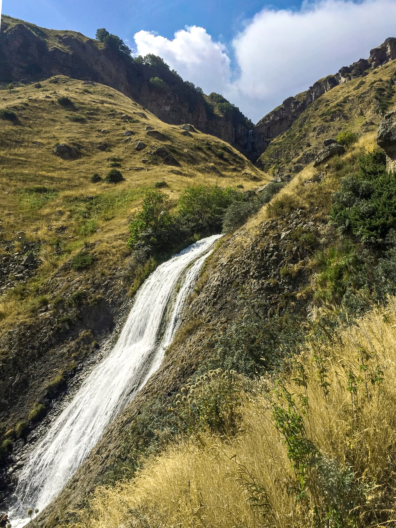
Arsha Waterfall
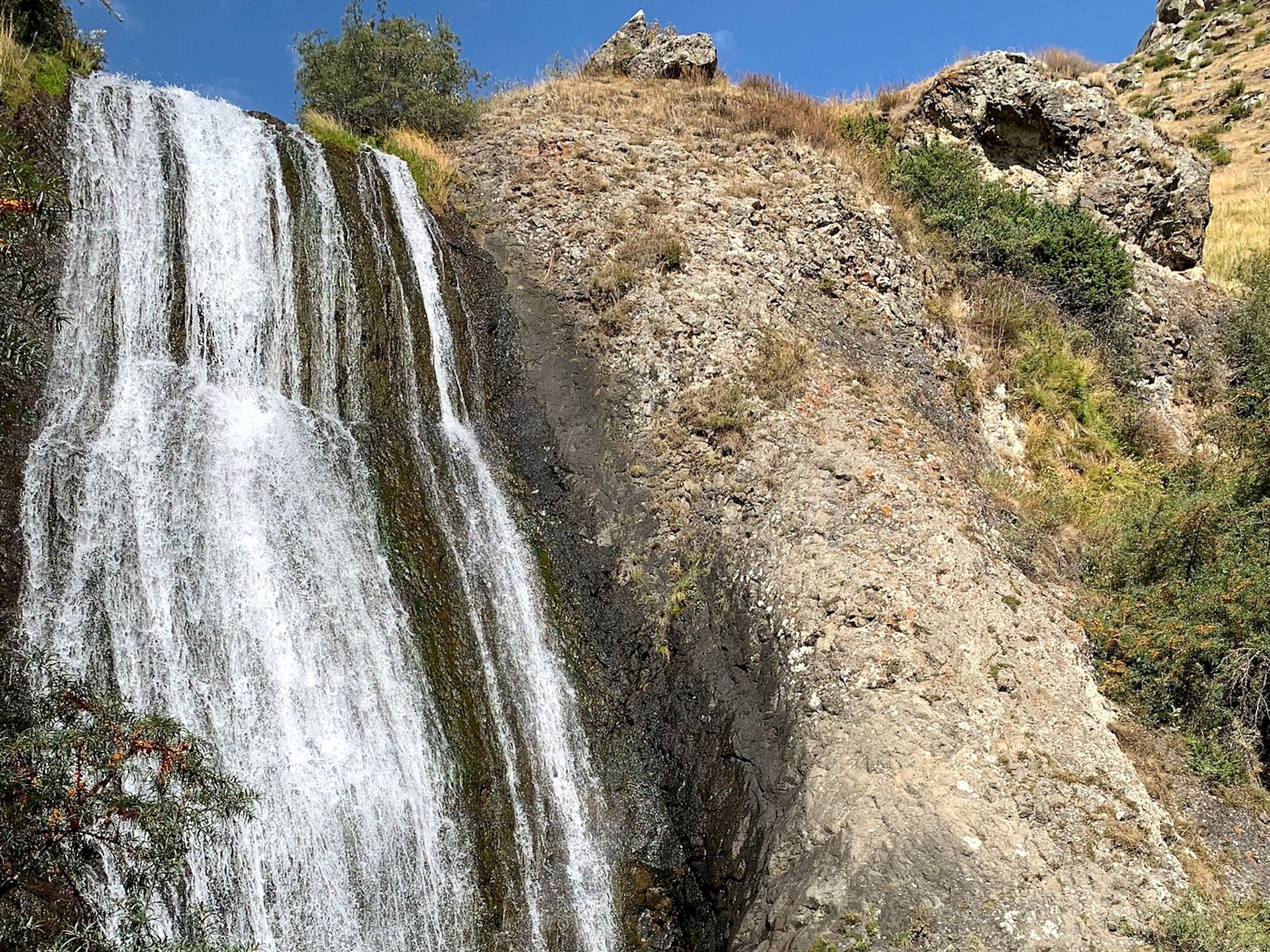
Arsha Waterfall Close Up
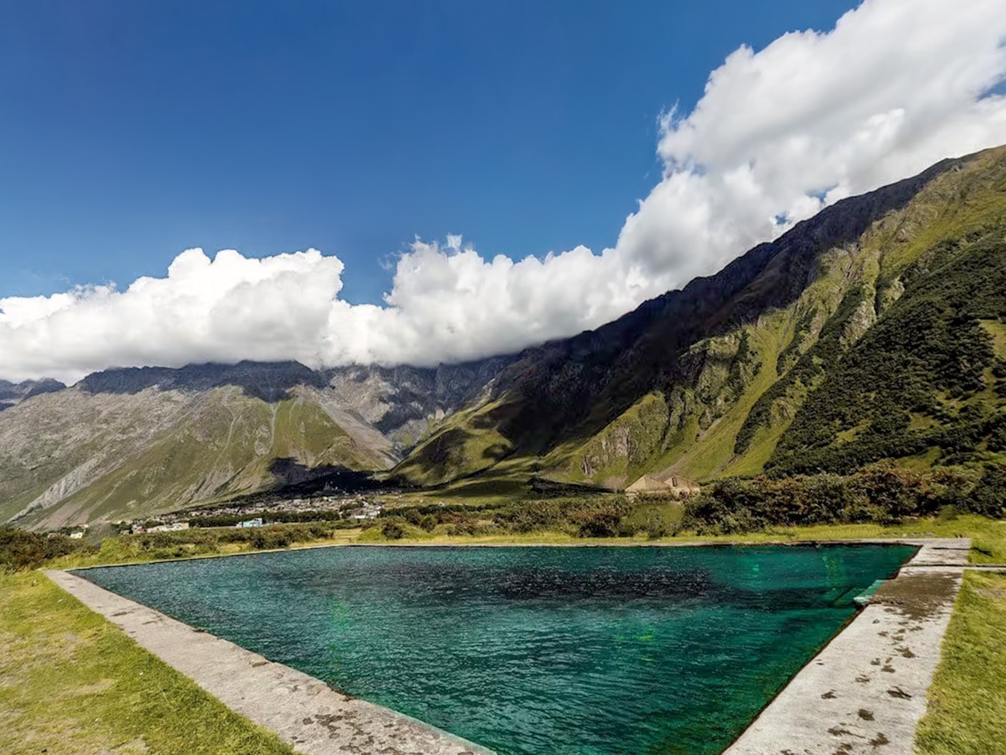
Mineral Pool in Pansheti
-
- For the exact route, this GPS track covers the full path in detail.
Which Kazbegi Hike Should You Pick?
- Only have half a day? Go for the small waterfall at Gveleti. The full round trip there is about 4 km and takes 1 to 2 hours, against a minimum of 4 hours for anything else on this list. Nothing else here fits inside a half day, and if you skip the scramble to the big waterfall, there's zero technical terrain either.
- Want the single hardest, most rewarding hike? Gergeti Glacier Hike. It gains about 1,700 m, more than double any other hike here, and it's the only one that ends at actual glacier ice instead of a lake or a waterfall. About an hour up, it also gives you the best view of Gergeti Trinity Church on this entire list, looking down at it from above with the Caucasus rising behind it, a shot you don't get from anywhere else. Budget the full day for it, this isn't one to squeeze in alongside anything else.
- Want the most photogenic hike? It's a tie between Gergeti Glacier and the Chaukhi Pass extension of the Chaukhi Lake Hike. The Chaukhi massif, the jagged granite spires above the lake, is known outside Georgia as the Dolomites of Georgia, and photos of it in good weather look genuinely different from anything else around Kazbegi. I got unlucky with clouds and rain on my own visit and didn't get to see much of it, so take that comparison as reputation rather than something I can personally back up.
- Traveling with young kids? The small waterfall at Gveleti is the actual safe option, flat, short, and the drive to the trailhead is a quick stretch off the main highway, nothing dramatic. I'd think twice about Truso with young kids specifically: the walk itself is flat, but the access road runs along an exposed cliff edge for a stretch, and this valley has more shepherd dogs than anywhere else in the area. They're not aggressive by default, but a pack of large dogs can rattle a small child fast. Chaukhi and Gergeti are both out for young kids too, the first has a collapsed footbridge and a river crossing, the second is a steep climb with a long day attached.
- Want to get away from other hikers entirely? Arsha Waterfall via Pansheti. None of the tour operators or organized shuttles that serve the other four hikes go anywhere near this route, and the trail thins out to almost nothing past the waterfall itself. You'll trade crowds for a much longer day, about 17 km against 4 to 12 km for everything else on this list.
Where to Stay for Hiking in Kazbegi
Stepantsminda is the town almost everyone means when they say they're staying in Kazbegi. Kazbegi technically refers to the wider municipality and to the mountain itself, not the town, but the two names get used interchangeably by pretty much everyone, including most hotels and tour listings. The town sits right where the Georgian Military Highway climbs into the high mountains, about 150 km and roughly 2.5 to 3 hours from Tbilisi, at an elevation of 1,744 m.
It's the town with the most hotels, guesthouses, restaurants, bars, currency exchange offices, and supermarkets in the whole area. It's still small, but if you book somewhere toward the center, almost everything you actually need is within walking distance.
I wrote a dedicated guide to the best hotels to stay in Kazbegi, but in a nutshell, these are the ones I can personally suggest:
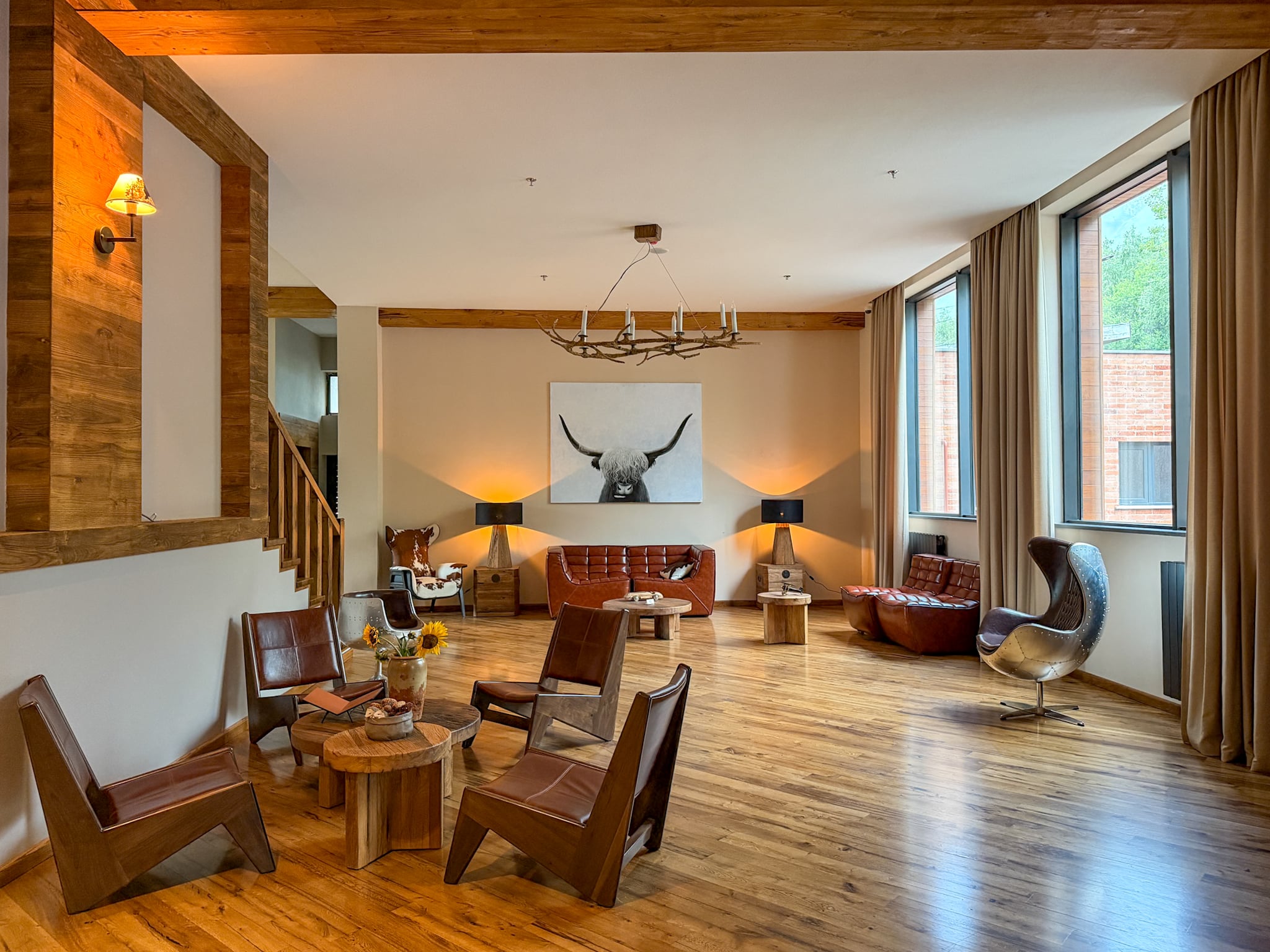
- Lens Design Hotel: modern rooms, good views, well run. I stayed here myself before the Gergeti hike.
- Rooms Hotel Kazbegi: the well known upscale option in town, worth booking for the hotel itself.
- Alpine Lounge Boutique Hotel: a four-star option, well equipped without the fully luxury price tag.
- Capra Hotel: the best value pick in the more budget-friendly range, still a solid choice.
-
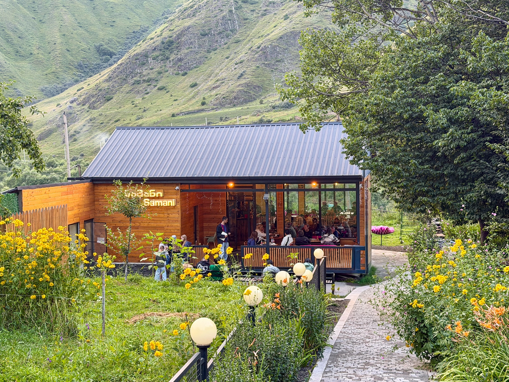
- After a long day on the trail, these are the best restaurants in Kazbegi I tried
Best Time to Hike in Kazbegi
June through September is the hiking window for all five of these trails.
- In terms of temperatures, Stepantsminda sits at 1,730 m, so even summer runs cooler than the rest of Georgia in August: daytime highs average around 20°C in July and August, dropping into 8-9°C overnight.
- Rain is a real factor here. May is the wettest month, with around 176 mm of rain spread across 21 days. August is drier by comparison, closer to 66 mm, but you should still expect to catch some afternoon storms.
- The first snow at altitude typically arrives in October. From then through April, the upper stretches of the Gergeti Glacier trail turn genuinely dangerous, icy and hard to follow safely without mountaineering gear. It gets better by June, although even late June and early July can still hold snow on the higher ground.
- If you're coming in winter instead of summer, this region isn't dead in the off season. Gudauri, about 30 minutes back toward Tbilisi on the same highway, runs one of the bigger ski resorts in the Caucasus from December through April.
- On crowds: I did all five of these hikes in August, the peak month. There were people on every trail, more so on Gergeti and Chaukhi than the other three, but nothing close to what you'd see on a comparable trail in the Alps in high season back in Europe. Tourism here is growing, but for now it's still a quiet corner by international standards.
FAQ
What's the best hike in Kazbegi?
It depends on what you're after, but if forced to pick one, the Gergeti Glacier Hike is the most complete experience: the hardest of the five, the most rewarding, and the only one that ends at actual glacier ice rather than a lake or a waterfall. It also happens to give you the best view of Gergeti Trinity Church on this entire list, looking down at it from above about an hour into the climb. If you want something shorter with a real payoff and less physical demand, Chaukhi Lake Hike is the better pick, and if photogenic scenery matters more to you than difficulty, it's a genuine tie between Gergeti Glacier and the Chaukhi Pass extension, since the Chaukhi massif is known outside Georgia as the Dolomites of Georgia.
How many days do you need to do all five hikes?
Realistically at least five days.
Gergeti, Truso, and Chaukhi each take up close to a full day on their own, six to eight hours once you count getting to and from the trailhead. Gveleti fits into a half day since it's the shortest hike on the list by a wide margin. Arsha via Pansheti, at around 17 km round trip, needs most of a day too, even though it's the only one that doesn't require any driving at all. Trying to combine two of the bigger three hikes in a single day, Gergeti and Truso especially, isn't realistic given how demanding each one already is on its own. You also have to factor in possible bad weather days.
Do you need a guide for hiking around Kazbegi?
Not for the hiking itself, on any of these five trails. All of them are well trodden and easy enough to follow, and GPS trail maps are widely available to download beforehand. That said, guided tours exist for most of them and are genuinely worth considering if you're new to hiking, nervous about being alone in a remote area, or want things explained as you walk. Truso is the one hike on this list where I'd think hardest about a guide even if experienced, mostly because of how many shepherd dogs you'll pass and how remote the valley feels.
Is hiking in Kazbegi safe?
In my opinion, hiking in Kazbegi is safe as long as you're informed and prepared for what you are doing. There are three primary concerns to keep in mind:
- First of all, Kazbegi is in direct proximity to South Ossetia, but I can confirm that as of 2026, none of these hikes required a permit, and nobody checked documents or asked me for anything at any point, even close to the border at Truso's Zakagori Fortress or near Gergeti Glacier. The situation can obviously change at any time, so always check for updates close to your departure date.
- The famous Caucasian dogs which roam freely on these trails can look scary to some people, but personally I didn't have any problematic encounter with them. I mostly tried to avoid the shepherd ones.
- I think the real risks here are fast-changing mountain weather and the access roads themselves. Both Truso and the drive into Juta for Chaukhi require a 4x4 and a driver genuinely comfortable on narrow, exposed roads, and poorly maintained infrastructure.
What's the easiest hike on this list?
The small waterfall at Gveleti, flat, short, and with zero technical terrain anywhere on it. If you're ruling out anything involving real elevation gain rather than just distance, Truso comes next: the walking itself stays flat and easy almost the entire way, even though the access road to reach the trailhead is the hardest of any hike on this list.
Can you do any of these hikes without a car?
Yes, one: Arsha Waterfall via Pansheti starts right in Stepantsminda and needs no transport of any kind, though driving partway is an option if you want to shorten it. Every other hike here, Gergeti, Truso, Chaukhi, and Gveleti, requires a car, taxi, or organized transfer just to reach the trailhead itself, before any walking even starts.
Which hike has the best views?
Gergeti Glacier and the Chaukhi Pass extension of the Chaukhi Lake Hike, in different ways. Gergeti gives you Mount Kazbek in view for nearly the entire climb, plus that elevated look back down at Trinity Church about an hour in. Chaukhi Pass takes you into the jagged granite spires of the Chaukhi massif, the range known as the Dolomites of Georgia. I had poor weather on my own visit to Chaukhi Lake and didn't get to see the massif clearly, so that comparison is based on its wider reputation rather than something I can personally vouch for.
Do you need special gear for these hikes?
Waterproof hiking boots are mandatory across all five: the ground is muddy on Truso, Chaukhi, and Arsha regardless of recent rain, and several of these trails have a river or stream crossing. Trekking poles aren't required on any of them but help on the way down after rain, especially on Gergeti's ridge route and the river crossing near Chaukhi Lake. None of the five need any climbing or mountaineering gear, with the one exception being the final scramble to the big waterfall at Gveleti, which is closer to easy rock climbing than hiking for that last stretch.
Is Stepantsminda worth staying in overnight, or can you day trip from Tbilisi?
Staying overnight is so worth it. Every one of these hikes is a long day on its own, and the drive from Tbilisi alone runs about 2.5 to 3 hours each way, which eats into a day that's already full before you've taken a single step. Basing yourself in Stepantsminda means starting fresh in the morning instead of arriving already tired, and it puts every trailhead on this list within an hour or less.