A complete guide to hiking from Gergeti Trinity Church to Gergeti Glacier in Kazbegi: trailhead parking, trail step-by-step description, valley vs panoramic ridge route, Altihut, and tips on where to stay and what to pack.
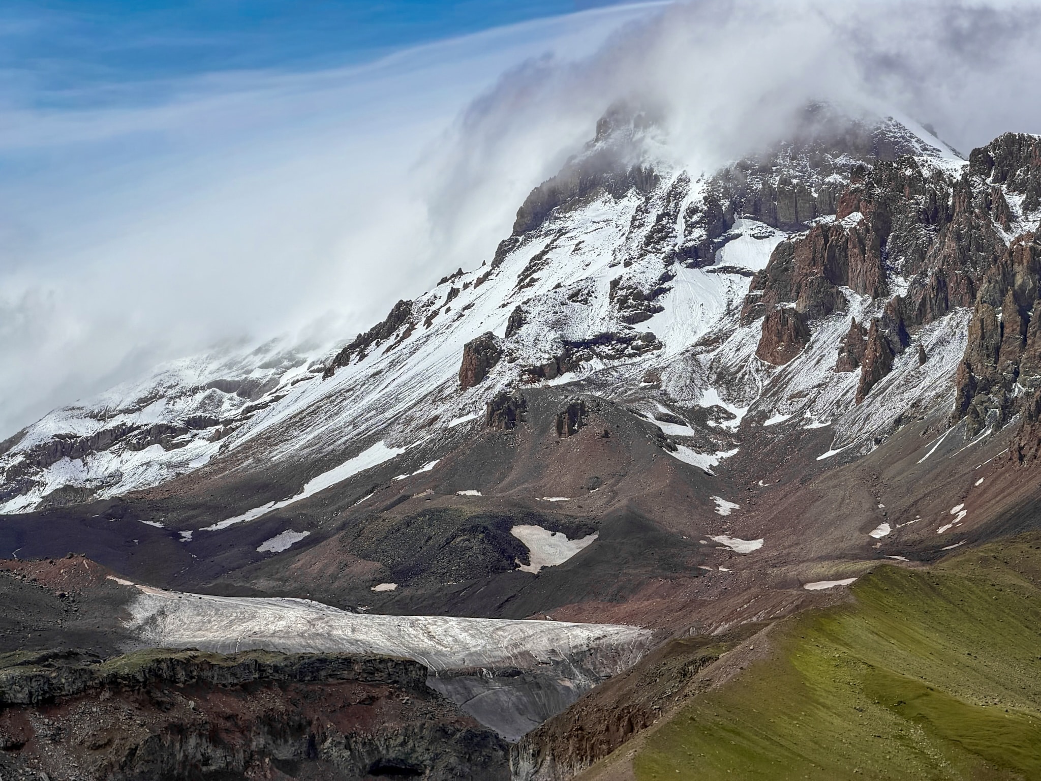
Gergeti Glacier sits below Mount Kazbek, reached on foot from Gergeti Trinity Church in Kazbegi. The route runs from the church past two mountain huts, Cafe 360 and Altihut, before reaching the ice itself. It's a full day out, steep from the first few minutes, and long enough that you won't want much else planned for that day.
I hiked it with my partner this past August, left the parking lot below the church around 9 AM. We took the valley path going up and the ridge path coming down, stopped for cake at the hut on the way up too, and got back to the parking lot just before 4 PM.
Based on my experience, below is the full route from the church to the glacier, broken into real stages with the times between each point, including both the valley option and the ridge option. You'll also find where to park, how hard the hike actually is, what the weather does up there, what to pack, and where to stay in Kazbegi.
-
- Gergeti Glacier is one of five hikes worth doing around Kazbegi. For the full ranking with the other four, see my guide to the 5 best hikes in Kazbegi
Gergeti Glacier Hike: Quick & Useful Info
-
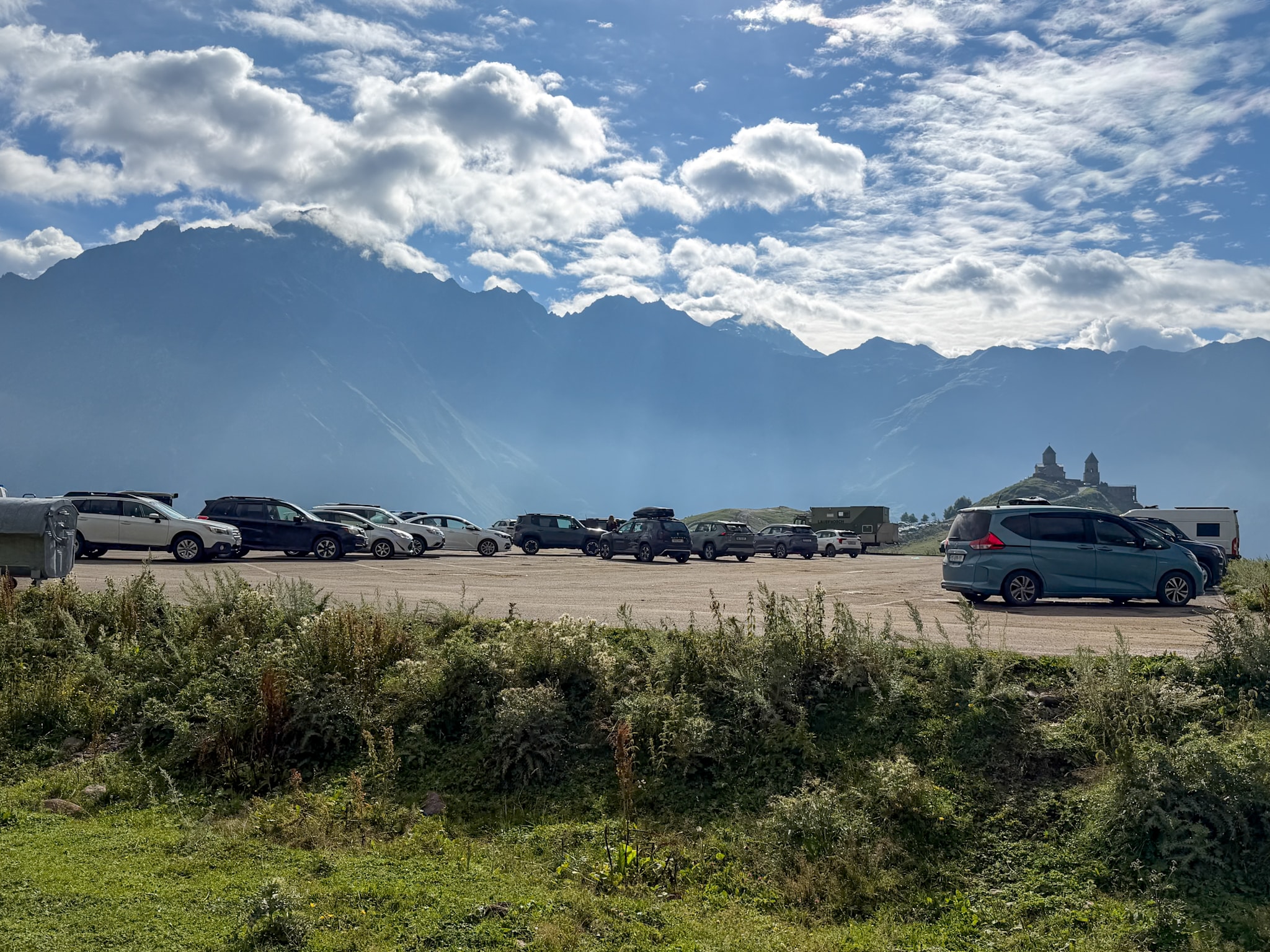
- Starting point: the free parking lot at the trailhead, below Gergeti Trinity Church (not the smaller lot right next to the church itself). Google Maps point here
- Distance: about 14 km (8.7 miles) round trip
- Elevation gain: around 1,200 m (3,940 ft)
- Highest point: about 3,300 m (10,800 ft), at the glacier
- Route type: out-and-back
- Alltrails route link
- Time: 6-7 hours round trip, depending on pace and stops.
- Difficulty: moderate terrain, no technical or exposed sections, but a steep, sustained climb
- Best season: June to September
-
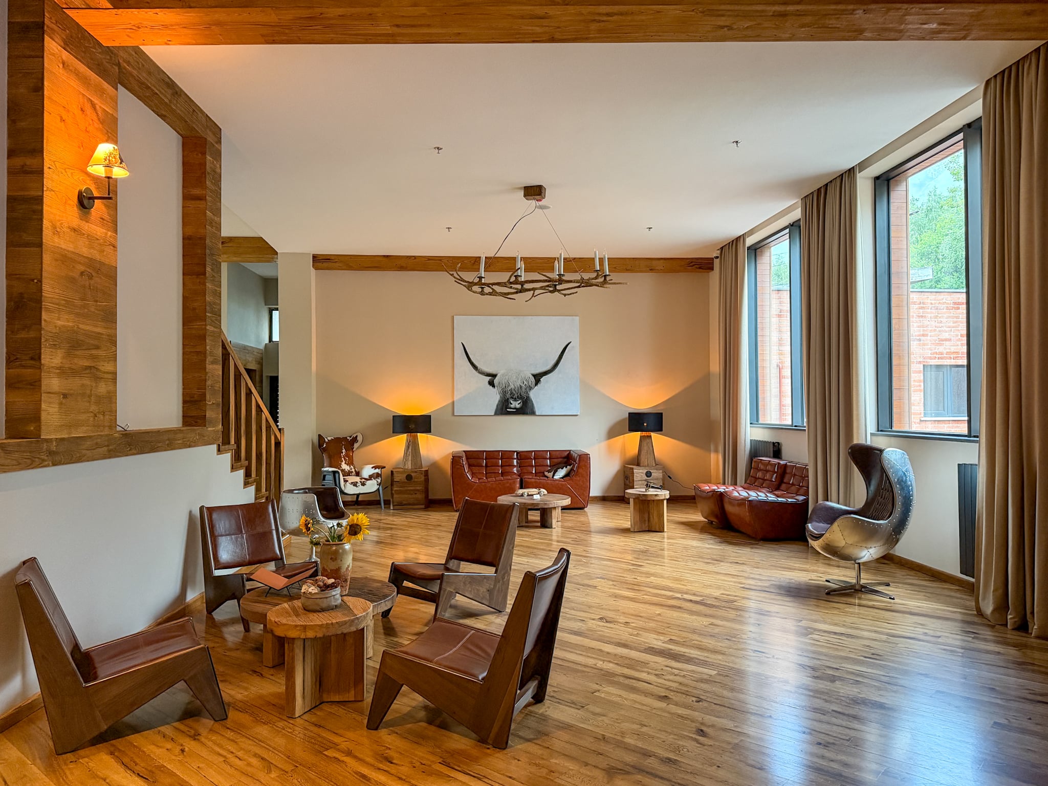
- Where to Stay: you'll need to stay in Stepantsminda, a short drive away (sometimes also called directly Kazbegi). Full list further down, but there are my favourite hotels in the area:
- Lens Design Hotel, a sleek modern stay where I spent the night before the hike
- Rooms Hotel Kazbegi, if you want something even more on the luxury side.
- Where to Stay: you'll need to stay in Stepantsminda, a short drive away (sometimes also called directly Kazbegi). Full list further down, but there are my favourite hotels in the area:
Getting to the Trailhead (Gergeti Trinity Church)
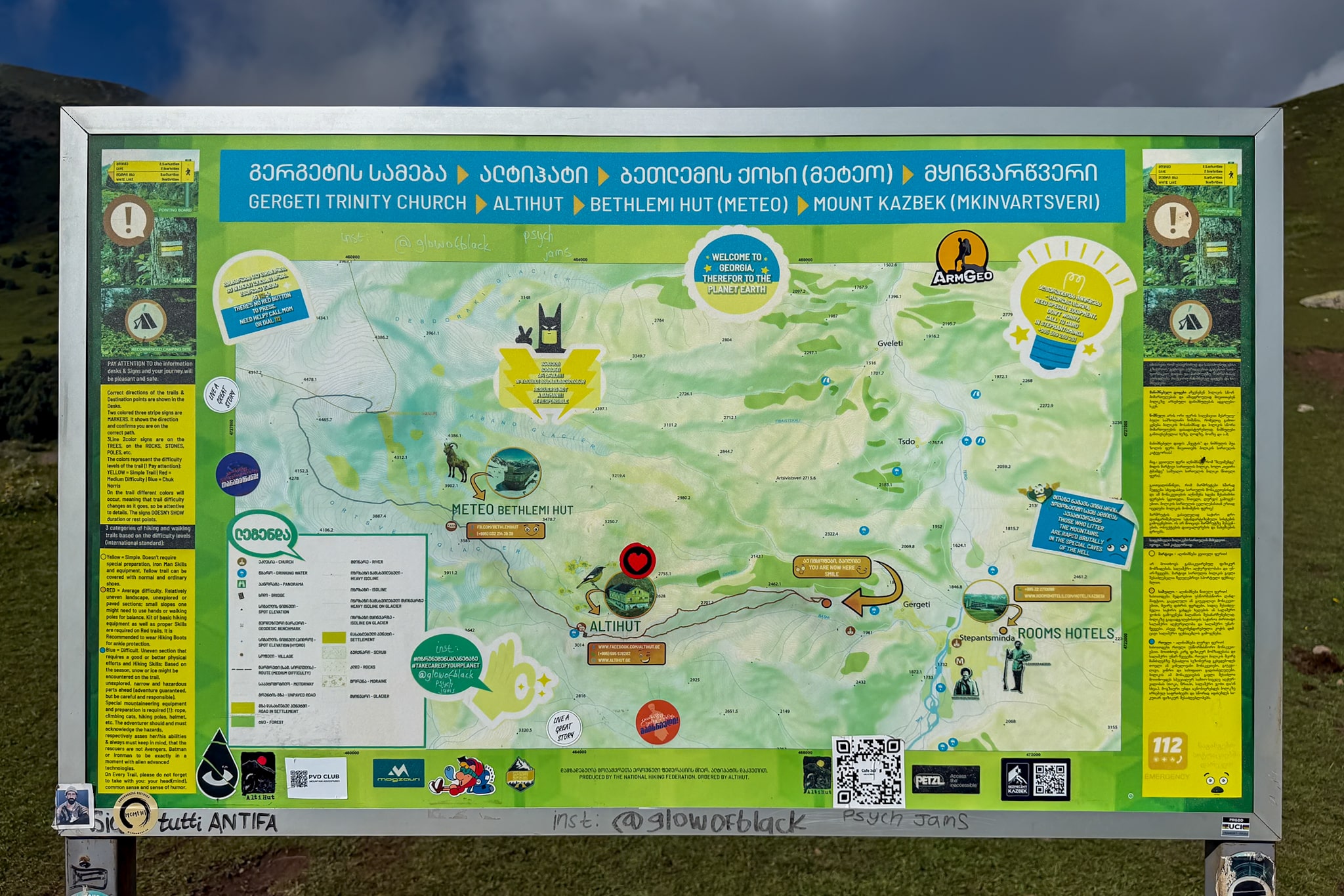
There are two parking areas near Gergeti Trinity Church, and one is located conveniently right next to the trailhead. It's a fairly large parking lot but it can still fill up fast in August. It's free, and there's a trail map posted right where the path begins.
Note there's another parking lot right next to the church, up on the hill, but it is for people visiting just the church.
You have a few options to get there from Stepantsminda, which is the closest town and base:
- Driving: I'd had a rental car for a few weeks already by that point in the trip, so I just drove straight to the lower parking lot.
- Taxi: if you don't have a car, a taxi or shared Delica SUV up from Stepantsminda runs somewhere around 15 to 20 GEL per person, or 60 to 80 GEL if you book the whole vehicle, usually with a short stop built in on the way up.
- Walking/Hiking: I would skip walking there from Stepantsminda, like some people used to do, and just drive up there. The road up now is fully paved, busy with cars and SUVs going back and forth all day, and there's nothing scenic about following it on foot.
One more thing on the church itself: entry is free, but if you're coming back down covered in mud from the trail, it's worth not walking straight in with your boots on.
The Trail, Step by Step
From the Trailhead to the Valley/Ridge Fork
We started around 9 in the morning. The trail climbs steep pretty much straight from the parking lot, a good warm up. For that first hour it's open grassland the whole way, so plan on sun exposure if the sky is clear.
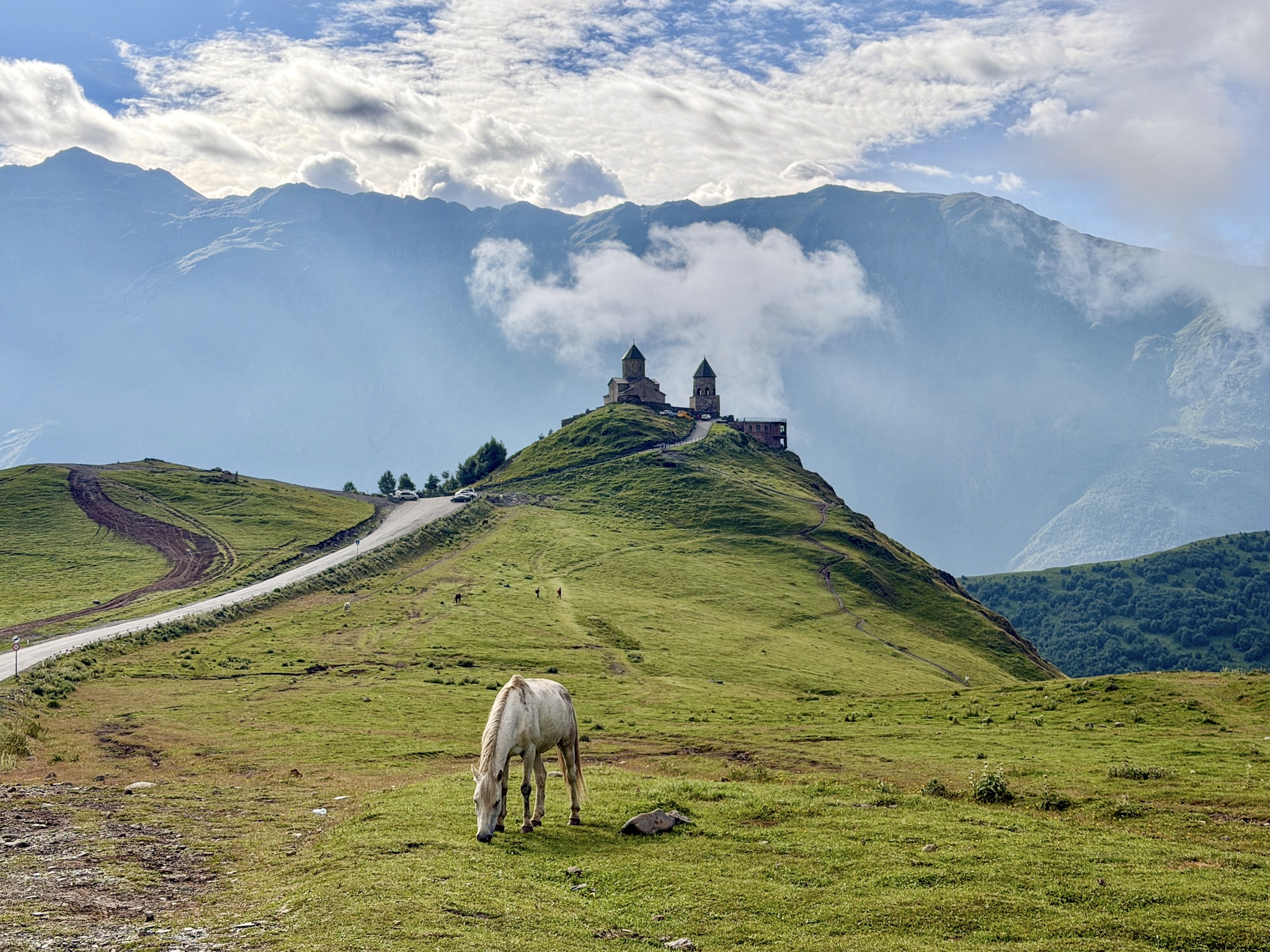
About an hour in, look back. This is one of the best spots on the whole trail for photos of Gergeti Trinity Church, since by then you're high enough to see it from above, sitting on its hill with the Caucasus behind it.
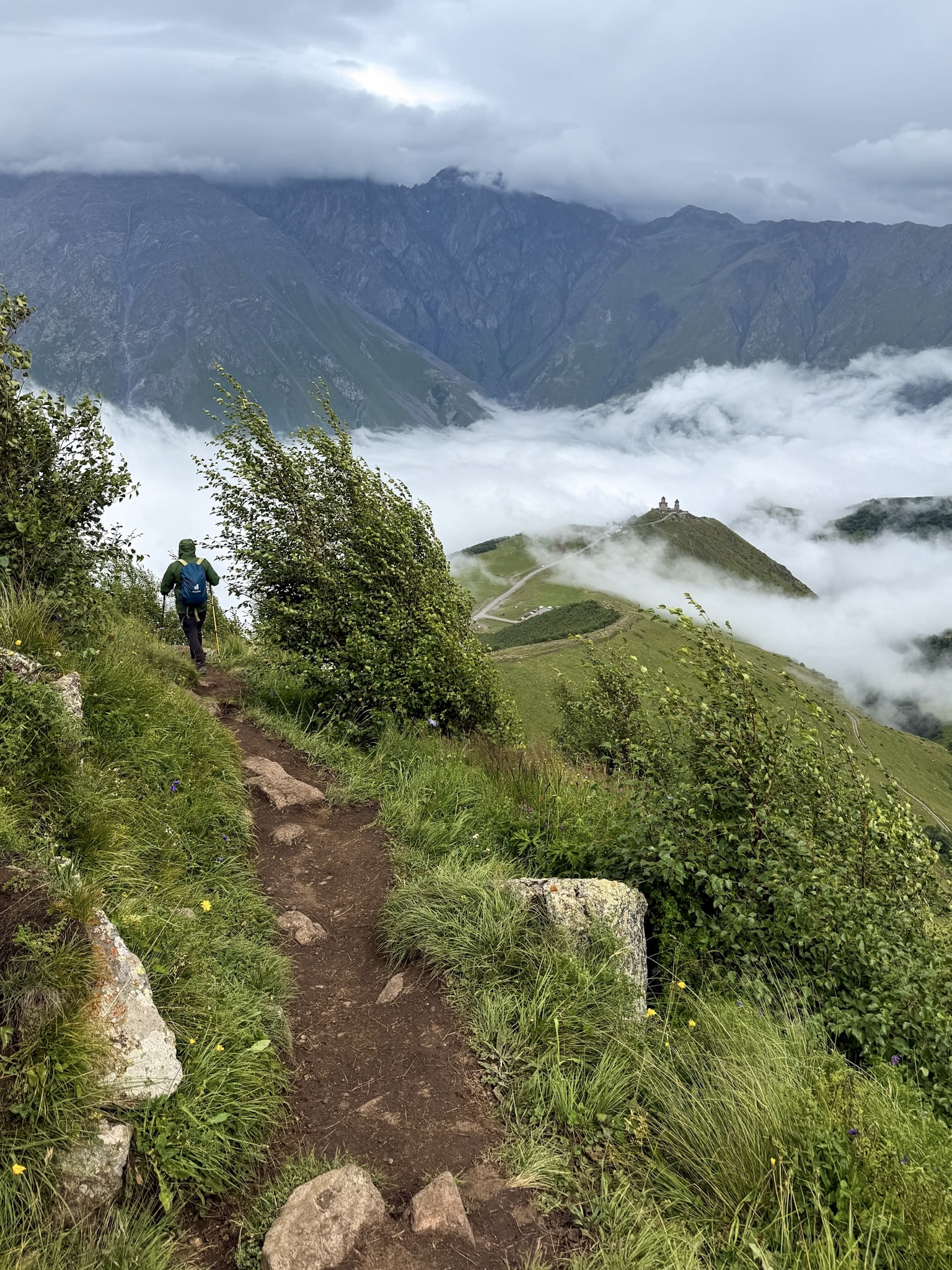
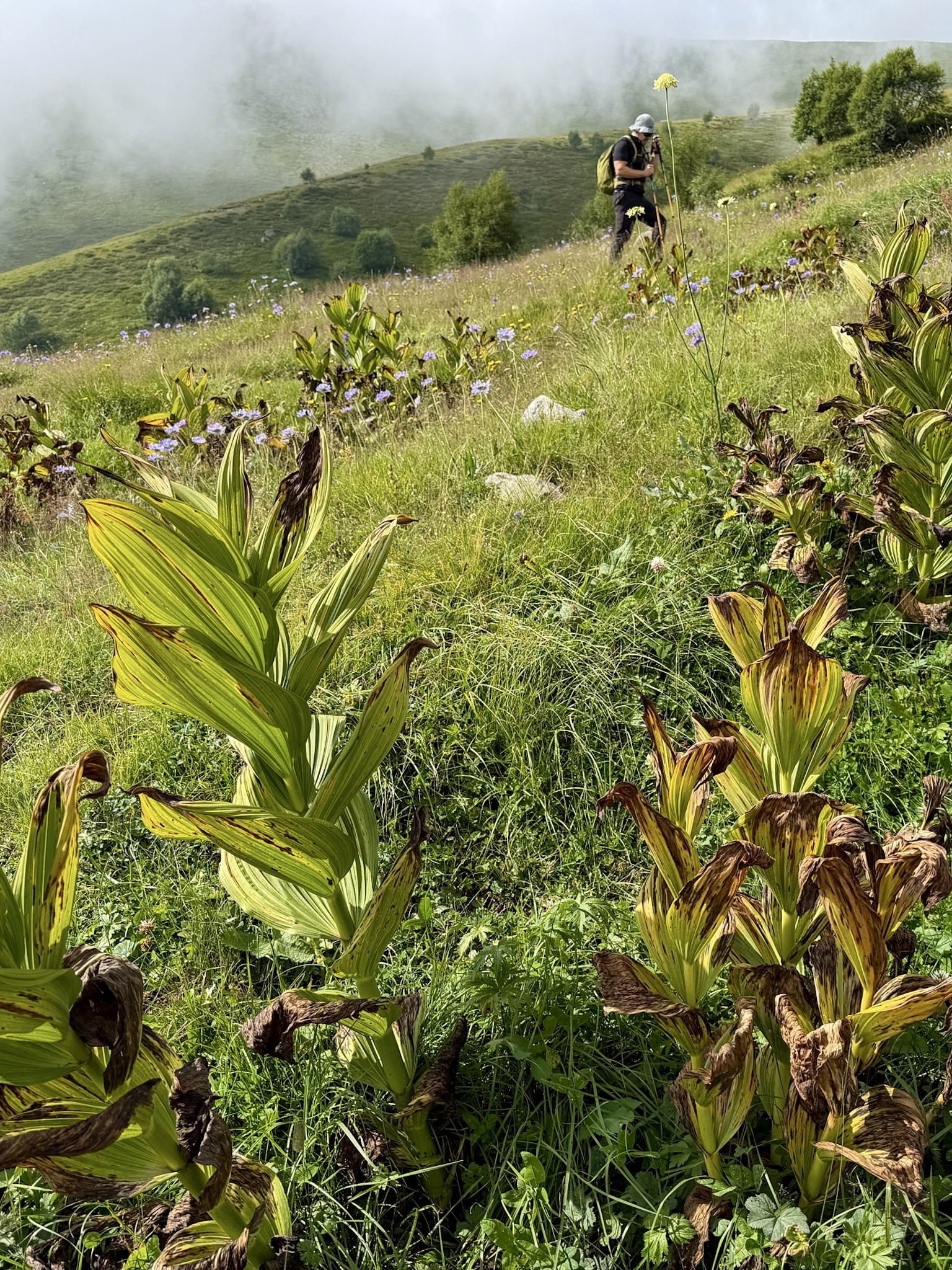
Not much further past that view, the trail splits. There's no sign marking the fork, nothing telling you which way is which. Take the right fork and you'll get on the panoramic path onto the ridge, the left fork drops into the valley instead. Both routes meet back up before Cafe 360, so the choice isn't permanent, but it's worth knowing.
Valley Route or Ridge Route? What I'd Choose
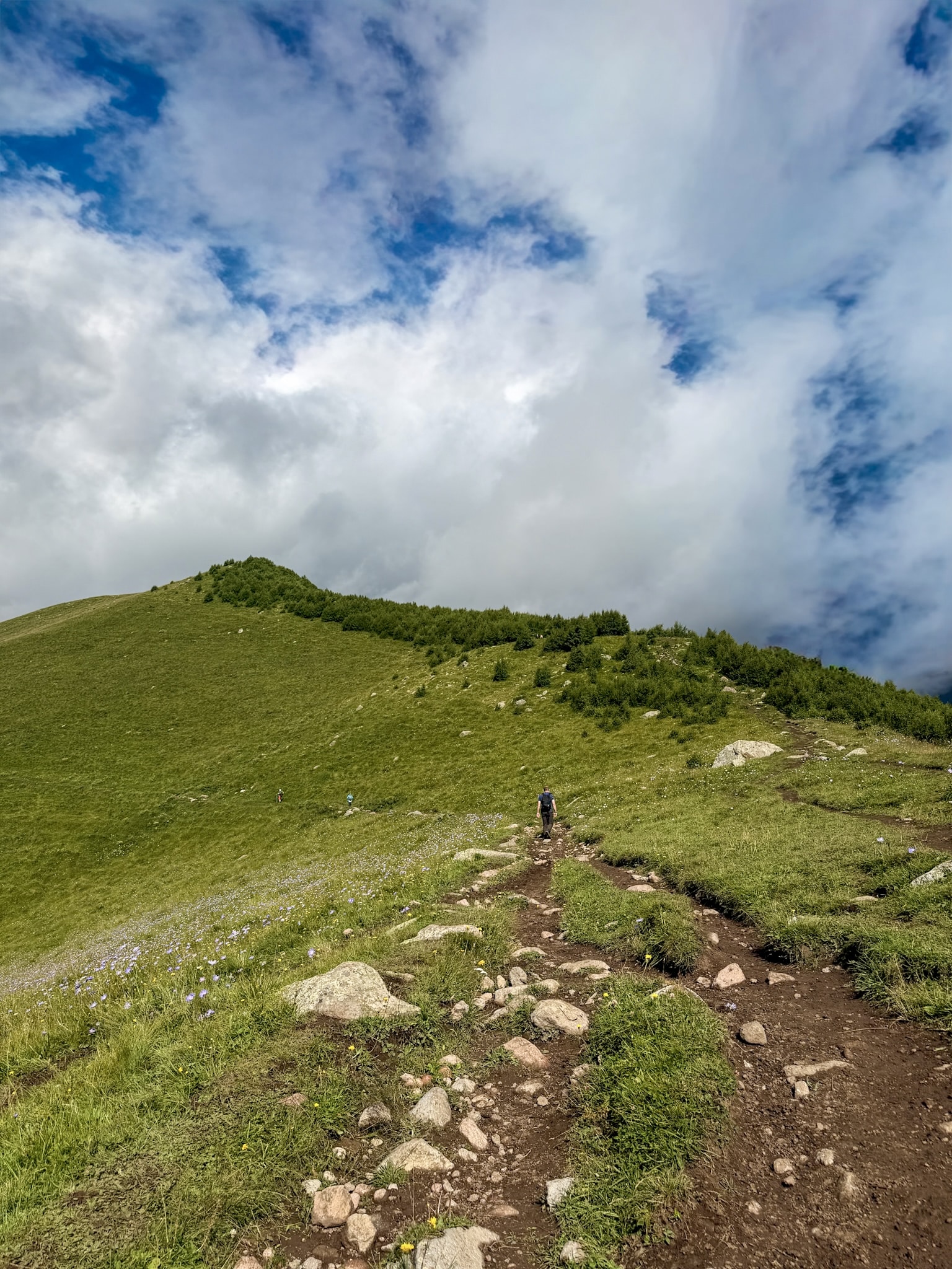
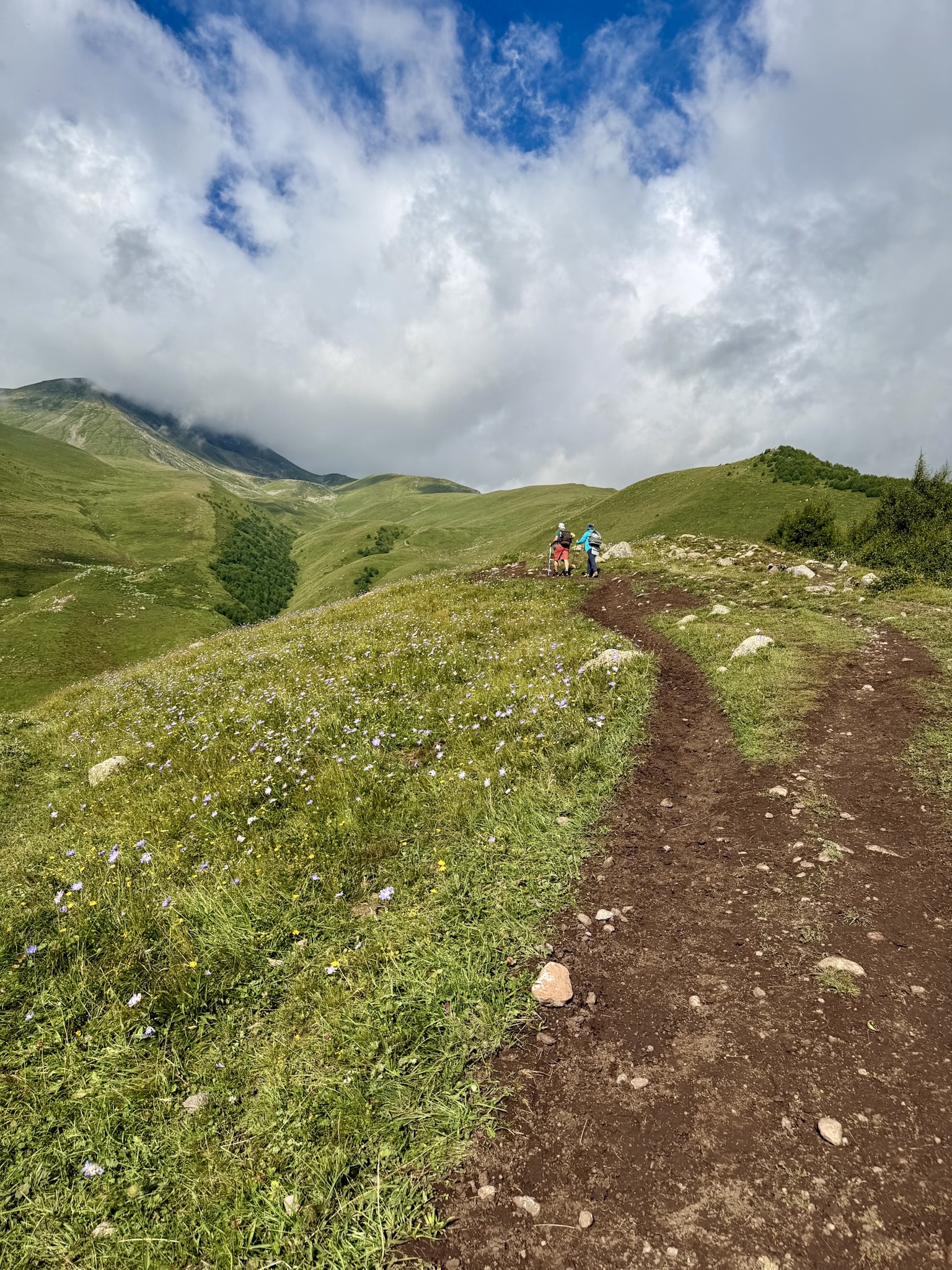
I went up through the valley and came down along the ridge, so I could compare the two. My take: go with the valley, or mix it up like I did.
The valley path winds through some genuinely nice vegetation, and for a good stretch you keep getting the view behind you of Trinity Church with the mountains rising up past it. The ridge isn't more scenic, and it's more exposed. Wind and the odd passing rain shower, both common up here, hit harder with nothing blocking them on a ridge line. Of the people I saw on the trail that day, I'd guess about 90% went up and down through the valley.
In the pictures below, panoramic route on the left, and valley route on the right.
Cafe 360 to Altihut
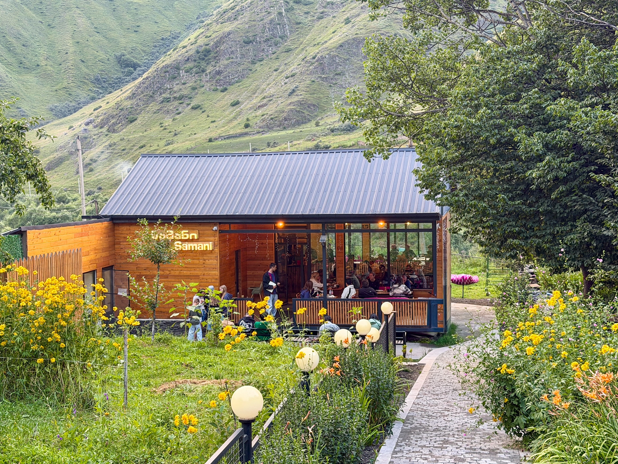
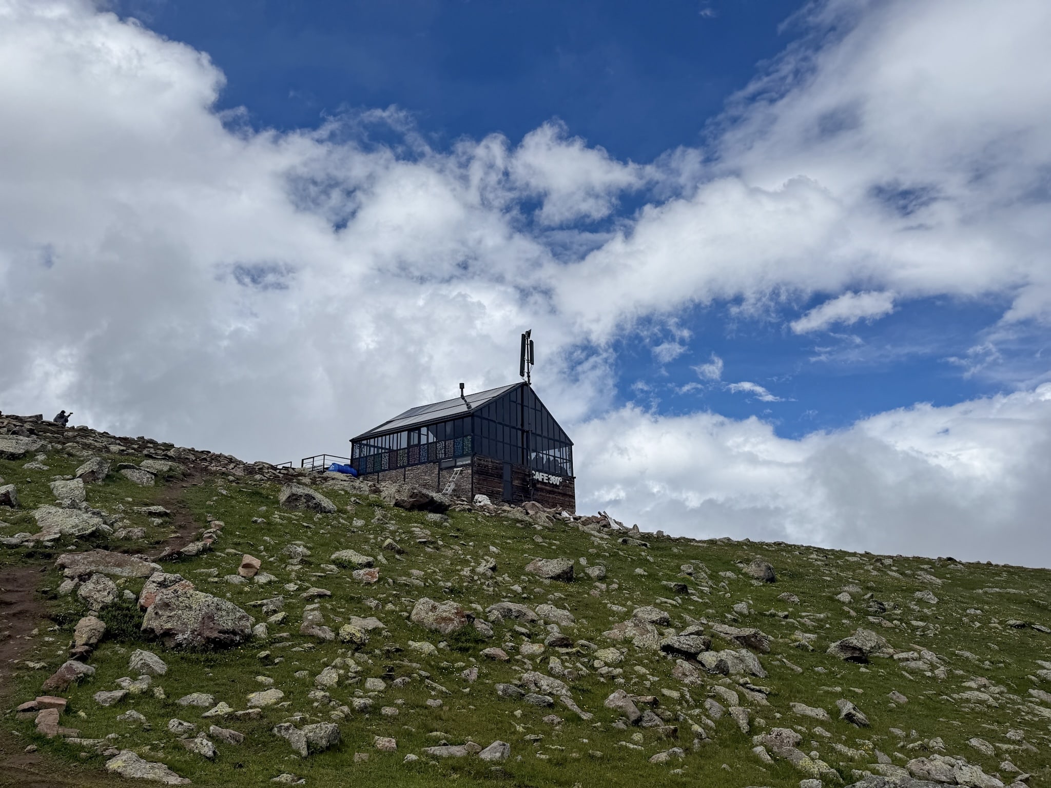
I reached Cafe 360 around 11:15, keeping a steady but unhurried pace the whole way up. It's a small glass and timber building perched right on the ridge, solar panels on the roof, easy to spot once you're close. I didn't stop there myself, so I can't tell you what's actually on the menu, but it's there if you want a break or a coffee before pushing on.
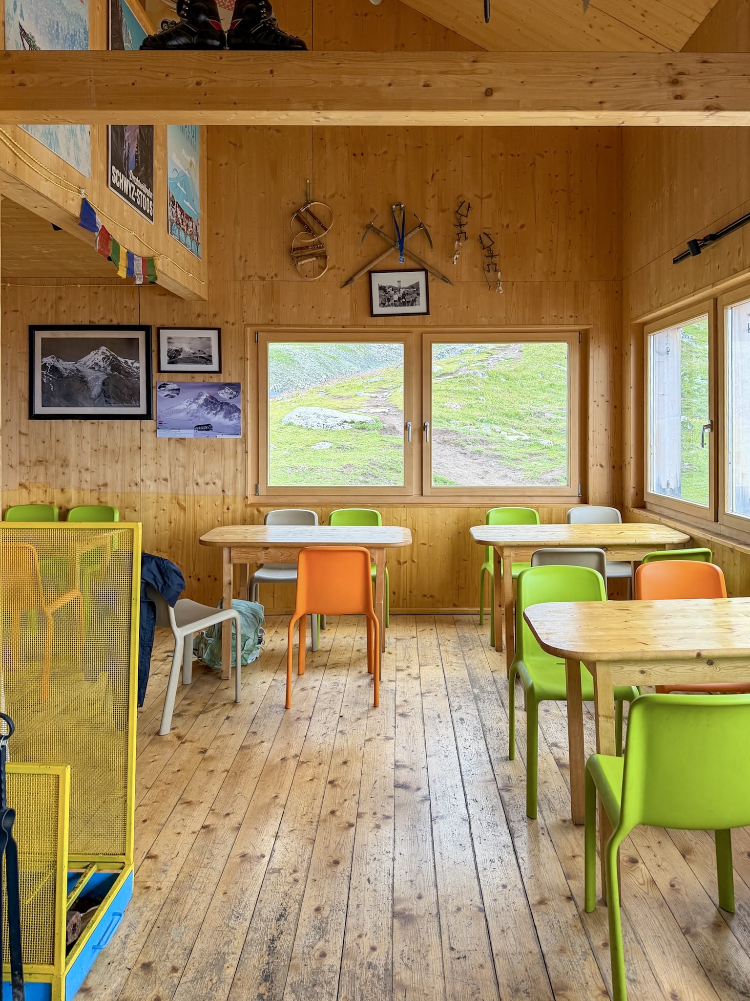
From Cafe 360 it isn't much further to Altihut, and I walked in a little before noon. The place is new and well built, with hot meals and snacks on offer, and they'll refill your water bottle for free. I had a slice of cake and a green tea for 20 GEL. The bathroom was clean, and there's space by the entrance to leave your boots and poles.
Altihut to Gergeti Glacier
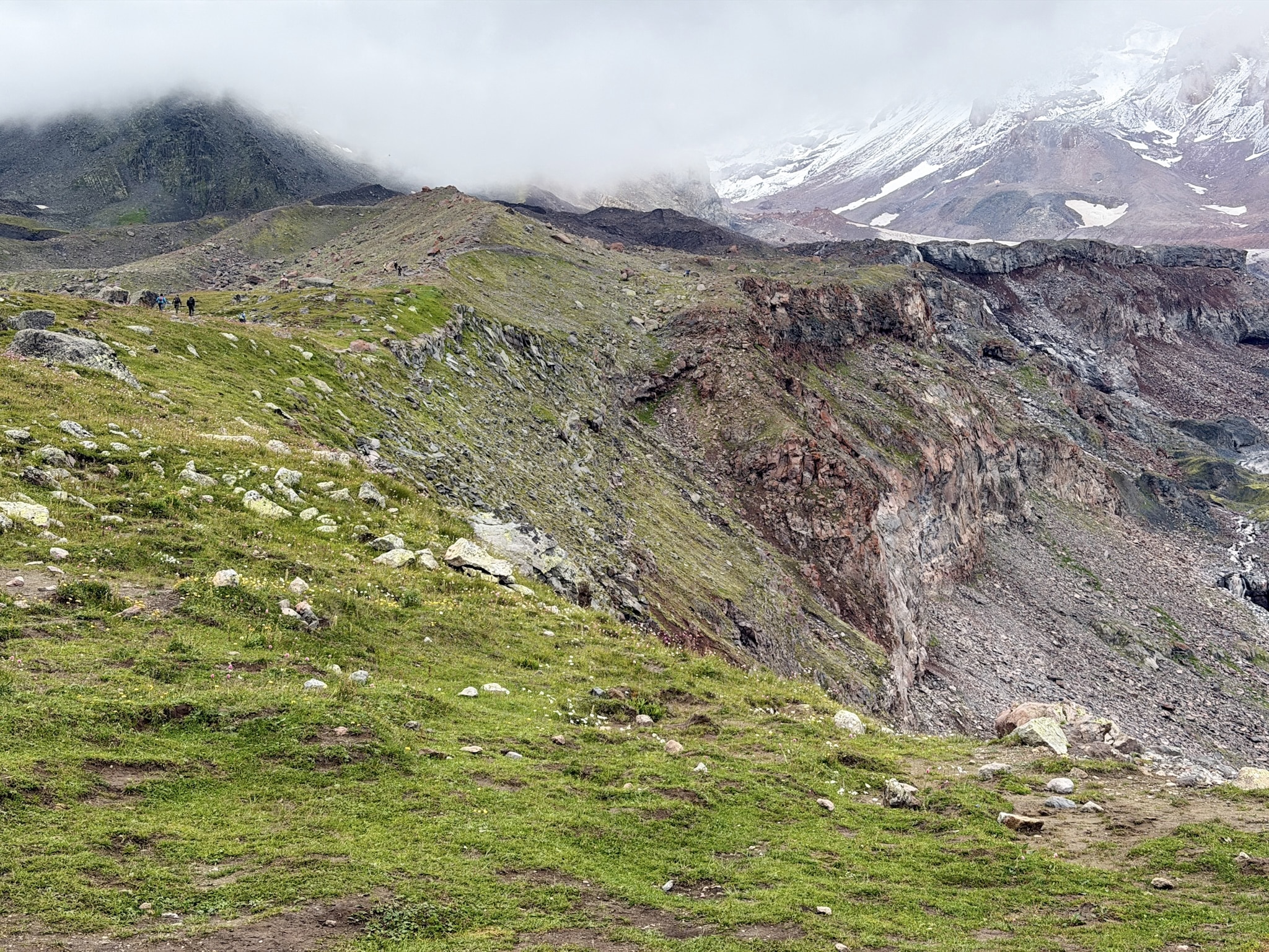
From Altihut, the trail keeps climbing until you're right at the glacier, and I got there just before 1pm. What you actually reach is a stretch of ice that Google Maps marks as Gergeti Glacier, sitting a bit below Bethlemi Hut, which is a separate stop further up that I didn't go to on this hike.
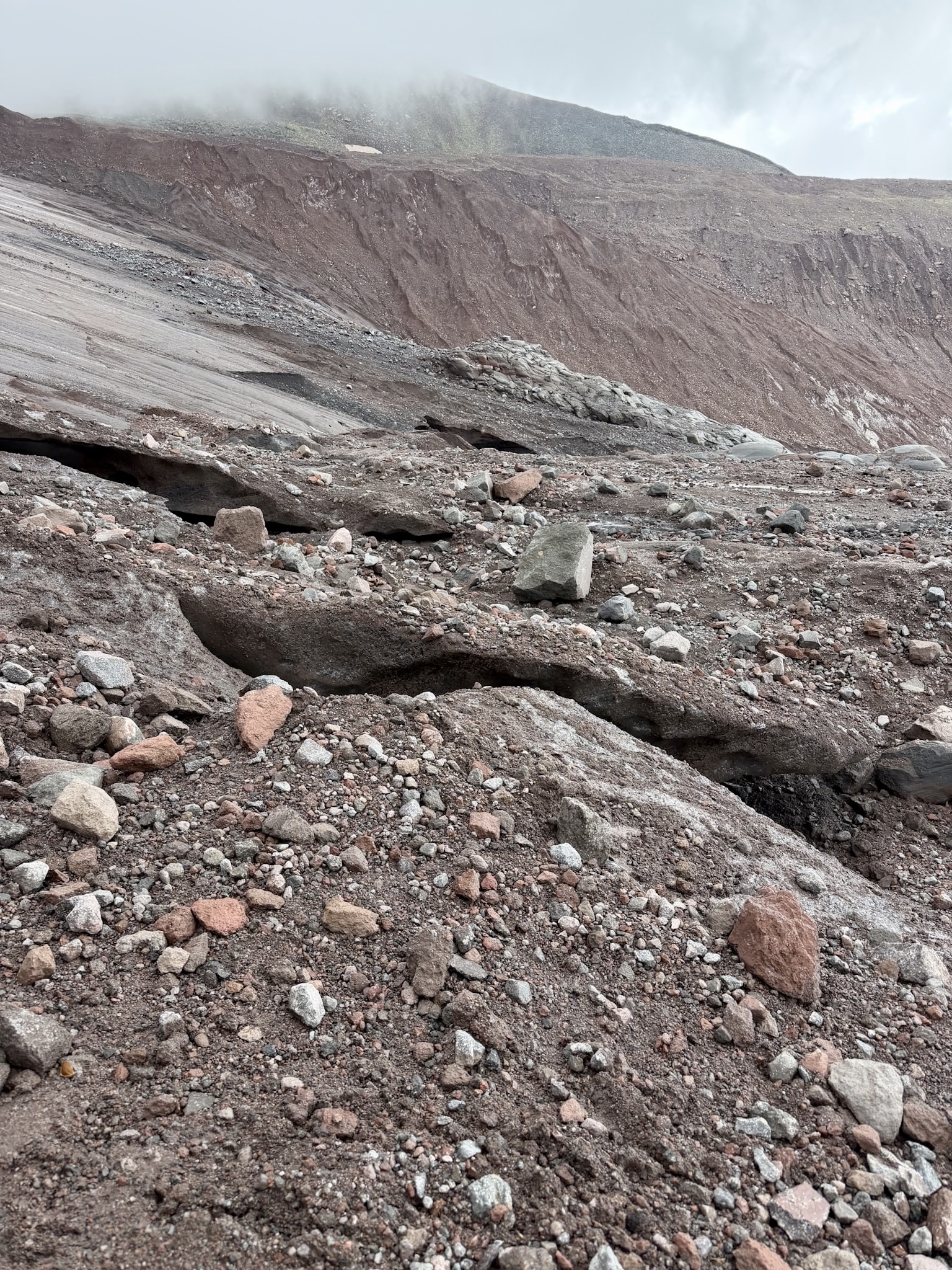
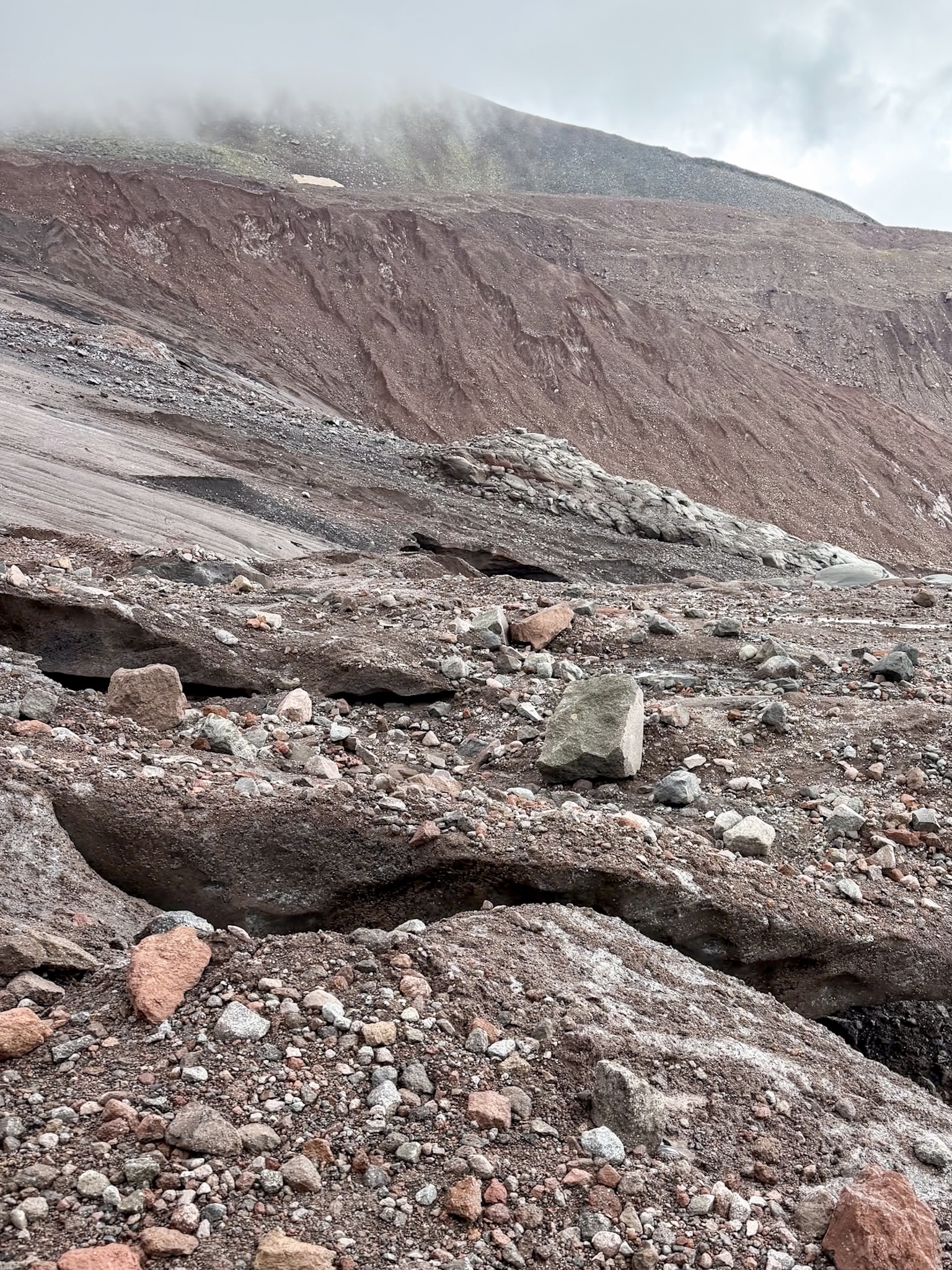
Some parts of the ice are covered in enough dirt and loose ground that you don't immediately realize you're walking on glacier until you look down. I kept my distance from the open ice itself, but I did see a few climbers heading further up and in, presumably continuing toward Kazbek. I spent about half an hour up there looking at the different tongues of ice before turning back. There was also a dog up there, one of the friendly strays you see all over Georgia.
As of 2026, nobody checked any documents or asked for a permit while I was there. Officially, this whole area sits inside Georgia's border zone, and permits are required closer to the border itself. That mostly seems to apply to people climbing on toward the summit rather than day hikers turning around at the glacier, but it's worth confirming the most updated rules.
What to Know Before Your Gergeti Glacier Hike
How Hard Is This Hike?
Terrain-wise, nothing here is technical. There's no scrambling, no exposed ledges, nothing that needs hands-on-rock moves. What makes it hard is the gradient: it climbs steadily and steeply almost the entire way. If you hike regularly, you'll manage the full distance to the glacier and back, though it's still a long, tiring day. If you're generally active but don't hike much, you don't have to write off the whole thing. Going up just the first stretch for the view of Trinity Church from above is a reasonable turnaround point, and pushing on to either Cafe 360 or Altihut before heading back is a good middle option too. Getting all the way to the glacier and back takes the stamina of someone who hikes regularly.
Weather on the Trail
The weather changed on me four times in one day: sun, clouds, rain, then sun again, all before I made it back to the car. That's fairly normal for mountains this tall. The higher peaks generate their own weather, and it shifts faster than you'd expect while you're still down on the trail. Visibility wasn't perfect the whole time, but even with clouds rolling through, the views held up. Starting early helps your odds, since cloud cover tends to build up as the morning goes on, and rain is more likely in the afternoon than earlier in the day.
What to Pack
Gear matters as much as fitness here. There's no shelter anywhere on the trail, nothing to duck under if the weather turns, and sections can get properly slippery when wet. Real hiking boots and solid rain gear are a must. In August I wore a breathable thermal base layer under a rigid rain and wind shell, and I'd pack the same again. Bring one extra layer beyond that too, just in case, since temperatures swing a lot between the valley and the higher sections. Trekking poles are especially useful if you end up on the muddier stretches of the ridge route or if it's rained recently anywhere on the trail. There's no shade at all on this hike, so sunscreen and something to cover your head matter even on a cloudy day. Bring more water and food than you think you'll need. Altihut refills bottles for free, but that's the only reliable stop, so don't count on finding water anywhere else along the way.
Best Photo Spots Along the Way
Right at the start, near the parking lot, you get Gergeti Trinity Church on its hill with the Caucasus behind it, and usually a horse or two grazing in the foreground grass. It's the first good shot of the day and one of the easiest to get. About an hour up, right around where the valley and ridge routes split, look back down at the church again. From up there you see it from above instead of straight on, with the full mountain backdrop behind it.
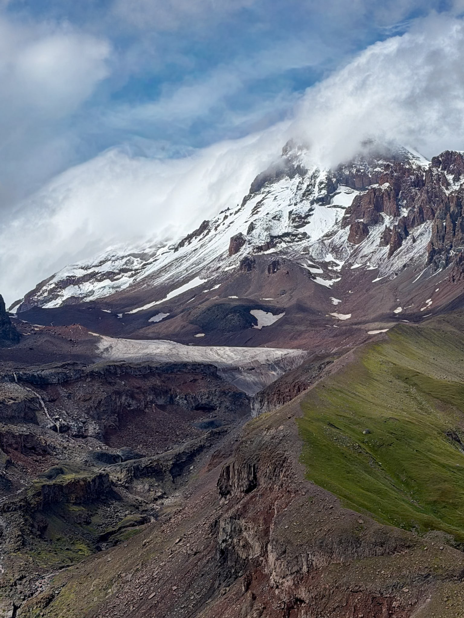
The other spot is roughly halfway between Cafe 360 and Altihut, where Mount Kazbek comes into view with the glacier sitting below it. This is the shot that actually shows you what you're walking toward.
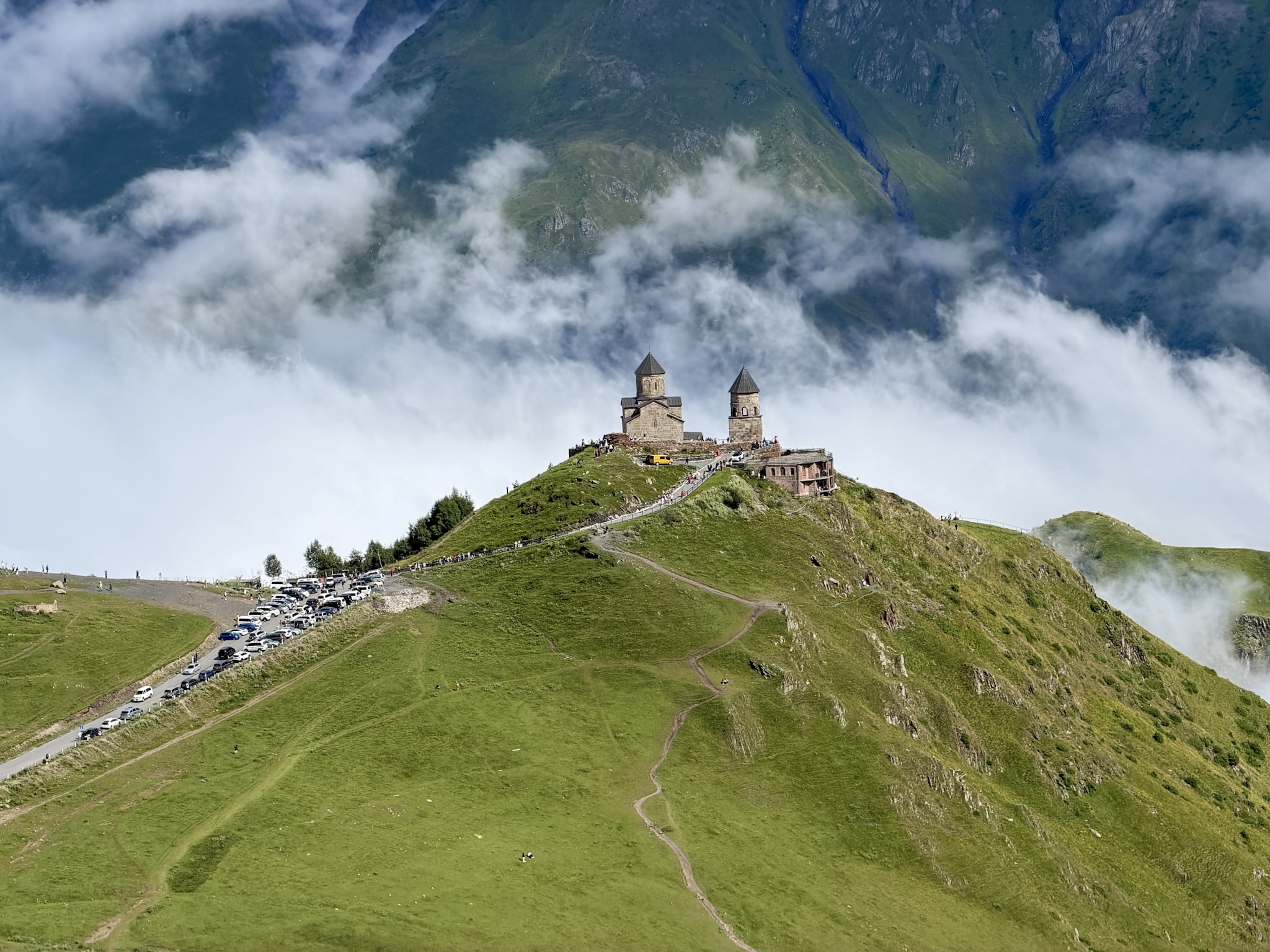
Gergeti Trinity Church
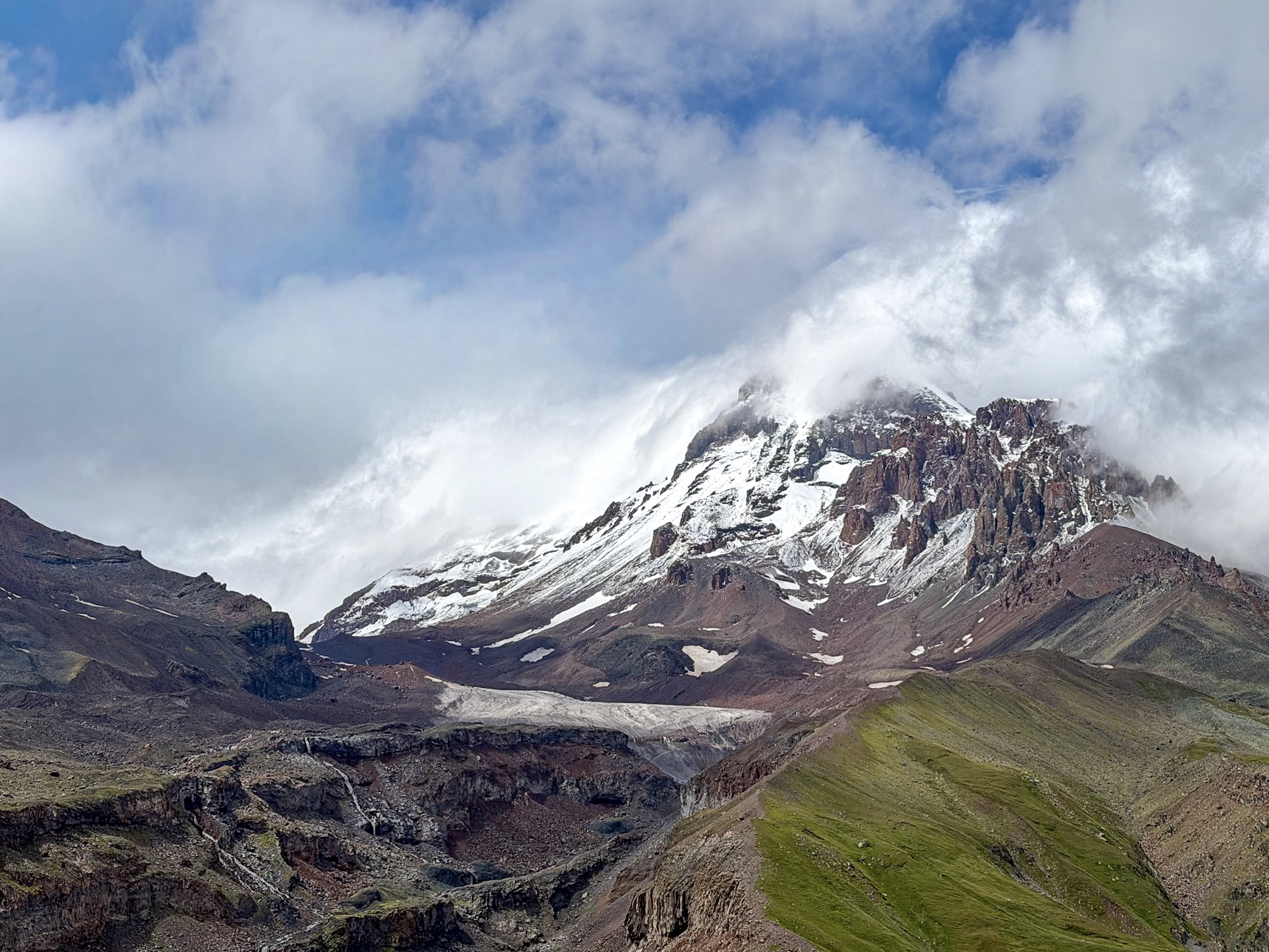
Gergeti Glacier & Mount Kazbek
Where to Stay for the Gergeti Glacier Hike
There are several options in Stepantsminda, for every budget:
- I stayed at Lens Design Hotel the night before the hike, and it was honestly one of the nicer places I stayed anywhere in Georgia. Modern rooms, good views, well run.
- If you want something with more polish and a bigger budget, Rooms Hotel Kazbegi is the well known upscale option in town, the place people book specifically for the hotel itself.
- For a four-star option that's well equipped without going fully luxury, Alpine Lounge Boutique Hotel is worth a look.
- And if you want the best possible value for money, Capra Hotel is the best pick I found in the more budget-friendly range, still a solid hotel choice without the price tag of the others.
FAQ
Is it worth hiking from Stepantsminda to Gergeti Trinity Church?
Not really, not anymore. There's a paved road running right up to it now, with parking a short walk from the church, and most people drive, taxi, or get a lift up rather than walk. Years ago, before that road existed, reaching the church on foot from Stepantsminda actually was the hike. Today, the hike this guide covers starts from the trailhead parking below the church and continues past it, toward the glacier.
Can you do the full route, from the trailhead to the glacier and back, in one day?
Yes, that's what I did. From the trailhead parking, budget somewhere between 6 and 7 hours round trip depending on your pace, the route you take, and how long you stop at the huts and the glacier.
Are there guided tours for this hike? Is it worth booking one?
Yes, guided hiking tours are offered for this trail specifically. It's worth it to look at this option if you're still relatively new to hiking, or want some company.
However, most hikers can do the hike on their own: the trail is easy to spot in most places, and there are plenty of GPS trail maps you can download. The trail is not "polished" but it also doesn't have anything a regular hiker would call technical, no scrambling, no exposed edges. What actually needs attention is muddy, slippery ground after rain and the weather, which can turn fast. The one place that genuinely deserves caution is the glacier itself: take it in from a safe distance, and don't walk directly onto the ice.
Does it work as a day trip from Tbilisi, since some tours offer it that way?
I wouldn't do it that way, personally. The drive alone from Tbilisi is long enough to leave you tired before you've even started, and this hike isn't one to rush through. You're better off spending the night in Stepantsminda, starting fresh in the morning, and not watching the clock the whole way up.
Do you need a permit to hike to Gergeti Glacier?
Not for the hike to the glacier and back, based on my own experience. Nobody checked anything along the way. The area is technically inside Georgia's border zone, and permits apply to people continuing further toward the border or the summit, so it's worth confirming current rules if that's your plan.
Which months make the hike too snowy or dangerous?
Roughly late October through April, when snow and ice regularly cover the trail past the huts. Even the shoulder months aren't fully guaranteed. Late June and early July can still have lingering snow on the higher passes near Sabertse, even after the season has otherwise opened up. June through September is the safer window overall.
Is this hike suitable for kids?
Not really, past the trailhead. The climb is steep and sustained almost the whole way, with a long day attached even for a fit adult, and there's no easier shortcut once you're past the huts.
Is "Gergeti Glacier" the only glacier there?
No, there are multiple. Mount Kazbek actually has six named glaciers on it, and Gergeti is one of them, sitting on the southeast slope and reaching down toward Altihut, which is the one this hike takes you to. The trailhead map also shows Devdaraki and Abano, but those are two other, separate glaciers on the mountain.
Is Mount Kazbek really a volcano?
Yes. It's a dormant stratovolcano, one of the tallest peaks in the Caucasus at just over 5,000 meters, sitting right on the border between Georgia and Russia. It hasn't erupted in centuries, and these days it's known for hiking and mountaineering rather than any volcanic activity.
-
- If you're still planning the rest of your trip, from the drive up from Tbilisi to what to see beyond the trails, my complete guide to the Caucasus mountains in Kazbegi covers all of it
Keep reading: