How I hiked to Shdugra Waterfall from Mazeri in Svaneti: getting there from Mestia, what the trail is like, how long it took me and what to bring.
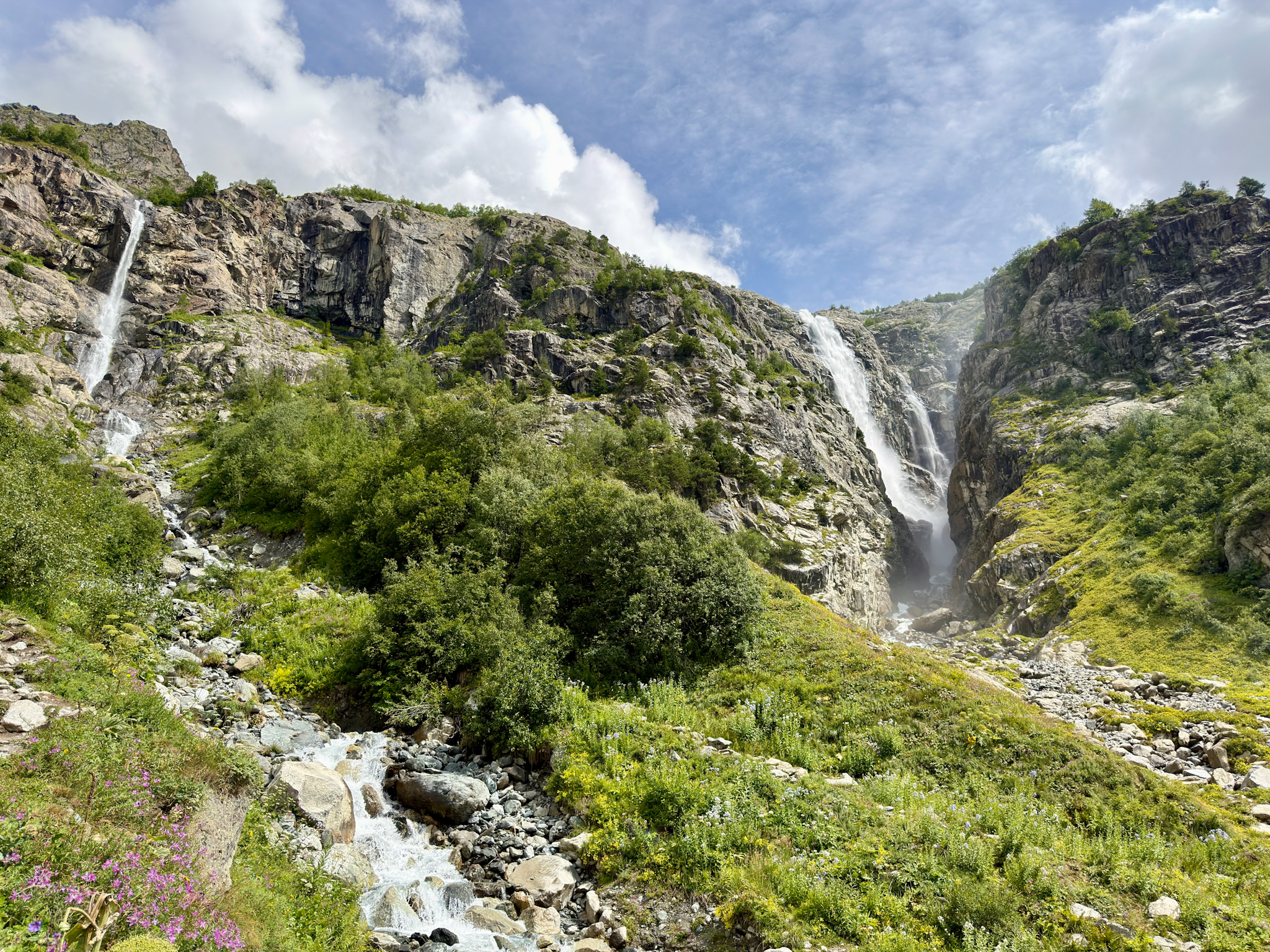
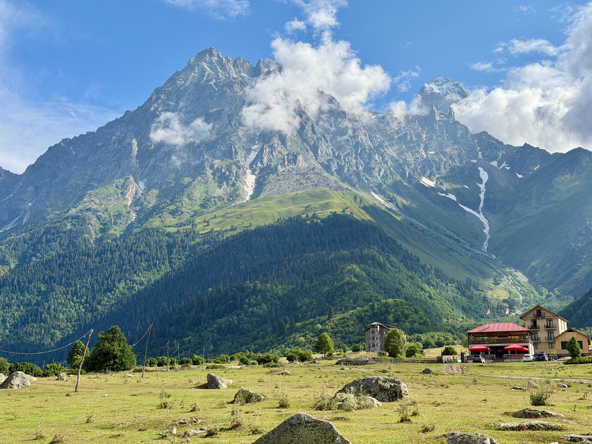
Shdugra Waterfall is a tall, beautiful waterfall in Svaneti, a mountain region in the northwest of Georgia, close to the border with Russia. It falls from a granite wall at the end of the valley of the Dolra River, a few miles past a village called Mazeri. Right above it stands Mount Ushba, a rocky mountain with two pointed summits that you can see from almost every point of the valley.
I did the Shdugra Waterfall hike in August 2026, on the second day of a three-day tour of Svaneti. We started from the Hikers Inn, a wooden café where the dirt road ends and the trail begins. The first half is flat and, after a rainy day, very muddy. All the real climbing comes in the last stretch before the falls. Easy to moderate overall. I found it a pleasant hike, and the falls were very scenic.
This is how the day went, plus a full step-by-step hiking guide, with everything I’d want to know before going.
-
- Shdugra Waterfall was one of my favorite hikes in Svaneti. For the full ranking with the other four, see my guide to the 5 best hikes in Svaneti
Quick Hiking Trail Info
-
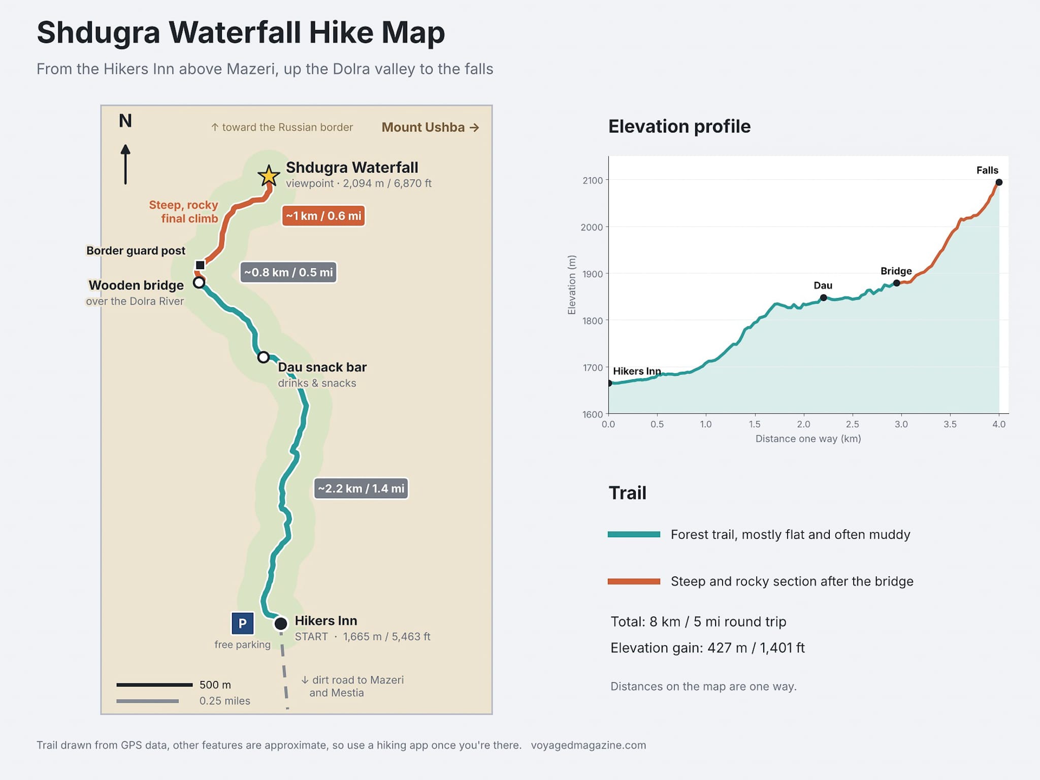
- Starting point: the Hikers Inn, a café at the end of the dirt road past Mazeri.
- Getting there: about 50 minutes by car from Mestia, the main town of Svaneti.
- Distance: 8 km (5 miles) round trip.
- Elevation gain: 427 m (1,401 ft).
- Highest point: 2,094 m (6,870 ft).
- Time: about 3 hours round trip, with a 20-minute stop at the falls.
- Difficulty: easy to moderate, with a steep and rocky final section.
- Entrance fee: none.
- Parking: free, in two areas next to the Hikers Inn.
- What to bring: a passport, there’s a border guard post along the trail, though they rarely stop anyone;
- Food and toilets: at the Hikers Inn. A smaller snack bar halfway sells drinks and snacks.
- Best season: May to October.
- AllTrails GPS track here
- How tall the Shdugra Waterfall is depends on who you ask. The Georgian tourism board says almost 120 m (394 ft), other sources go anywhere from 70 to 135 m (230 to 443 ft), and it gets described a lot as the biggest waterfall in Georgia by volume of water. I couldn’t have guessed a number from below.
-
- Where to Stay: Mestia is the best base, with the most hotels and restaurants in the area. I've stayed at the Lahili Boutique Hotel in Mestia ⭐️⭐️⭐️⭐️, and quite enjoyed it. You can see more hotels in my guide on where to stay in Mestia.
- Where to Stay: Mestia is the best base, with the most hotels and restaurants in the area. I've stayed at the Lahili Boutique Hotel in Mestia ⭐️⭐️⭐️⭐️, and quite enjoyed it. You can see more hotels in my guide on where to stay in Mestia.
Where Is Shdugra Waterfall?
Shdugra Waterfall is in Upper Svaneti, about 25 km (15.5 miles) from Mestia. Becho is the name of the valley, and of the small community living in it, a handful of villages spread across green meadows, and Mazeri is the last and highest of them. It’s also where climbers start when they try to summit Mount Ushba. You’ll also find this place called Ushba Waterfall, after the mountain that feeds it, or Mazeri Waterfall.
After Mazeri the asphalt ends. A dirt road follows the Dolra, a fast glacial river with milky grey water, up to the Hikers Inn, and from there you walk.
How to Get to the Shdugra Waterfall Trailhead
The trailhead is the Hikers Inn, a wooden café at the end of the dirt road past Mazeri. It’s about 50 minutes by car from Mestia. There’s no public transport going there, so you need a tour, a transfer, a taxi or your own car.
Option 1: A tour or transfer from Mestia
This is how I did it. We were on a three-day Svaneti tour with Megobari Tours, which I’d recommend, and our guide drove us from Mestia to the café in a 4x4. These are local agencies in Mestia that go to the Hikers Inn. Prices are the ones listed on their websites in October 2026. GEL is the Georgian lari, the local currency.
- Travel Mestia: shared 4x4 for 50 GEL (about $18) per person, or private car for 250 GEL (about $92) for up to 7 people. You hike on your own. A guide is available for an extra fee.
- ProSvaneti: private car to Mazeri from 250 GEL (about $92) per car.
- Svaneti Trekking: transfer plus local guide, from $120 per person for a group of two.
- GetYourGuide: small-group guided hike with transfer, about $75 per person, up to 7 people.
The shared transfer is the cheapest way if you’re on your own. All four leave from the center of Mestia.
Option 2: A taxi from Mestia
Taxis in Mestia are local drivers waiting around the main square, there’s no app to book them. Ask for a round trip, and agree beforehand on the price and on how long the driver will wait for you, since the hike takes about 3 hours.
Option 3: Driving yourself
The road is paved as far as Mazeri, then becomes a dirt track for the last few kilometers. Parking is free, in two areas: one right in front of the café, just after the bridge over the river, and one a little before the bridge.
If you're still wondering how to get to Svaneti, I cover all options in detail in my guide on how to get to Mestia.
Shdugra Waterfall Hike: The Trail Step by Step
The trail is an out-and-back, so you walk up and come down the same way. I started at 10 a.m. and was back at the car at 1:10 p.m., with a 20-minute stop at the falls. Here’s how it went, section by section.
The Hikers Inn, Where the Hike Starts
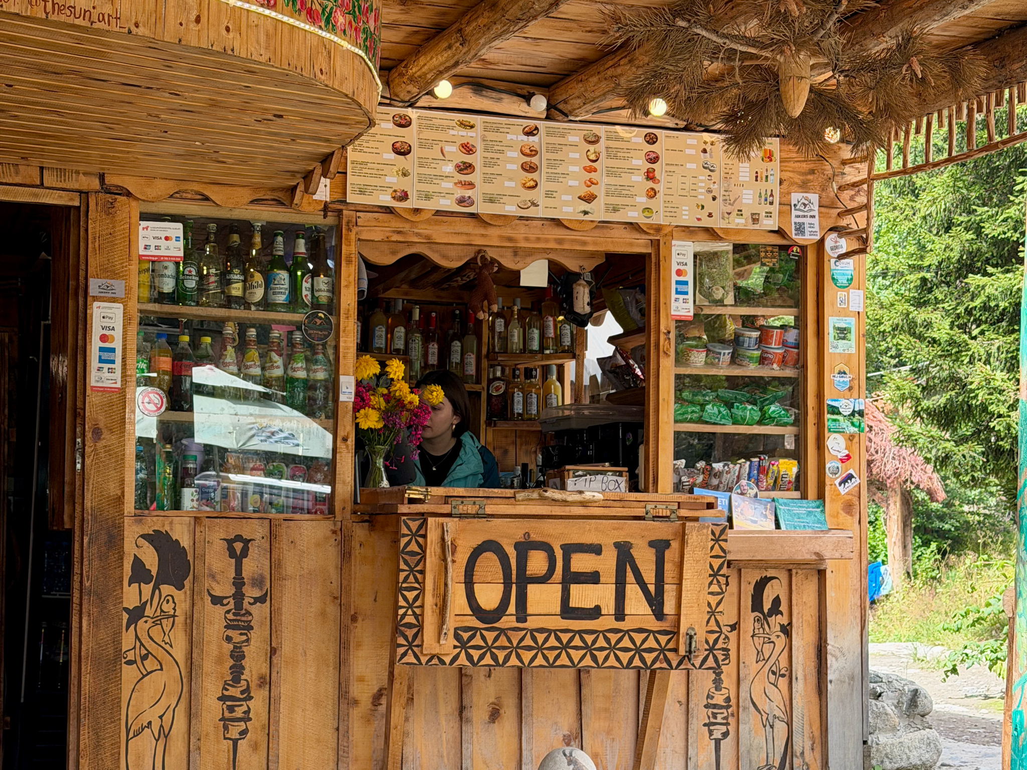
The Hikers Inn is a cluster of wooden cabins and terraces built by a local, right where the dirt road ends. A big wooden signpost at the entrance lists everything they have, a café-bar, a sauna, a small lake for swimming and another one for fishing, horse rental, cottages to sleep in.
The counter is well stocked. Hot and cold drinks of every kind, plus candy bars and nuts for the trail. At lunchtime it works as a restaurant too, with Georgian dishes. They usually take cards.
The outdoor seating is all wooden benches and tables, and it’s a nice place to sit. The toilets are a different story. Squat toilets, very basic. Go anyway, because there’s nothing else until you’re back.
We skipped it on the way up and had a coffee there when we got back down.
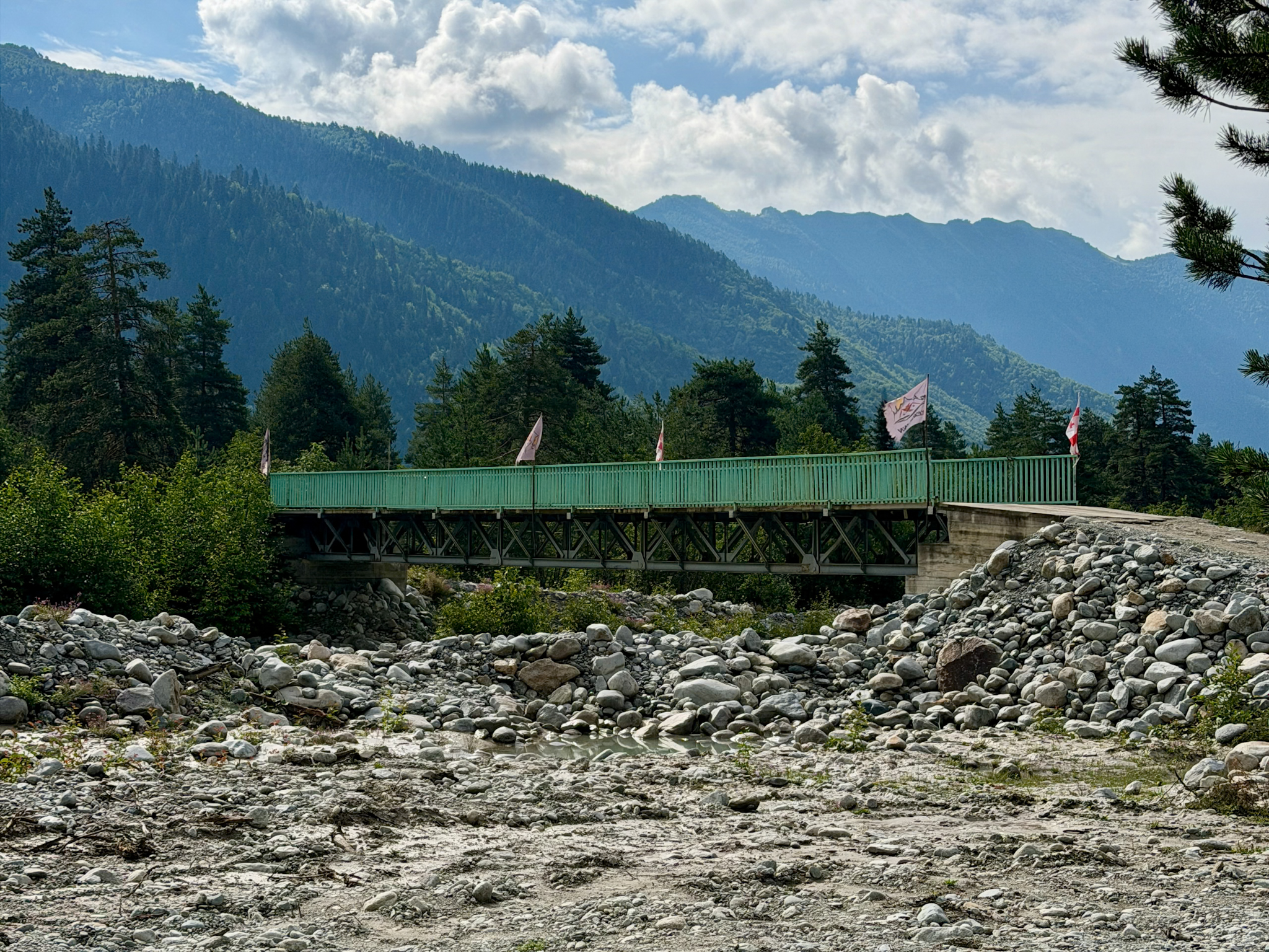
Bridge for Shdugra Waterfall Hike Trailhead
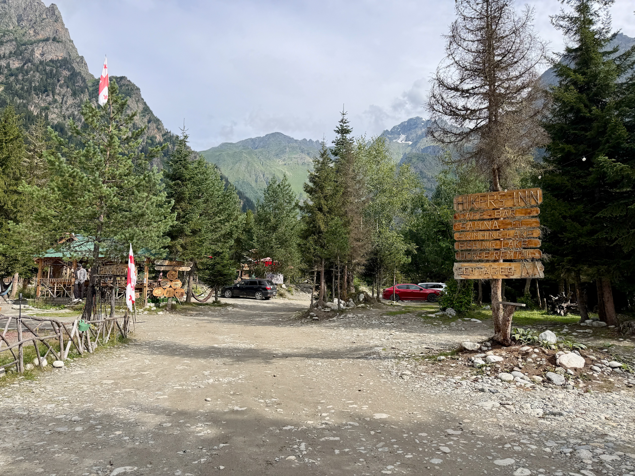
Parking at Shdugra Waterfall Trailhead
Shdugra Waterfall Cafè & Restaurant
From the Hikers Inn to Dau: Flat and Muddy
The trail starts right behind the café, next to a post with a “Horse Rental” sign and a red and white trail marker. From this first stretch you can already see the waterfall, a thin white line far away at the end of the valley.
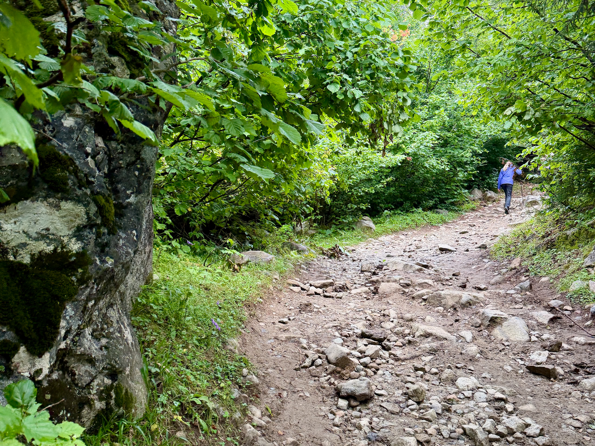
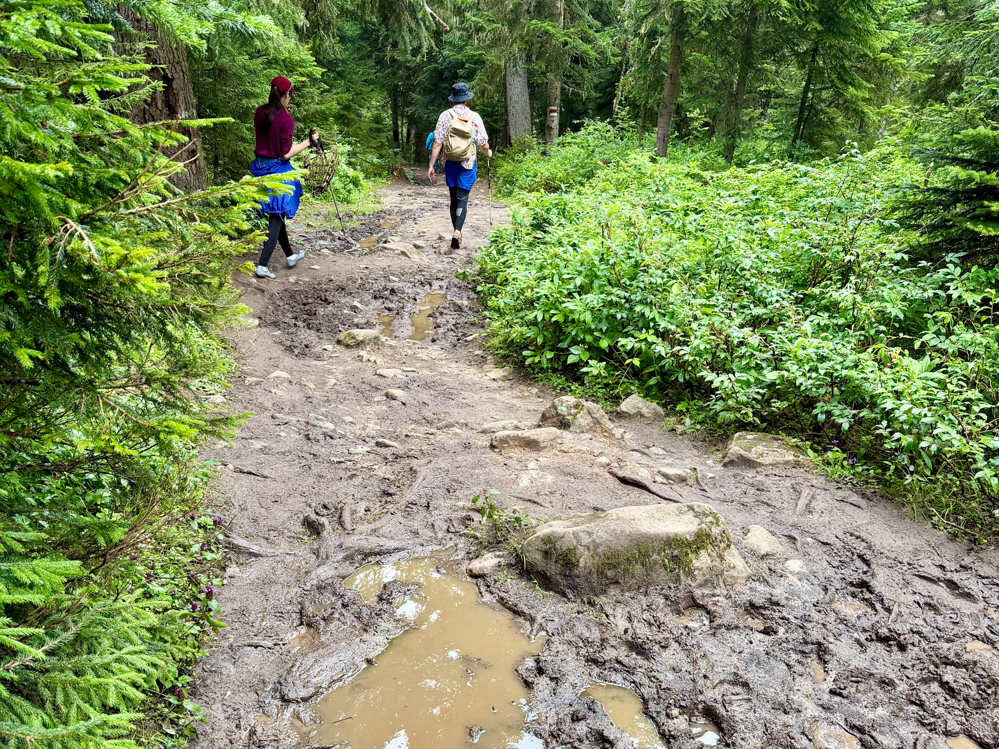
For a long time the path is flat. It starts as dry packed dirt, then it goes into a forest of pines and firs and turns to mud, a lot of it. My trekking poles helped a lot here as I used them to balance on stones and fallen logs and keep my boots out of the worst puddles.
Trail markers are few and far between, a red and white stripe painted on a tree now and then. But it doesn’t matter, there’s only one path, with no turns, and you always know where to go. We met a local leading a horse by hand along the trail.
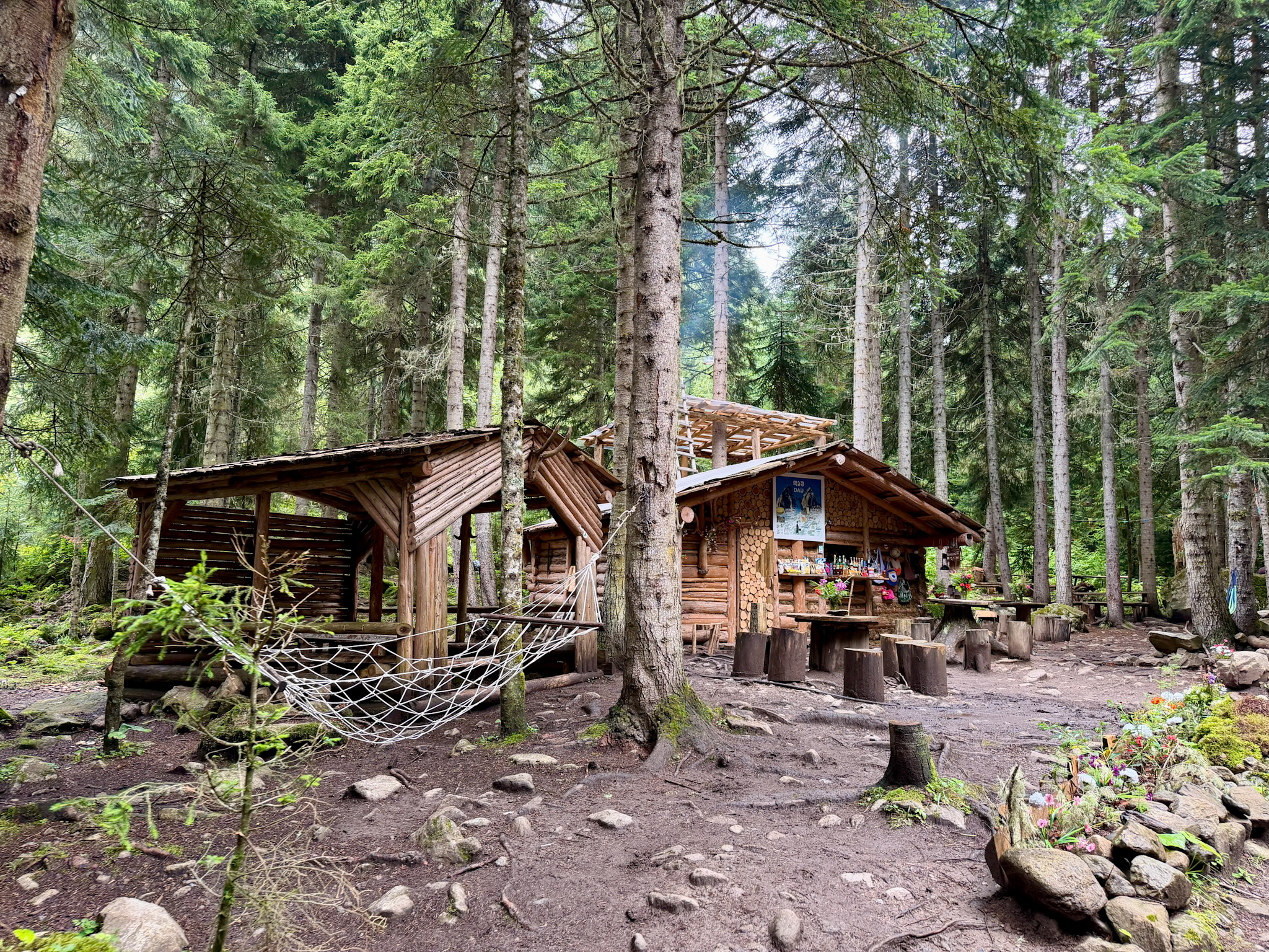
After 50 minutes we reached Dau, a small wooden snack bar in the middle of the forest. It sells drinks and snacks and has a hammock and a few tree-stump stools.
Shdugra Waterfall Hiking Trail
Muddy Trail for Shdugra Waterfall
Wooden cafè on Shdugra Waterfall Trail
From Dau to the Wooden Bridge and the Border Post
After Dau the path starts to climb a little. It stays close to the Dolra River, and between the trees you catch the waterfall again, closer now.
Ten minutes later we were at the wooden bridge. It’s made of rough planks over the river, and the water underneath is fast and grey-white, the milky color that glacier water has. The bridge is solid. It’s still a mountain bridge, so watch your step.
Just past it there are a few wooden buildings, a clearing with picnic tables and umbrellas, and horses grazing loose. This is a post of the Georgian border police, since the Russian border is only a few miles north of here. Guards are often around. They didn’t stop us or ask for anything, and our guide told me they rarely do, only now and then with people carrying a lot of gear, who might be heading further toward the border. Carry your passport anyway.
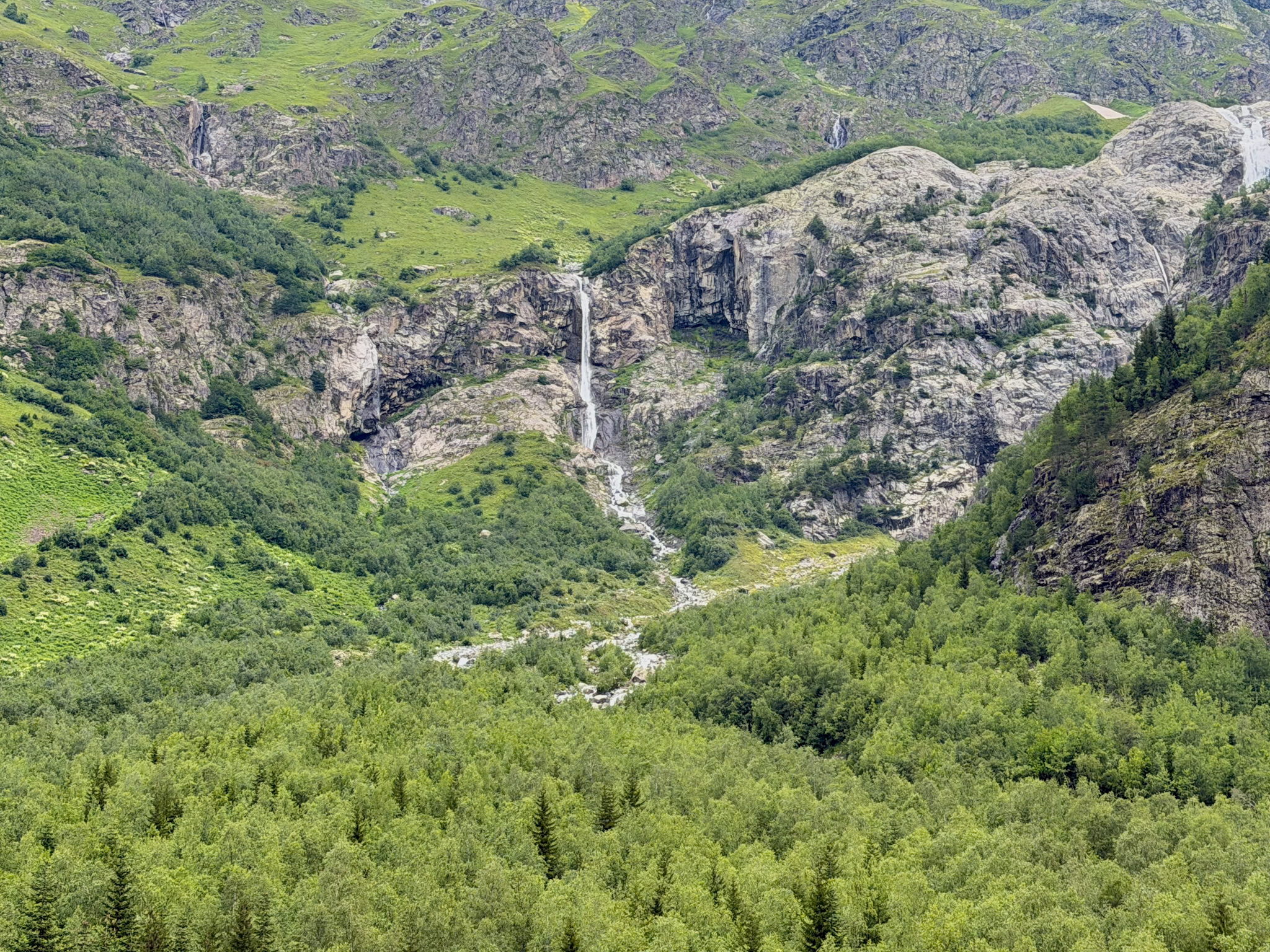
First Shdugra (Ushba) Waterfall View
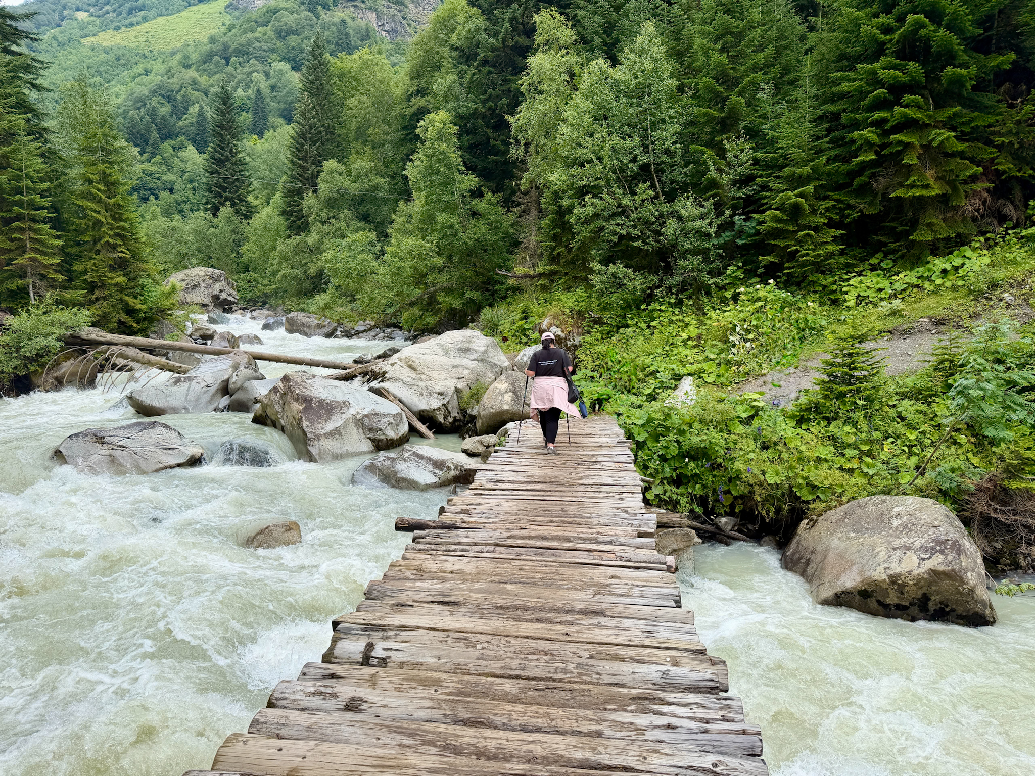
Wooden bridge for Shdugra Waterfall
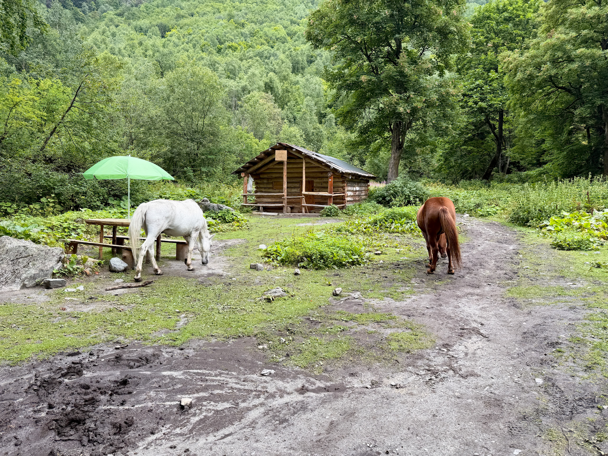
Guards Post with Horses
The Steep Rocky Climb to the Falls
This is where the real elevation gain is. In about 1 km (0.6 miles) you climb more than 200 m (660 ft), on a path made of stones and boulders, steep and rocky all the way to the falls.
You need to pay some attention to where you put your feet, especially on the wet rocks. I never had to use my hands. Some basic stamina and a decent sense of balance are enough. It took us about 40 minutes.
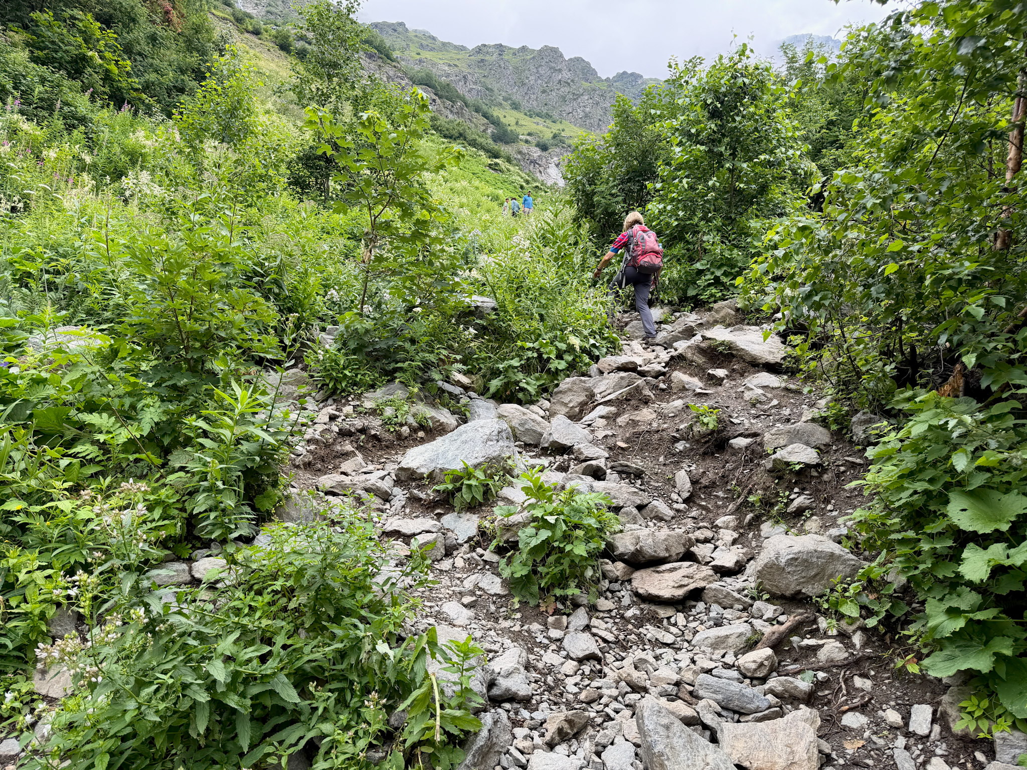
At the Base of the Falls & The Way Back
We got to the falls at 11:40. From the end of the trail you’re looking straight up at Shdugra, with the second, thinner waterfall on the left and a stream running down between the rocks and the wildflowers. If you want, you can walk very close to the main fall. Where I stood the spray didn’t reach me. There were lots of other people around at that point, but plenty of space for everyone.
We stayed around 20 minutes, mostly taking photos, and started back down at noon.
You return the same way. Going down the rocky section is slower than you’d think, then it’s the forest, the bridge, Dau and the mud again. The view in this direction is different, down the whole Dolra valley, with forested slopes on both sides and snowy peaks far away in the clouds.
We were back at the parking at 1:10 p.m., about an hour and 10 minutes after leaving the falls.
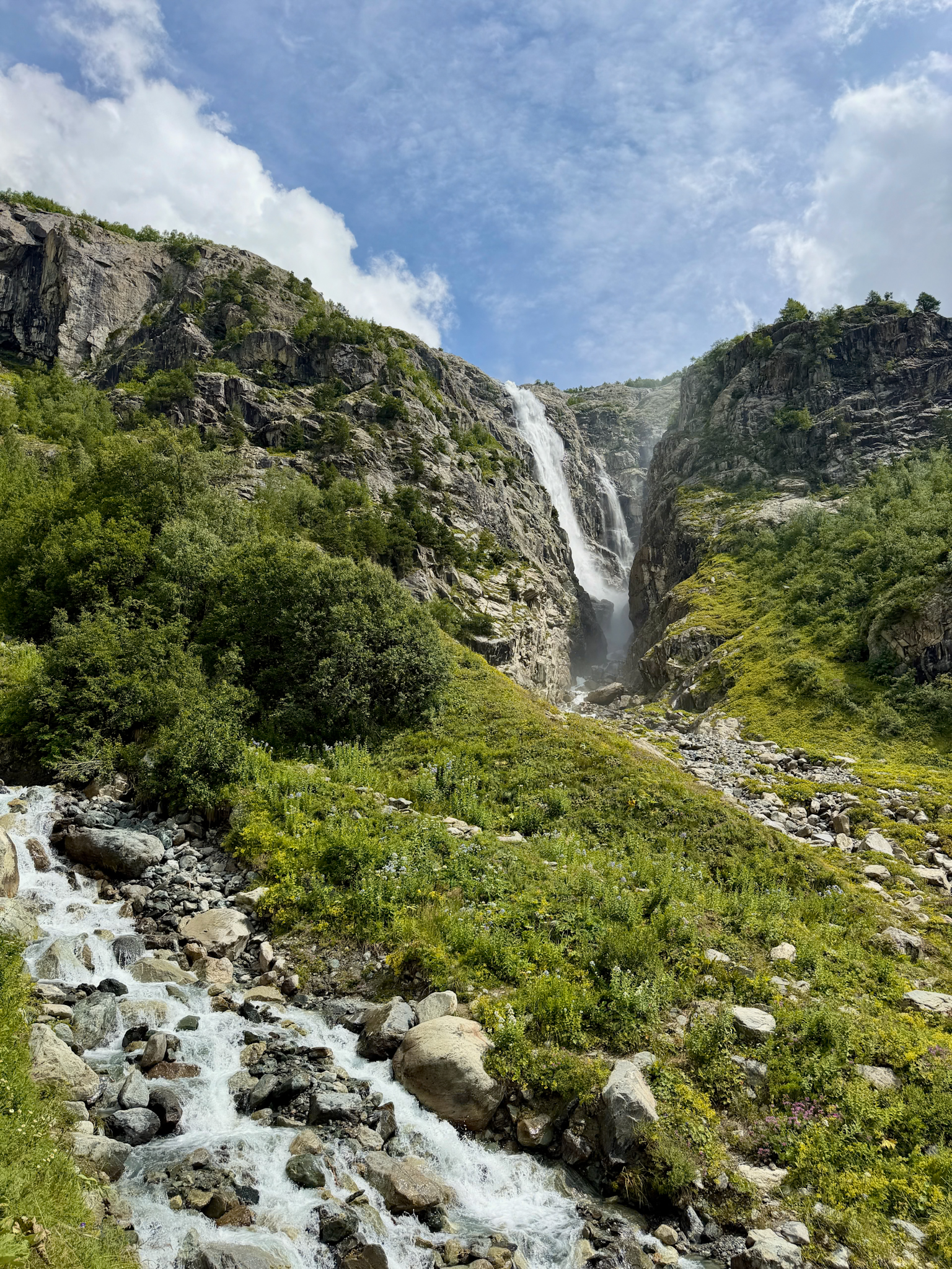
Shdugra (Ushba) Waterfall Close up
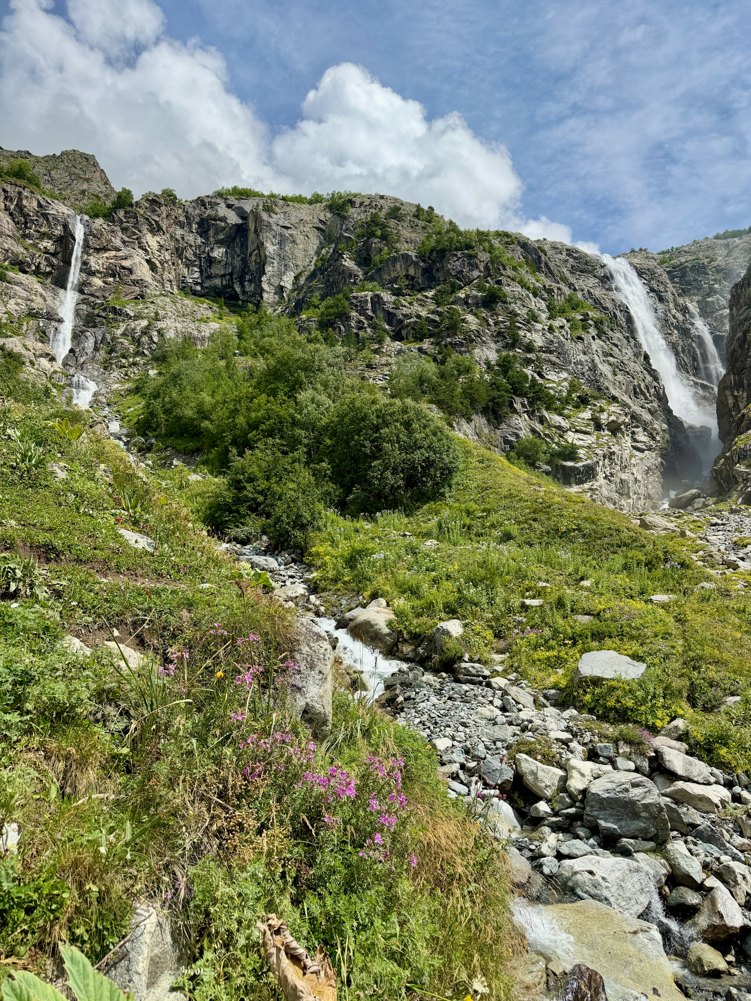
Shdugra (Ushba) Waterfall
Can You Continue to the Ushba Glacier?
Yes, the trail goes on past the waterfall to the Ushba Glacier, the ice field that feeds the falls.
Distance: 2.4 km (1.5 miles) one way from the waterfall.
Elevation gain: about 500 m (1,640 ft).
Time: about 2 hours one way.
Difficulty: hard.
The path leaves the main trail just before the turnoff to the falls and climbs very steeply, at one point along a narrow rocky ledge. Then you cross the stream that feeds the waterfall. It’s strong but doable with care, and stone cairns mark the best spots to cross. After the forest the trail reaches a moraine, a field of rocks and gravel left behind by the glacier, and a memorial to the climbers who died on Ushba. From there you walk over the rocks toward the ice. Keep off the glacier itself.
Two things to know before going: First, the border guards want to see your passport and record it if you’re going up to the glacier, because it brings you closer to the Russian border. Secondly, it’s a route for expert hikers in good weather only, since the rocks get dangerous when wet and clouds can hide the path.
Tips for the Shdugra Waterfall Hike
Wear waterproof hiking boots. The forest section is muddy for a long stretch, and the final climb is all wet rock. I wore my usual hiking boots and layers of waterproof clothing, and I’d pack a light rain jacket even on a sunny morning. In Svaneti the weather can switch from sun to rain within an hour.
Bring trekking poles. On the flat part they help you cross the mud without sinking into it, and on the way down the rocky section they take a lot of weight off your knees.
Start early in the morning. This trail is popular, plus local guides say clouds often cover Mount Ushba in the afternoon. We started at 10 a.m. and still saw it for a while from the falls, between clouds.
Go between June and September. Tour operators run this hike from May to October. Late spring brings more water, so expect more mud.
Pair it with the Koruldi Lakes. We hiked to the waterfall in the morning and went up to the Koruldi Lakes by 4x4 in the afternoon, which made for a long but great day.
FAQ
Is the Shdugra Waterfall hike difficult?
It’s easy to moderate. Most of the trail is flat or climbs gently through the forest, but the last kilometer after the wooden bridge is steep and rocky, with over 200 m (660 ft) of elevation gain. There’s nothing technical and you won’t need your hands, just some stamina and a good sense of balance on wet rocks and mud. Of the three day hikes I did in Svaneti, it was maybe the hardest but not by much. The Chalaadi Glacier hike near Mestia and the Shkhara Glacier hike from Ushguli climb gradually all the way, with no section as steep as the final climb to Shdugra.
Can you do the Shdugra Waterfall hike on horseback?
Horses are available for rent at the Hikers Inn, and some local tour operators offer the ride. I don’t think the trail is suited to it. The forest path is narrow and muddy, and the final climb is steep and full of rocks. The only horse I saw on the trail was being led by hand.
Can you do the Shdugra Waterfall hike without a guide?
Yes. The trail is only lightly marked, but there’s one path with no turns, so it’s impossible to get lost. A guide only makes sense if you’d like one for company or if you’re going on to the Ushba Glacier.
Can you swim at Shdugra Waterfall?
Not at the waterfall itself, as far as I saw. The water comes straight from the glacier and the base of the falls is all rocks and fast water. The Hikers Inn has a small lake for swimming, if you want a cold dip after the hike.
Keep reading: